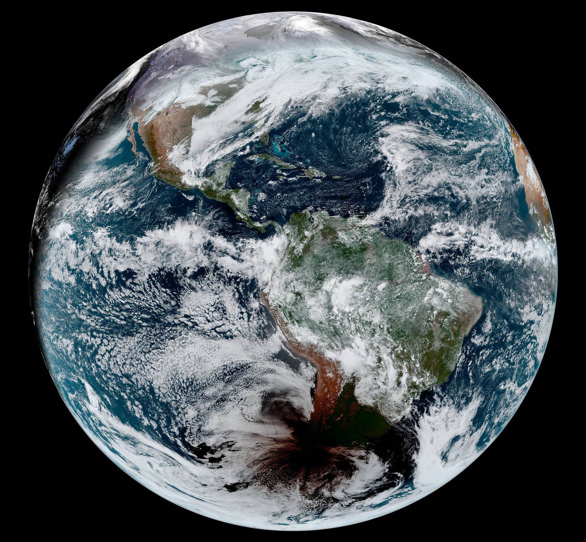
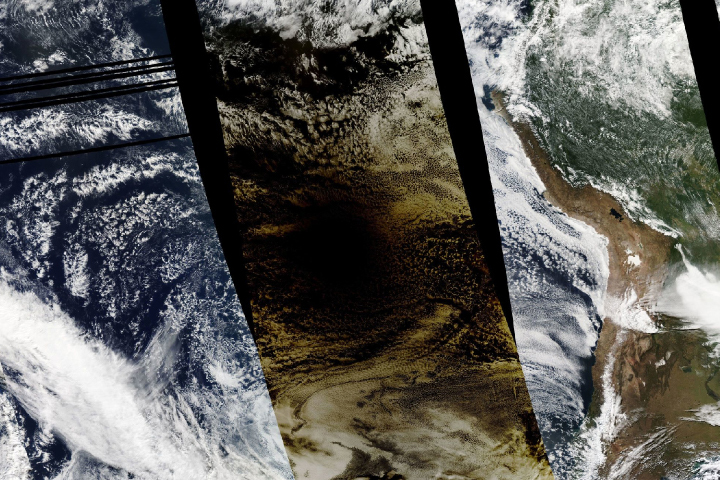
The first and only total solar eclipse of 2020 occurred on December 14, with the path of totality stretching from the equatorial Pacific to the South Atlantic and passing through southern Argentina and Chile. However, the view from above may have been better than the view most people got from the ground.
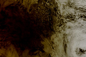
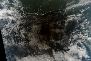
The Advanced Baseline Imager (ABI) on Geostationary Operational Environmental Satellite 16 (GOES-16) captured these images of the shadow of the Moon crossing the face of Earth. GOES-16 is operated by the National Oceanic and Atmospheric Administration (NOAA); NASA helps develop and launch the GOES series of satellites.
The time-lapse video below includes 72 images acquired every 10 minutes between 0600 and 1800 Universal Time (3 a.m. to 3 p.m. in southern Chile) on December 14. GEOS-16 flies at about 36,000 kilometers (22,000 miles) altitude over the equator and views the Western Hemisphere from 75 degrees West latitude.
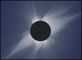
The shadow cast by an eclipse consists of the completely darkened umbra and the partially shadowed penumbra. For people standing within the umbra on December 14, the Moon completely blocked the disk of the Sun for about 2 minutes, and the much dimmer solar corona and its streamers became visible to the naked eye.
The “path of totality” (umbral path) for the eclipse this week was roughly 90 kilometers (60 miles) wide and passed across South America from Saavedra, Chile, to Salina del Eje, Argentina. However, meteorologist Matthew Cappucci reported that an atmospheric river event caused thick cloud cover over much of the region.
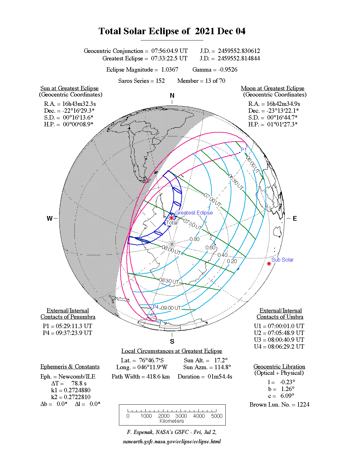
While a total eclipse of the Sun occurs roughly every 18 months, seeing one from any particular location on Earth is rare. On average, a solar eclipse passes over the same parcel of land roughly every 375 years. The next total solar eclipse will occur on December 4, 2021, over Antarctica. The next total solar eclipse to make an appearance in North America will be April 8, 2024.
NASA Earth Observatory video and images by Joshua Stevens, using GOES 16 imagery courtesy of NOAA and the National Environmental Satellite, Data, and Information Service (NESDIS) and umbral shadow calculations from NASA/GSFC. Caption by Michael Carlowicz with Kasha Patel.


