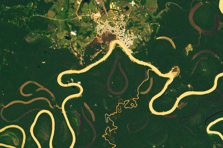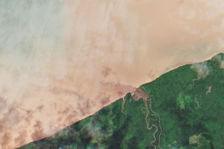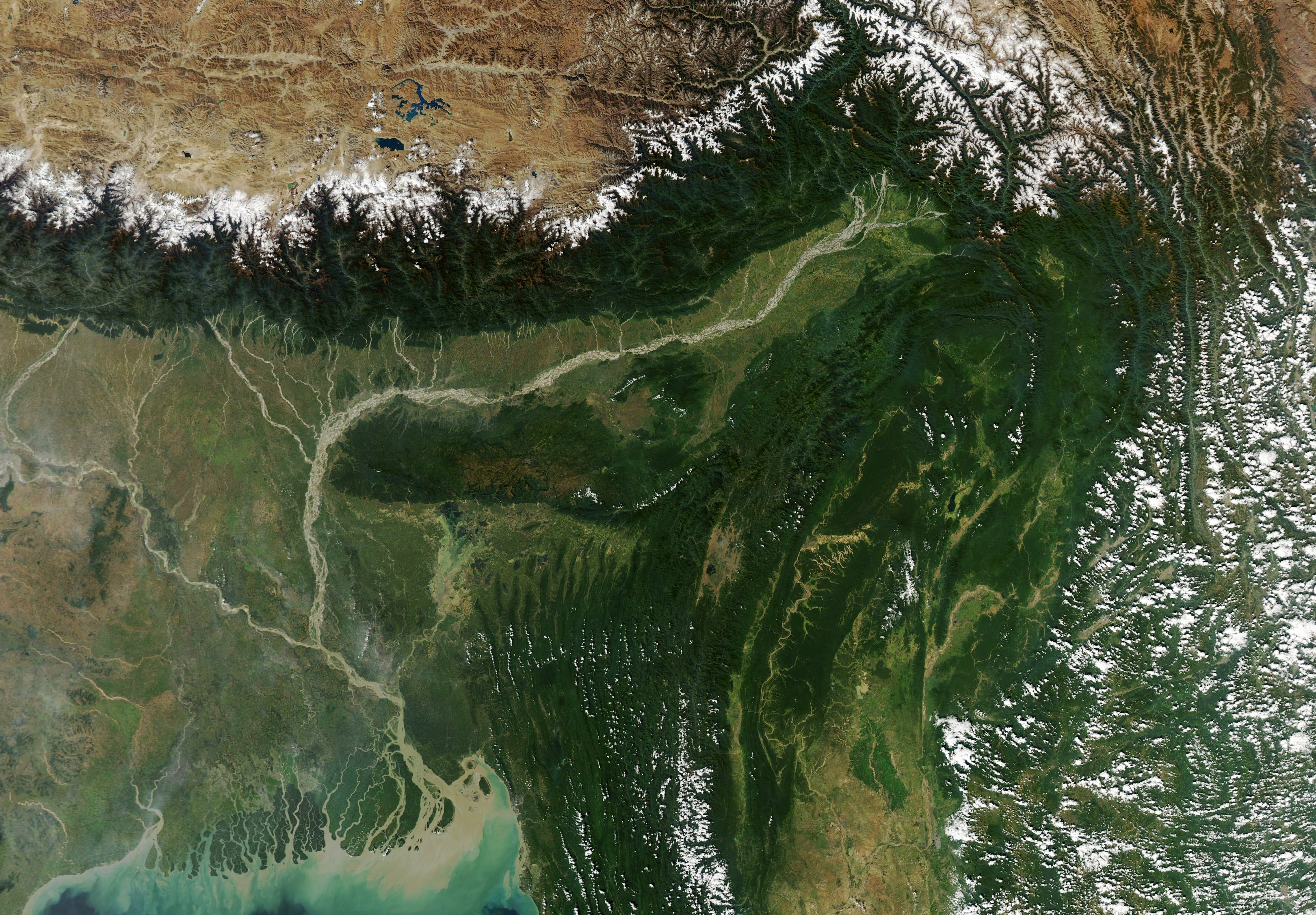
The Brahmaputra is a river of many names. In its upper courses, where it winds through a maze of narrow gorges in Tibet, it is the Yarlung Tsangpo. After a hairpin turn near Namche Barwa, it becomes the Siang. As it cascades through the Himalayan foothills in the northeastern Indian state of Arundal Pradesh, it is called the Dihang. People start calling it the Brahamputra as it widens and flows through Assam. After crossing into Bangladesh and absorbing the flow of several tributaries, it becomes the Jamuna River, then the Padma, and finally the Meghna before pouring into the Bay of Bengal.
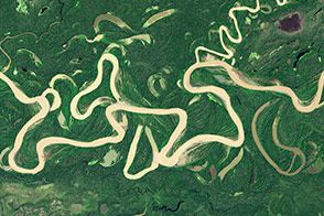
The Moderate Resolution Imaging Spectroradiometer (MODIS) on NASA’s Aqua satellite captured this natural-color image of the river on November 9, 2020. Notice how the narrow channel widens after passing the town of Pasighat, transforming into a braided river with multiple, interlacing channels. As the water slows in the flatter Brahmaputra Valley, it loses its capacity to carry sediment, depositing the excess silt in sandbars. In the course of a few kilometers, the river channel increases its width twentyfold.
With dozens of sediment-rich streams flowing south from the Himalayan highlands into the Brahmaputra Valley and an area with very high erosion rates near Namche Barwa, the Brahmaputra has one of the highest sediment loads per square kilometer of any river in the world—second only to China’s Yellow River.
In some ways, the sediment is a blessing. Annual floods spread mineral-rich silt across farmland adjacent to the river, replenishing the soil. In other ways, it poses challenges. There is so much of it that large boats are unable to navigate many parts of the river. In an attempt to limit how much the narrow, shallow channels erode land and flood, authorities have launched a number of large-scale dredging projects.
The vast amount of sediment deposited each year in the Ganges-Brahmaputra delta has ramifications for sea level rise. According to one recent study, the increasing weight of sediment piling up in the delta causes the land surface to sag downward. The authors found sediment loading adds 2 to 3 millimeters of subsidence per year, an amount comparable to the rate of global mean sea level rise.
NASA Earth Observatory image by Lauren Dauphin, using MODIS data from NASA EOSDIS/LANCE and GIBS/Worldview. Story by Adam Voiland.