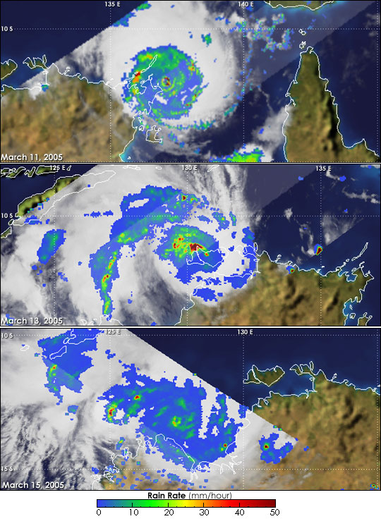
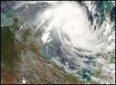
It is extremely rare for a powerful tropical cyclone to make landfall, weaken significantly, then later re-intensify back into a powerful storm again, but Cyclone Ingrid did just that. After crossing Queensland’s Cape York Peninsula on the 10th of March 2005, Cyclone Ingrid appeared to have all but dissipated (please see our related TRMM story). On March 11, 2005, a greatly-weakened Ingrid re-emerged over open water in the Gulf of Carpentaria. In a phenomenal re-birth, Ingrid rapidly re-intensified, going from tropical storm strength back to a Category 4 cyclone with maximum sustained winds estimated at 120 knots (138 mph) by the Joint Typhoon Warning Center in the span of just 12 hours.
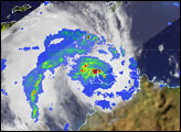
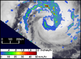
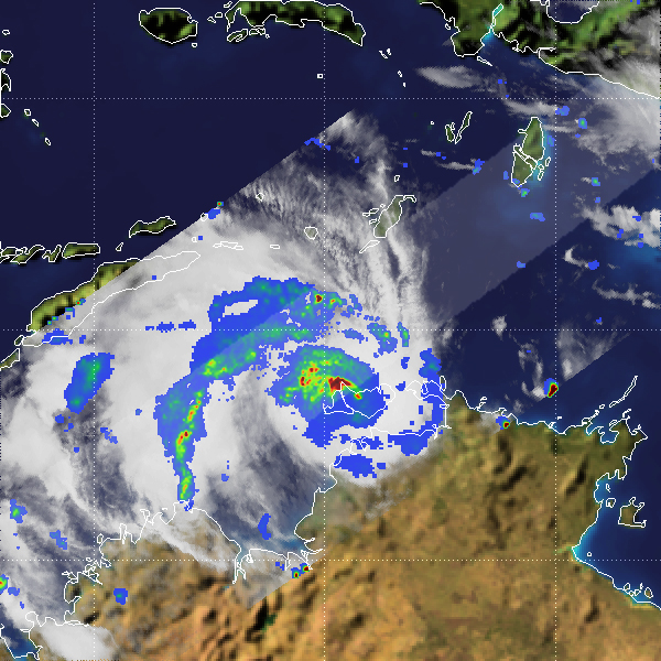
The Tropical Rainfall Measuring Mission satellite captured the top image of a rejuvenated Ingrid just off of the northeastern tip of Australia’s Northern Territory at 16:05 UTC on March 11 (2:05 a.m. on March 12, Australian CST). The image shows the horizontal distribution of rain intensity (top down view) as viewed by the TRMM satellite. Rain rates in the center swath are from the TRMM Precipitation Radar (PR), while rain rates in the outer swath are from the TRMM Microwave Imager (TMI). The rain rates are overlaid on infrared (IR) data from the TRMM Visible Infrared Scanner (VIRS). Ingrid’s center appears well-defined with a tight, symmetrical eye. Heavy rain rates (red areas) are embedded in the eyewall, and good banding is evident in the arcs of moderate rain intensity (green arcs) surrounding the eye.
Ingrid continued to move due west, paralleling the coast and remaining over water. This also allowed the storm to strengthen even further, becoming a Category 5 Super Cyclone on the evening of March 12 (local time). During the night and early morning of the following day, March 13 (local time), Ingrid hammered Croker Island with reports of recorded winds reaching 320 kph (198 mph), devastating the island. Fortunately, there were no reported deaths or injuries as residents took shelter. Continuing westward, Ingrid next crossed northern portions of the Cobourg Peninsula followed by Melville and Bathurst Islands north of Darwin.
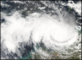
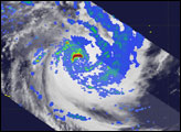
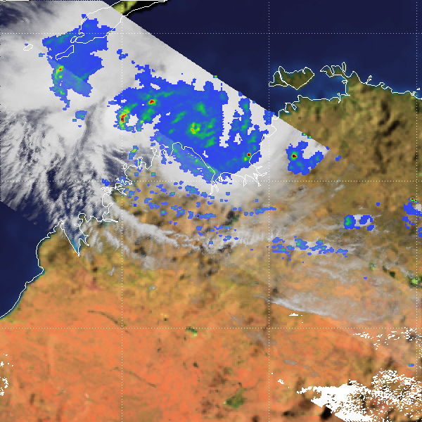
The center image, taken by TRMM at 15:50 UTC on March 13 (1:50 am on March 14, Australian CST) shows Ingrid right over the northern tip of Melville Island. At the time, Ingrid was a Category 3 storm with maximum sustained winds estimated at 100 knots (115 mph). An eye is not readily apparent with the storm’s circulation having been disrupted by its passage over the Cobourg Peninsula and Melville Island. However, a large area of intense rain (red area) still exists near the center with prominent banding still visible in the surrounding rain field.
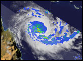
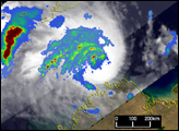
After passing over the northern tip of Bathurst Island, Ingrid entered the Timor Sea and was once more over open water. The storm now took a more southerly course heading southwest and began to strengthen yet again. On March 14, remarkably, Ingrid reached Category 4 intensity for the 3rd time with winds estimated at 115 knots (132 mph). The final image was taken at 05:45 UTC (3:45 pm Australian CST) on March 15. Although the storm’s center only falls within the TMI swath, a complete eye is clearly visible once again (green circle) with localized areas of heavy rain (red areas) embedded in the eyewall. Near the time of this image, Ingrid’s sustained winds were estimated at 130 knots (150 mph). Ingrid finally came ashore on the northern coastline of Kimberley in Western Australia on the night of March 15 (local time) near Faraway Bay.
TRMM is a joint mission between NASA and the Japanese space agency JAXA.
Images produced by Hal Pierce (SSAI/NASA GSFC) and caption by Steve Lang (SSAI/NASA GSFC).


