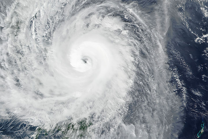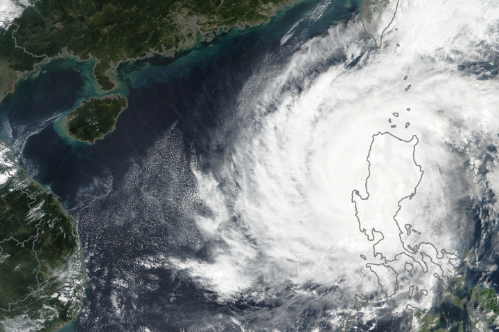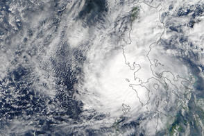
On December 2, 2019, a typhoon brought violent winds and torrential rainfall to the central Philippines, causing thousands of people to evacuate low-lying and mudslide-prone areas. The storm known as Kammuri (or Tisoy in the Philippines) is expected to pass Manila, the country’s capital, on December 3.
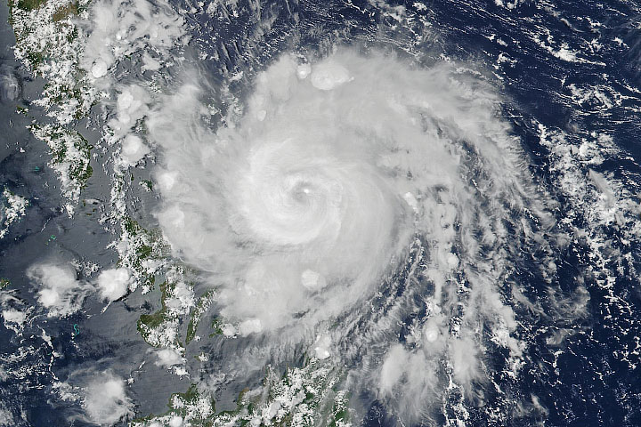
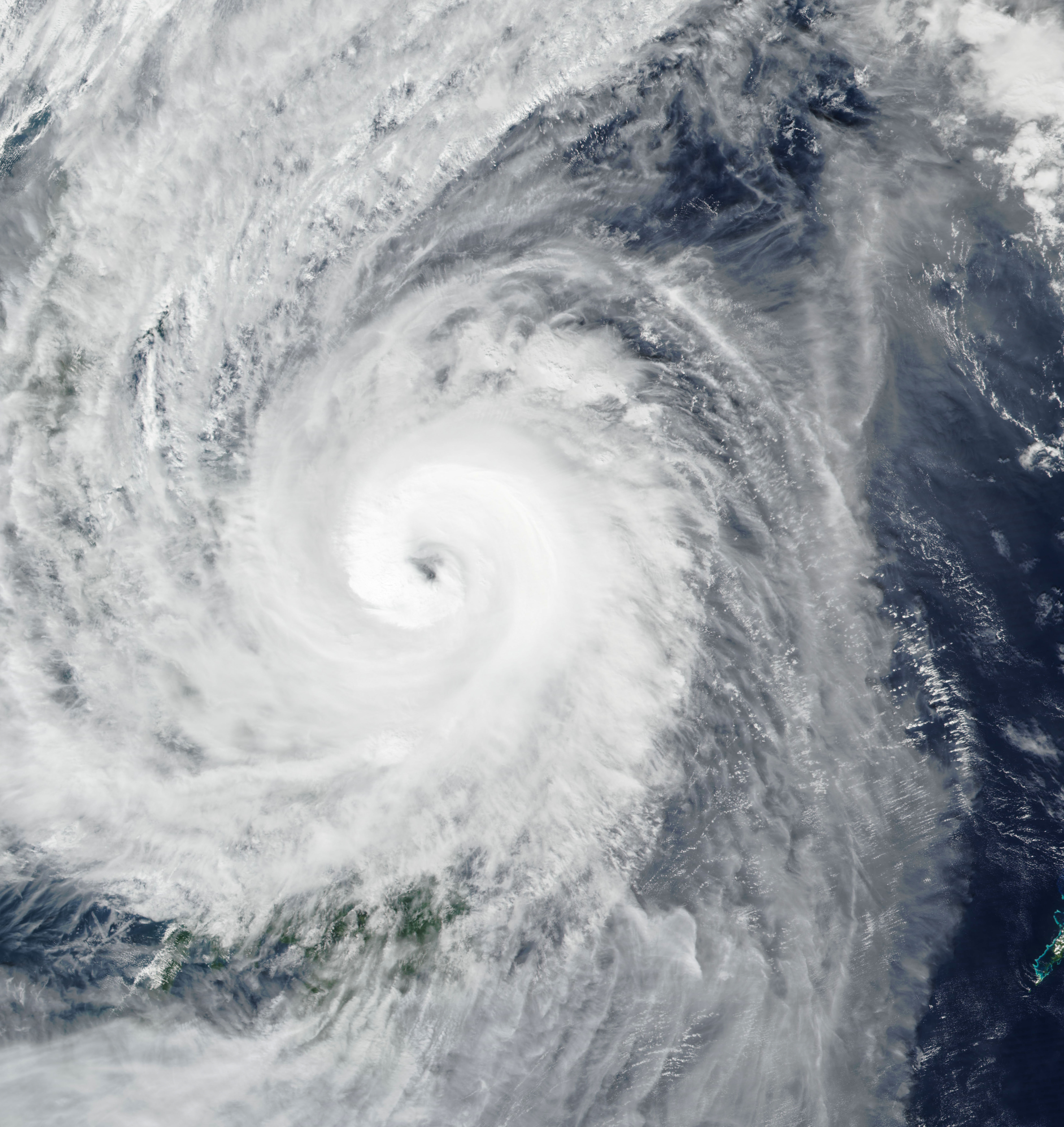
The image above shows Kammuri approaching landfall on December 2, when the typhoon’s maximum wind speed reached 90 knots (105 miles/170 kilometers per hour). The image was acquired by the Visible Infrared Imaging Radiometer Suite (VIIRS) on the NOAA-NASA Suomi NPP satellite.
Kammuri rapidly intensified from a category 1 to category 4 storm in 24 hours from December 1-2 before making landfall at Gubat. At the time of landfall on December 2, peak winds were estimated to be in category 3 range. By December 4, the storm is expected to weaken and exit into the South China Sea.
The Philippines meteorological agency, PAGASA, warned of possible flooding and landslides in several coastal areas over the next few days. More than six inches (15 centimeters) of rainfall are expected across the region through December 4, particularly affecting the Bicol Region, Calabarzon, Mimaropa, and Central Luzon, which includes Manila. PAGASA forecasted a storm surge up to three meters (10 feet) for many coastal areas. Winds could also knock over many trees and blow off the roofs of houses.
NASA Earth Observatory image by Joshua Stevens, using VIIRS data from NASA EOSDIS/LANCE and GIBS/Worldview, and the Suomi National Polar-orbiting Partnership. Story by Kasha Patel.