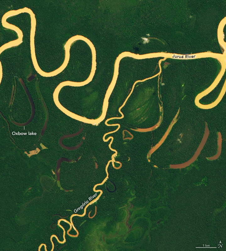


The Juruá River emerges from highlands in east-central Peru, then winds its way through lowlands in Brazil. By the time it empties into the Amazon River near Fonte Boa, the river course spans more than 3000 kilometers (2,000 miles). But as the crow flies, the distance between the river’s source and mouth is only about 1000 kilometers (600 miles).
Meanders make up two thirds of the Juruá’s length, making it one of the most sinuous rivers in the Amazon Basin. On May 27, 2019, the Operational Land Imager (OLI) acquired this image of a stretch near Eirunepé, a settlement established in the 1800s as a hub for rubber production. A semicircle of land has been cleared around the city (light green), probably for ranching. Buildings and roads (white) are clustered along the river, which flows through seasonally flooded wetland forests known as várzea (dark green).
Note the abundance of oxbow lakes flanking the river. These form when parts of wide, curved meanders—oxbows—grow so close together that the river breaks through the bank and creates a more direct route. This often happens during floods.
What makes rivers like the Juruá twist and turn so much more than other rivers? It flows through relatively flat terrain, which allows water to change course more readily than in other terrain. But research indicates that a heavy sediment load might be even more important. In analyzing three decades of Landsat images for 20 locations in the Amazon basin, the researchers from Cardiff University found that rivers carrying large amounts of sediment meandered more and had more cutoffs and oxbows than those carrying less sediment. The extra sediment accelerates the growth of point bars—sandy areas along the inside bends of meanders that can change the course of the flow and encourage the formation and lengthening of bends.
The river has such sediment-rich “whitewater” because it flows through hilly areas in the foothills of the Andes that have soft, easily eroded rock and soil.
NASA Earth Observatory images by Lauren Dauphin, using Landsat data from the U.S. Geological Survey. Story by Adam Voiland.