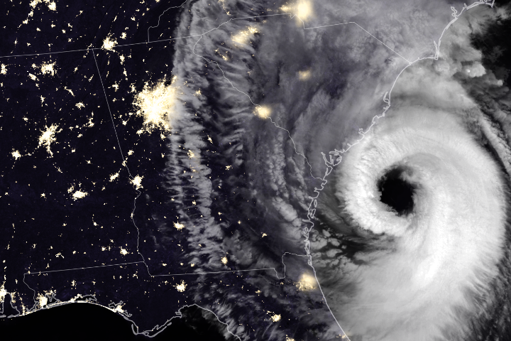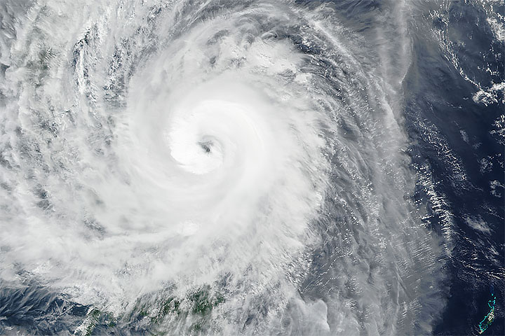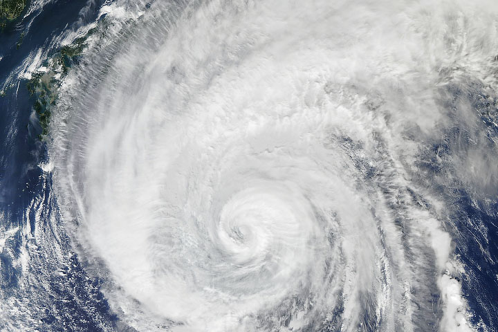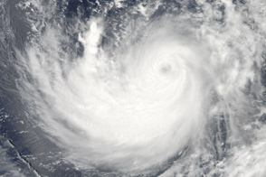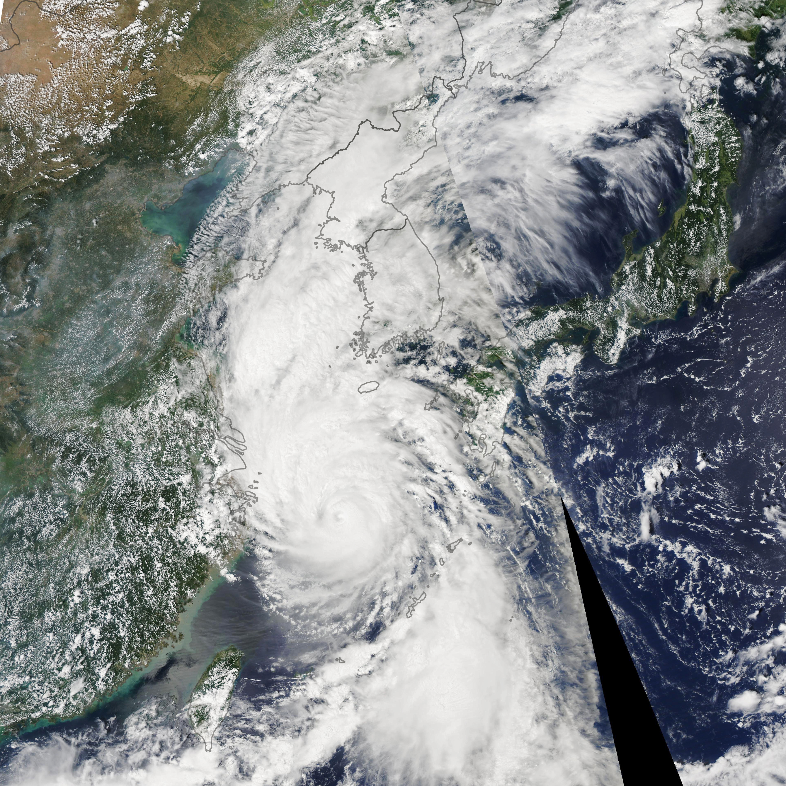
In early September 2019, Typhoon Lingling swept by the Philippines and Japan’s Ryukyu Islands, bringing heavy rain and strong winds that knocked over trees and utility poles. With maximum sustained winds of around 160 kilometers (95 miles) per hour, the typhoon is now headed toward South and North Korea.
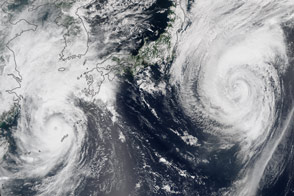
The Moderate Resolution Imaging Spectroradiometer (MODIS) on NASA’s Aqua satellite acquired this image of the typhoon on September 6, 2019. The storm was moving north at 40 kilometers (25 miles) per hour and is expected to reach the Yellow Sea on September 7. It is then forecasted to make landfall in North Korea, according to the Japan Meteorological Agency.
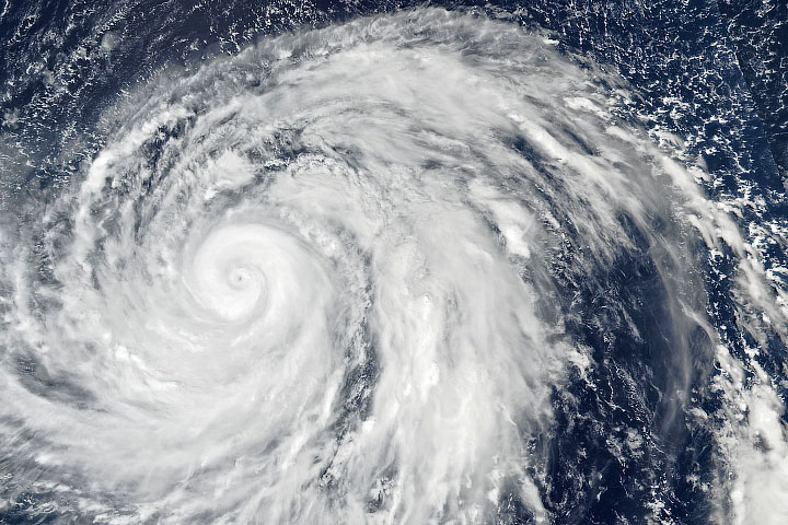
The typhoon is expected to weaken as its outer bands interact with land on South Korea, but forecasters still expect torrential rainfall and damaging winds. Forecasters predict around 75 to 150 millimeters (3 to 6 inches) of rainfall and a storm surge, both of which may cause flooding and landslides.
Typhoon Lingling is the thirteenth tropical cyclone (typhoon or tropical storm) in the North Pacific this year. However, the Korean Peninsula typically sees just one landfalling storm per year.
The Northwest Pacific experiences a lot of tropical cyclone activity (usually the most in the world) due to the basin's deep supply of ocean heat to fuel storms. According to climate scientist Wei Mei of the University of North Carolina, typhoons in the northwest Pacific have been increasing in intensity over the past four decades due to warming coastal seas. Wei published a study in 2016 showing that typhoons striking East and Southeast Asia intensified by 12 to 15 percent from 1977-2014. His ongoing research shows that the trend continued through 2018.
NASA Earth Observatory image by Lauren Dauphin, using MODIS data from NASA EOSDIS/LANCE and GIBS/Worldview. Story by Kasha Patel.