A NASA-led, international study finds Asia’s high-mountain glaciers are flowing more slowly in response to widespread ice losses. Analyzing two million pairs of satellite images, researchers measured the slowdown of glaciers in the region and found that 94 percent of the differences in flow rates could be explained by changes in ice thickness.
For more than a decade, satellite data have documented that glaciers were thinning as the amount of surface melting increased. “However, it has not been entirely clear how these glaciers are responding to this ice loss,” said the lead author of the new study, Amaury Dehecq of NASA’s Jet Propulsion Laboratory (JPL). “The rate at which they will disappear in the future depends on how they adjust to a warming climate.”
Asia’s mountain glaciers flow from the cold heights of the world’s tallest mountains (the Himalaya and Karakoram ranges) down to warmer climate zones where they melt much faster. This snow and ice feeds major rivers such as the Indus and Yangtze, so any changes in how glaciers flow and melt can affect freshwater availability in India, Pakistan, and China.
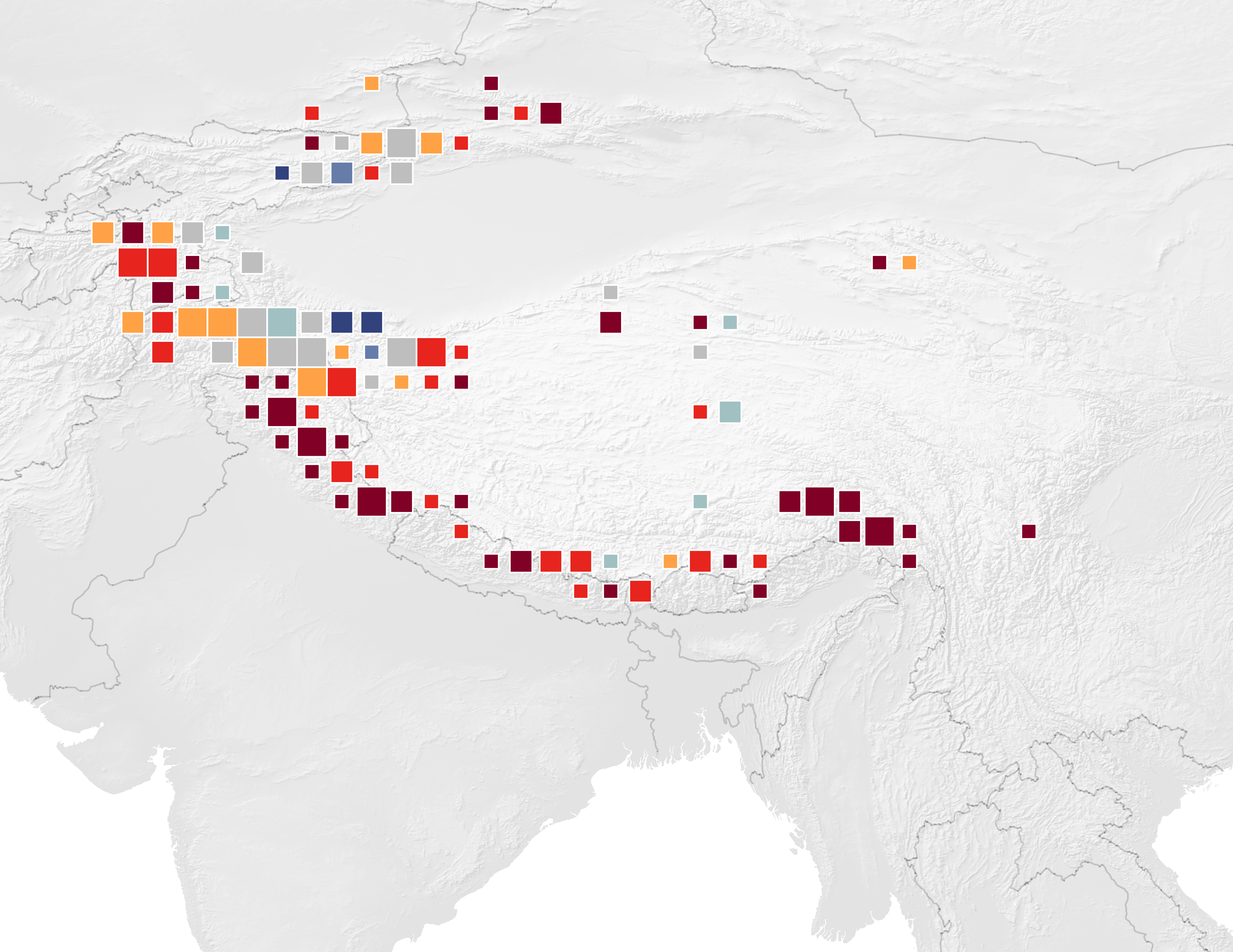
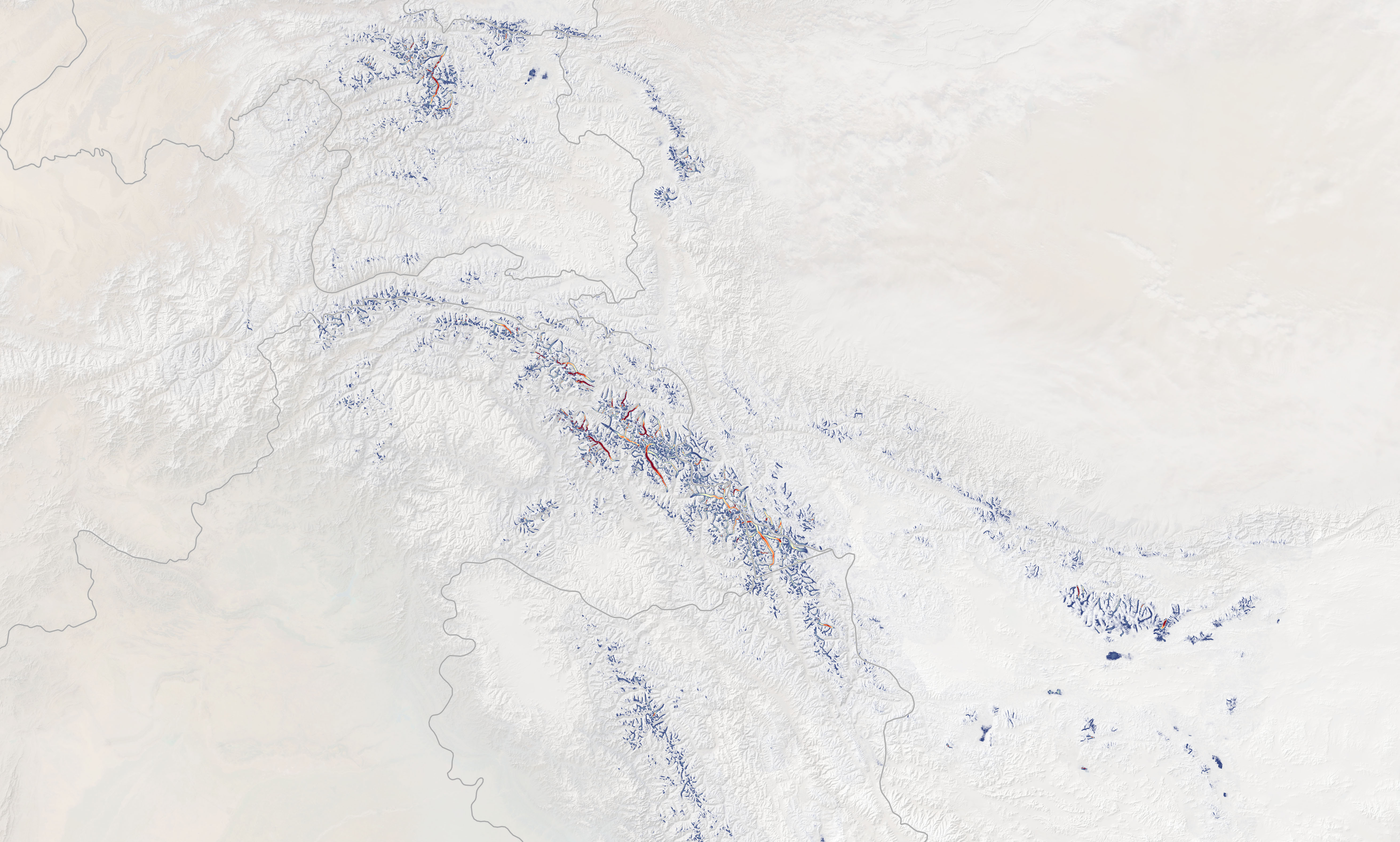
The map above depicts changes in glacier flow velocity in Asia from 2000 to 2017. Scientists have sought to understand what is regulating the flow speeds of glaciers in order to project how meltwater will contribute to the region’s water resources and to sea level rise. Observing the glaciers from the ground is difficult because of their huge geographic expanse and inaccessibility, so the researchers turned to satellite images.
Dehecq and colleagues developed computer algorithms to analyze almost two million pairs of Landsat images collected between 1985 and 2017. They used automated feature tracking to measure the distance that distinctive spots on the glaciers—such as crevasses or patches of dirt—traveled in the time between two images. “We do this millions of times and average through the noise [errors and random disturbances] to see changes in velocity on the order of one meter a year,” said study coauthor Alex Gardner of JPL.
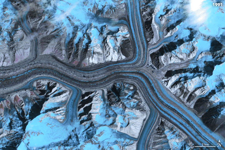
The animation above shows a sequence of false-color images from Landsat 5 and 7 (wavelength bands 5-4-3) of Baltoro Glacier flowing in the Karakoram range from 1991 to 2002. The moving ice appears in shades of gray and blue; the brighter blues on the surrounding landscape are changing snow and ice cover. The image below is an example of the flow velocity maps that Dehecq, Gardner, and colleagues can derive from such imagery.
“What is surprising about this study is that the relationship between thinning and flow speed is so consistent,” said coauthor Noel Gourmelen of the University of Edinburgh. In the few locations where glaciers have been stable or have thickened (rather than thinning), the study found that flow speeds have increased slightly.
The reason a glacier flows down a slope at all is because gravity pulls on its mass. The pull makes a glacier both slide on its base and deform or “creep”—a slow movement caused by ice crystals slipping past each other under the pressure of the glacier’s weight. As the glacier thins and loses mass, both sliding and creeping become more difficult, and the glacier's flow slows as a result.
However, other factors affect a glacier's rate of flow, such as whether water is lubricating the base so it can slide more easily. Scientists were unsure of the relative importance of these different factors. The new study shows that ice thickness outweighs any other factor in regulating flow speed over the long term.
NASA Earth Observatory images by Joshua Stevens, using data from Dehecq, A., et al. (2018) and Landsat data from the U.S. Geological Survey. Story by Carol Rasmussen, NASA Earth Science News Team.