animations:
small movie (972 KB MPEG)
large movie (2.5 MB QuickTime)
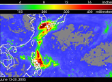
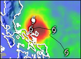
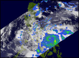
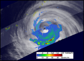
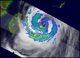
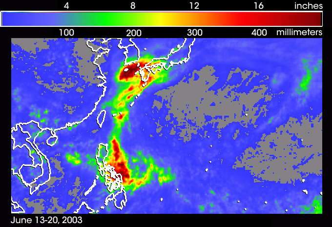
After traversing through the western Pacific over the past week, Tropical Cyclone Soudelor (07W) was beginning the end of its life cycle as it passed through the Korean Strait. Soudelor was named a Tropical Storm just west of the central Philippines at 12:00 UTC on the June 13, 2003. In the days following, the storm slowly skirted east of the Philippines where it delivered several inches of rain to the central islands as seen in the TRMM-based, near-real time Multi-satellite Precipitation Analysis (MPA) from the NASA Goddard Space Flight Center. Once past the Philippines, Soudelor took a more northerly track staying well east of the island of Taiwan and was elevated to typhoon status at 18:00 UTC on the June 16. After briefly reaching a strength of category 4 on the June 18, Soudelor began to weaken as it left the East China Sea and passed through the Korean Strait into the Sea of Japan.
TRMM was able to capture Soudelor's the swath of heavy rainfall extending from east of the Philippines all the way into southern Japan where the cyclone interacted with a frontal system. This rainmap shows the total rainfall accumulation for the period June 13-20, 2003. The heaviest rainfall totals were found just off the southern coast of Korea and were a result of Soudelor's interaction with the frontal system. Although parts of southern Japan are shown to have received several inches of rain, fortunately the heaviest amounts remained offshore.
NASA's TRMM or Tropical Rainfall Measurement Mission features a spaceborne weather radar built by the Japanese space agency NASDA. In operation for five years, TRMM has provided unprecedented views of tropical rain events around the globe. For more information on TRMM, please visit the TRMM website.
Image and movie courtesy of Hal Pierce, TRMM Project, NASA Goddard Space Flight Center.