By Walt Meier
Whenever I tell people that I’m a polar scientist or that I study sea ice, inevitably one of the first questions I’m asked is, “so, have you been to the ice?” I’ve always had to answer no. I’m a remote sensing scientist who works with satellite data. Other than a few aircraft flights over the ice several years ago, I’ve spent my career in front of a computer analyzing satellite images. When I’ve needed field data, e.g., to validate satellite measurements, I could always obtain it from colleagues. So there has never been any need for me to go out on the ice. And to be honest, spending days or weeks in the field, as many researchers do, does not have particular appeal to me – I like the comforts of my heated office! Nonetheless, I’ve always wanted to get out at least once in my career and see the ice close up, feel it crunching under my feet, hear it creak and groan as it strains under the winds and currents.
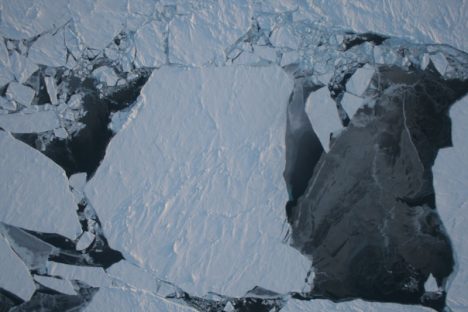
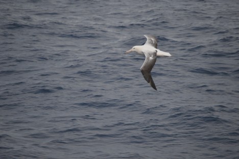
An image of sea ice in northwest Greenland, captured by NASA’s Operation IceBridge.
Now I am getting that chance, thanks to a National Science Foundation funded Summer Sea Ice Camp workshop. I and a couple dozen fellow scientists are heading to Barrow, Alaska – the northernmost point in the United States at 71 degrees N latitude – to partake in a unique project. The goal of this project isn’t specifically to collect data (though I hope that some of the data we collect will be useful), but rather to foster communication between remote sensing scientists like myself, sea ice modelers, and field researchers.
While there is a lot of collaboration in the sea ice community in terms of sharing data and results, scientists tend be silo-ed within their own area of expertise when it comes their actual work. Modelers focus on model development, validation, and results. Remote sensing folks like myself analyze satellite data. And field researchers collect and analyze in situ observations. Partly this is simply due to time – just focusing on one area keeps one plenty busy. But it is also partly due to a lack of communication. For example, I know a bit about modeling, but I don’t really understand the details of how a sea ice model is put together, how it can and should be used. Similarly, while modelers often use remote sensing data to compare with their model results, they don’t often understand the capabilities and limitations of satellite data. This can lead to under use or misuse of the data. And neither modelers nor remote sensing scientists may have much understanding of how to best take advantage of in situ data.
The goal of this workshop is to bring the three groups together for a week to talk and work with each other to better understand each of the three specialty areas and how perhaps the three groups can better work with each other to advance our understanding of sea ice. So now I’m on my way to Barrow, Alaska, looking forward to helping others understand satellite data, as well as running sea ice models and feeling that crunch of ice and snow under my feet as I collect data from on top of the Arctic Ocean. More in my next blog post from Barrow!
Credit: NASA/Christine Dow
By Christine Dow
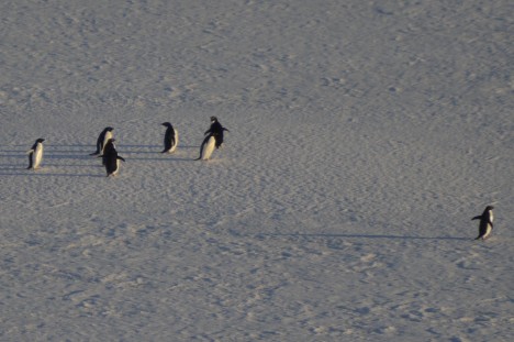
We have arrived back safe and sound after 11 days crossing the Southern Ocean. Our exit from Jang Bogo involved one last (very short) helicopter ride taking us to the Araon icebreaker so that they didn’t have to re-break ice to get back into port. I stayed up till the wee hours on the top deck watching us motoring away from my home for the last month, pushing large chunks of sea ice out the way. Some Adélie penguins were also witness to our departure along with snow and cape petrels diving and swooping around the wave tops. It was a very idyllic sight and I was sad to say goodbye to the Antarctic (until next time).
Credit: NASA/Christine Dow
Onward ho. Over the next few days we crashed and bumped our way through the sea ice. This was a good chance to get used to the (very) rolly motion of the boat. Icebreakers are designed with highly rounded keels, excellent for smashing through ice packs but not so great on the stomach. A very good distraction was the on-board table tennis table. Many doubles games were played over the course of the voyage, some more successful than others depending on whether the boat allowed both balls and players to be on a sensible trajectory.
Credit: NASA/Christine Dow
After two days, we were almost out of the sea ice pack when we suddenly had to turn around and return south. There had been a distress call from a fishing boat stuck in the ice and R/V Araon went to the rescue. We successfully hauled the boat free from the ice that it had become wedged on and escorted them to a region easier to navigate through. On the return journey we also stopped to collect some long sediment cores that the Korean scientists will analyze later.
The timing of our journey meant that we had Christmas on board the boat. Our party was on Christmas Eve and involved a veritable feast – the chefs had been very busy all day kindly preparing this for us. One of the Korean scientists also played some clarinet and saxophone music to get us in the Christmassy mood. We even had a Christmas tree, lashed to a railing to stop it flying all over the place.
Credit: NASA/Christine Dow
On the 11th day of our journey we could see land. It was very strange to see trees and green again after so long with just hues of blue and white. We had also been slowly getting used to the dark as we moved north following our time in 24-hour daylight; the first sunset of the voyage had been spectacular with giant albatross swooping behind the boat. I watched as we finally docked at the port of Lyttleton in New Zealand, feeling that “normal” life would be a little surreal after our adventure. It was time to say goodbye to our friends and colleagues and go home, just in time for the New Year. After such a trip it’s not surprising that one of my resolutions for the new year is to get back to the frozen continent…some day.
By Ryan Walker
Credit: NASA/Christine Dow
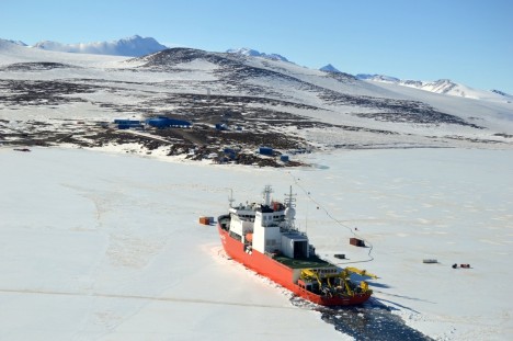
Before it was time to recheck our GPS stations and download data from them, the icebreaker Araon arrived at Jang Bogo, bringing new scientists, a new helicopter crew, fresh food, and other supplies. Because of heavy sea ice cover on the bay, the arrival was in slow motion, taking most of a day from the time the ship was visible from the station until it stopped a few hundred yards offshore due to unbreakable eight-foot-thick ice. Thick ice often requires an icebreaker to back up a considerable way, then charge forward into the ice, breaking through either by pure impact or by sliding the bow up onto the ice, causing it to collapse under the ship’s weight. One passenger told Christine and me that it was “like being in a car crash — all day.” We’re quite happy that there will already be a clear path out of the bay when we take the Araon back to Christchurch. Before leaving again for a roughly week-long science cruise, the ship also dropped off quite a lot of equipment for the various science teams, including most of the instruments to be installed by our hosts, the Extreme Geophysics Group. This meant that the time between Araon’s departure and return would be very busy, with limited time to install instruments before most of the scientists leave on the ship. On top of this, we had several days of bad weather that prevented any helicopter flights. In order to finish our work on the GPS stations, we had to squeeze into a busy flight schedule, which meant that Christine and I would go on separate flights.
Credit: NASA/Christine Dow
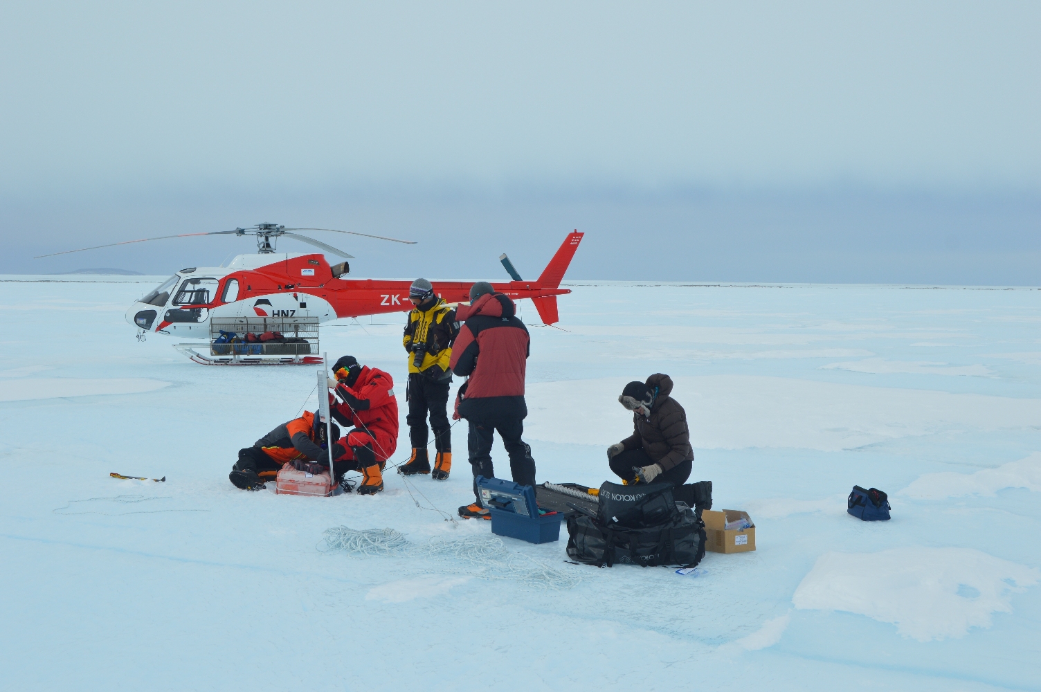
I was on the first flight on December 10, which began with Dr. Choon-ki Lee installing a new GPS station on a large piece of ice at the front of Nansen Ice Shelf that looks ready to calve off into a tabular iceberg. There’s a huge crack, miles long and sometimes over a hundred yards wide, which runs more or less parallel to the front of the ice shelf. Over the winter, the sea surface freezes and traps small icebergs in the crack, producing a fascinatingly broken icescape. Comparing ice velocities between this new GPS and our stations should let us monitor the calving process and learn more about how it works. When we moved on to check the first of our GPS stations, I found that it wasn’t operating at all. After checking the wiring, I worked out that the problem was either in the wire to the receiver, the regulator (the electrical component that connects the solar panel, battery, and receiver), or the GPS receiver itself (potentially big trouble) — but had no idea which one. I pulled out those three components to check back at Jang Bogo, and we secured the rest of the station and moved on. Fortunately, after an unpromising start, the two other GPS stations we visited were working perfectly. While downloading the data, which involved about fifteen minutes of connecting my laptop and then sitting on the ice typing obscure commands, I was amused by how much this aspect of field work resembled the computer modeling work I usually do, though with vastly better scenery. We then returned to Jang Bogo with two stations in good shape, two yet to be checked, and one hopefully to be repaired.
Christine says: It was getting worryingly close to the time when we would be leaving the Antarctic and we still had some data to collect and the GPS to fix. I found that the GPS problem had been due to a faulty solar regulator and replaced it with a spare back at base. Luckily I managed to piggy back on a flight out to the Nansen Ice Shelf with the Extreme Geophysics Group while they were putting out seismic stations. Replacing the GPS was quick, with the satellite lights blinking encouragingly; now we just have to hope the system will continue working for the next couple of months. At the next station, I downloaded the data while wind blew some loose snow all over me and the computer. I probably looked a little like a snowman by the end of that. The final job was to replace the tethers on the last GPS (see our previous blog post). It was not without sadness that I waved goodbye to the plucky little machines, which would sit out on the ice on their own until the end of February. At that stage one of our Korean colleagues who is overwintering at Jang Bogo will collect them for us and send them back on the ship.
Speaking of the ship, we’re off. It is due to arrive tomorrow and we will set sail for our 7-10 day ‘cruise’ back to Christchurch in New Zealand. Its hard to believe we’ve been here 5 weeks already and it feels a bit strange to be packing up and leaving. We’re hoping for some wildlife spottings on the boat and more importantly not to be completely debilitated by sea sickness. Internet is not readily available on the Araon so we will report back when we reach dry land. Wish us luck!
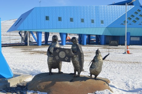
Goodbye, Jang Bogo! (Credit:NASA/Christine Dow)
By Brian Walker
November 19th — After the final cargo flight on November 17th, we finally had all our equipment and could prepare for installation. This wasn’t without some drama, as we initially received only four batteries and various pipes, but none of the actual instruments. After a few tense hours of emailing, we found that the rest of our gear had accidentally been sent to the Italian Mario Zucchelli Station, so we would be fine. (Zucchelli and Jang Bogo are within sight of each other, about six miles apart on opposite sides of a bay which is currently frozen over, so the Italians and Koreans share flights.) Christine joined a group taking a tractor drive over to Zucchelli the next day and retrieved the misplaced equipment. After a long day of testing our GPS units outside in high winds and organizing the equipment in a slightly cramped laboratory building, we were ready to go the next morning.
We were fortunate to begin the day with good weather, and due to a slow schedule, we had both helicopters. This allowed four Korea Polar Research Institute (KOPRI) personnel, including a safety guide, to join us. With their help, we were able to install the GPS stations much more quickly (sometimes in as little as half an hour) than we would have been able to manage by ourselves.
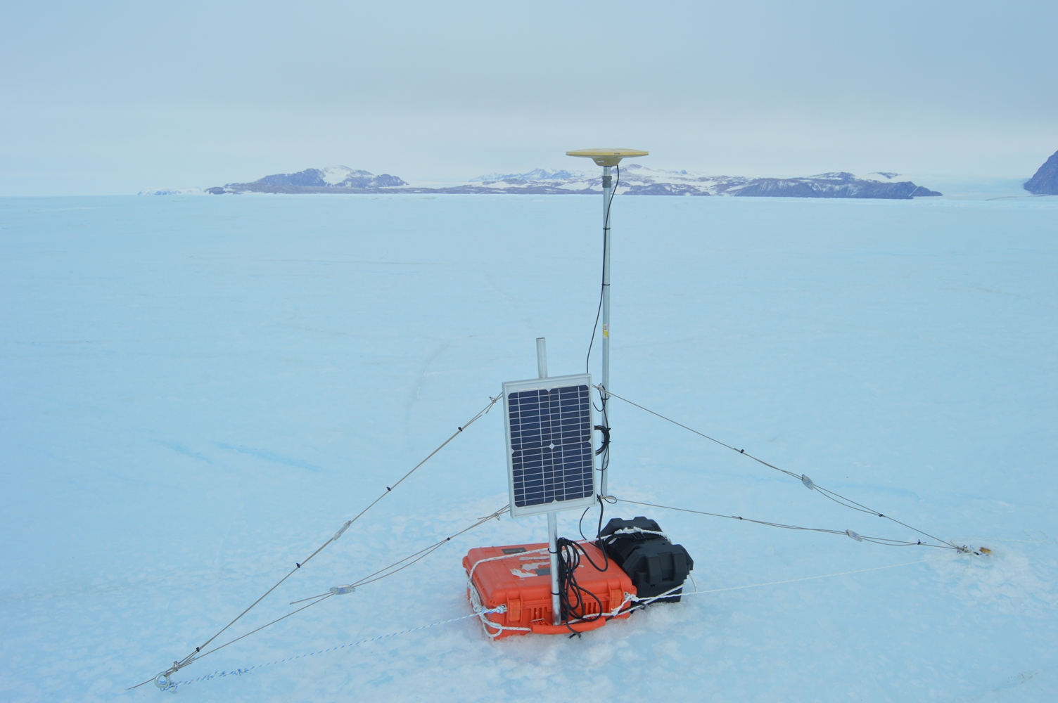
Our GPS systems include a disk-shaped antenna that receives satellite signals and a computerized unit that processes and records data. With good processing after the stations are retrieved, we should get positions accurate to about half an inch, which will allow us to study the vertical and horizontal motion of the ice shelf, especially the effect of ocean tides. The stations also include a solar panel and a 12-volt battery (essentially a car battery) for power. To install a station, we wire the receiver (the computer), which stays inside a weatherproof plastic box the size of a carry-on suitcase, to the antenna, solar panel, and battery. The antenna is mounted about five feet off the ground on the end of an eight-foot steel pole sunk into a three-foot drilled hole. The solar panel is mounted on a shorter pole that also passes through the carrying handle of the plastic receiver box, so that it’s much harder for the receiver to blow away — a constant threat with a slippery ice surface and high winds. Wires attached to anchors drilled into the ice secure the solar panel, and the battery is firmly strapped to the receiver box. Where necessary, we used ice axes to chop roughly six-inch deep holes for the receiver box and battery to rest in. For the poles and anchors, the final step was to pour water into their holes, which instantly froze and locked them into place.
We had planned on installing two GPS stations, then returning to Jang Bogo to reload the helicopters and installing the remaining three in the afternoon. However, heavy cloud cover started to blow in as we installed the first station of the afternoon. Clouds diffuse sunlight and create an effect called “flat light”, in which depth perception of white snow and ice surfaces becomes difficult. This obviously isn’t good for flying helicopters, so we returned to the station early to be safe. It was still a good day, with three GPS stations successfully installed. Two GPS stations and two tilt meters remain to be installed when weather and flight schedules permit.
By Ryan Walker
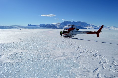
On our first full day at Jang Bogo, we weren’t expecting very much to happen. The majority of our equipment wouldn’t be arriving for another three days, so we thought we would settle in and learn about the basic amenities of the station — food, showers, laundry, wifi, espresso machine. (I’m not joking, there really is an espresso machine. You can learn all sorts of unexpected skills living in Antarctica.) But then the day turned out to be sunny and clear, perfect for flying, and one of our collaborators, Dr. Hyeon Jae Yoo, came and told us that he had reserved a helicopter for that afternoon to scout out our field sites.
Choosing field sites can be rather tricky. We had spent quite a while looking at satellite images and computer model output in order to estimate where the processes we wanted to study would likely be strongest. For GPS measurements of ocean tides causing ice motion, we wanted to be more in the middle of the ice shelf, away from the islands and rocky outcrops that pin its margins in place. For tilt meter measurements of ice shelf flexure, we would need to be near the landward edge of the shelf — most of an ice shelf floats freely up and down on the tides, and the bending happens in a narrow strip (maybe a few kilometers wide) between the floating ice and the ice resting on the land. Field site selection is then a balance between finding the ideal place to collect data and finding places where you actually can collect data. Crevasses (large cracks in the ice), very uneven ground, and ponds formed by melting of the ice surface can all prevent setting up instruments. In the end, it’s essential to get an in person look at your sites, preferably before you’ve dragged all your equipment there.
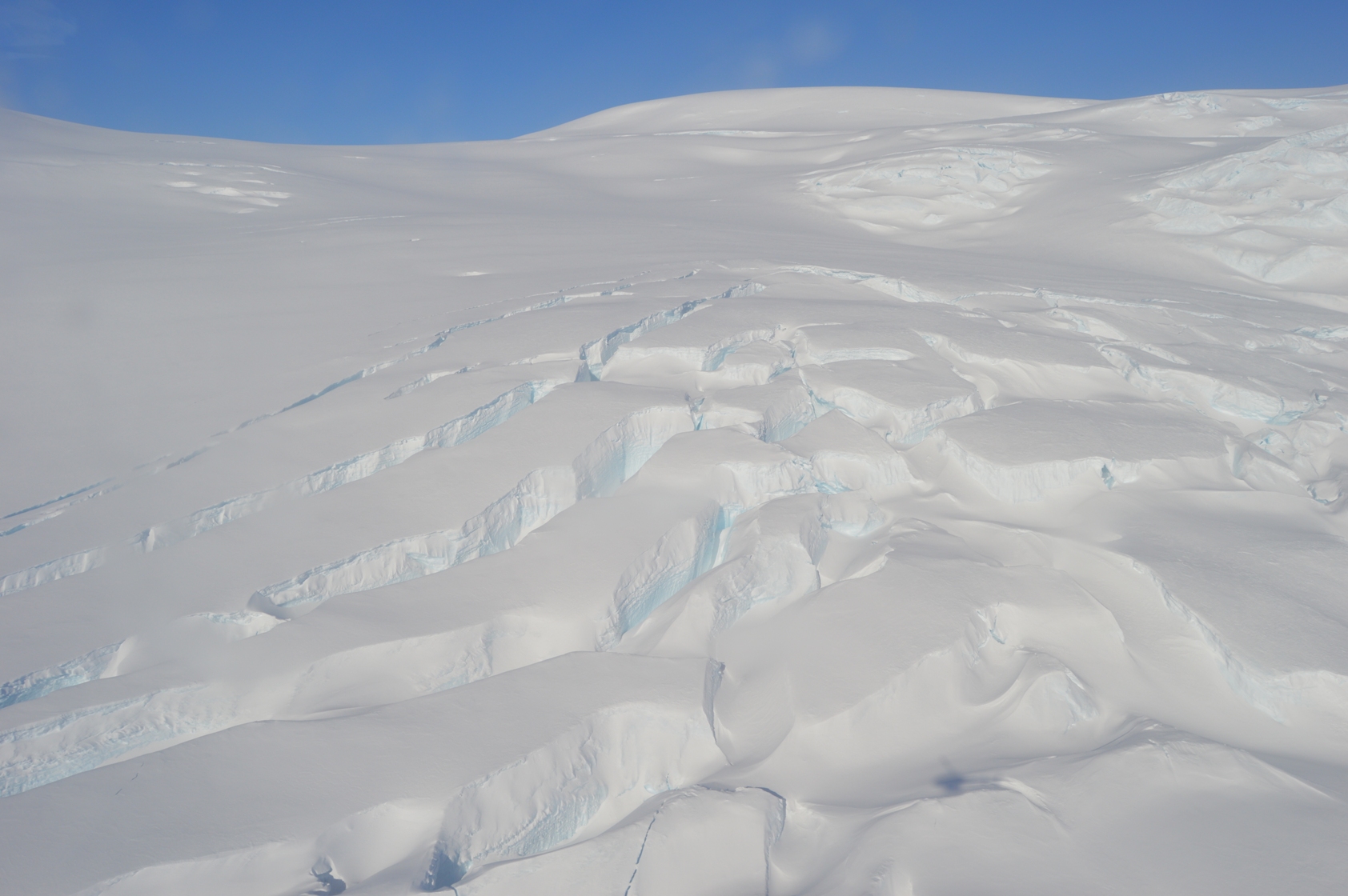
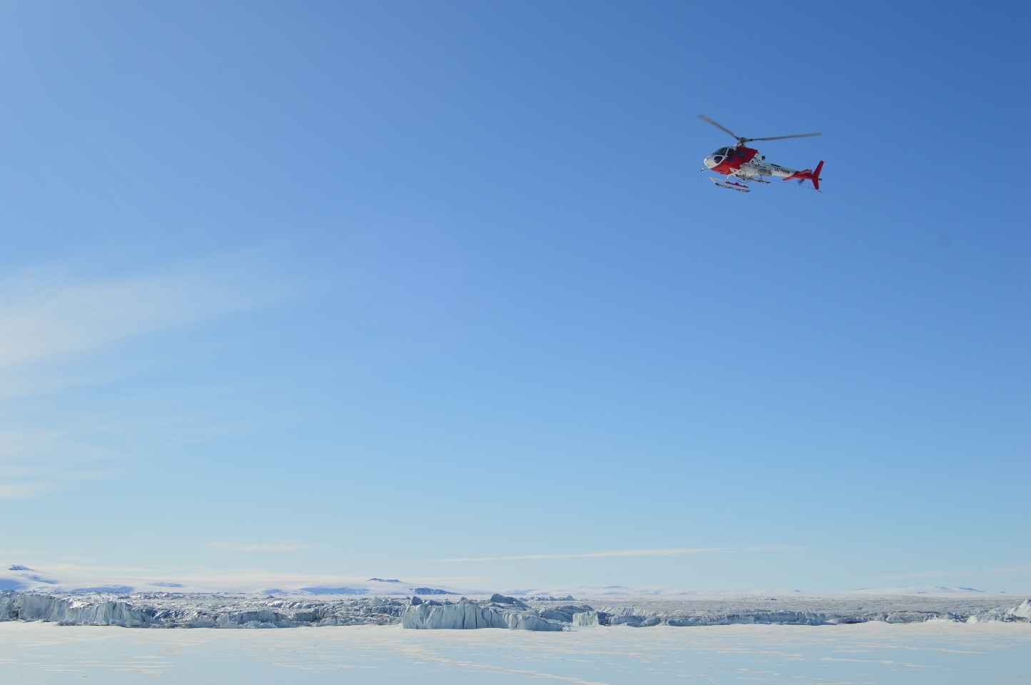
Large crevasses in the ice.
This was my first helicopter flight, and since it was my birthday (what a celebration!) Hyeon Jae and Christine insisted I should sit up front. Taking off is sort of like riding in a glass elevator. Flying in a helicopter is very different from flying in an airplane. Being able to go low and slow (or hover) gives great views. We were able to circle our GPS sites at about 10 feet off the ground, and touch down briefly (with the rotors going) at our tilt meter sites to test the firmness of the snow. Our GPS sites are all on blue ice, with no snow cover, and look favorable for installing the instruments. We’ll just have to shift a few of them a short distance so they’re on ridges rather than hollows — although the ice is pretty flat, this matters when the ice surface starts to melt later in the summer and the water flows downhill. Our tilt meter sites are on a snow-covered area, so we will have to dig down to ice (or at least very firm snow) to get a solid base so we can install the instruments level. This is really important because the ice only bends a little, so the tilt meters measure angles less than half a degree. (That’s a little less than 1 foot up per 100 feet across.)
Overall, we were very happy with the results of this flight. Our field areas look good, and we got truly spectacular views of the ice shelf and the rocky hills surrounding it. I shot video with a NASA-provided GoPro, and it came out great, even though all I had to do was point the camera at the windscreen and try to hold it still. The files are too large to post from Antarctica, but the best scenes should be part of the final video that Goddard will produce when we’re back home. Thanks to our pilot, Dominic of Helicopters New Zealand, for a smooth and safe flight.
