In a quiet town on the border of Peru and Brazil, indigenous representatives from across the Amazon met with a team of NASA-funded geographers seeking to better understand how climate change is affecting the region–and trying to set an example for how the scientific community works with indigenous peoples.
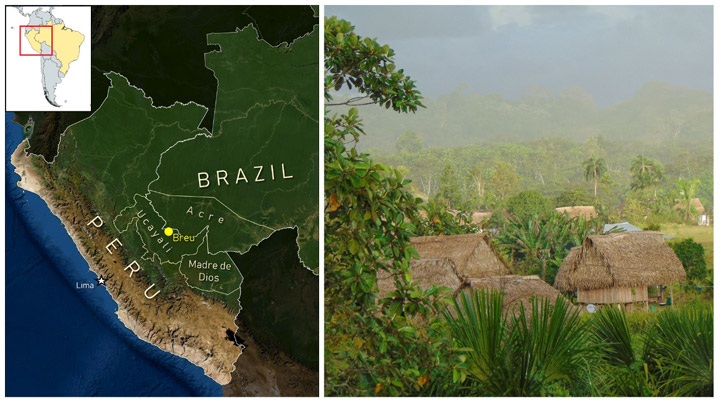
Puerto Breu, Peru (population: 600-ish) is not the town you might think of for an important work meeting. A holdover of the late 19th Century Amazonian rubber boom, this remote outpost is only accessible by charter flights or by long, winding journeys by river boat. In June 2022, Breu hosted an important summit between SERVIR Amazonia and indigenous communities from across the southwestern Amazon. The event allowed geographers with SERVIR, a joint program of NASA and the U.S. Agency for International Development, an opportunity to listen to members of the communities they study and learn how to better protect the region from climate change and other environmental challenges.
SERVIR collaborates with leading scientific and conservation organizations in the region, such as Conservación Amazónica (ACCA) and the Upper Amazon Conservancy, which make events like this possible. The program’s mission is to address climate and environmental challenges by helping communities around the world access and learn to use data from NASA’s Earth satellites. Many of its regional projects in Amazonia are designed to aid rainforest conservation and to prioritize the participation and leadership of local communities in the process.
“Much of this region is still forested and remote, but the pace of deforestation and other illegal activities has been intensifying in recent years,” said Katie Walker, a Regional Science Associate with the SERVIR Program who helped with the event. She notes that attention on the southwestern Amazon is a relatively recent development. Scientists and conservationists have historically been preoccupied with the southeastern Amazon, where greater proximity to major cities and highways catalyzed land development.
“In the Brazilian states of Rondonia and Mato Grosso, for example, most of the land area not occupied by indigenous groups has been either deforested and converted to cropland, or has been influenced by these activities,” Walker said. “But now attention is also turning to the southwestern Amazon, where similar patterns are emerging.”
In Peru’s Ucayali Department and the neighboring Brazilian state of Acre, the Upper Amazon is threatened by climate change and demand for luxury hardwoods. Informal roads, or carreteras, built by logging and mining ventures, cut through the jungle and often serve as stepping stones for further deforestation as further human development follows. In the intense equatorial sun, losing tree cover quickly dries out the ground, which can permanently diminish the soil quality and hinder new growth. To protect the world’s climate and help preserve the region’s human and ecological heritage, scientists need in-depth understanding of ecosystem services in the region. Especially for such a historically isolated region, the scientific community needs to consult the best experts it can find: the indigenous communities who live there.
The accelerating loss of forests in the southwestern Amazon creates a major threat to the region’s many indigenous communities, like the Ashéninka, Asháninka, and Yaminahua/Jaminahua. Historically, scientists and conservationists have often prescribed answers to these communities without acknowledging the generations of knowledge these communities have regarding their surroundings.
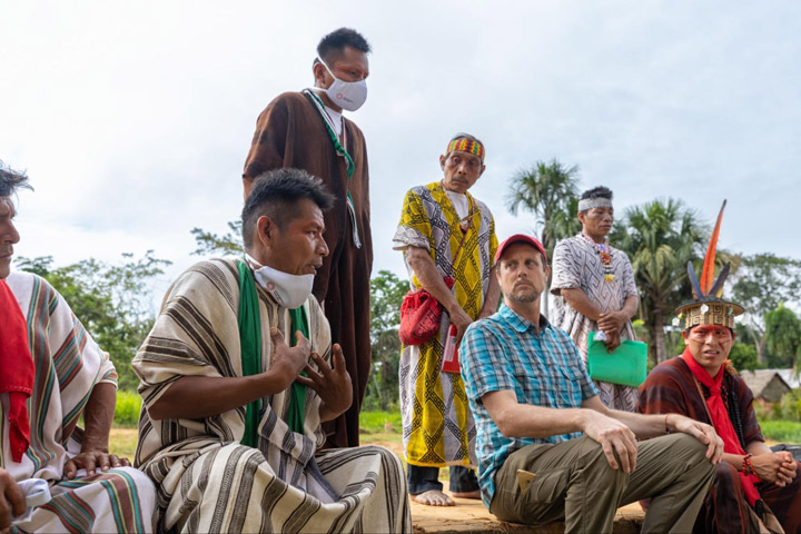
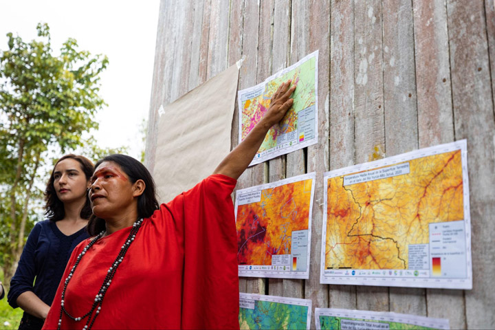
Dr. David Salisbury, a geographer from the University of Richmond’s Amazon Borderlands Spatial Analysis Team, led the NASA-funded visit to Breu in June to meet with more than 120 indigenous representatives from communities across the Southwest Amazon. The goal of the meeting was to seek community feedback about online tools that use NASA satellite data to monitor forest conditions in the region, but also to draw connections between the observations seen in satellite imagery and the daily observations of people on the ground.
“This was a historic workshop given that we had 120 Indigenous participants from 13 different ethnicities representing a transboundary area in Brazil and Peru the size of Michigan,” said Salisbury. “Our top goal was to give our Indigenous counterparts, who are local forest and climate experts, the opportunity to see if their lived experience and long-term observations of the forests, humidity, seasonality, and rainfall matched up with forest and climate trends our University of Richmond team was picking up in our satellite imagery analysis. Once the Indigenous participants became experts in our maps, they saw the benefits of our online tools that could show how ecosystem services could change in their homelands across space and time.”
Though Salisbury has almost 20 years of experience working in this part of the Amazon (he smoothly transitions between English, Spanish, and Portuguese mid-sentence), he emphasizes that his experience is relatively little in comparison to the lived experiences of local communities. In a packed one-room schoolhouse, the team spent two days talking with indigenous communities, inviting them to introduce their communities and explain how each is seeing the manifestations of climate change on a local and personal level.
“The quantity and quality of participation was amazing […] The key was then to take the first day slowly and focus on building community through the sharing of their own expert knowledge of forest and climate,” Salisbury said. “We mapped out how they were connected to each other through culture, watersheds, and landscape as they introduced themselves. Everyone had the opportunity to get to know each other across gender, age, and geography. Once they established their expertise, built a positive learning community, and shared similar concerns for their future, we introduced the science and technology to our receptive and empowered Indigenous collaborators.”
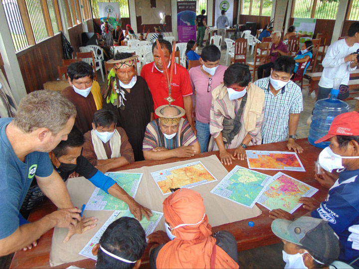
The event used discussion groups split by ethnic group, age, and gender to better understand how the effects of climate change and deforestation are experienced in different communities and by different demographics. These groups were asked for their opinions about climate change and for their interpretations of maps the team created using data from NASA Earth satellites.
“The studies they have done will help us a lot to do our monitoring of the community, and to involve more women,” Maria Elena Paredes said. Paredes is an Ashéninka activist and the coordinator of the Community Vigilance Committee for the Sawawo Hito 40 community in Peru, and was a vocal figure in both the women’s discussion groups and in the broader conversations.
“[The studies] involve more young people so that they learn how to take care of our forest and community,” Paredes said, noting the high representation of young indigenous participants. Her son Luis was a participant in the youth-focused discussion groups.
The team hopes that feedback from the event will not only help them better tailor their data and tools to the needs of local communities, but also to set a positive example for centering the expertise and experience of indigenous communities in Earth science research. Healthy dialogue between indigenous groups and the scientific community make for conservation efforts that are more effective and socially just.
The lessons learned in Puerto Breu can hopefully improve the efficacy of applied Earth sciences, and more importantly, set a positive example for the scientific community.
