In a quiet town on the border of Peru and Brazil, indigenous representatives from across the Amazon met with a team of NASA-funded geographers seeking to better understand how climate change is affecting the region–and trying to set an example for how the scientific community works with indigenous peoples.
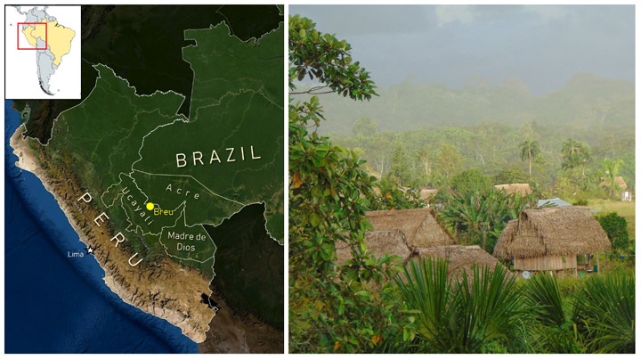
Puerto Breu, Peru (population: 600-ish) is not the town you might think of for an important work meeting. A holdover of the late 19th Century Amazonian rubber boom, this remote outpost is only accessible by charter flights or by long, winding journeys by river boat. In June 2022, Breu hosted an important summit between SERVIR Amazonia and indigenous communities from across the southwestern Amazon. The event allowed geographers with SERVIR, a joint program of NASA and the U.S. Agency for International Development, an opportunity to listen to members of the communities they study and learn how to better protect the region from climate change and other environmental challenges.
SERVIR collaborates with leading scientific and conservation organizations in the region, such as Conservación Amazónica (ACCA) and the Upper Amazon Conservancy, which make events like this possible. The program’s mission is to address climate and environmental challenges by helping communities around the world access and learn to use data from NASA’s Earth satellites. Many of its regional projects in Amazonia are designed to aid rainforest conservation and to prioritize the participation and leadership of local communities in the process.
“Much of this region is still forested and remote, but the pace of deforestation and other illegal activities has been intensifying in recent years,” said Katie Walker, a Regional Science Associate with the SERVIR Program who helped with the event. She notes that attention on the southwestern Amazon is a relatively recent development. Scientists and conservationists have historically been preoccupied with the southeastern Amazon, where greater proximity to major cities and highways catalyzed land development.
“In the Brazilian states of Rondonia and Mato Grosso, for example, most of the land area not occupied by indigenous groups has been either deforested and converted to cropland, or has been influenced by these activities,” Walker said. “But now attention is also turning to the southwestern Amazon, where similar patterns are emerging.”
In Peru’s Ucayali Department and the neighboring Brazilian state of Acre, the Upper Amazon is threatened by climate change and demand for luxury hardwoods. Informal roads, or carreteras, built by logging and mining ventures, cut through the jungle and often serve as stepping stones for further deforestation as further human development follows. In the intense equatorial sun, losing tree cover quickly dries out the ground, which can permanently diminish the soil quality and hinder new growth. To protect the world’s climate and help preserve the region’s human and ecological heritage, scientists need in-depth understanding of ecosystem services in the region. Especially for such a historically isolated region, the scientific community needs to consult the best experts it can find: the indigenous communities who live there.
The accelerating loss of forests in the southwestern Amazon creates a major threat to the region’s many indigenous communities, like the Ashéninka, Asháninka, and Yaminahua/Jaminahua. Historically, scientists and conservationists have often prescribed answers to these communities without acknowledging the generations of knowledge these communities have regarding their surroundings.
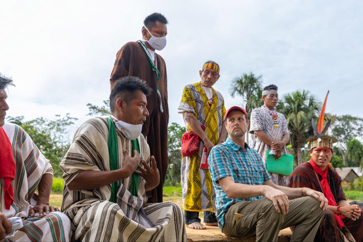
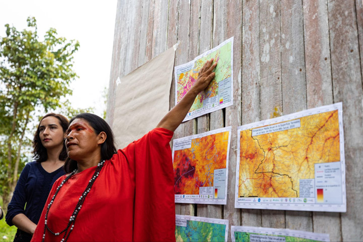
Dr. David Salisbury, a geographer from the University of Richmond’s Amazon Borderlands Spatial Analysis Team, led the NASA-funded visit to Breu in June to meet with more than 120 indigenous representatives from communities across the Southwest Amazon. The goal of the meeting was to seek community feedback about online tools that use NASA satellite data to monitor forest conditions in the region, but also to draw connections between the observations seen in satellite imagery and the daily observations of people on the ground.
“This was a historic workshop given that we had 120 Indigenous participants from 13 different ethnicities representing a transboundary area in Brazil and Peru the size of Michigan,” said Salisbury. “Our top goal was to give our Indigenous counterparts, who are local forest and climate experts, the opportunity to see if their lived experience and long-term observations of the forests, humidity, seasonality, and rainfall matched up with forest and climate trends our University of Richmond team was picking up in our satellite imagery analysis. Once the Indigenous participants became experts in our maps, they saw the benefits of our online tools that could show how ecosystem services could change in their homelands across space and time.”
Though Salisbury has almost 20 years of experience working in this part of the Amazon (he smoothly transitions between English, Spanish, and Portuguese mid-sentence), he emphasizes that his experience is relatively little in comparison to the lived experiences of local communities. In a packed one-room schoolhouse, the team spent two days talking with indigenous communities, inviting them to introduce their communities and explain how each is seeing the manifestations of climate change on a local and personal level.
“The quantity and quality of participation was amazing […] The key was then to take the first day slowly and focus on building community through the sharing of their own expert knowledge of forest and climate,” Salisbury said. “We mapped out how they were connected to each other through culture, watersheds, and landscape as they introduced themselves. Everyone had the opportunity to get to know each other across gender, age, and geography. Once they established their expertise, built a positive learning community, and shared similar concerns for their future, we introduced the science and technology to our receptive and empowered Indigenous collaborators.”
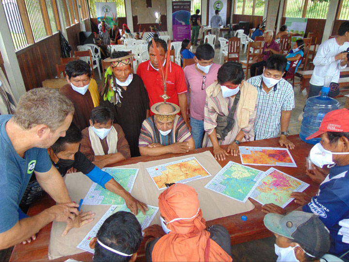
The event used discussion groups split by ethnic group, age, and gender to better understand how the effects of climate change and deforestation are experienced in different communities and by different demographics. These groups were asked for their opinions about climate change and for their interpretations of maps the team created using data from NASA Earth satellites.
“The studies they have done will help us a lot to do our monitoring of the community, and to involve more women,” Maria Elena Paredes said. Paredes is an Ashéninka activist and the coordinator of the Community Vigilance Committee for the Sawawo Hito 40 community in Peru, and was a vocal figure in both the women’s discussion groups and in the broader conversations.
“[The studies] involve more young people so that they learn how to take care of our forest and community,” Paredes said, noting the high representation of young indigenous participants. Her son Luis was a participant in the youth-focused discussion groups.
The team hopes that feedback from the event will not only help them better tailor their data and tools to the needs of local communities, but also to set a positive example for centering the expertise and experience of indigenous communities in Earth science research. Healthy dialogue between indigenous groups and the scientific community make for conservation efforts that are more effective and socially just.
The lessons learned in Puerto Breu can hopefully improve the efficacy of applied Earth sciences, and more importantly, set a positive example for the scientific community.
For students who want to take atmospheric science as literally as possible, it doesn’t get much better than flying in a NASA aircraft.
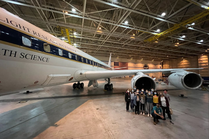
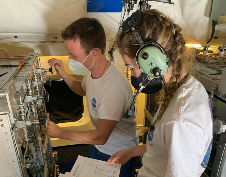
Each year, the Student Airborne Research Program (SARP) invites a team of rising college seniors to Armstrong Flight Research Center in Southern California to conduct research aboard NASA’s airborne science fleet. Each aircraft is equipped with instruments for land, ocean, and atmospheric research–enabling sample collection and imaging over the Earth’s surface. After operating the instruments in-flight, participants are then able to use the resulting data for their own individual research projects.
…as soon as they recover from the air sickness, of course.
Jacob Schenthal, who graduated from Vanderbilt University in 2021, was drawn to the NASA SARP program for its emphasis on independent, field-based research and multidisciplinary scientific teams. McKenna Price-Patak, a 2021 Tulane University grad, felt it was a rare opportunity for an undergraduate student to be responsible for an entire research project: from data collection to analysis and project development.
“I’ve always had interests in a variety of fields within Earth science, which is why I was excited about the multidisciplinary aspect of SARP,” Price-Patak said.
Both Schenthal and Price-Patak were placed with Dr. Donald Blake, conducting air sampling aboard the aircraft to study atmospheric pollution.
Dr. Blake is kind of a big deal in the atmospheric science community. An atmospheric chemist at UC Irvine, Blake is half of the eponymous Rowland-Blake Group: the research lab whose other namesake, the late Dr. F. Sherwood Rowland, won a Nobel Prize in chemistry for identifying compounds responsible for Earth’s ozone hole. Today, Blake continues the lab’s work as a leading expert on the impacts of atmospheric chemistry and air pollution on human health, and has conducted NASA-sponsored airborne research for over 30 years.
“Dr. Blake is a phenomenal mentor and really helped me find a newfound interest in air quality research–which intersects directly with climate change and environmental justice: two of my other passions,” Schenthal said. As Price-Patak put it, “Don takes a genuine interest in each member of his group and their success. When my project took a last minute detour and had to be redone days before final presentations, Don sat with me on Zoom for hours a day helping me recover and create a project I was proud of.”
Both Schenthal and Price-Patak were accepted into the SARP program in 2020. Unable to make the flights that year due to the COVID-19 pandemic, the program had to take a different approach. For the first time in SARP’s history, participants received air quality testing canisters in the mail to remotely collect initial data points.
“Although the program during summer 2020 was remote, it was exciting to take air samples to help measure emission impacts of the COVID-19 lockdowns,” Schenthal said.
“The way the program pivoted to a virtual environment was incredible,” Price-Patak said. “While we would’ve loved to be in person, we still had so much support from our research groups and mentors so we could successfully complete our projects in the short time frame.”
Schenthal’s project, titled Investigating Xylene and Toluene in Disadvantaged Communities Downwind of LAX, blended NASA’s airborne science data within an environmental justice framework. He examined how xylene and toluene–two airborne compounds that damage the nervous system with chronic exposure–are more common in disadvantaged communities near and around Los Angeles International Airport (LAX). Schenthal found that Inglewood, a predominantly Black and low-income community, experienced exposure levels for both compounds at 50 times the background level. Additionally, his project results indicated the compounds acted as tracers, meaning hundreds of other pollutants are also potentially travelling from LAX throughout these communities.
Price-Patak’s project, Dimethyl Sulfide (DMS) in the Imperial Valley and its impact on Sulfate Aerosol Loading, used data collected on SARP flights from 2014 to 2019 to locate sources of inland DMS. DMS is typically released from plankton in the ocean, and can turn into sulfate aerosols which can cause respiratory illness. Her research indicated there may be inland sources of DMS producing up to 10% of the sulfate aerosols in the Imperial Valley, an important agricultural region east of Los Angeles.
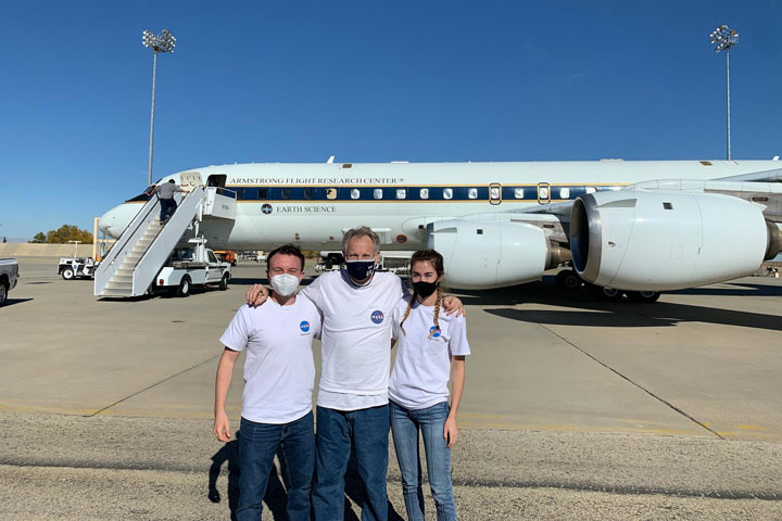
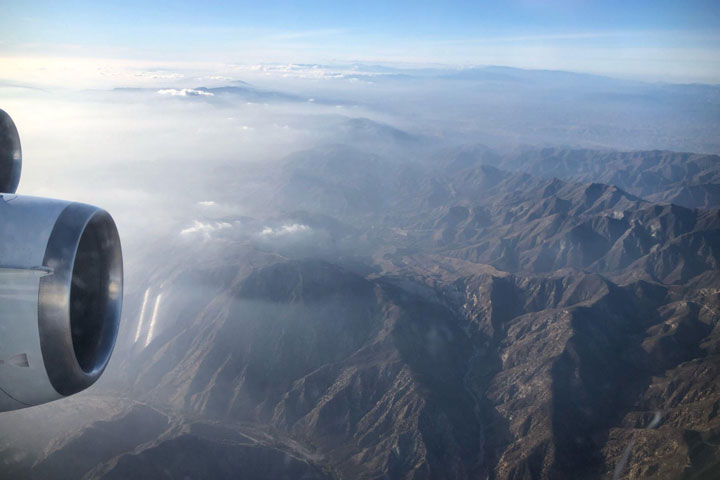
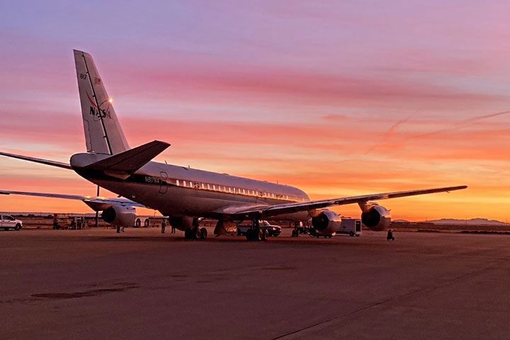
More than a year later, they got their chance to make the flight. In December 2021, fully-vaccinated participants from the 2020 and 2021 teams were finally able to take their projects airborne. Over the course of a week, the team participated in multiple flights over southern California aboard a DC-8 aircraft, taking samples adding to the program’s extensive record of air quality data.
By the end of the program, Price-Patak and Schenthal were able to rack up a combined 27 hours of flight time–and even experienced sitting in the cockpit for low approaches around Long Beach harbor!
According to Price-Patak, the value of the program comes not only from the work itself, but from the opportunity to connect with other early career scientists.
“Through SARP, I developed a new interest in atmospheric chemistry and connected with other students who have gone on to work as consultants with business firms, pursue PhDs, and everything else in between. Not only is the opportunity to conduct research through the program incredible, but the flights are truly a once in a lifetime experience. I would recommend any undergrad student with a STEM background to apply!”
“SARP has been an incredible experience, both personally and professionally. For me, it allowed me to explore my interest in air quality and environmental justice–all while engaging in field research and my independent research project,” Schenthal added.
Now, Schenthal and Price-Patak credit SARP in helping their careers take off–with both program alumni now working with NASA SERVIR at the University of Alabama in Huntsville (UAH).
A collaboration between NASA and USAID, SERVIR works with organizations around the world to design and implement satellite-based services supporting climate adaptation and natural resource management. Schenthal is the Regional Science Associate for SERVIR’s Mekong hub, while Price-Patak is a graduate research assistant for SERVIR-Hindu Kush-Himalaya while enrolled in UAH’s Master’s program in Earth science. And yes–both are still involved in air quality research. The application for SARP 2022 closes January 26th, and can be found here. Don’t hesitate to apply–and be prepared to pack your dramamine!
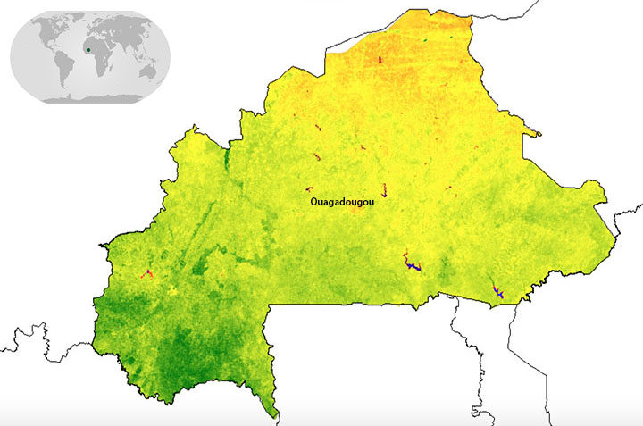
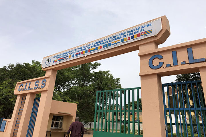
When I said I was going to Ouagadougou (Wa-ga-du-gu), the first question was “where, again?” So let’s start with the basics. Ouagadougou is the capital of Burkina Faso–a land-locked country in West Africa–located to the south of Mali, southwest of Niger, and north of Ghana and Togo. It is home to over 80 ethnic groups as well as Africa’s largest craft market. Burkina Faso also happens to be one of four pilot countries of the SERVIR-West Africa program, which launched in July 2016. The country’s forests are quickly degrading and shrinking; therefore, the first SERVIR service in Burkina Faso focuses on resource management, land use, and restoration.
The week-long workshop brought together members from communes, or sub-provinces, across Burkina Faso with representatives from SERVIR-West Africa, the West Africa Biodiversity and Climate Change (WABiCC) program, NASA, and the US Agency for International Development (USAID). Together, we discussed environmental problems impacting the local communities–from degraded forests due to agricultural expansion, to the build-up of garbage around communities. Through the work of SERVIR-West Africa, one idea is to use satellite datasets (e.g. from Landsat) for land use planning and monitoring environmental degradation.
One major limitation many communes throughout Burkina Faso encounter with any activity is safety. The primary concern of safety is related to terrorism, which spiked in December of 2018. This can be a major hurdle when trying to map the landscape like we want to do with this service, because there is no easy way for someone to physically go to different areas to validate land cover and land use maps. Therefore, one innovative approach SERVIR-West Africa and the Higher Institute for Space Studies and Telecommunications (ISESTEL) is using small Unmanned Aerial Vehicles (sUAVs) with cameras attached. I had the opportunity to actually see this technology in action, and the sUAVs drew quite the crowd. The goal is to use this drone imagery to validate the larger-scale NASA satellite data to map communes and monitor changes over time.

The second week of the trip to Burkina Faso included stakeholders from across Niger and Burkina Faso brought together to discuss a wide range of water-related issues. We focused on flooding, groundwater, and surface water monitoring. Each of the partners in attendance were able to discuss what they are currently involved in around these various topics and where they may be able to work together.
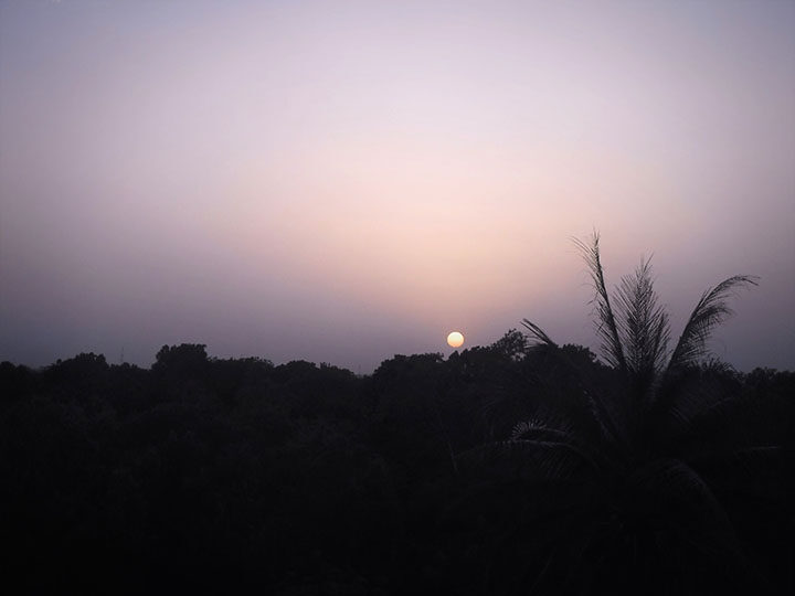
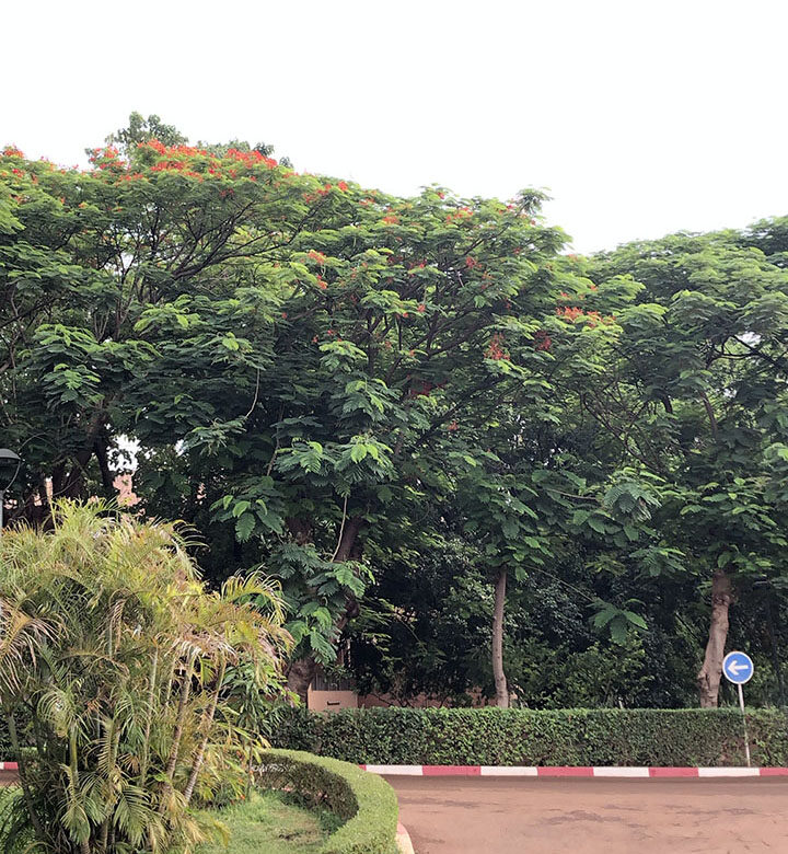
After two productive weeks in Ouagadougou, it was time for the sun to set on the trip and for me to head back to the United States. From what I saw of Burkina Faso, it is a beautiful country with plenty of greenery and different flora, delicious food, and lots to see. I look forward to being a part of the innovative work being done with our institutional partners–from the fusion of sUAVs with satellite data to finding new ways to do field work.