Andreas Colliander
Below are quick-look images from yesterday’s first science flights (June 7). A single polarization each of the radiometer and radar are shown. The data are from high-altitude lines 3 through 8 (lines 1 and 2 were not acquired). For reference, the study site map is also shown (at right).
The radiometer brightness temperature (Tb) and normalized radar cross-section (sigma-0) images are uncalibrated – default parameters were used to convert instrument counts to the respective Tb and sigma-0 quantities. No external calibration has been done at this stage using the lake reference data, however the lake data were used to check that the data levels were approximately correct.
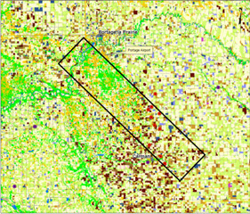
Map of Study Area
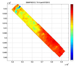
PALS v-pol brightness temperature (Tb-v).
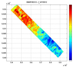
PALS vv-pol radar cross-section (sigma-0-vv).
To read more about these images, visit SMAP Blogs from the field.
Mike Cosh
June 7th was our first day of soil moisture sampling in the SMAPVEX12 experiment after two days of training and rehearsal. Beginning at 6:45am, 13 soil moisture teams set out to record surface soil moisture at 59 fields. By 2pm, the teams had returned successfully measuring moisture at 53 fields.
Installing a temporary network station
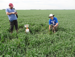
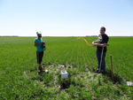
Justin and Marco sampling near a temporary network station in a spring wheat field.
For more information, visit SMAP Blogs from the Field
