By Walt Meier
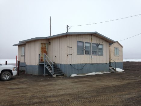
I have arrived in Barrow, Alaska. It was an interesting flight up from Anchorage: the plane had seats only in the back half of the plane because the front half is used for cargo. That is because there are no roads into Barrow, so supplies need to be brought in by plane or, during the short summers, by barge. After a stopover in Prudhoe Bay, we arrived to gloomy skies, which are quite typical for this time of year. Temperatures are right around freezing. We are staying at the NARL, which originally was the Naval Arctic Research Laboratory. Various research groups and other activities –even a college– now share this facility.
The accommodations are spare, but comfortable. Most people are staying in Quonset huts (prefabricated huts made of galvanized steel), but I’m with four others in “The House”, which is more like, well, a house. We have a living room, kitchen, full bath, and four bedrooms. Because we have a kitchen, we are the base for meals where the whole group meets up to eat breakfast and lunch. Last night we all gathered for a light meal after arriving and, with 24 people, it got pretty crowded. But it was nice to catch up with old friends and meet new colleagues. Already the collaborations have begun as we informally discussed each other’s research.
The whole campus is on a narrow spit of land north of town sticking out into the Beaufort Sea. I can see the sea ice from the house. So you might say we’re staying at a beachfront resort! With the ice right out the window, it was tempting to take a walk out there last night. However, we were told to not go out on the ice until we get a safety orientation. The ice off the coast is landfast ice – ice that is attached to the coast, so it doesn’t drift with the winds. However, it can still shift with the tides, as evidenced by piles of ice ridged formed as ice got pushed together. So one doesn’t want to just run out on the ice without being familiar with the hazards. Oh, and there are also potentially polar bears roaming around – another very good reason not to go roaming off by oneself.
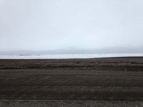
Our view of sea ice from The House.
Now we’re heading off to our orientation session and introductory discussions where we’ll start learning about modeling, satellite data, and field observations. This afternoon we’ll take our first trip out onto the ice. When the week is over, each of us will have broadened our expertise beyond each of our core research areas and hopefully we may find new areas of research to collaborate on and advance our understanding of sea ice.
By Walt Meier
Whenever I tell people that I’m a polar scientist or that I study sea ice, inevitably one of the first questions I’m asked is, “so, have you been to the ice?” I’ve always had to answer no. I’m a remote sensing scientist who works with satellite data. Other than a few aircraft flights over the ice several years ago, I’ve spent my career in front of a computer analyzing satellite images. When I’ve needed field data, e.g., to validate satellite measurements, I could always obtain it from colleagues. So there has never been any need for me to go out on the ice. And to be honest, spending days or weeks in the field, as many researchers do, does not have particular appeal to me – I like the comforts of my heated office! Nonetheless, I’ve always wanted to get out at least once in my career and see the ice close up, feel it crunching under my feet, hear it creak and groan as it strains under the winds and currents.
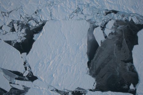
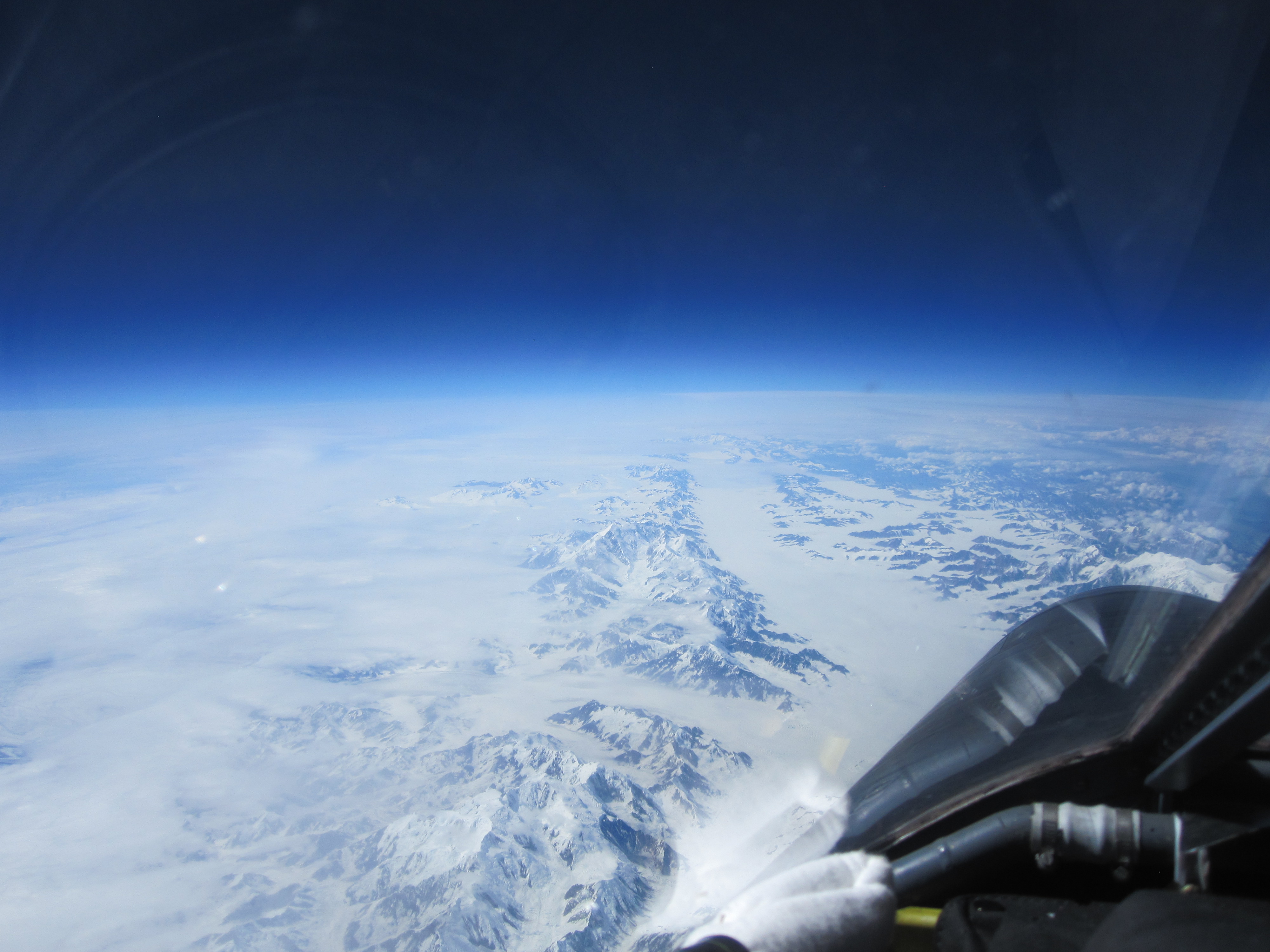
An image of sea ice in northwest Greenland, captured by NASA’s Operation IceBridge.
Now I am getting that chance, thanks to a National Science Foundation funded Summer Sea Ice Camp workshop. I and a couple dozen fellow scientists are heading to Barrow, Alaska – the northernmost point in the United States at 71 degrees N latitude – to partake in a unique project. The goal of this project isn’t specifically to collect data (though I hope that some of the data we collect will be useful), but rather to foster communication between remote sensing scientists like myself, sea ice modelers, and field researchers.
While there is a lot of collaboration in the sea ice community in terms of sharing data and results, scientists tend be silo-ed within their own area of expertise when it comes their actual work. Modelers focus on model development, validation, and results. Remote sensing folks like myself analyze satellite data. And field researchers collect and analyze in situ observations. Partly this is simply due to time – just focusing on one area keeps one plenty busy. But it is also partly due to a lack of communication. For example, I know a bit about modeling, but I don’t really understand the details of how a sea ice model is put together, how it can and should be used. Similarly, while modelers often use remote sensing data to compare with their model results, they don’t often understand the capabilities and limitations of satellite data. This can lead to under use or misuse of the data. And neither modelers nor remote sensing scientists may have much understanding of how to best take advantage of in situ data.
The goal of this workshop is to bring the three groups together for a week to talk and work with each other to better understand each of the three specialty areas and how perhaps the three groups can better work with each other to advance our understanding of sea ice. So now I’m on my way to Barrow, Alaska, looking forward to helping others understand satellite data, as well as running sea ice models and feeling that crunch of ice and snow under my feet as I collect data from on top of the Arctic Ocean. More in my next blog post from Barrow!
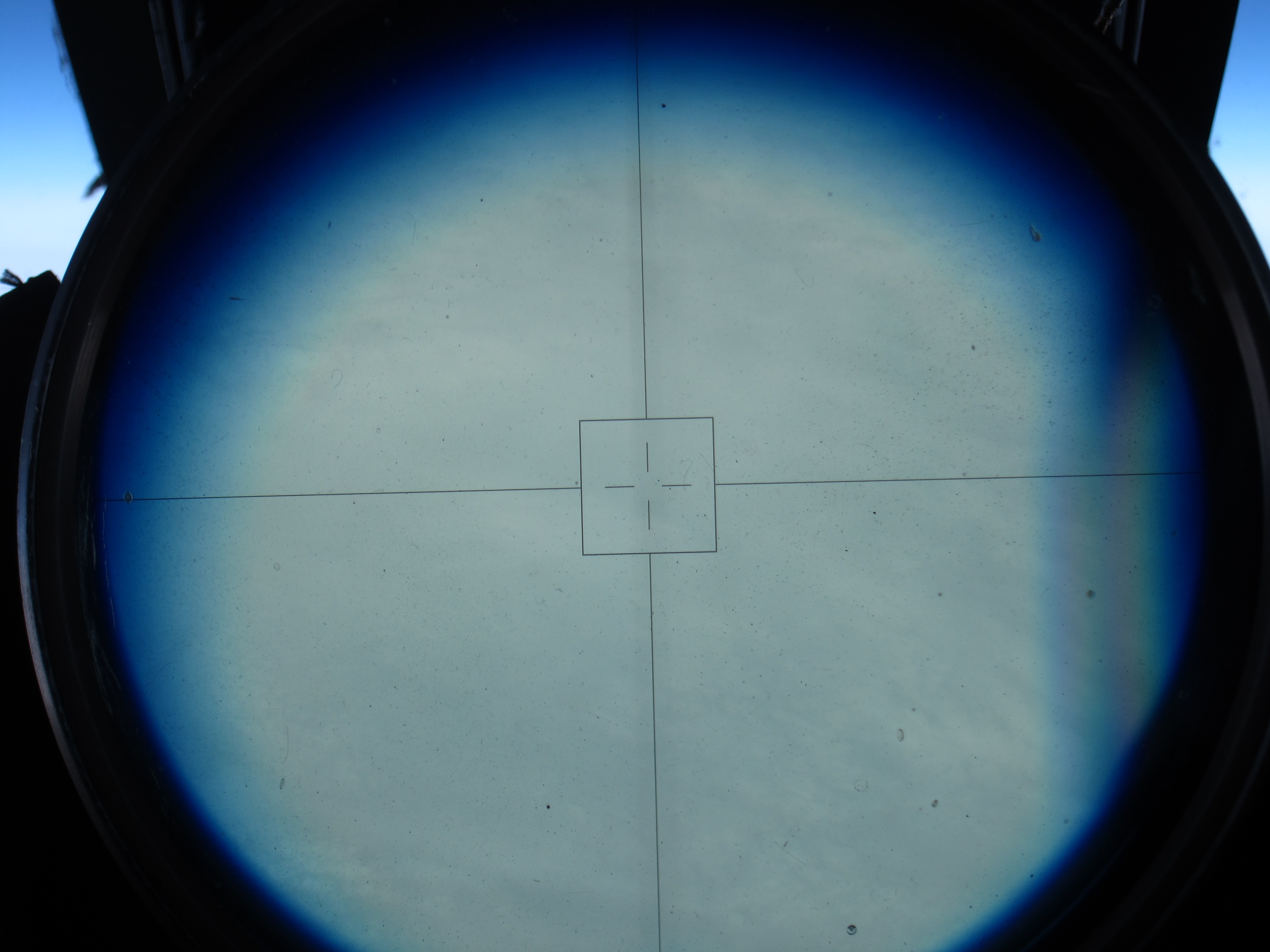
The North Pole! NASA pilot Tim Williams flew over the pole Wednesday afternoon. It was a cloudy day at 90 degrees north, as seen through the ER-2’s viewsight. (Credit: Tim Williams/NASA)
Fly north from Fairbanks and after a while, you’ll be off the map. Literally, as ER-2 pilot Tim Williams found out Thursday when he flew the NASA aircraft on a mission to the North Pole and back.
“At some point, the map’s not there,” he said at a post-flight debrief Thursday evening.
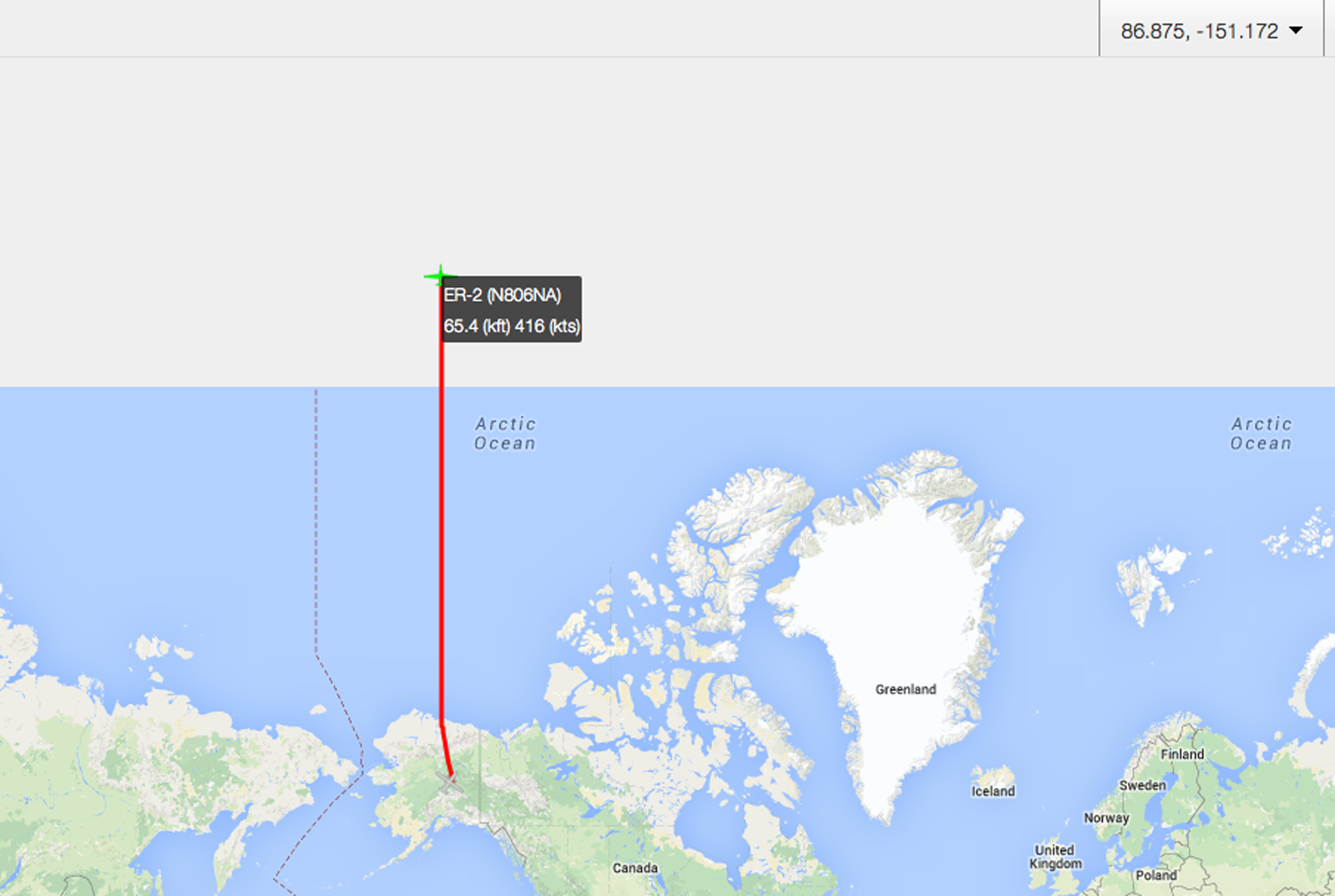
“Here be monsters” – or just map projection issues. Once the ER-2 got above about 89.5 degrees North, the pilot’s map didn’t cover it. Those of us tracking the plane from https://airbornescience.nasa.gov/tracker/ lost the map even earlier.
Williams flew due north along the 150 degrees west longitude line, carrying scientific instruments including MABEL, a laser altimeter that scientists are using to develop software for the upcoming ICESat-2 satellite mission. The goal for the pole-bound trip was to gather data over the spectrum of summer ice – from open water, to degrading ice, to thin ice, to multiyear ice, with some melt ponds on the way.
It was a smooth and cloudy trip up, Williams reported, and through breaks in the clouds he could see cracking ice below.
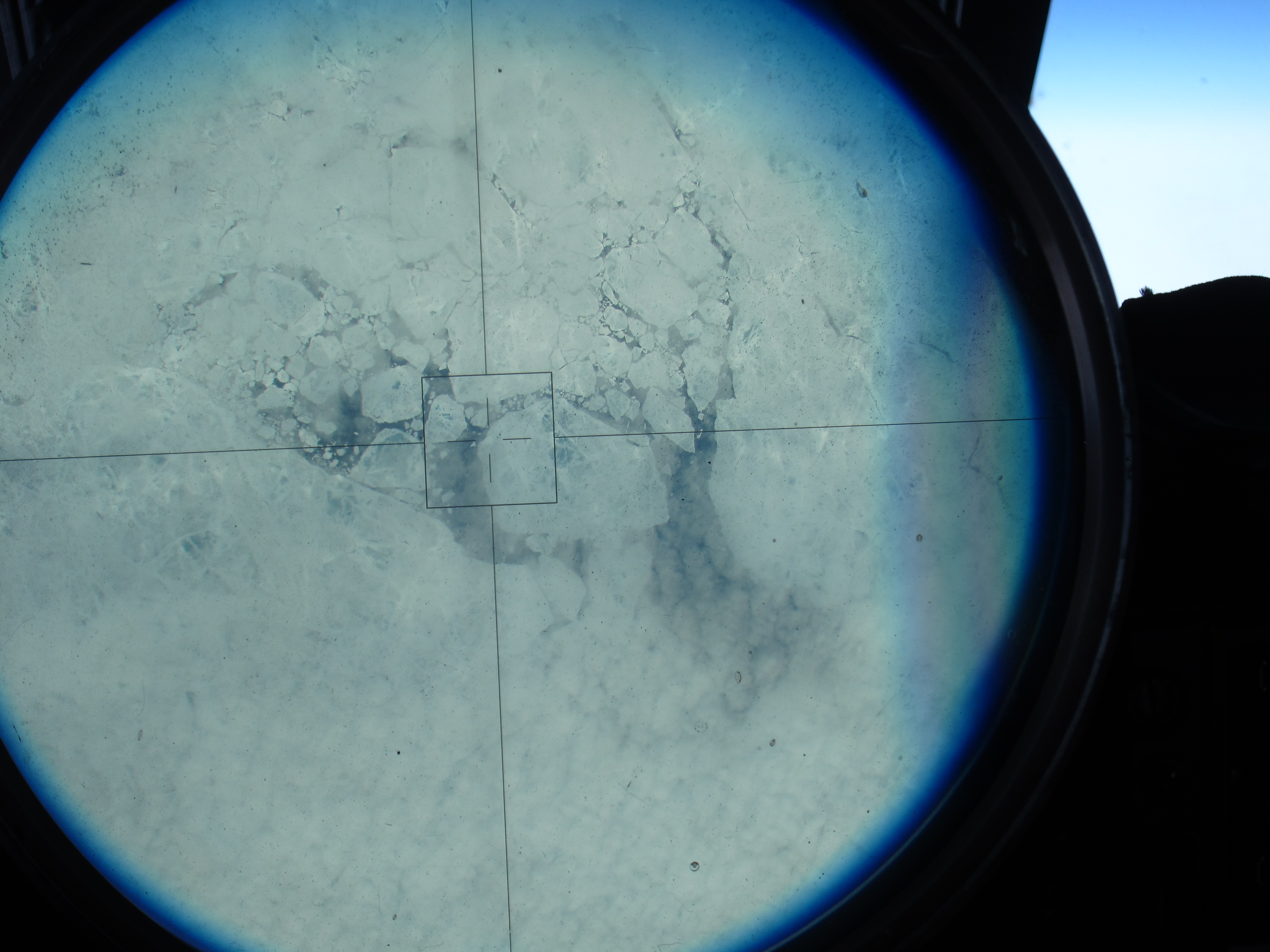
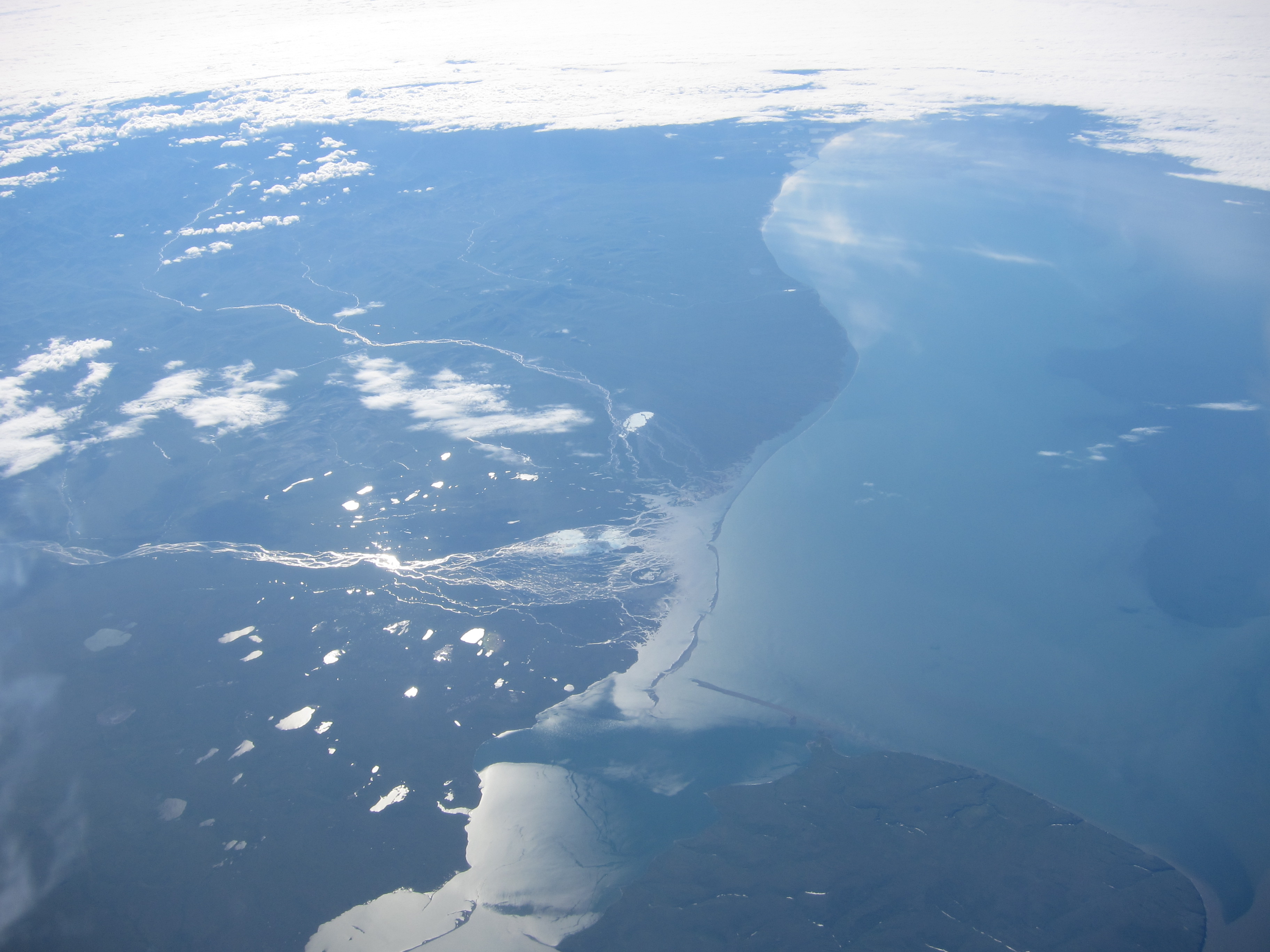
Sea ice, as seen through the ER-2’s viewsight, on the 150 degree latitude line north of Alaska. (Credit: Tim Williams/NASA)
“I expected it to be a lot more solid; it’s not,” he said. “It doesn’t look thick where I could see it.”
After about four hours in the air he reached the pole – 90 degrees latitude. His instincts were to look at the compass onboard, but it was “just a mess, it’s all over the place,” Williams said. At one point, his compass showed 180 degrees opposite from his navigation system.

On top of the world! Tim Williams piloted the ER-2 to the North Pole – it’s all south from here. (Credit: Tim Williams/NASA)
Still, he knew which way to go: “When you hit the pole, everything is to the south. So you just make a turn,” Williams said.
He rolled out, circling from the pole, until his navigation system gave him a heading. He found the 140 degree line, and flew back to Fairbanks – headed south.
NASA pilot Tim Williams took this picture over the pole, as he was turning to head south . (Credit: Tim Williams/NASA)
The view of Alaska from the cockpit, as the ER-2 returns to Fairbanks. (Credit: Tim Williams/NASA)

After flying to the North Pole and back, NASA pilot Tim Williams talks with the ER-2 crew about what happens to flight instruments when you reach 90 degrees north. (Credit: Kate Ramsayer/NASA)

NASA’s ER-2 readies for takeoff. (Credit: Doug Morton/NASA)
I didn’t know a hybrid sedan could take a corner that fast. We were sitting in the car, adjacent to the runway where NASA’s ER-2 high-altitude aircraft was about to land. Tim Williams – an ER-2 pilot who will fly later this campaign – was driving, poised to speed down the runway after the plane, in case his fellow pilot needed help avoiding obstacles and gauging conditions.
And as soon as the sleek ER-2 came into view and descended over the runway, we were off. Williams hit the gas (battery?) on the hybrid and swung onto the runway, sending me and my video camera flailing against the passenger-side door as the aircraft buzzed overhead. We raced down the runway, chasing after the plane as it landed, balanced on its two wheels.

ER-2 pilot Tim Williams watches for the plane to land. (Credit: Valerie Casasanto/NASA)
On board the ER-2 is MABEL – the Multiple Altimeter Beam Experimental Lidar – a laser altimeter that is gathering data for the ICESat-2 mission. Wednesday’s flight was the first science flight of MABEL’s summer campaign to measure summer sea ice, land ice and more in Alaska.
The day started with a crew and weather briefing at 7 a.m., where pilots Denis Steele and Williams reviewed weather conditions and possible routes with ER-2 Mission Manager Tim Moes, NASA Goddard scientists Thorsten Markus and Kelly Brunt, weather forecasters and others.
With cloudy conditions on the way to the North Pole – covering the dynamic melting edge of the sea ice the campaign hopes to document – the team decided to head southeast out of Fairbanks. That route heads down to the Alaska Peninsula to survey volcanoes, then heads east over glaciers and high-elevation ice fields in south central to southeastern Alaska.
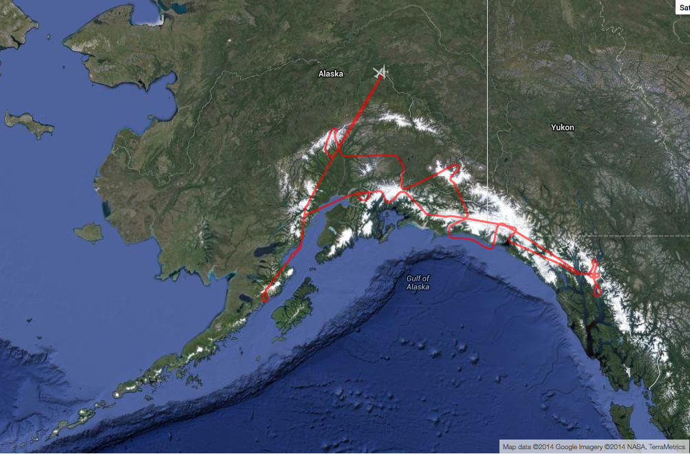
The ER-2, with MABEL on board, flew over volcanoes and glaciers in south central and southeastern Alaska. (http://airbornescience.nasa.gov/tracker/)
With the flight route set, scientists made final checks of the instruments and Steele put on a pressurized suit – necessary for flying at 65,000 feet. He has to “pre-breathe” pure oxygen for an hour before flight, to raise his blood oxygen level.

Ryan Ragsdale, engineering technician, helps ER-2 pilot Denis Steele put on a pressurized suit before the flight, which will take him to 65,000 feet. (Credit: Valerie Casasanto/NASA)
Meanwhile, the plane was slowly towed out of the hangar onto the runway at Fort Wainwright and fueled up. The ER-2 crew and Williams went through the preflight checklist, which would be difficult for Steele as the pressurized suit has big gloves and limited dexterity.

ER-2s Denis Steele, in the cockpit, and Tim Williams, checking notes, get ready for the day’s flight. (Credit: Kate Ramsayer/NASA)
After Steele got in and started the engines, he taxied to the end of the runway accompanied by a maintenance van and a chase car: the van so that the crew could grab the bright orange stabilizing wheels, which fall off during takeoff, and the chase car driven by Williams, who supports Steele as necessary.
The ER-2 takes off amazingly fast. One moment it’s at the end of the runway, the next, the roar of the engine sounds. Then, all of a sudden, the aircraft’s in the air, climbing fast to the clouds. The plane disappeared into the clouds before the sound faded, and then the team went back to check the instruments’ vital signs, transmitted from flight.
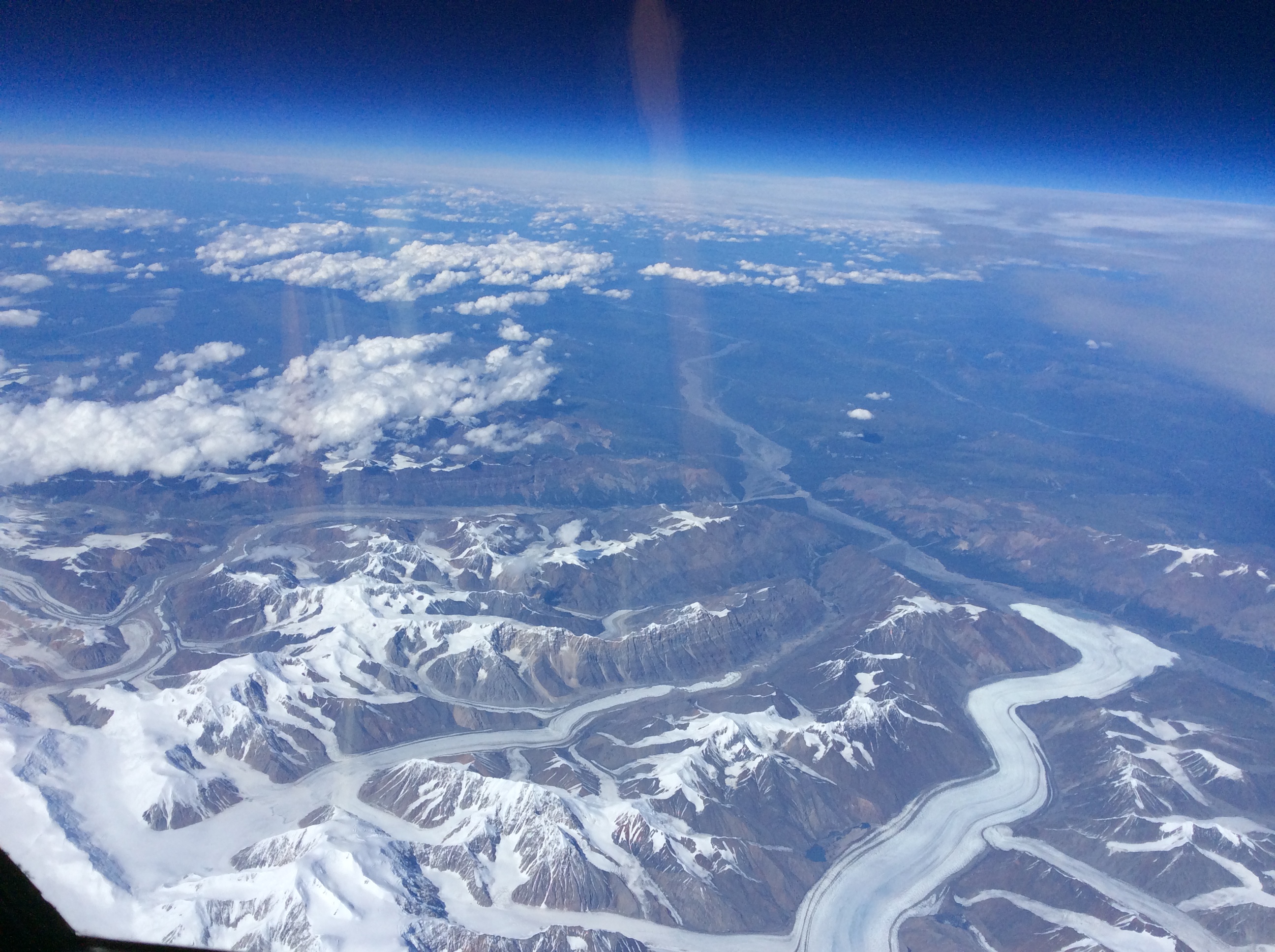
A view of Alaska’s Bagley Ice Field from 65,000 feet. (Credit: Denis Steele/NASA)
Just under seven hours later, after flying over a number of key glacier and volcano points north of the Gulf of Alaska, Steele landed the plane. The crew reattached the bright orange stabilizing wheels, and towed him back to the hangar, where scientists were eager to download and view the data.
Steele reported on highlights of the flight – what was cloudy, what was clear – and Moes ended with a reminder of the next early morning meeting to review weather conditions and determine whether the ER-2 would fly another route over Alaska today.
Very few people get to fly 65,000 feet above Alaska’s glaciers. And even fewer get to fly over ones they share a name with. But on Friday, as pilot Denis Steele flew NASA’s ER-2 aircraft from Palmdale, California, to Fairbanks, Alaska, he snapped a picture of the scenery below – including Steele Glacier in the southwestern corner of Canada’s Yukon territory.
From NASA’s ER-2 aircraft, pilot Denis Steele saw glaciers in southern Alaska and Canada — including the Steele Glacier, the horizontal feature in the center of the image, and the Donjek Glacier (lower right). (Credit: Denis Steele)
Steele and the ER-2 team, along with NASA scientists, engineers and others, are here in Fairbanks to fly a laser altimeter – MABEL, or Multiple Altimeter Beam Experimental Lidar – over melting summer sea ice, glaciers and more. It’s a campaign to see what these polar regions will look like with data from ICESat-2, once the satellite launches and starts collecting data about the height of Earth below. Gathering information now allows scientists to get a head start in developing the computer programs scientists will need to analyze ICESat-2’s raw data.
MABEL and other lidar instruments are flying on the ER-2, which provides a high-altitude perspective. In the next three weeks, the plan is to cover melting sea ice, glaciers, vegetation, lakes, and more.
Steele wasn’t the only one looking out of the plane windows on flights north. Kelly Brunt, a research scientist at NASA’s Goddard Space Flight Center, spotted a wildfire in Eastern Washington. The fire, burning in steep terrain, resembled an erupting volcano.
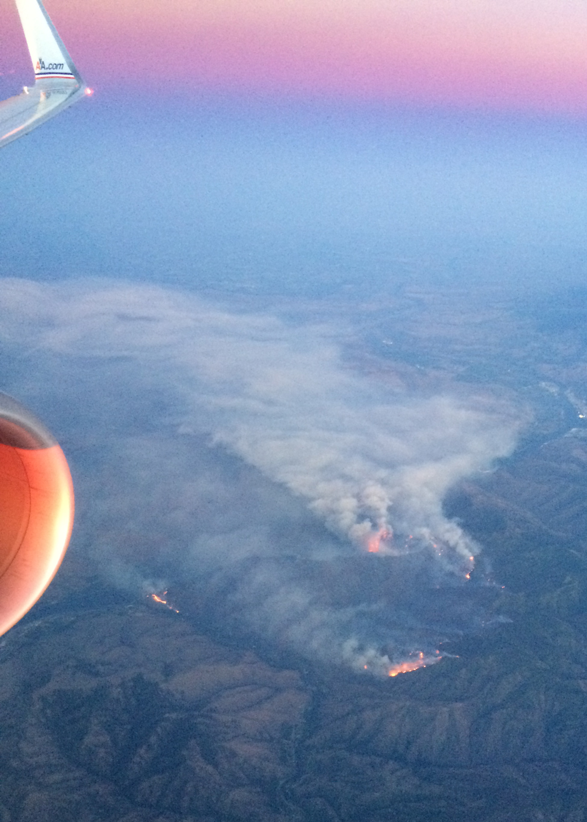
A wildfire burns in Washington, just east of the Cascades. (Credit: Kelly Brunt)
Over the weekend, the team settled into Fairbanks and a hangar at the U.S. Army’s Fort Wainwright, downloading data from the transit flight and ensuring the instruments are ready to fly when the weather allows. Cloudy skies over key sites means the ER-2 won’t fly today (Monday), but the team will check the weather tonight and see if it clears enough to fly the first science flight on Tuesday.
Want to follow MABEL and the ER-2? Check back here, and also check NASA’s flight tracker: http://airbornescience.nasa.gov/tracker/
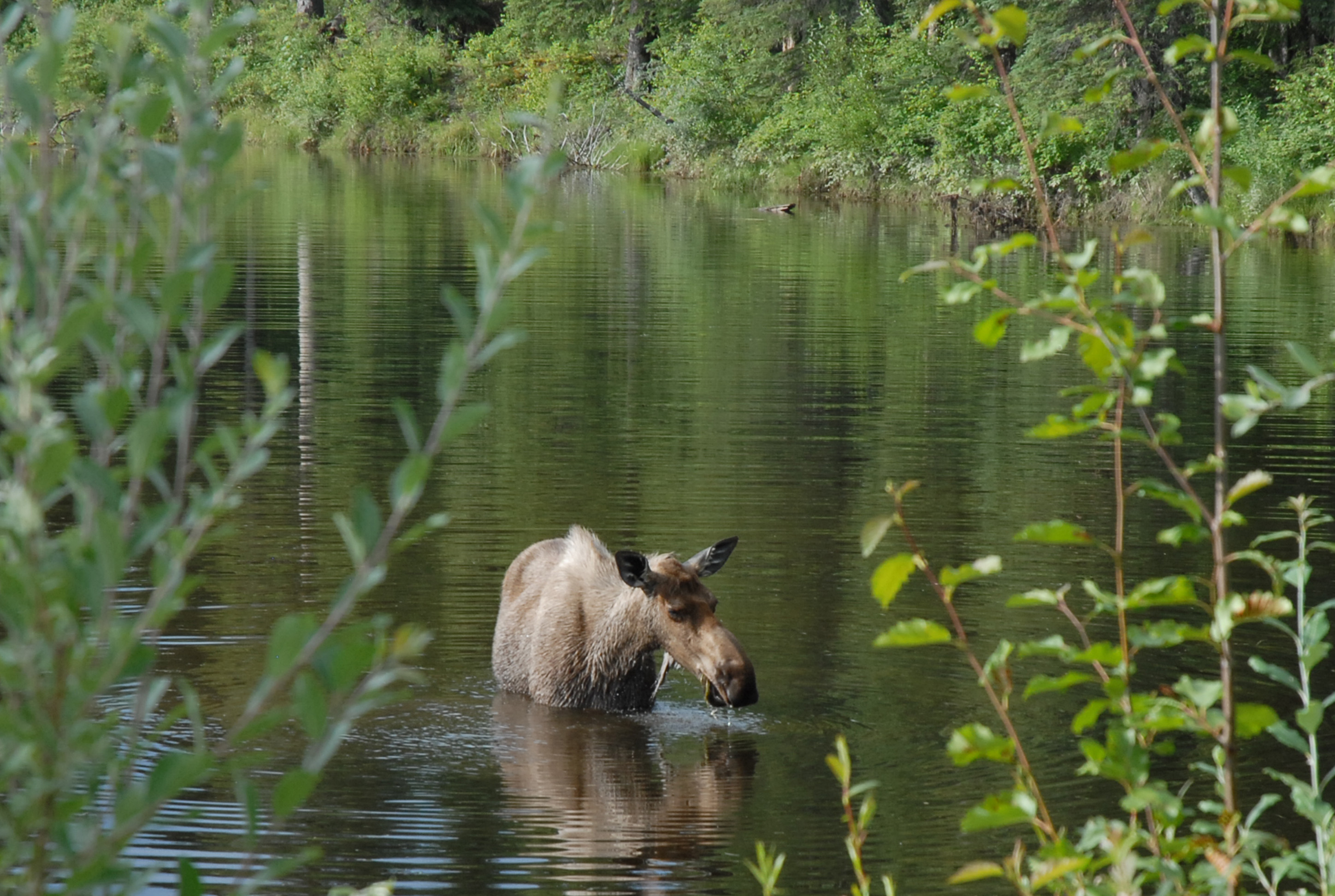
Yep, we’re in Alaska! A moose along a road east of Fairbanks. I’ll call her Mabel. (Credit: Kate Ramsayer)
