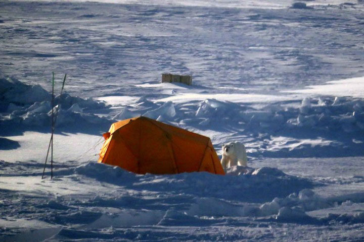
This past week we had the first polar bear sighting of leg 3. In the early morning hours, a curious male polar bear walked through the Central Observatory, checked out a few installations, played with a rubber fender, and continued on to about 800 meters from the ship. There it sat near a small crack in the ice for almost two hours, likely waiting for a seal to surface. It caused no damage and, given that no one was outside working at the time, led to very minor disruptions in our work.
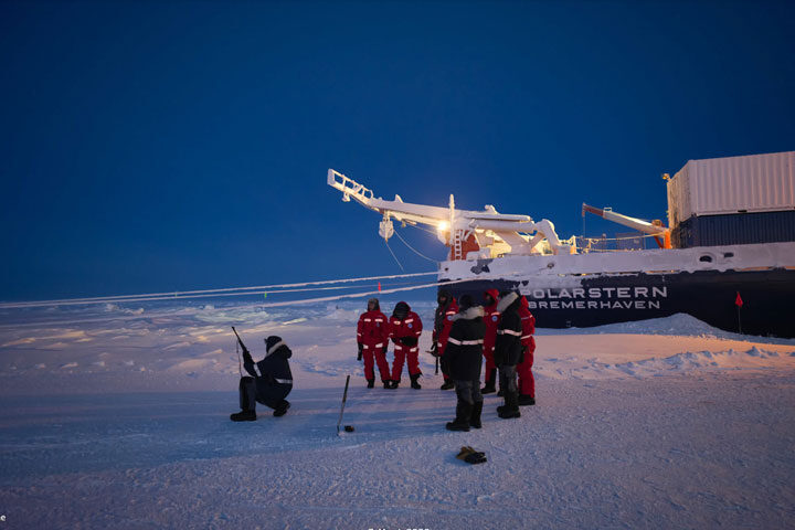
Here on MOSAiC, we are always prepared for the possibility of seeing a polar bear while out on the ice. For one, our logistic team is incredibly experienced when it comes to working in regions where polar bears are present. During working hours, two logistics members are stationed on the ship – one on the bridge and one on the stern – with the job of scanning the horizon for polar bears and communicating with teams on the ice. Additionally, each scientist on MOSAiC was required to complete a polar bear safety course prior to coming onto the ship, which included a section on rifle safety. When out on the ice, each science party must have a “polar bear guard” with them whose sole task is to keep a careful watch for polar bears. The polar bear guard carries a rifle and a safety flare gun with them at all times as a precaution. The comforting news from the logistic team is that in their combined 50+ of years of experience in the Arctic, none of them have ever had to use a rifle on a polar bear.
It was pretty exciting to see a polar bear outside of a zoo for the first time. However, it also served as a gentle reminder to stay alert while on the ice. We may call this floe “our home,” but now we’ve seen whose home it really is.
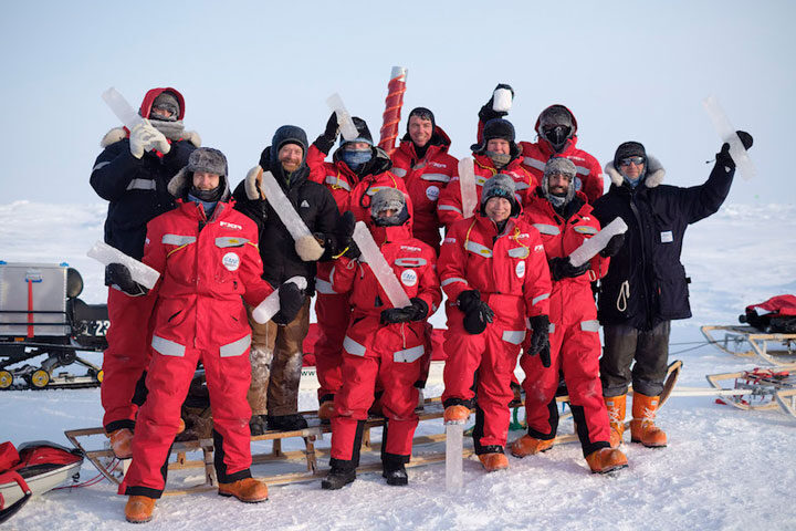
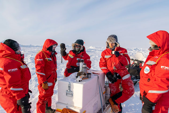
The main task I am involved with here on MOSAiC is the drilling of sea ice cores. Each week, a group of 10 scientists from the Sea Ice, Ecology, and Biogeochemistry teams goes out to two different “Dark Site” locations on the floe to drill ice cores that will be used in a variety of different experiments back on the ship. We call this large weekly effort “Coring Monday.” Here’s a sense of what this day looks like:
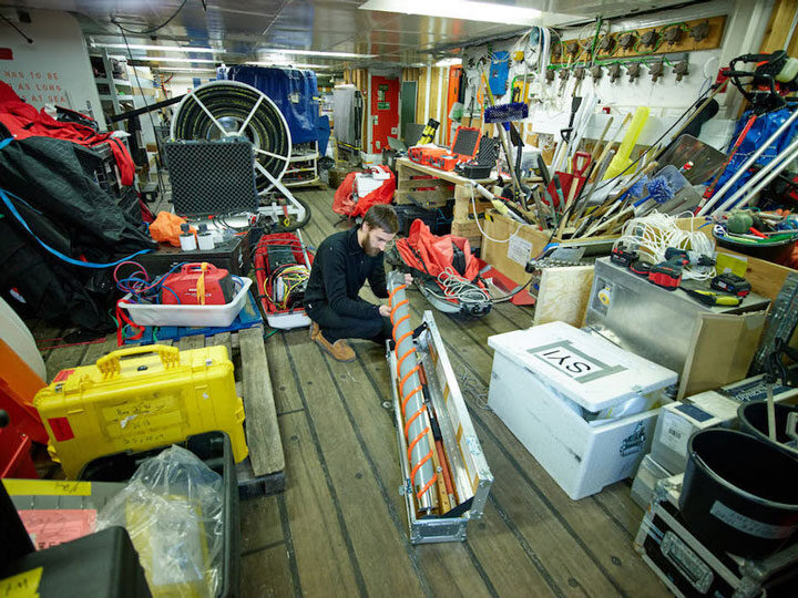
Night: Coring Mondays always start the night before with the preparations and packing of the gear. We need lots of equipment: drills (with many, many extra batteries), saws, shovels, core barrels, and storage containers, just to name a few. I am responsible for preparing the data sheets for the next day and working with the team leaders to decide which – and how many – ice cores we will plan to drill. Most coring days we aim for between 30 and 40 cores total from the two sites.
07:30: Breakfast time. The whole team generally eats right away in the morning, and makes sure to have enough for the long day in the field. We also pack some food to eat for lunch out on the ice.
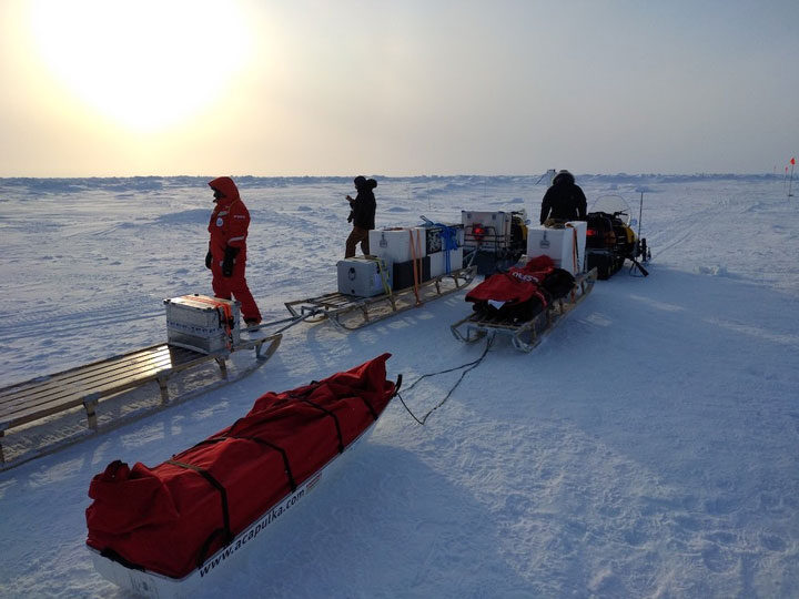
08:00: After a quick breakfast, the team meets to load all the coring gear onto the ice floe. Our whole operation requires 4 snowmobiles, each one pulling two 10-foot-long sleds filled with coring equipment. By 9:00, our teams are packed and ready to go. We are joined by two polar bear guards from the logistic team, and set off for the Dark Site. My team heads to the First Year Ice site (FYI) while the other group goes to core at the Second Year Ice (SYI) site. If you’re lucky, you can get a seat on the snowmobile. Otherwise, it’s a long bumpy ride sitting on the wooden sled.
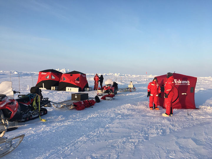
09:30: After arriving to the site, our work immediately begins. I start with a snow pit analysis, measuring the depth, temperature, and density of the snow pack. The rest of the team prepares the gear and sets up the 2 working tents and 1 “warming-up” tent.
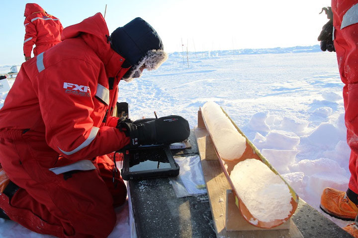
9:45: The ice coring begins. Two people work on drilling the cores, two people examine the drilled cores, note down features, and slice some for later processing; one person works between both groups, transferring the cores and facilitating communication. About half of the cores that are drilled get sliced up in the field into 5- or 10-centimeter sections, while others stay as full cores and get put into 1-meter-long bags.
The cores are drilled with a hollow barrel that has blades on the bottom and threads around the outside. As the blades cut into the ice, the barrel drills down, filling up the hollow space with a long cylinder of ice. The ice core can then be removed for slicing or packaging.

13:00: After a few hours of coring, it’s time for a lunch break. Sandwiches and hot chocolate/tea help keep the energy up!
13:30: The coring continues. At the FYI site, the ice is typically around 1.7 to 1.8 meters thick at this time of year. This is ice that has grown since the end of last summer. The SYI site, on the other hand, is ice that started growing after two summers ago (hence the name) and did not completely melt at the end of last summer. The SYI, therefore, is generally around 2.2 to 2.6 meters thick. Most of the ecology and biogeochemistry teams’ work is focused on FYI, so more cores are drilled there. The sea ice team is interested in the physical properties of the ice (salinity, temperature, density) and therefore takes an equal number of samples from both sites.
17:00: After roughly seven hours working in the field, we finally reach the end of our list. We start the clean-up by packing up the sleds and all of our gear, which is more or less the same procedure as the morning. The largest change, however, is that we’ve typically added around 40 meters worth of ice cores, which can weigh a few hundred pounds.
17:30: We arrive back to the ship to unpack all of the gear and distribute the ice cores to the various teams.
18:00: What we’re most looking forward to by now: dinner!
19:00: After dinner, the work continues. We need to clean all of the gear that was used during the day, so that it will be suitable to work next week. This means rinsing off the salty seawater from all of the equipment.
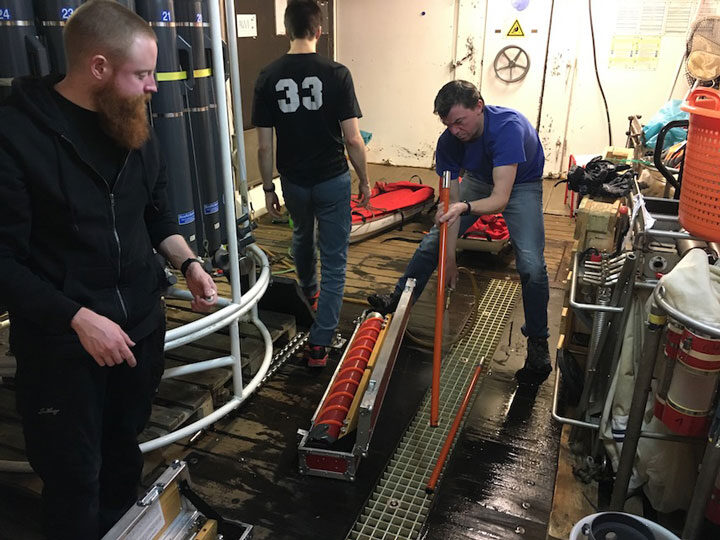
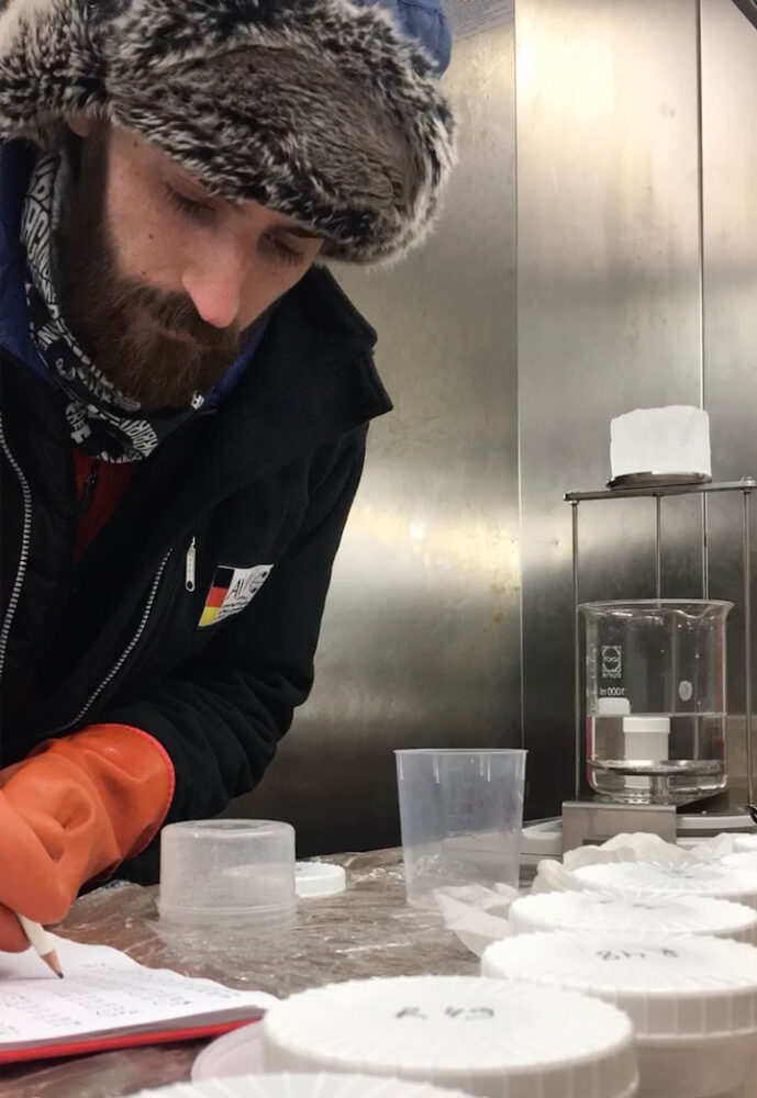
20:00: Processing begins. Some cores need to be processed the same day, so many of us head to our labs to work on the samples that we drilled. I run some core sections through a centrifuge to remove and analyze the brine, and measure the ice density on other sections.
22:00: After a long day of work, it’s finally time for bed.
The next few days will be filled with more processing of the ice core samples and entering data. Before long, it’s Sunday night and we get to start the process over again.
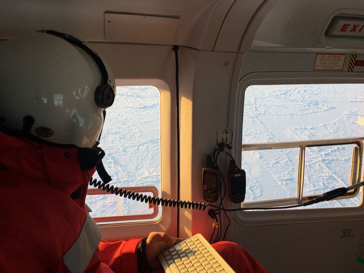
One of my scientific objectives while on MOSAiC is to make measurements that will help validate sea ice data collected by NASA’s ICESat-2 satellite. Using a helicopter, a laser, precise GPS coordinates, and some chocolate, we were able to do just that.
On the Morning of March 22, I looked into the upcoming ICESat-2 orbits and noticed that the satellite would be passing almost directly overhead of Polarstern the following day, a little over 24 hours from that moment. This presented a unique opportunity: If we could fly a helicopter (mounted with a laser scanner) directly underneath the ICESat-2 orbit at the exact time that the satellite was passing over, we would effectively have two independent sources of the same measurement – sea ice elevation detected by a laser – taken at the same time over the same sea ice. This method has been done previously during NASA’s Operation IceBridge campaigns, and has proven incredibly useful for validating the ICESat-2 data.
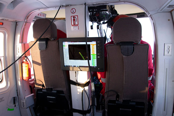
I checked with Robert Ricker, a remote sensing scientist with AWI and the operator of the helicopter-based airborne laser scanner (ALS), to see if this would be possible. He was excited to give it a shot…provided the flying conditions were favorable.
When we awoke on March 23, the weather was perfect. There was just one snag: The Captain of Polarstern wanted to ground all helicopter flights so that the ship’s crane could be used to move cargo on board. We quickly jumped in and explained the importance of our flight and just how time-sensitive it is. After a bit of convincing, he agreed to let our flight be the only one of the day.
A little after 12:30 p.m., we took off in the helicopter. Robert was manning the ALS and my eyes were fixed on the GPS, making sure that we stayed on the orbit track. Since ICESat-2 has six beams, we planned to fly beneath the middle two beams, which are spaced 90 meters apart. The footprint of the ALS is about 300 meters wide, so we aimed to capture both of the middle ICESat-2 beams within the ALS footprint. It sounds easy in theory, with about 100 meters of buffer room on either side. In reality, it was like walking a tightrope. Any slight gust of wind would cause the helicopter to drift off track, prompting Robert or I to inform the pilots to veer slightly back along the orbit. We did our best to stay in line, and after around 45 minutes of flying on the orbit track ICESat-2 passed directly overhead!
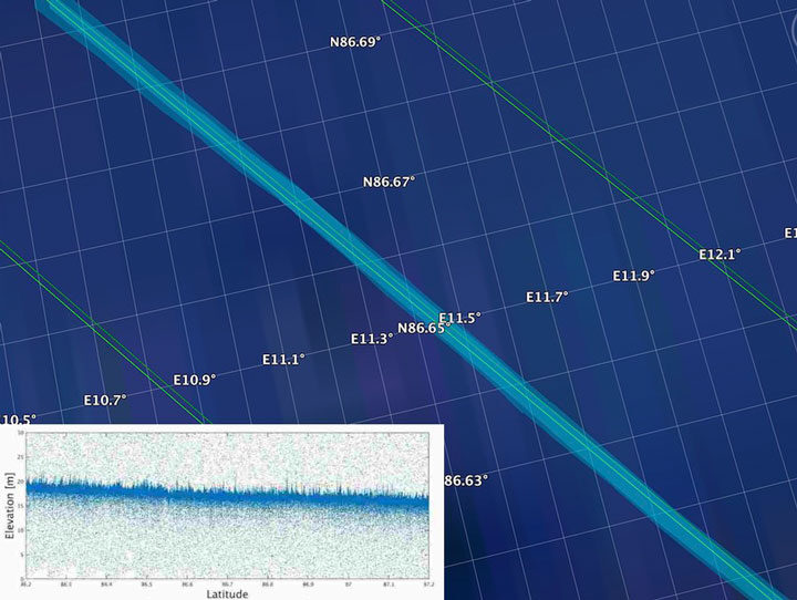
Overall, we flew around 75 nautical miles away from Polarstern along the ICESat-2 orbit before turning around and heading back to the ship the way we came. Of course, we shared a celebratory chocolate bar with the helicopter pilots on the way home. By performing this underflight, we collected valuable data that will not only be used to help validate the ICESat-2 sea ice algorithms, but also will help to scale up the measurements taken on MOSAiC to the larger Arctic sea ice cover.
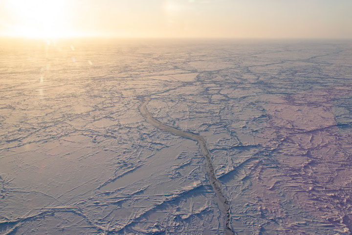
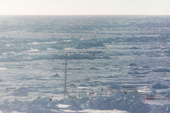
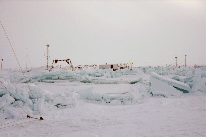
The leads that formed the last weeks throughout the floe continue to have an impact here on MOSAiC.
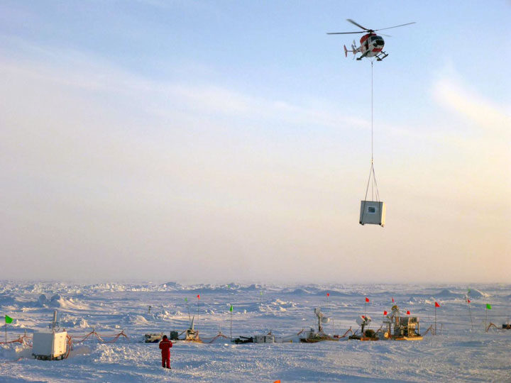
The wide lead that split off two sites from the rest of the central observatory started to close again, forming a large ridge that threatened some of the instruments and huts that were out on the ice. Knowing that a storm could re-open the leads or force the ridge to grow even larger, we decided to hold a rescue operation to move any instruments that were too near to the ridge to safer ground.
That morning, the logistics team scouted the ridge and eventually found a safe location to cross it on snowmobile. With the go-ahead from logistics, a large team of almost 20 people headed over to save the instrumentation. It was just in time – one instrument was beginning to be crushed, while others were too close to the ridge for comfort. I was working at the Remote Sensing site, where we employed shovels, snowmobiles, and even a helicopter to move everything to safety.
It took all day and a lot of heavy lifting, but we managed to disconnect power lines, dig out sensors that were beginning to be covered by snow, and move all the equipment back away from the ridge. Some sensors that were not working and couldn’t be accessed for a few days because of the lead were able to be returned to near the ship where they could be fixed. The Met city team also had a successful instrument rescue day, saving a 25-meter tall tower that was just a few feet from a lead.
It’s tough to call today a “success,” since many instruments had to be powered off and many measurements had to be stopped to complete this work. In the long run, however, this action may have saved many sensors from total loss, allowing measurements to continue throughout MOSAiC.
In the last post, we took a brief tour of some of the sites that make up MOSAiC. In the days since, much has changed with the MOSAiC floe. Specifically, leads have formed in the ice pack that have altered our floe map and impacted our daily schedules drastically.
Put simply, a lead is just a crack in the ice. It’s never that simple, however. There are many complex processes that determine where and when leads form, how wide they can become, and whether or not they close back up or just re-freeze. Although leads are common features in sea ice and are vitally useful for satellite measurements of sea ice thickness, they still serve as a not-so-gentle reminder that the sea ice can be extremely dynamic, and that we have to be prepared for anything when working out on the ice.
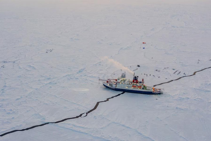
A few days ago, a small crack formed near the ship that was just a few inches wide when it was first noticed. We were still able to go out on the ice, but it was being monitored closely. About an hour later, everyone out on the ice got a radio call from the ship that it was time to return. The crack had grown to a few meters wide, and ran directly under the ship and out in both directions. It continued to widen for a few hours, but luckily this first crack didn’t form under any installations or sensitive instruments. This lead, however, was just the start.
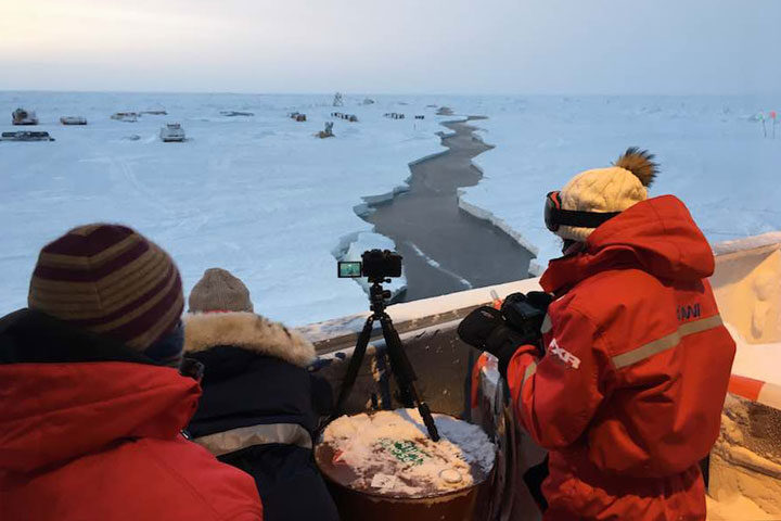
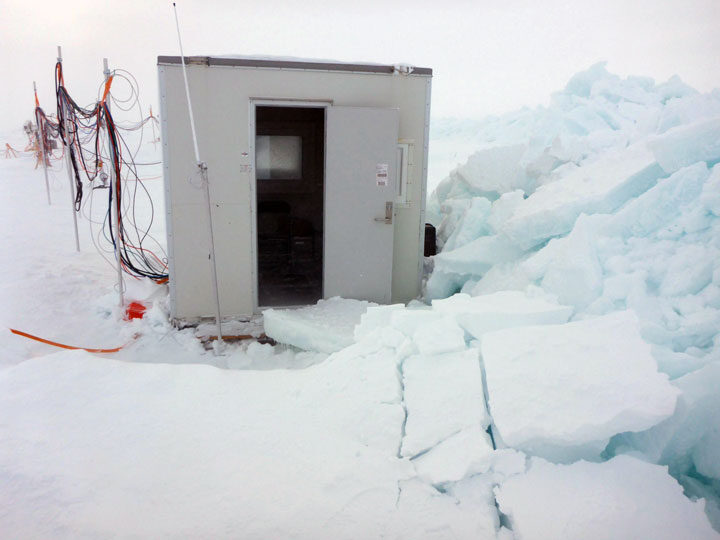
In the next hours and next days, many other leads formed off of that initial crack. Some stayed only 1 meter wide, while others grew to 10 meters or more. Almost all work on the ice has been limited, and the leads are monitored closely. The most critical lead formed between the Central Observatory and two important sites: Met City and the Remote Sensing Site. It shifted the sites a few dozen meters from their previous location, to the point where the power cables had to be disconnected before they snapped.
While the leads themselves pose threats to the instruments and infrastructure on the ice, they are only half of the concern. When (and if) the leads close again, there is a possibility that ridges could form when the two sheets of ice collide together again. Ridges can grow to several meters tall and would crush anything that was caught in the middle. For now, we are keeping an eye on everything that is on the ice in order to limit any impact that the leads or ridges may have. We also keep our fingers crossed that the ice stabilizes soon!