By Ludovic Brucker
We were on Greenland’s ice sheet for only a week, but despite the short deployment, we had to accomplish two main science objectives. The first was drilling two deep cores into the firn (aged snow) and ice (30- and 65-m deep, respectively), to insert temperature probes that will record temperature evolution at various depths. Secondly, we wanted to drill shallower cores (7 to 15 m) to record the snow’s density vertical profile using a neutron density probe – and this is what this post is going to be about: the shallow drilling that we did and the measurements we took in these holes to monitor the snow and ice layering and their properties.
To drill the shallower cores, we used the same solar-powered drill as in 2010 and 2011 in Antarctica during the Satellite Era Accumulation Traverse. It is composed of four parts, which I’ll describe from top to bottom. The first segment contains the motor to rotate the other parts. The second and third parts are barrels — one for the snow and ice chips, and the other to store the one-meter long drilled core. The fourth part, the cutters, is screwed into the latter barrel. Cutters are critical since they are the sharp elements that cut the snow, firn, and ice. Since snow and ice having different properties, the cutters for snow and ice are different. For instance, if we use the ice cutters at a smaller angle, we will drill at less depth during each barrel rotation. Where we drilled, part of the winter snow melts during the summer and when it refreezes, it forms a thick ice layer every year. The snow that did not melt will slowly evolve to firn, and, eventually, ice. Because of the different, we thus had to switch cutters during our drilling: otherwise, we would have not been able to drill through the past summer ice layers.
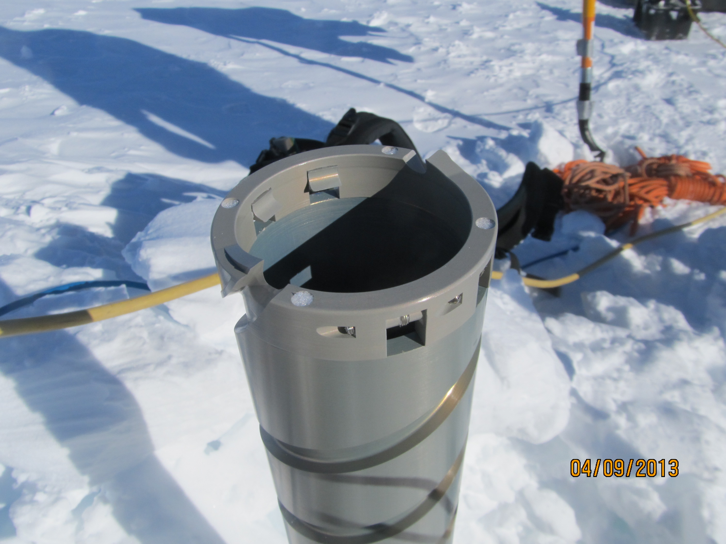
Ice cutters screwed at the bottom of the barrel, which rotates into the ice to extract an ice core.
Lora showing how to extract the first meter of the snow core.
Jay drilled cores through the water contained within the firn (the aquifer). We used our smaller drill, since we did not want to enter in contact with the aquifer. Therefore, each of our cores was shallower than the water layer’s top and each was drilled in about an hour.
Once we had drilled the hole, we observed the layering of the snow and ice cover using a video camera. Thanks to the camera’s flashlight, we were able to identify the thick 2012 summer ice layer (about 3 m below the surface) that formed after a massive surface melt event, as well as the previous summer ice layers. Our team used this sensor to monitor a water-filled hole for the first time. We were all really excited to see the inner upper part of the ice sheet!

Lora holding the video camera that she will send down in the hole to monitor the snow and ice layering.
Rick and Clem enjoying the first view of the firn’s internal stratigraphy
We also used this useful device to check the position of the temperature probes and to ensure that the entire line of temperature sensors was straight inside the hole. The first time we inserted the camera into the water in the hole, we were amazed to discover the amount of air bubbles released by the firn, which propagated toward the water/air interface. The aquifer is composed of ice, water, and air. These elements are present several meters below the surface, which means they’re under pressure. Once we drilled the cores, the pressurized air bubbles in the vicinity of the hole migrated toward the hole and then moved upwards to the water/air interface.
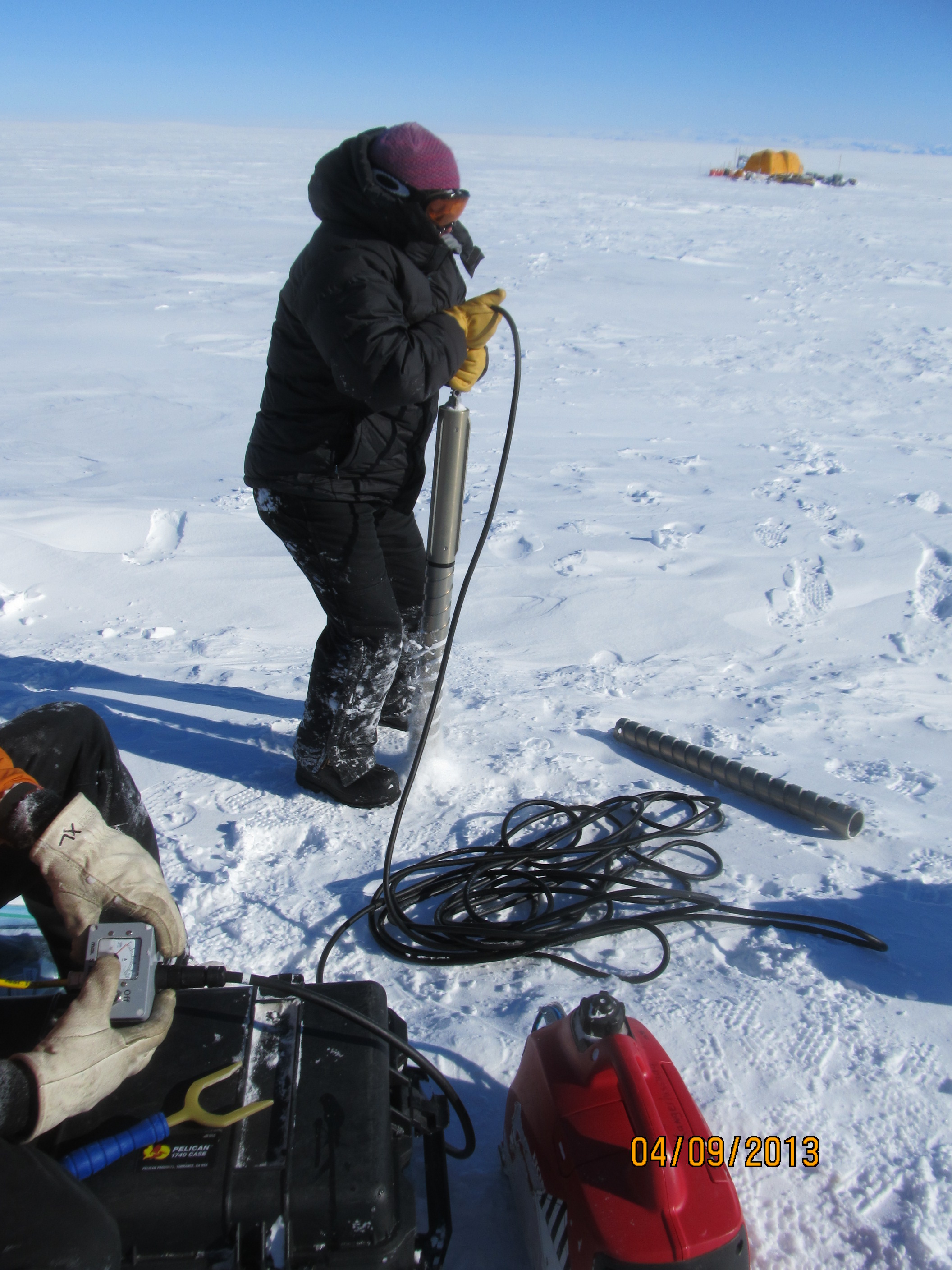
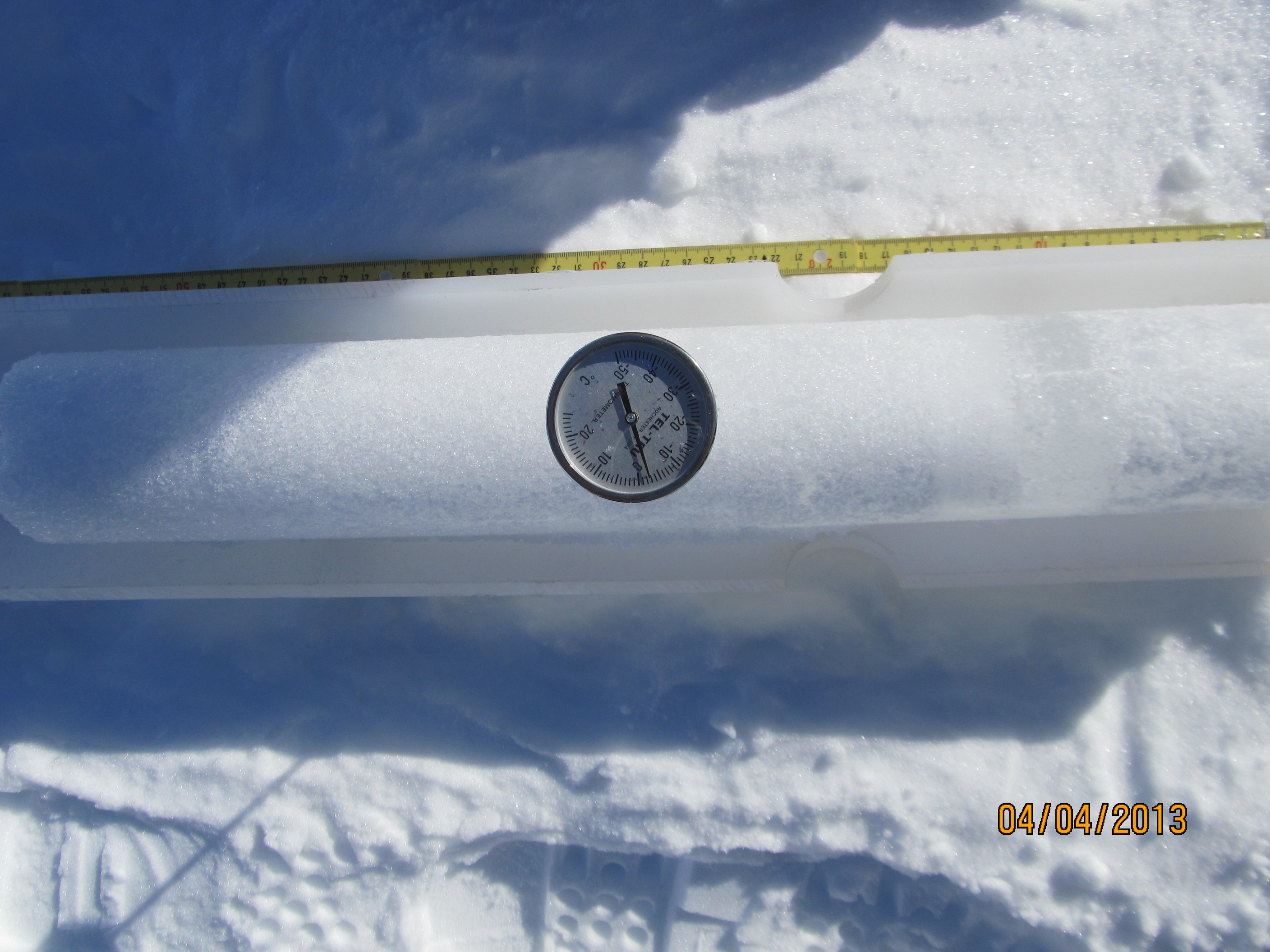
Our last scientific activity was to monitor density with 1-cm vertical resolution using the neutron density probe. We moved the probe along the borehole at a speed of about 5 cm per minute. This sounds like a time-consuming measurement, but measuring density manually is significantly more labor intensive since one must saw the core into segments and then measure each segment’s length, diameter, and weight.
To be more comfortable during the drilling and while recording our scientific data, we always paid particular attention to staying behind our wind break.
Lora and Ludo drilling behind a windbreak during a windy day, with a lot of blowing snow near the ground.
A windbreak is composed of a simple plastic tarp supported by bamboo sticks and held by bungee cords. While we were in Kulusuk preparing our departure to the field, Jay told us several times that bamboo sticks would be critical pieces of equipment while we worked on the ice and that they had to be in mint condition to offer the best resistance to wind. So we spent more than a day in Kulusuk fixing and reinforcing bamboo sticks, using wires and tape. And I am glad we did it!
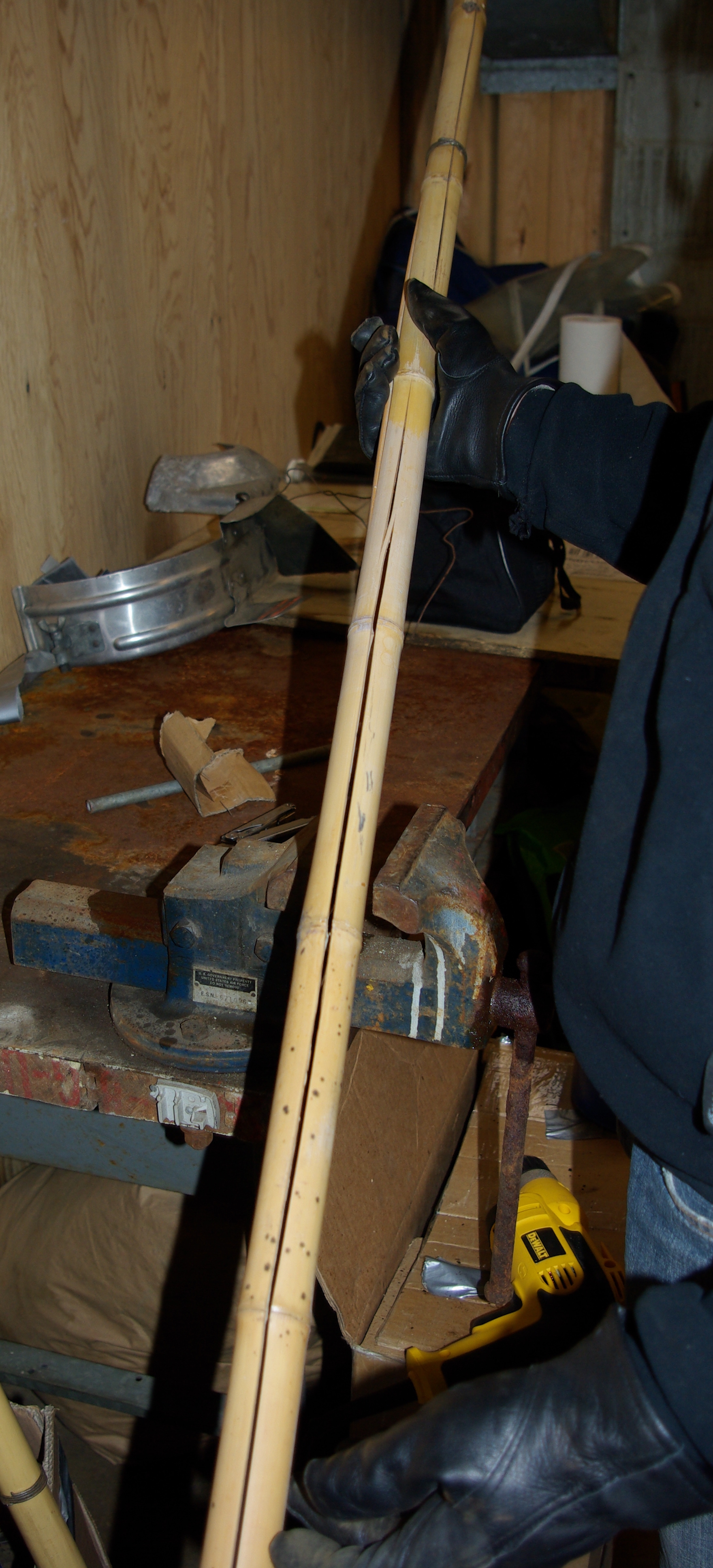
Working in the warehouse to improve the bamboo sticks that we’ll use in the field as wind breaks.
Once we had collected all the data needed from a hole, we packed our equipment, removed the precious windbreak and the bamboo sticks, and either headed toward a new site few hundreds meters away, or went to the cook tent for diner. That’s how our busy days in the field went!
By Clément Miège
Hi there! Today I will give you some background on the radar measurements we collected in southeast Greenland. The radar we deployed is sensitive to snow density changes and to wet snow. The main goal of the radar measurements was to provide information about the spatial variations of the top of the aquifer (a water layer trapped within firn, or old snow).
The radar we used is made by GSSI, a company specialized into geophysical measurements, and it has a center frequency of 400 MHz. In snow and firn, the electromagnetic waves sent by this ground-penetrating radar can image approximately the first 50 meters of a dry snowpack. The layers that we observe in radar measurements show the snowpack stratigraphy (density changes). If there is water within the snow and firn, we observe a really strong radar echo in the radar profile. Then, by dragging the radar around, we are able to see how this water layer evolves spatially.
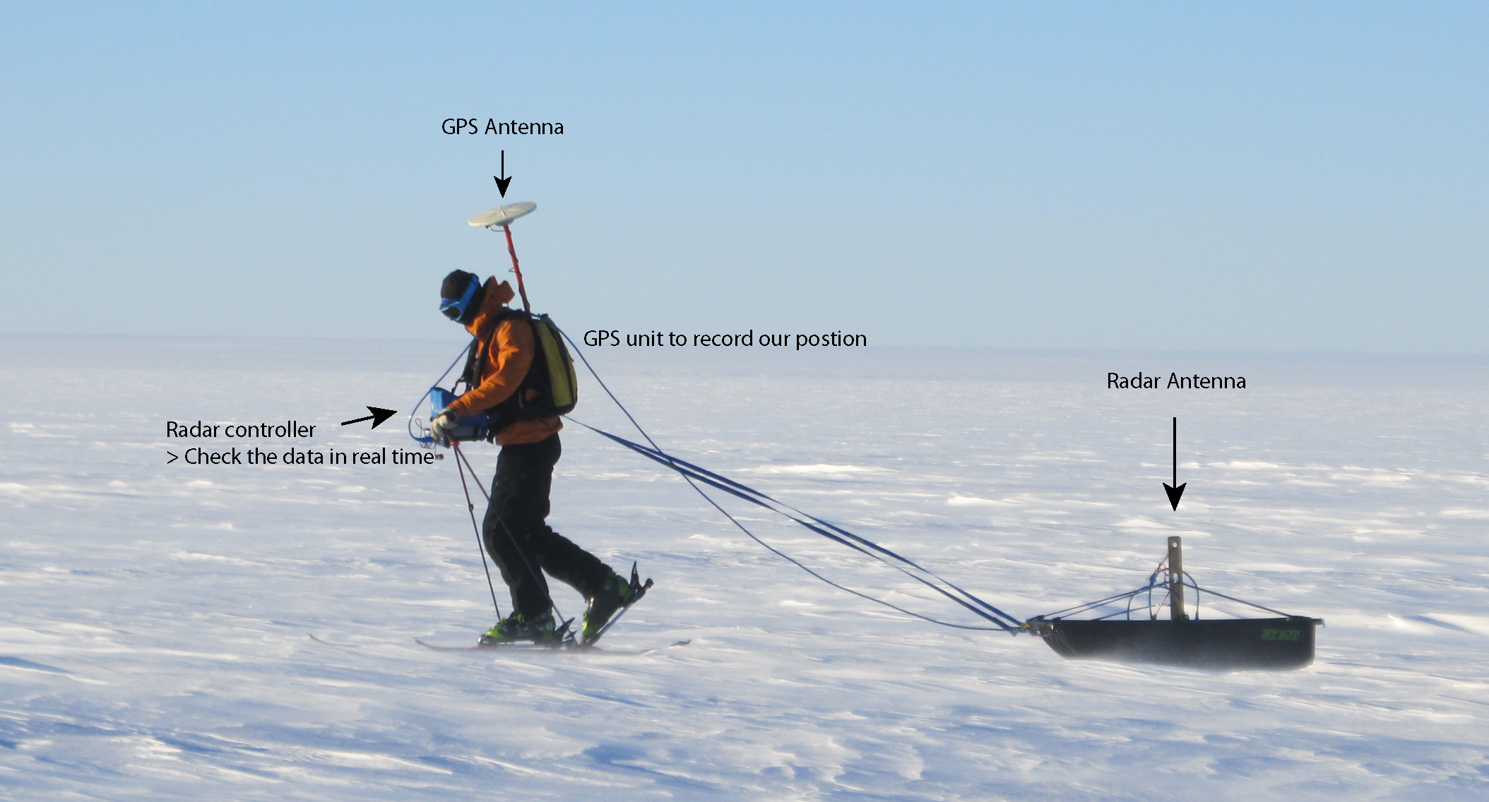
Here is the radar system in action, with Ludo pulling the sled. It can be a pretty tiring job with the wind and the cold. The balaclava was an absolute must to protect your face from the freezing temperatures.
Mostly to lighten our helicopter loads, but also to exercise a bit, we decided to pull the radar sled with skis. But it ended up not being an easy job at times: some of our field days were really windy and cold, so we needed to be warmly dressed and have our face well-protected. In addition, we carried a backpack with the GPS unit and a battery – they became pretty heavy after an hour of pulling the radar. Ludo and I set up the rule of not doing more than 2 hours of survey at a time, which corresponded to about 5 km total.
Once on the ice sheet, as soon as the helicopter took off, we turned on the radar. Indeed, we wanted to make sure that we had been dropped over water and then find the best location for our drilling site. By looking at the radar profile, we identified the water layer (great!) and we converted its depth from electromagnetic wave two way travel time to meters. We observed that over a 2-km transect, the top of the aquifer varied up to 10 meters. By knowing this variation, we were able to pick the site location at a depth that fitted our science needs.
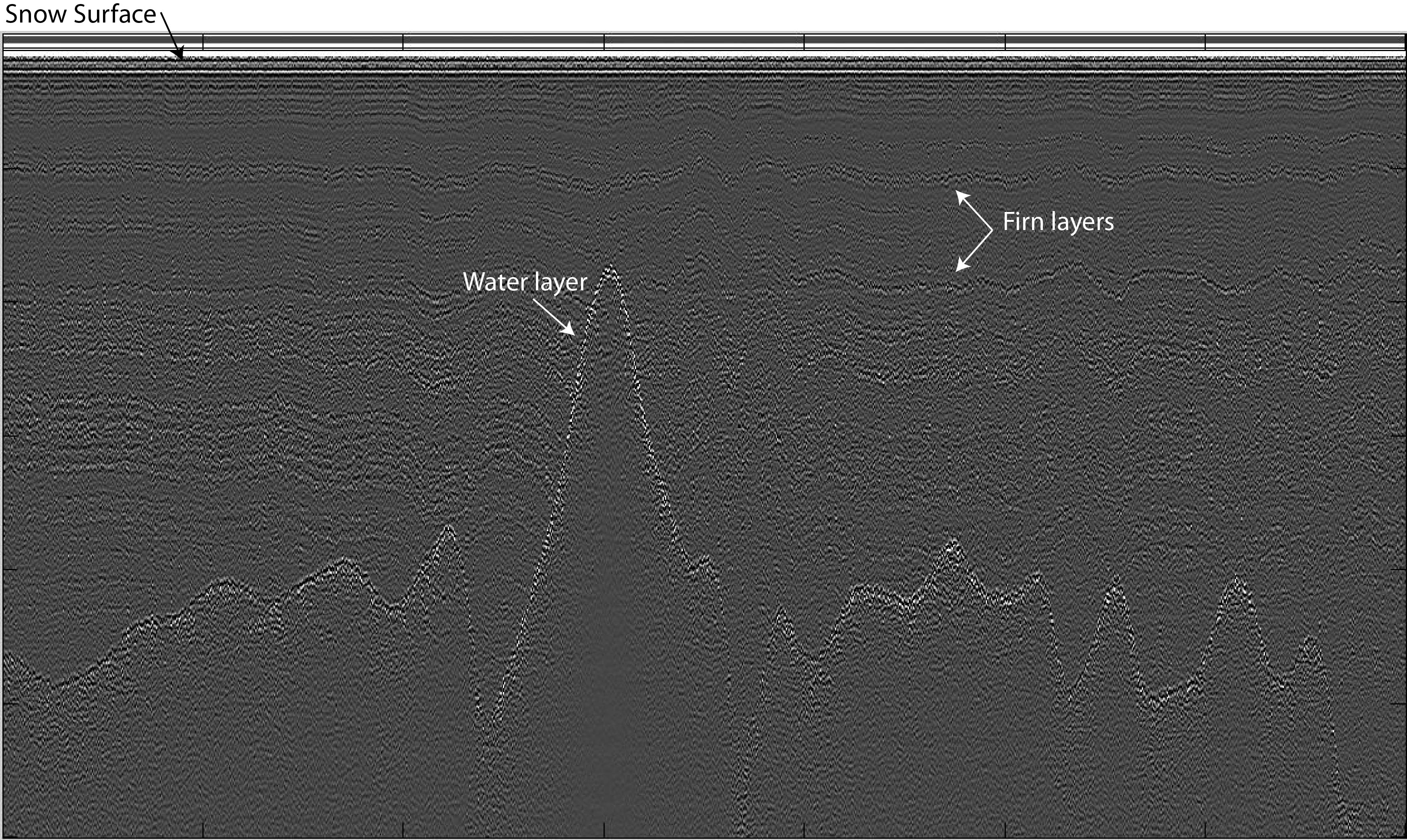
An example of the radar profile observed: the bright reflector represents the top of the water layer. Other internal reflections can be seen — they are linked to previous summer layers, which are denser.
The advantage of doing this preliminary radar survey is that we then knew before drilling at which depth the drill would encounter water and penetrate into the aquifer. And the good thing was that the radar picked the right water depth in both drilling sites! The radar ended up being a really good tool to extend spatially the localized information obtained by the firn cores.

Doing some radar at sunset with no wind was just so great!
For the radar survey, we were doing some elevation transects, to see how the water layer changed with the local topography, and some grids and bowties to extent spatially the core site stratigraphy. We stayed within a radius of 2 km from our camp.
Overall, doing the radar surveys was a great experience. It’s incredible to think that we were skiing with liquid water right below us, while surface temperatures averaging -15C.
Finally, concerning the radar setup, we have already some improvements in mind for the next time. For example, the GPS unit and its antenna need to be in the sled, maybe mounting the GPS antenna on a corner of the radar sled, trying to keep the all setup stable. That will allow us to drag the radar longer. We will work on that for our next radar adventure!
By Jay Kyne (Greenland Aquifer Team’s driller)
Jay, drilling in SE Greenland.
At first we all talked on the phone about it. And then I saw the picture: another driller had drilled into water and, as the drill hung on the surface, there was water dripping from it. Of course that drill quickly froze. So the question was: how do we drill thru the cold snow on top and then into the wet, warm snow/ice below it?
I’ve been drilling into the Greenland ice sheet for nearly 25 years, but I never imagined that there was water down there that didn’t freeze over the cold, dark winter. There have been some deep holes drilled way out in the middle of the ice sheet, all the way to the bottom (about 2 miles deep) and there at the base of the ice sheet the temperatures are near freezing, but not quite there: heat is coming up from the earth, warming the underbelly of the ice sheet. But the newfound aquifer was water that came from the top, melted snow that percolated down the ice. That was surprising to find out, but now the question was how we were going to drill through it.
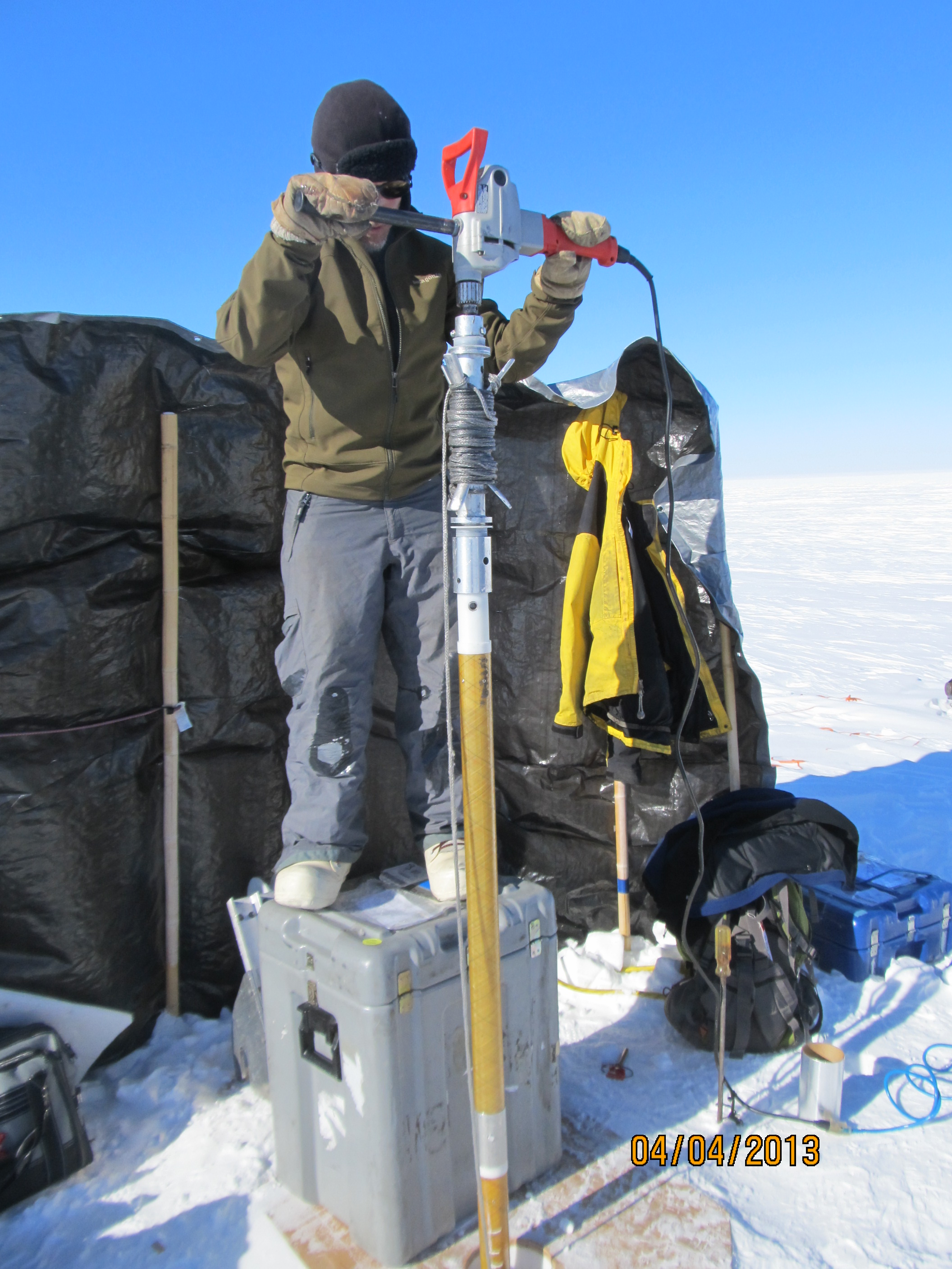
They told me that their radar showed that the water was between 12 and 25m below the surface. I’ve drilled a lot of holes to that depth with a small lightweight drill that I turned from the surface with a big electric drill. It’s basically a tube with helical plastic strips attached to the outside and cutters at the bottom end. You have to come up about every meter and take the core out and dump the snow cuttings, or “chips”, as we call them. As you get deeper, you add more stem to reach the bottom.
I’ve also drilled ‘warm’ ice with a drill that melts its way down, but that was in the continental United States: in Wyoming, Washington and California. That ice was right at freezing temperature.
So we decided to use both of these drills and make the switch when we felt the time was right. And it worked! It was fun working with the Greenland Aquifer Team, too.

Clem collects some of the water dripping from the drill.
Measuring the temperature of an ice core.
By Lora Koenig
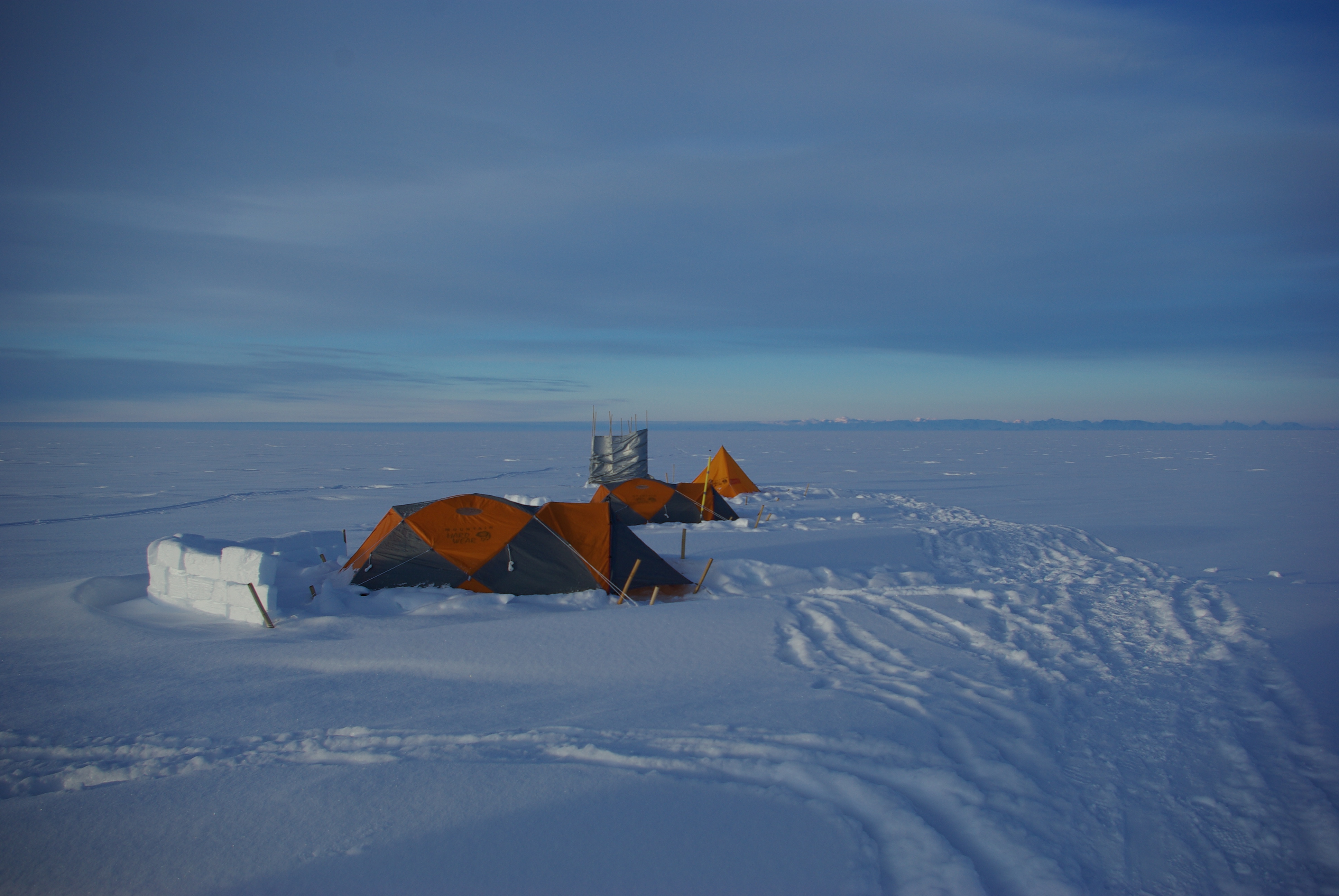
Mountain tents with walls. The gray tarp is the wind break for the bathroom.
April 9, 2013 — I suppose you could say I got up at 3:38 am this morning, but I don’t think I ever really went to sleep. I did get into my sleeping bag around 10 pm last night, but I didn’t sleep. Yesterday we had 20-knot katabatic winds, cold air flowing off the ice sheet near the surface – strong winds, blowing the recent snow into our faces, which feels like being sandblasted but with sharp ice particles. With wind breaks, created with bamboo stakes and tarps, Ludo and I were able to complete our third and final shallow ice core while Rick and Clem prepared all of the final electronics for the thermistor strings. As a reminder, the shallow ice cores are to look at the density structure of the firn above the aquifer, while the thermistor strings will measure the temperatures 60-m deep into the aquifer for the next year so we can learn more about how it was formed.
But I digress to science, let me get back to why I so rudely had to leave my tent in the wee hours of the morning. I last officially measured the winds at 25 knots at around 10 pm with our hand-held weather station. At 25 knots, the blowing snow is annoying but you can still see through it and walk normally. The noise of the tent blowing was loud but tolerable. By midnight, though, the tent was blowing too loudly to sleep, even with earplugs. I guess we were at 30 knots. At 2:40 am, in Ludo, Clem and Rick’s yellow Arctic oven tent, Clem woke Ludo up to make sure the tent corner was still intact (it was), while Rick, who was being showered by the wind blowing the condensation crystals off of the roof and onto his face was also wondering if he was still inside the tent or if it has blown away in his sleep leaving him in a snow drift. He looked up and was relieved to see the tent roof.
I was by myself in a smaller mountain tent. With these tents, we build snow walls behind them to stop the snowdrifts from getting in. My tent wall, built from snow blocks, was about 4-foot tall. At around 3 am, I became aware that the back of my tent was filling in with snow and pushing in on me — I knew I would soon have to get out of the tent and shovel. This is nothing new to me, but I still can’t imagine anyone who enjoys getting out of a warm sleeping bag into a barrage of ice pellets to shovel snow in the dark. Well, it had to be done. I rummaged around to find my head lamp, pulled on my boots and parka, took a sip off my tube of sweeten condensed milk (a great treat and source of heat if you are cold when you are sleeping) and crawled out of my tent. And I mean crawled: the drift had come around the front of the tent and I had to squeeze my way between the vestibule and the snow drift.
I would like to say that I simply stood up and started shoveling but with the winds, probably just shy of 40 knots by now, made it difficult to walk. I kept falling on the drifts while bracing against the wind trying to get to the back of my tent to assess the damage. Sure enough, the drift had come up over the wall — I had not built it tall enough for this storm. I dug out the drift at the back of the tent and made my wall higher. This helped and it would get me through the night until daylight, when I would build a new second wall behind the first. I got back in my sleeping bag around 4:15 am and waited until 6:30 am to get up, take a weather observation and go to go to the cook tent. It was, after all, our scheduled take-out day, but there was no way a helicopter could come in this weather. I called in the weather report for the pilots at 6:50 a.m.: 25 knots sustained winds gusting to 30 knots, -15.2 C (4.6 F), surface definition poor, blowing snow. It doesn’t get much worse than that, so we all knew we would be here another day. I went back out with Ludo to start building a new wall for my tent. With all the blowing snow and wind, it was wet, tiring work and the long full days of fieldwork were catching up with me. I knew I needed a rest, but once the wall was built there would be nothing to do but sit in our tents and rest for a few days.
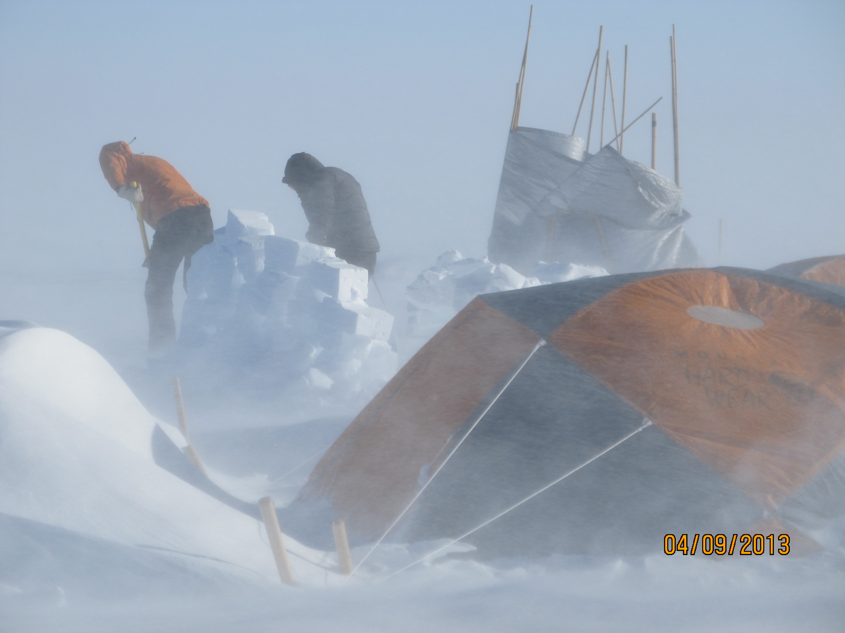
Ludo and Lora building a new wall for the mountain tent just before the winds stopped.
Blowing snow
While Ludo and I built the wall, Rick and Clem went to work on charging the batteries for the thermistor string. They went out to the drill site, where the thermistors are placed down the boreholes, to find the wall they had built yesterday for a windbreak had blown over. They started the generator to charge the batteries and it blew over in the wind. Defeated, they correctly decided to come back to the cook tent to try again later once the storm was over.
Around 9:15 am, I realized that wow,it was only 9:15 am and already it had been a busy day. We all ended up back in the cook tent beaten by the wind and called for our check in. To my surprise, the pilots did not cancel our flights — they asked for another weather report at 11:00 am saying that the weather forecast called for diminishing winds at 10 am. We all laughed – together as a team, we have over 40 years experience working in cold icey places and we were certain we would be here for not only one more day, but probably a few more. So we made some hot drinks to warm us up, dried off and sat down in the cook tent. Suddenly, I realized it seemed rather quiet. Clem opened the tent door and, in a matter of about 15 minutes, our 25-knot plus winds dropped to 8 knots. We were all dumbfounded. I called in the new weather conditions 8 knots sustained winds, -14 C (6.8 F), surface definition clear, no blowing snow… it doesn’t get much better than that!
Then the mad dash started. We completed the final installation of the thermistor strings, packed the food boxes, dug out the cargo and tents from the drifts and pack our personal gear. The helo was scheduled to arrive at 12:30 pm and it did, taking half the gear, Jay and Rick away. Ludo, Clem and I took down the last two tents (for safety, we always leave one up until we know our transport is on its way) and waited for our flight. At 3:45 pm, we left our camp with everything but the thermistor strings.
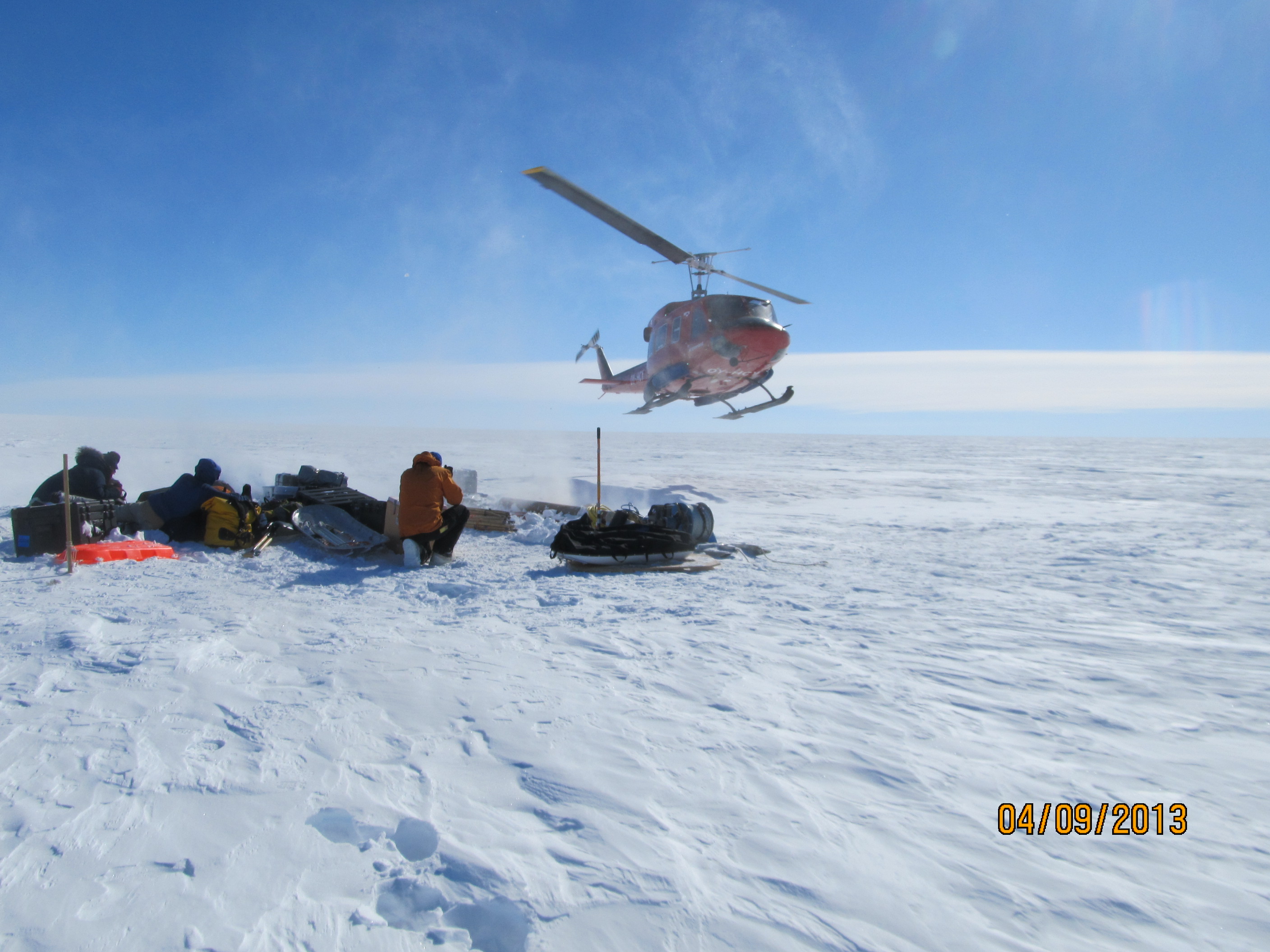
Helicopter landing to pick up cargo.
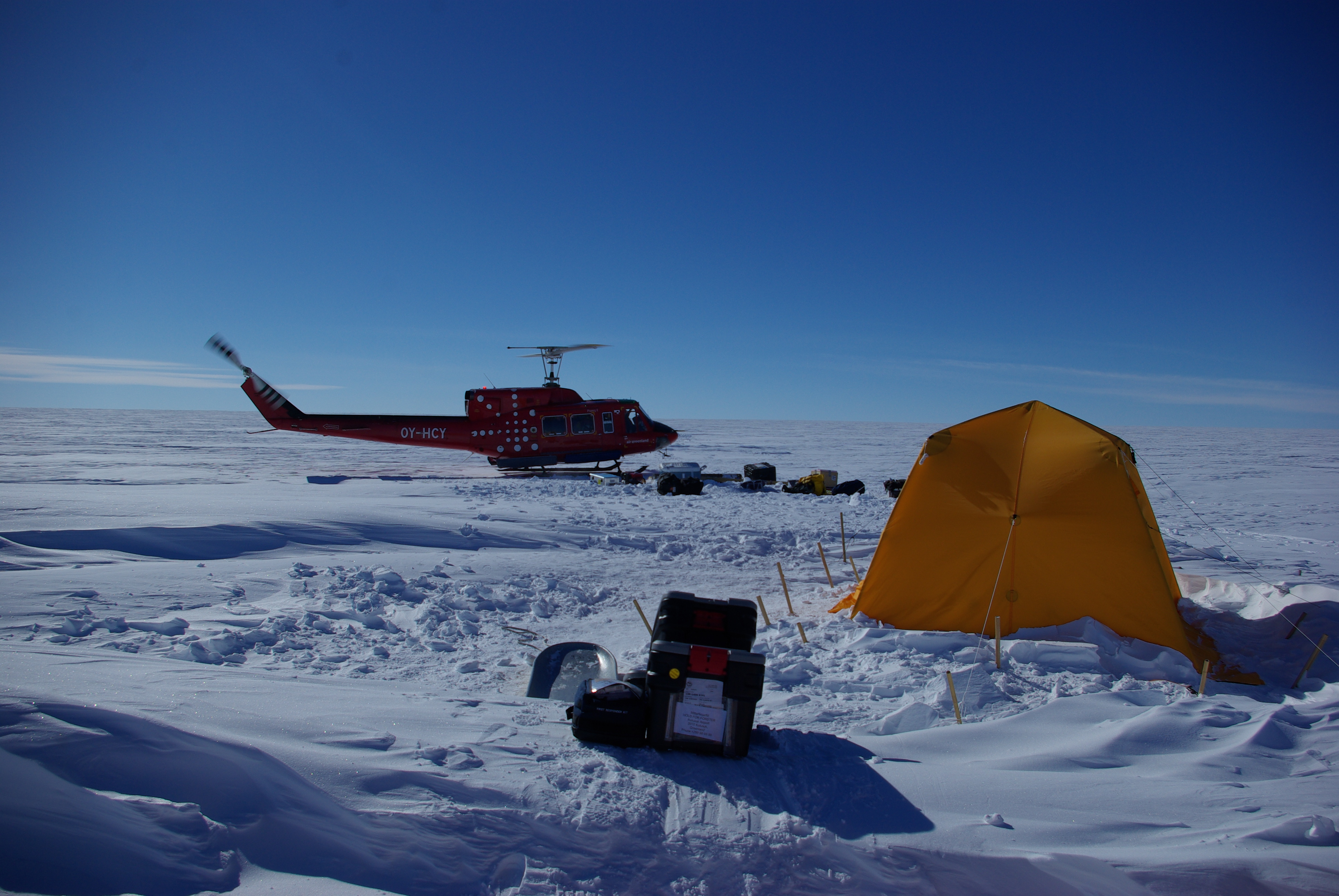
Helo taking off with Rick and Jay. The Arctic oven still standing for safety until we knew the helo would return for second trip.
Rick loaded in helicopter to head back to Kulusuk after a successful field campaign.
Ludo, Clem and I landed softly at around 5:00 pm, still a bit shocked that we had gone from a huge storm on the ice sheet to a calm and sunny Kulusuk in the same day. We unloaded the helicopter, walked to the warehouse, unloaded the gear and opened up every box so all the blowing snow could dry out. After the work was completed, we had an hour to shower and put on clean clothes for a nice dinner of salmon at Hotel Kulusuk. We were all feeling good but tired: we realized we had all worked every waking hour we were in the field to get back on schedule from the delayed put-in Field work is hard, but always rewarding!
In the middle of dinner, the hotel manager came out and said there were three polar bears across the fjord, a mother and two cubs. We grabbed binoculars and were able to see fuzzy, creamy dots on a big rock, on an island in the middle of the frozen fjord. Very cool! Many of the people from the town were taking snowmobiles out to look at the furry visitors.
I have been writing most of the blog posts so far, but now the rest of the team members are going to submit some posts on the specific science they are doing to give you different perspective on the trip. Enjoy them as they are posted over the next few days, with lots of images of the work form the field!
By Lora Koenig
I finally made it to our field site on Thursday and we’ve been working super hard since then to make up for our delays. Jay has done an amazing job, drilling 10 hours a day, and I’m glad to report we’re back on schedule. We’ll be done by the end of today, and hopefully we’ll fly back to Kulusuk tomorrow.
We’ve drilled two deep holes: one is 30 meters deep, and the other 60 meters. We’ll lower our thermistor strings (cables with temperature sensors on them) into these holes and leave them there for a year, recording temperatures. We’re also videoing the holes, to see what’s in there.
The aquifer, which is about 12 meters below the surface at the spot where our camp is located (it is shallower or deeper in other parts of the ice sheet), contains more water than we expected. So much, in fact, that we haven’t been able to use our small drill to make holes. We’re only using the big drill, the thermal one. We use the radar to locate the top of the water layer and when we drill, we try to stay about two meters above the aquifer so the drill doesn’t get stuck. Our hands get cold with so much water and at the end of the day we can’t bend our gloves, because they’re encrusted in ice.
We’ve also drilled three other small holes, about 10 meters deep, spread along a 500-meter line. I’m doing density measurements in these holes (and I tell you: it is tiring to pull a sled with the science equipment half a kilometer from our camp to the farthest hole). The density gives us information on the structure of the layers of snow that water goes through to get to the aquifer below. We’ve been able to observe the melt layer cause by last summer’s extreme surface melt event – it’s now 2.5 meters below the surface, which means that this winter has brought 2.5 meters of snow accumulation at this spot.
If we had brought the right equipment, we’d also be doing porosity studies of the cores – but we didn’t, because this is just an initial assessment of the aquifer and we’re traveling light. Still, we’ve tried blowing into portions of the cores to make water come out, so we can see the tiny pathways it used.
On Friday and Saturday, we got the big storm that had been forecasted, but it wasn’t all that bad. The winds were mild and we got 3 inches of new snow. But now, even when it’s sunny, we have 20-knot katabatic winds that are blowing the new snow in our direction and burying our tents.
As I mentioned, the helicopter’s supposed to pick us up tomorrow. We’ll only need two loads this time, in part because we’ve shed 250 kilograms of cargo (by eating our food and leaving behind some of the science equipment, like the thermistor strings), and in part because helicopters are able to carry more load when flying out of the field, since they land on an airway instead of the ice sheet. The problem will be the volume of our gear, not the weight – we’ll try to pack everything as tight as possible.
Once we’re back in Kulusuk, we’ll spend a couple days drying and cleaning our gear, and we’re giving a talk at the local school on Friday. We’re scheduled to fly back to the U.S. on Saturday.
More on our fieldwork (and photos!) when we’re back in Kulusuk!
—-
[Note: This blog post was written by María-José Viñas, based on a satellite telephone conversation with Lora Koenig. Normally, Lora writes her own posts and María-José edits and publishes them. However, there is no Internet 1,500 meters high on the Greenland ice sheet.]
