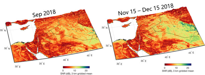
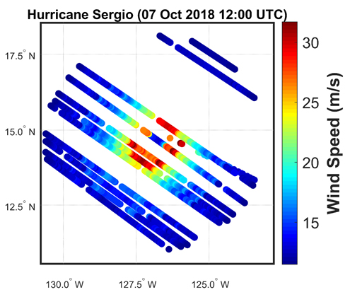
NASA recently completed its senior review process for Earth science missions and CYGNSS has been approved to continue science operations through 2023. Another senior review will occur then. The constellation of eight spacecraft are healthy and operating nominally in their orbits 524 kilometers above the Earth. They continue to make 24/7 measurements of ocean surface winds, both globally and in tropical cyclones, to help understand meteorological processes and improve numerical weather forecasts. Over land, measurements of flood inundation, water body extent, and soil moisture are used in hydrological process studies and for disaster monitoring.

Our ability to forecast the strengthening of hurricanes has been improved by CYGNSS measurements of their inner core winds, which allow us to track the transfer of energy from the warm ocean water into the atmosphere in the form of latent heat flux. Currently, CYGNSS data are being used in re-analysis investigations; that is, revisiting old hurricane forecasts with new CYGNSS data added to see how the predictions are improved. Eventually, the goal is to use the data directly in operational forecasting by NOAA’s National Hurricane Center. CYGNSS wind observations can also be used to provide better estimates of the location of the hurricane, as reported in 2019 in the Journal of Applied Meteorology and Climatology.

Measurements by CYGNSS over land are used to determine soil moisture content under dense vegetation. This, in turn, allows for the identification of conditions conducive to major locust outbreaks in East Africa. Locating locust breeding grounds before the insects are mature and able to fly provides a unique opportunity for eradication efforts on the ground. This capability is being investigated through a partnership between members of the CYGNSS science team, NASA SERVIR, the U.S. Agency for International Development (USAID), and the United Nations Food and Agriculture Organization (FAO). For more information, refer to this Image of the Day published in March 2020.
With NASA’s continued support, CYGNSS will be able to continue with its investigations supporting a better understanding of and ability to forecast tropical cyclones, and to expand its investigations into novel applications over land.


this is very helpful thank u so much im doing a tga about the solar system and this really helps thank u