
Gangneung and Daewallyeong, the cities where the Winter Olympics are taking place, have a unique characteristic for precipitation. The cold and dry front from Siberia converges with the moist air of the Korean East Sea to produce stratiform clouds that occasionally precipitate over the PyeongChang province. This condition where the precipitation comes from the east is difficult for forecasters to predict. When the clouds are formed from the west due to low pressure, prediction is difficult because the ground-based radar’s sensing is limited due to the complex orography. Thus, no matter whether snow comes from east or west, it is always hard for meteorologists to forecast weather it in this area. Nevertheless, snow clouds in the region have a particular characteristic, they normally form around 2 kilometers over the sea level.
On February 13th, the D3R Radar from NASA which is located near PyeongChang captured a low elevation snow formation coming from the west which can be seen in the following images.
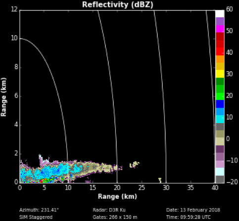
On the left is D3R RHI Reflectivity image at Ku frequency band, and on the right is D3R PPI Reflectivity image at Ku frequency band.
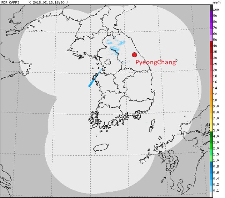
Compound Weather Radar Map of Korea by KMA.
However, no other operational radars from Korea were able to see the snow coming because of the complex relief where outdoor Olympic venues are located. The image below, taken from the KMA website, shows no snow around the PyeongChang region.
The D3R images allowed KMA staff to predict unexpected snow three hours before it started. Television screen captures taken on this day from the NBC Olympics broadcast (below) show snowfall during the cross country classic spring competition.
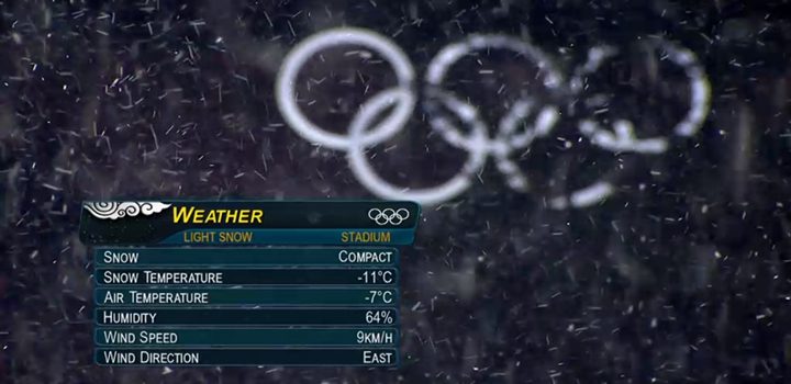
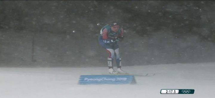
Photos of NBC live streaming the Winter Olympic Games.
Tags: GPM, ICE-POP 2018, Pyeongchang, Winter Olympics