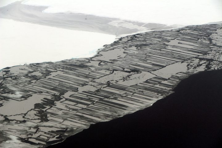
This photograph shows finger rafting in sea ice, captured during the Operation IceBridge mission on November 14, 2017. Photo by NASA/John Sonntag.
“I don’t understand it. I haven’t been this perplexed about the weather in the Weddell Sea area for years,” said John Sonntag, mission scientist for NASA’s Operation IceBridge mission. Sonntag is a self-described weather geek. He is also world-renowned for his insight into the weather in West Antarctica.
Instrument operators, flight crew, and various IceBridge support people gathered on the evening of November 13 in Ushuaia in a hotel conference room, where they listened to Sonntag’s synopsis of the weather situation. A number of factors go into choosing which of the science targets to fly. Weather is a big one. Not only for safety, but most of the instruments on board need little to no clouds in order to make measurements. One thing was certain: weather permitting, the next day’s mission would be over Antarctic sea ice.
According to Sonntag, the location of a high-pressure ridge should cause wind to blow from north to south immediately east of the peninsula. That would cause fog to form when it reached the Weddell Sea; farther from the peninsula the fog would clear as the winds reversed around the ridge. Some models agreed, but others called for the opposite. That’s the challenge faced by Sonntag and IceBridge project scientist Nathan Kurtz, who had to decide whether to fly a mission the next day. Which weather forecast model do you trust? And which remaining mission plans will provide the most scientific value?
The main goal of flights over sea ice is to map its thickness. That’s typically done with a satellite, but the ICESat mission ended in 2009 and ICESat-2 is scheduled to launch in 2018. In the meantime, thickness can be measured from aircraft with a radar instrument by timing how long it takes radar waves to penetrate the layers in the sea ice.
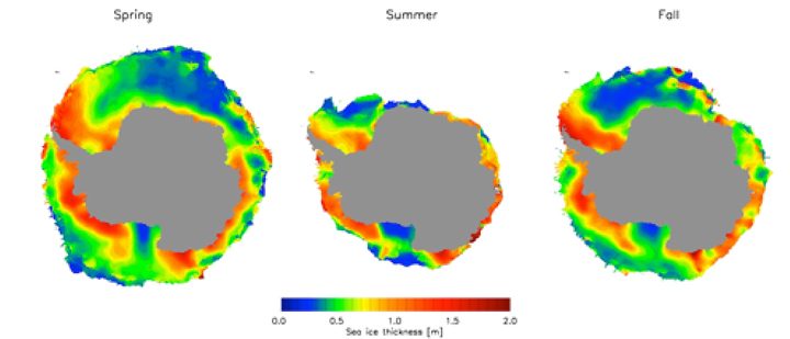
Data from ICESat were used to construct these maps of sea ice thickness around Antarctica. In lieu of a satellite, data from Operation IceBridge is used to map sea ice thickness in targeted areas.
On the morning of November 14, Kurtz and Sonntag re-evaluated the forecast models and Kurtz made the final call: The “Seelye loop south” mission over sea ice was a go. The nearly 10-hour mission, flown almost every year since IceBridge started making flights over Antarctica in 2009, is essentially an out and back line over the Weddell Sea. At this point in the campaign—more than halfway through and with plenty of allotted flight hours remaining—he decided to play the odds. Time would tell where the clouds really were.
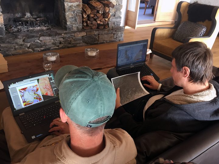
On November 14, 2017, John Sonntag (left) and Nathan Kurtz (right) evaluate the newest forecast models before deciding whether to fly a sea ice mission. Photo by NASA/Kathryn Hansen.
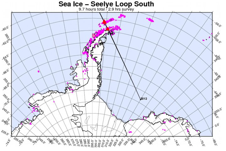
This map shows the planned flight line for the “Seelye loop south” mission.
As I’m writing, we’re flying over the Antarctic Peninsula toward the Weddell Sea. Fog extends all the way to the ground but you can still make out the faint shapes of rock outcrops. A moment later the fog dissipates. Kurtz watches out the window and smiles. “It’s exhilarating, it’s a lot like gambling.”
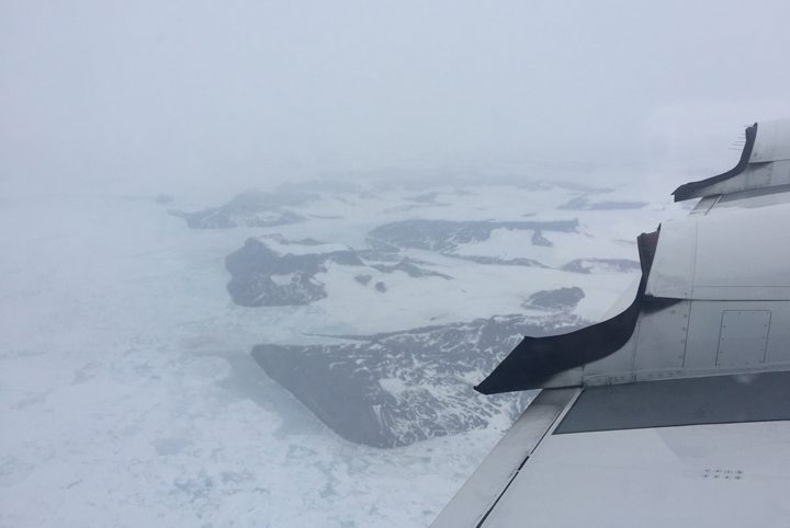
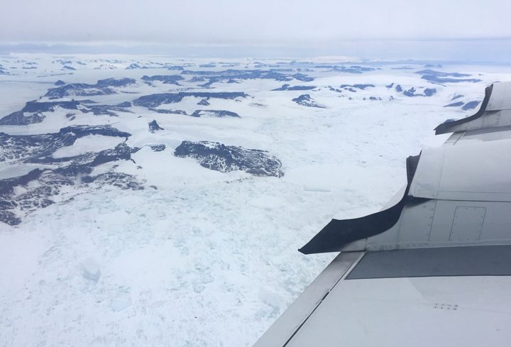
Fog (top) gives way to clear skies (bottom) over the Antarctic Peninsula. Photos by NASA/Kathryn Hansen.
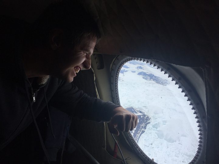
Nathan Kurtz is relieved to see the skies turn from foggy to clear over the Antarctic Peninsula. Photo by NASA/Kathryn Hansen.
Instrument operators monitor the incoming data. Flying at an average altitude of 1,500 feet (sometimes as low as 1,000 feet), I spot the occasional seal. Then, as we continue along the flight line we become sandwiched between layers of clouds. It’s hard to tell where the sky ends and the ice begins.

Pilots fly the P-3 between layers of clouds.
But as fast we encountered the clouds, we leave them behind again. “It was a roller coaster, up and down,” Kurtz says as we head back to Ushuaia. “But now I’m excited, the flight went well.”
Perhaps you know the feeling: that moment when you see with your eyes something you have previously only seen in pictures. Before today, I knew the Larsen C ice shelf only from the satellite images we have published since August 2016. The attention paid to the shelf off the Antarctic Peninsula has been due to a rift that eventually calved an enormous iceberg. Today (November 12), the Operation IceBridge mission flew its suite of airborne instruments over the shelf and I caught a first-hand look.
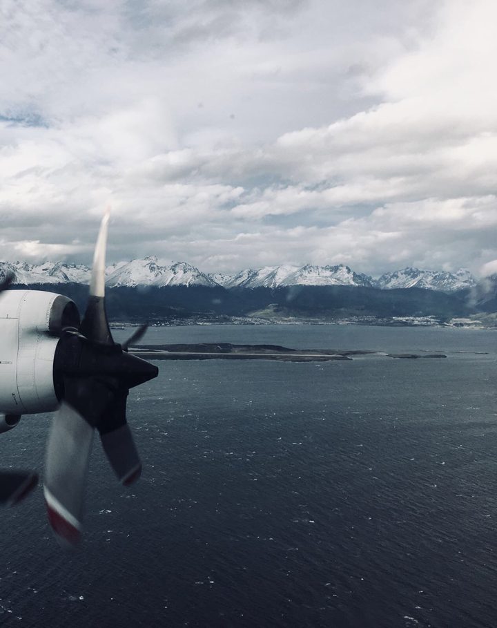
The view from the P-3 after take off shows mountains that received an overnight dusting of snow in Ushuaia, Argentina. Photo by Aaron Wells.
I was aware that I would be seeing an iceberg the size of Delaware, but I wasn’t prepared for how that would look from the air. Most icebergs I have seen appear relatively small and blocky, and the entire part of the berg that rises above the ocean surface is visible at once. Not this berg. A-68 is so expansive it appears if it were still part of the ice shelf. But if you look far into the distance you can see a thin line of water between the iceberg and where the new front of the shelf begins. A small part of the flight today took us down the front of iceberg A-68, its towering edge reflecting in the dark Weddell Sea.
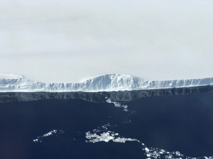
The edge of A-68, the iceberg the calved from the Larsen C ice shelf. Photo by NASA/Nathan Kurtz.
This particular flight, however, aimed to get more than just a surficial look at Larsen C; to understand the system as a whole, scientists also want to know the bathymetry of the bedrock below. To do that, the flight path was planned with gravity measurements in mind. While radar instruments can “see” through snow and ice on land to map the bedrock, radar has trouble when instead of land there is water below the ice. For the gravimeter, that’s not a problem. The new flight lines—flown for the first time—followed the ground tracks of the future ICESat-2 satellite, and simultaneously increased the area of Larsen C mapped with the gravimeter.
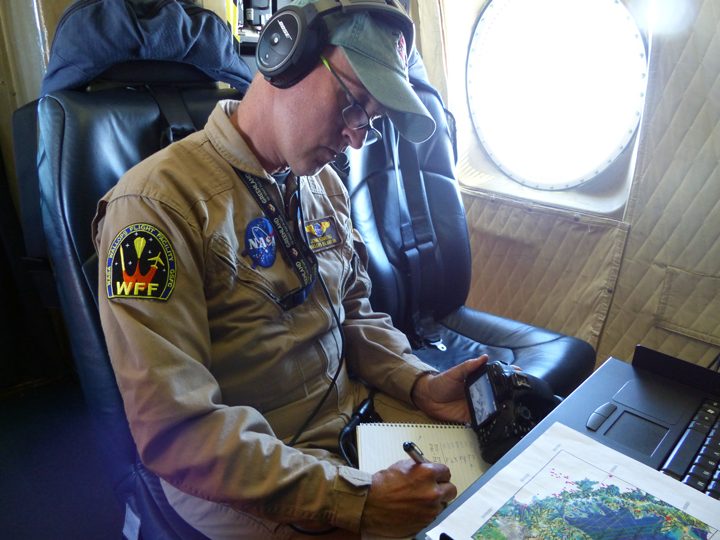
John Sonntag, Operation IceBridge mission scientist, takes notes during the science flight over Larsen C. The planned flight lines are in the foreground.
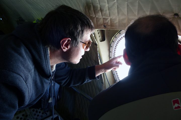
Nathan Kurtz (IceBridge project scientist) and Sebastián Marinsek (Instituto Antártica Argentino) observe Larsen C from a window on the P-3.

David Ho.
Trying to clearly explain the carbonate chemistry of seawater taxes the best in our field. There are mass and charge balances to be maintained, complex relationships of reactions to temperature, salinity, and pressure to be considered, and deeper mysteries of buffering capacity and interaction with life (biogeochemistry) to tip inexpert thinking into chaos. However, there is much to learn and theoretical notions to be tested in the real, complex ocean. On R/V Revelle we have an expert lifting the fog of long-lost chemistry lessons and illuminating the role of rain in gas exchange between the atmosphere and ocean.
David Ho, from University of Hawaii, has been studying carbon chemistry and rain for about 20 years. SPURS-2 is his first opportunity to carefully measure the impact of rainfall on the carbonate chemistry of surface seawater. This work is a scientific first. It is a “ƒblog first” 20 years in the making – David Ho was one of the first graduate students I supported when I started as NASA Physical Oceanography Program manager. He was totally into rain and gas transfer then – in the laboratory at NASA Wallops Island Facility. And I was totally into getting NASA to measure salinity from space. I think we both knew then that if we were both successful, our careers would cross again. Sometimes serendipity befalls those who have prepared well! In this case, were both preparing for opportunities that fit hand in glove.
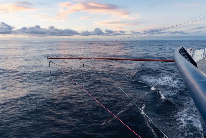
The salinity snakes bring water aboard from the top few inches of the ocean (photo J Schanze).
David contends (a scientific hypothesis already published) that fresh raindrops in equilibrium with atmospheric carbon dioxide will lower the carbon dioxide gas (pCO2) in surface water. Maybe this is not rocket science, but it has yet to be observed and documented because this kind of measurement is typically made from a depth of about 5 m (~15 ft), too deep to see this surface change. He comes to sea to measure pCO2, pH and dissolved inorganic carbon (DIC) to test this hypothesis. As I described in the last blog post, all of NASA’s support for the “cottage industry” of measuring surface salinity enables David to precisely collect the surface samples he needs to test his hypothesis. Serendipity for him and synergistic science for us. Win-win.
The oceans are currently estimated to take up about 25% of the CO2 emitted to the atmosphere due to human activities. The pCO2 of the surface ocean is important because it controls the amount of CO2 that travels between the atmosphere and the ocean, and knowing surface ocean pCO2 will enable scientist to accurately determine how much CO2 the oceans are taking up.
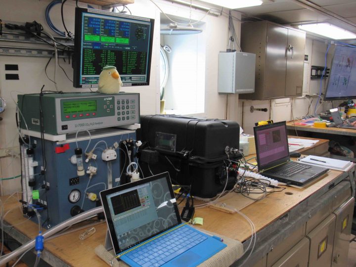
Total DIC and pCO2 analysis equipment.
Never before has David seen such a perfect line-up of synergistic observations for his work. He can access water from the upper few inches of the sea via the Sea Snake system; benefits too from the quality controlled and calibrated temperature and salinity data it provides. Likewise, on this voyage we are well-equipped for rain measurement – getting drop size distributions and rain rates from the state-of-the-art SEA-POL radar and an extensive rain gauge system on Revelle for this voyage. SPURS-2 is superbly focused on working in the rain and on the properties of the surface ocean. Therefore, the opportunity for David Ho’s synergistic science was a perfect addition to the voyage. David can focus on the carbon chemistry but answer the larger questions he has worked on for years. And, as I said, the seeds of this circumstance were planted nearly 20 years ago. We have NASA’s persistence in Earth science and technology development to thank for allowing this harvest of knowledge.
Much to our pleasure, the results are very promising. There is clear evidence of steep declines in pCO2 in the surface water when it rains. The details will have to come with further analysis, but we know this has been a success for science – and program management too. Both David and I feel like there was a big victory here for “synergistic science of opportunity.”
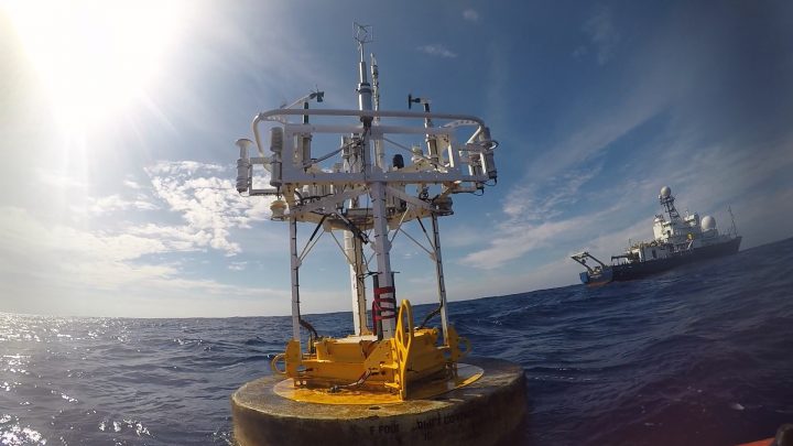
WHOI Mooring Buoy (credit Ray Graham).
One of the reasons our work requires a large research vessel is that we are dealing with large arrays of sensors moored in the deep ocean. That requires big buoys, lots of rope and wire, lots of floatation, and big anchors with very strong and steady human guidance.
Time series collected from moorings are among the most valuable data sets collected in oceanography. Anchoring sensors at one location and precisely placing them at pre-determined depths provides a view of the ocean that cannot be supplied by any other means.
SPURS-2 deployed three moorings in late summer of 2016 and recover the equipment now, in November 2017. Our “central mooring” from Woods Hole Oceanographic Institution is heavily instrumented with temperature, salinity, and velocity sensors (See Prior Blogs: Mooring Deployments and Mooring Deployment). Two additional moorings from NOAA PMEL (See Prior Blog: NOAA Contributions to SPURS) are instrumented with “Prawlers” (See prior blog: Prawlers, Engineers, and the Future of Oceanography at Sea) – a single sensor package that crawls up and down the mooring wire profiling the water column. In addition to ocean measurements, these moorings provide a year long record of the surface meteorological conditions.
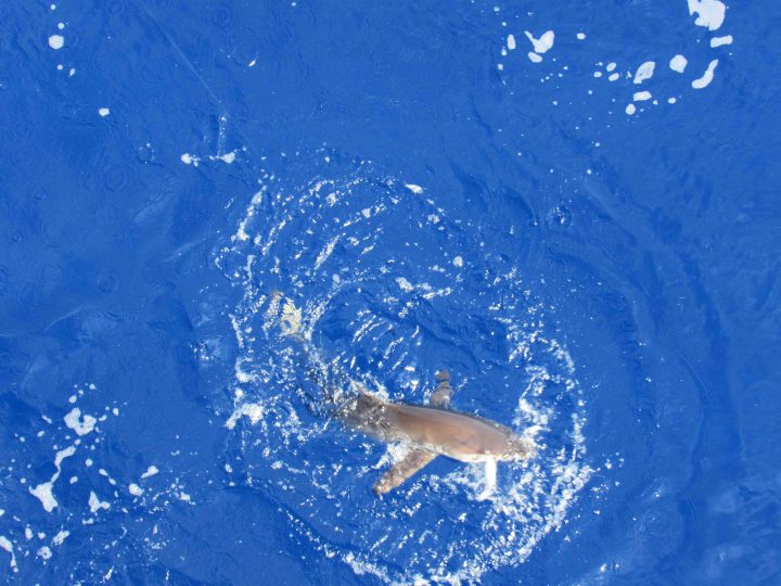
Silky Shark on the line at WHOI mooring.
One of the interesting thing about these moorings, that you seldom hear about, is the “buoy ride.” Several times during this voyage we have put men on the mooring buoy to complete assignments such as replace batteries, change out meteorological gear, and finally to remove all the meteorological equipment in preparation for recovery of the entire mooring. Ben Pietro and Ray Graham described the experience quite vividly – of clambering aboard the buoy from Revelle’s small boat and attempting to stay safe on a rocking, rolling, heaving, slippery, guano-encrusted, shark-surrounded, pillar of modern oceanography.
In the approach via small boat, we are told, one is impressed immediately by the number and variety of fish swimming around the buoy. There are also the menacing, shadowy figures of sharks among the fast-swimming tuna and mahimahi. That gives the short leap from the boat to the buoy the feeling of a do-or-die effort!
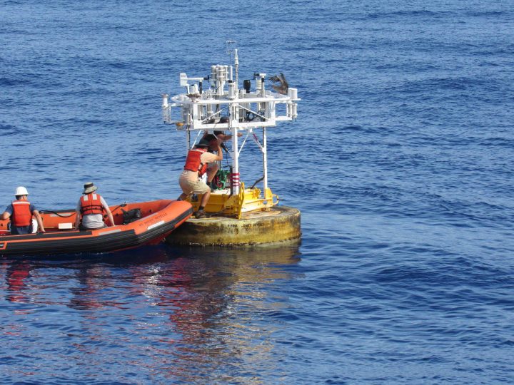
Once aboard the buoy the footing is slippery with seawater and guano, so the discipline of a rock climber is required. It may be only a short way down, but who wants to splash around with hungry sharks? One only has to recall the fishing, of days recently past, where on one cast all that was brought aboard was the lure and the head of the tuna; the sharks having won an easy and quick dinner. Best to hold on tight. Ben said his knees were sore from clamping down hard on the buoy while using both hands to get the meteorological gear free and stowed.
Serious profession this!
Ray and Ben riding the WHOI Buoy!
One of the fascinating projects to watch during the mooring recovery is the dismantling of the “hardhats” – the mass of floatation at the bottom of the mooring above the anchor that brings the bottom end to the surface. As deployed, it is a tall tidy assembly of glass balls in their protective hardhats, in bunches of four, connected with chains. As recovered (see photo), it is a confusing puzzle of twisted chain and shackles in an untidy pile. Amazingly, it took a dozen people only twenty minutes to untangle the puzzle and stow the hardhats four by four back in their shipping box (AKA, the snake pit). Honestly, it was an amazing operation to watch!
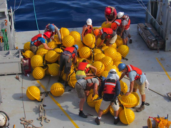
The Puzzle of Untangling the Hardhats.
While ocean moorings are often described as autonomous observing platforms, the human ingenuity required to deploy and recover them demands a steady human with a tight grip.
Taking off from Baltimore Washington International Airport on November 6, the view out the window was stunning. If the foliage wasn’t exactly at peak autumn color, it was close. Landing in Buenos Aires the next day was equally beautiful, but it was the purple blooms of the jacaranda trees that caught my eye. And upon landing in Ushuaia the day after that, I noticed vibrant red blooms on the shrubs. Within 48 hours and 6,500 miles, I went from autumn to spring.
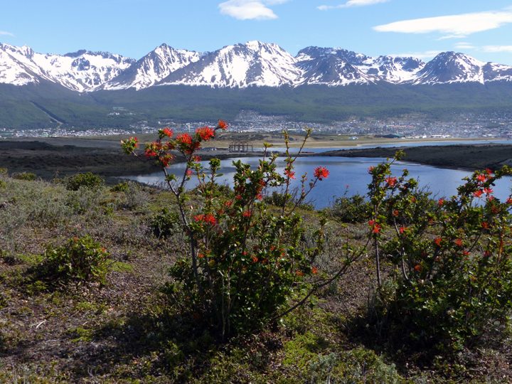
Spring flowers bloom in Ushuaia, Argentina. Photo by Kathryn Hansen.
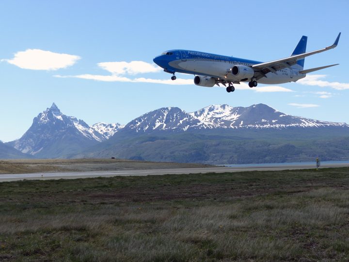
An Aerolineas Argentinas flight lands in Ushuaia. Photo by Kathryn Hansen.
Ushuaia (blue dot) is known as the southernmost city in the world. The red pin is Buenos Aires.
Spring in the Southern Hemisphere is when NASA makes annual science flights over Antarctica. The flights are part of Operation IceBridge, NASA’s longest-running mission to map polar ice (now in its ninth year in the Southern Hemisphere). But for the first time, flights over the icy continent are being staged from Ushuaia, Argentina, instead of Punta Arenas, Chile.
Upon arriving in Ushuaia, I met some of the IceBridge scientists and caught up on the status of our aircraft, the P-3. Most people have already been here for a few weeks, as science flights began on October 29.
For the next 10 days, I will be your blogger in the field. These Notes from the Field will differ from others, which are typically written by scientists. I am not a scientist. But as a writer for NASA Earth Observatory, I look forward to being your eyes and ears in the field, delivering stories about the people and the science happening at the bottom of the world.
This hangar will be our office. As the photograph shows, the office is a bit sparse today. Engineers are waiting for parts to arrive to repair a window through which the Airborne Topographic Mapper makes its observations.
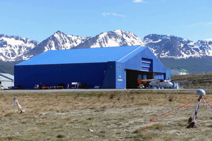
The hangar in Ushuaia. The P-3 is on the ramp south of this image (not pictured). Photo by Kathryn Hansen.
On a no-fly day, the office in the hangar is sparsely populated. Photo by Kathryn Hansen.
In the meantime, many took a break from nearly non-stop work for a quick camping trip. I caught up with a group that needed to use the spare time to install the magnetic ground station. This is essentially a point on the ground where the magnetic field is known. Flying over that point gives researchers the information—ground-truth—that allows them to make corrections in the data collected inflight by the magnetometer.
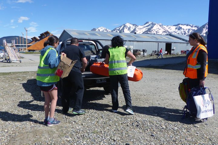
The gravity and magnetics team loads gear into the truck. Photo by Kathryn Hansen.
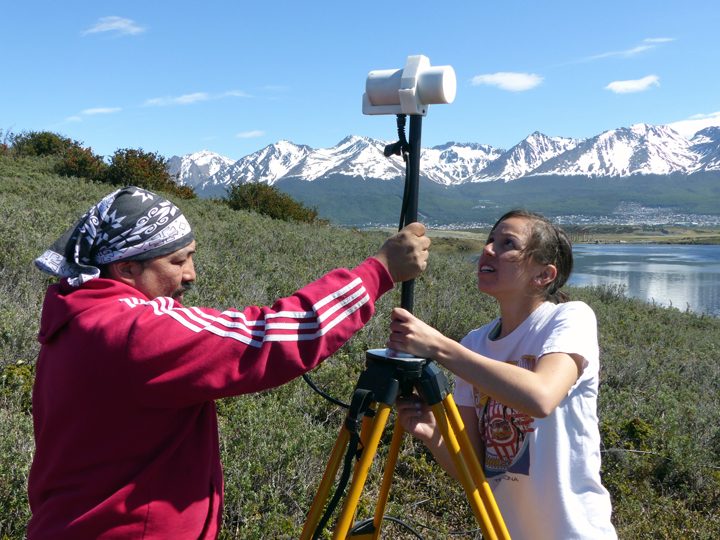
Katrina Zamudio of USGS (right) installs the magnetic ground station. Photo by Kathryn Hansen.
On our way back to the hangar, our kind escort gave us a tour of airport grounds and the shores of the Beagle Channel, where we did some beachcombing. It’s back to work tomorrow!
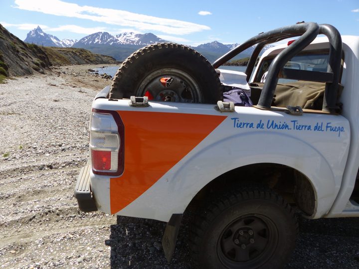
On our way back to the airport we made a quick detour for a closer look at the shoreline. Photo by Kathryn Hansen.
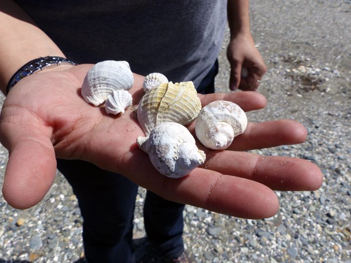
Shells crunched under our feet as we walked on the beach. Photo by Kathryn Hansen.
