Clouds blanketed much of MABEL’s potential flight routes over the Alaskan Arctic or southern glaciers on Monday, so the ER-2 aircraft stayed in the hangar at Fort Wainwright in Fairbanks, Alaska.
But the MABEL team was busy. They took advantage of a day on the ground by improving the instrument’s new camera. The goal is to take more images like the one below, to help scientists interpret the data from the airborne lidar instrument.
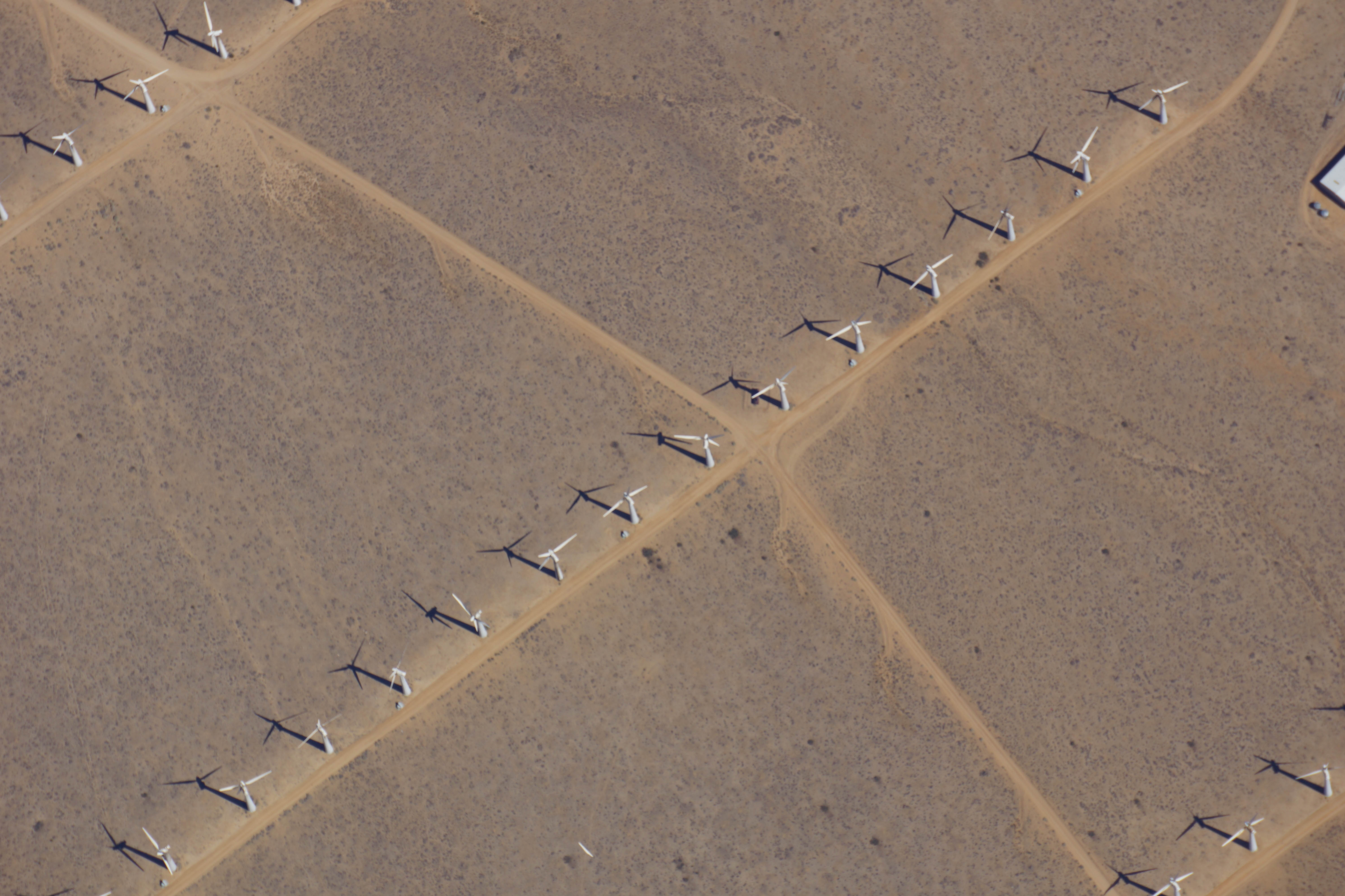
As the ER-2 aircraft traveled from Palmdale, California, to Fairbanks, Alaska, the camera on MABEL took this shot of wind turbines near Bakersfield, California. (Credit: NASA)
It’s the first week of the summer 2014 campaign for MABEL, or the Multiple Altimeter Beam Experimental Lidar, the ICESat-2 satellite’s airborne test instrument. MABEL measures the height of Earth below using lasers and photon-counting devices. This year, the team is using a new camera system to take snapshots of the land, ice and water in parallel with MABEL’s measurements.
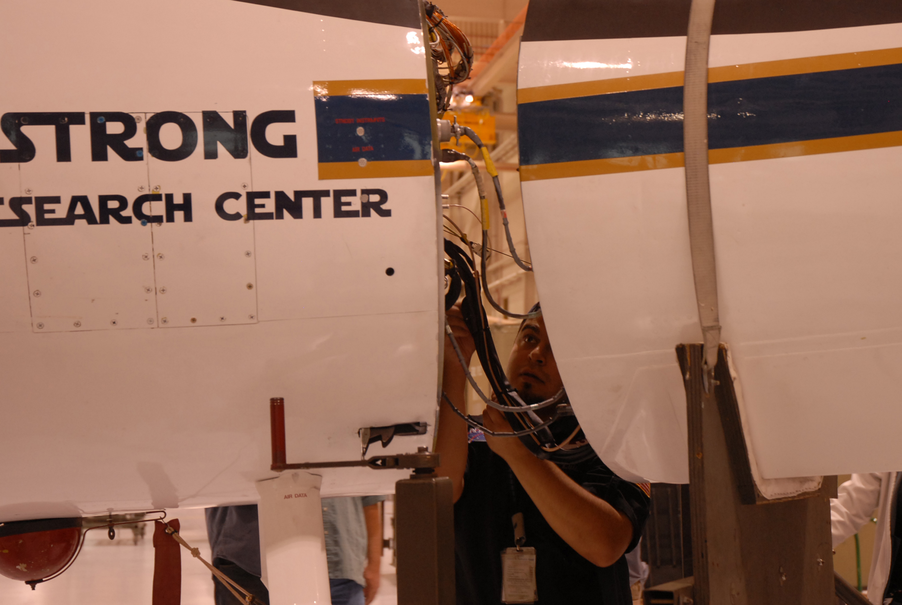
The MABEL instrument is nestled snug in the nose cone of the high-altitude ER-2, which has a circular window in the base where the laser and the camera view the ground. To get access to MABEL and the camera, the crew propped up the nose and wheeled it away from the aircraft.
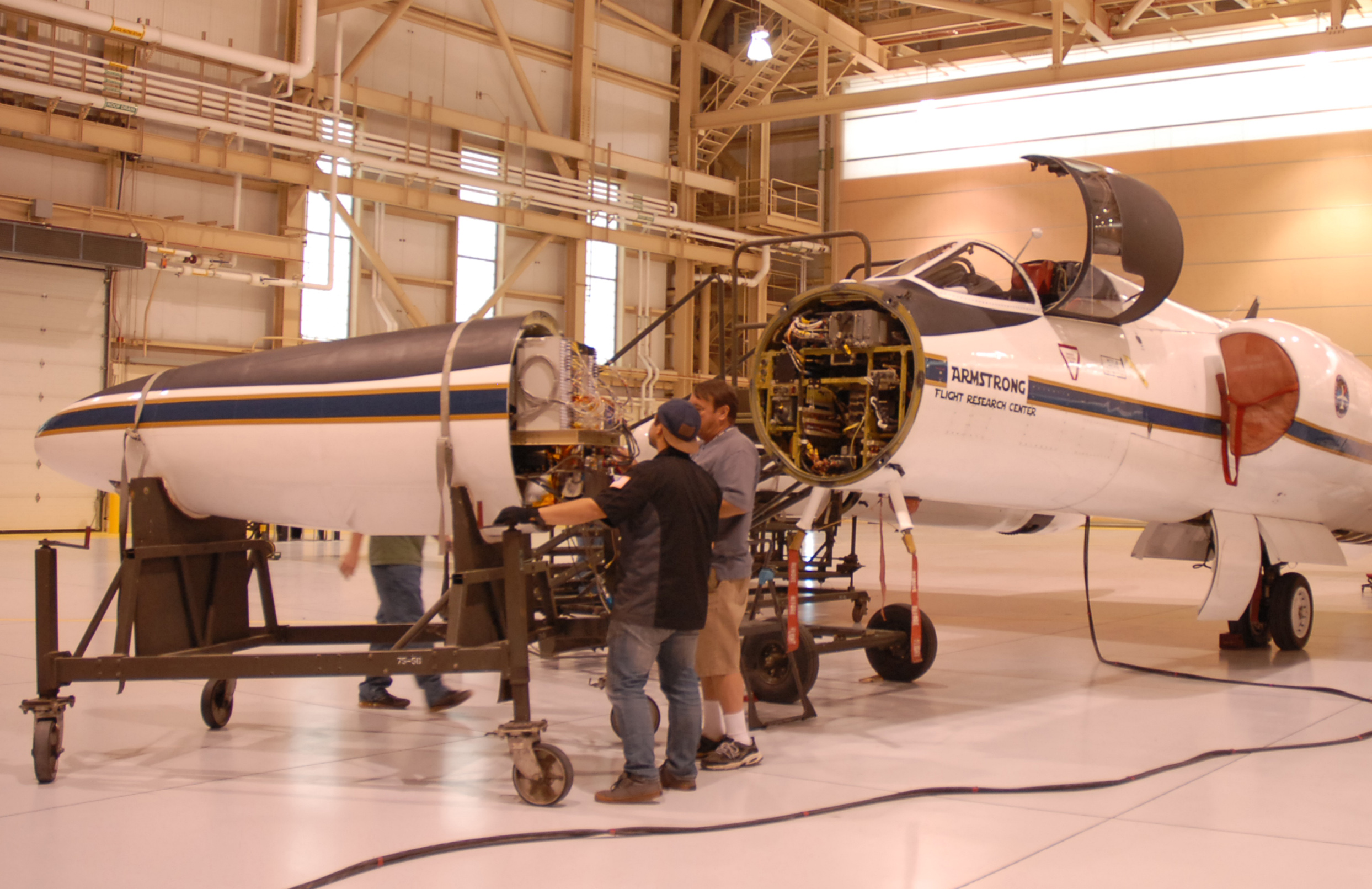
The ER-2 crew rolls the aircraft’s nose — containing MABEL — away from its body, so engineers could work on the instrument. (Credit: Kate Ramsayer/NASA)
The team then carefully slid the instrument out onto a cart, so that MABEL’s on-site engineer and programmer – Eugenia DeMarco and Dan Reed – could work on the camera and ensure the connections were sound.
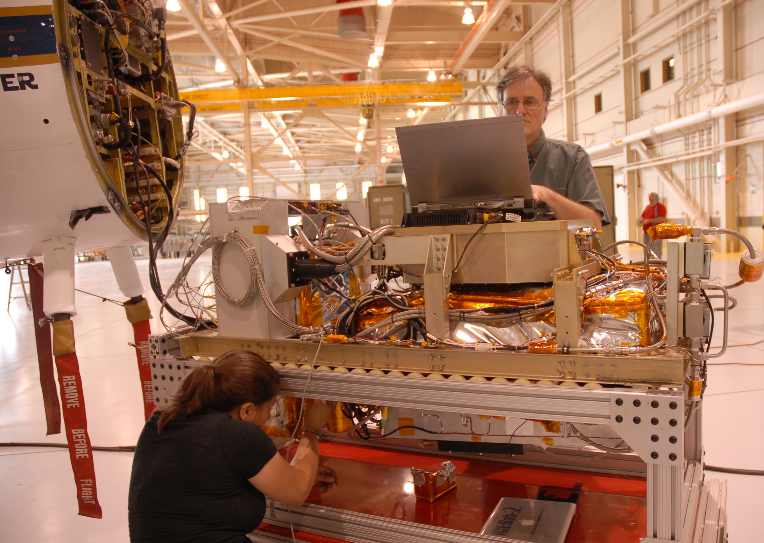
MABEL engineer Eugenia DeMarco and programmer Dan Reed work on improving the new camera system for the instrument. (Credit: Kate Ramsayer/NASA)
When the camera was set to document the terrain from 65,000 feet, the team slid MABEL back to its spot and wheeled the aircraft’s nose back to the rest of its body. They connected the instrument to the plane’s electronics, sealed the plane back up, and are ready to go whenever the weather cooperates.
Luis Rios, with NASA’s ER-2 crew, checks the connections between the MABEL instrument and the aircraft. (Credit: Kate Ramsayer/NASA)
From early July through mid-August 2014, scientist Doug Morton of NASA’s Goddard Space Flight Center in Greenbelt, Maryland, will be flying low over the treetops of interior Alaska. The purpose? First-of-a-kind look at the state’s forests with a portable, airborne imaging system called G-LiHT to map the composition, structure and function of the ecosystem.
According to Morton, key components of the fieldwork include:
“First, we are partnering with the U.S. Forest Service, as directed by the recently-passed Farm Bill, to incorporate remote sensing technology into forest monitoring efforts. Our pilot study will be the first inventory of forests in interior Alaska; a standard ground inventory (as in the lower 48) has always been too costly or logistically challenging to implement.
Second, we will study post-fire recovery, with plans to sample more than 80 percent of all fires in the Tanana region since 1950. Fire is the major agent of change in interior Alaska, and understanding the patterns of forest recovery is essential to gauge the vulnerability/resilience of forests to future climate change.
Third, we will benchmark conditions (topography/permafrost, forest cover, forest composition) across a large portion of the Arctic-Boreal Vulnerability Experiment (ABoVE) science domain.”
Follow Morton through the summer as, Internet connection permitting, he sends updates and photos from the field.
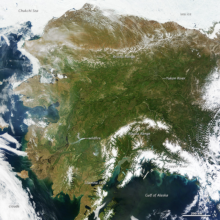
Very few people get to fly 65,000 feet above Alaska’s glaciers. And even fewer get to fly over ones they share a name with. But on Friday, as pilot Denis Steele flew NASA’s ER-2 aircraft from Palmdale, California, to Fairbanks, Alaska, he snapped a picture of the scenery below – including Steele Glacier in the southwestern corner of Canada’s Yukon territory.
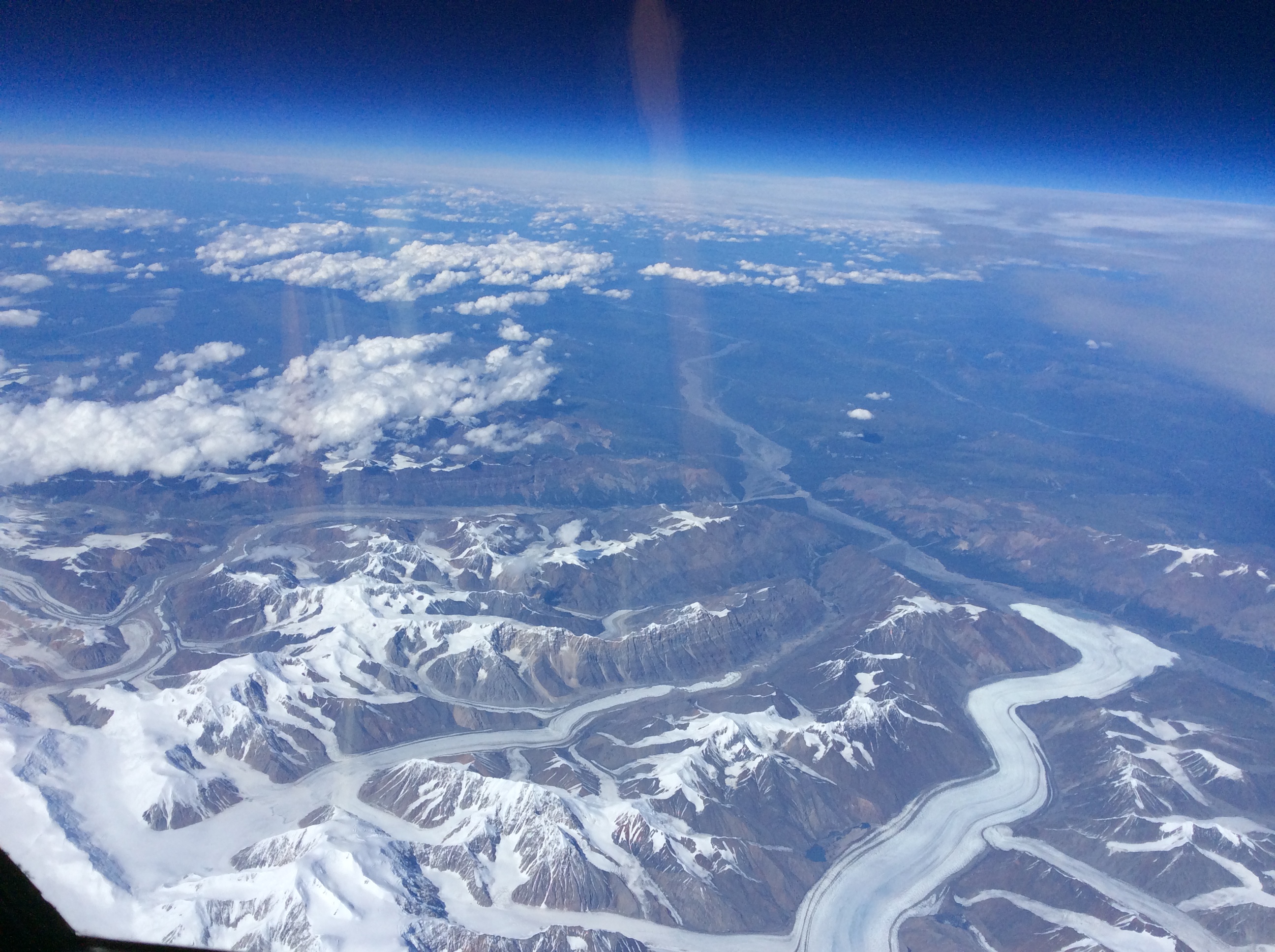
From NASA’s ER-2 aircraft, pilot Denis Steele saw glaciers in southern Alaska and Canada — including the Steele Glacier, the horizontal feature in the center of the image, and the Donjek Glacier (lower right). (Credit: Denis Steele)
Steele and the ER-2 team, along with NASA scientists, engineers and others, are here in Fairbanks to fly a laser altimeter – MABEL, or Multiple Altimeter Beam Experimental Lidar – over melting summer sea ice, glaciers and more. It’s a campaign to see what these polar regions will look like with data from ICESat-2, once the satellite launches and starts collecting data about the height of Earth below. Gathering information now allows scientists to get a head start in developing the computer programs scientists will need to analyze ICESat-2’s raw data.
MABEL and other lidar instruments are flying on the ER-2, which provides a high-altitude perspective. In the next three weeks, the plan is to cover melting sea ice, glaciers, vegetation, lakes, and more.
Steele wasn’t the only one looking out of the plane windows on flights north. Kelly Brunt, a research scientist at NASA’s Goddard Space Flight Center, spotted a wildfire in Eastern Washington. The fire, burning in steep terrain, resembled an erupting volcano.
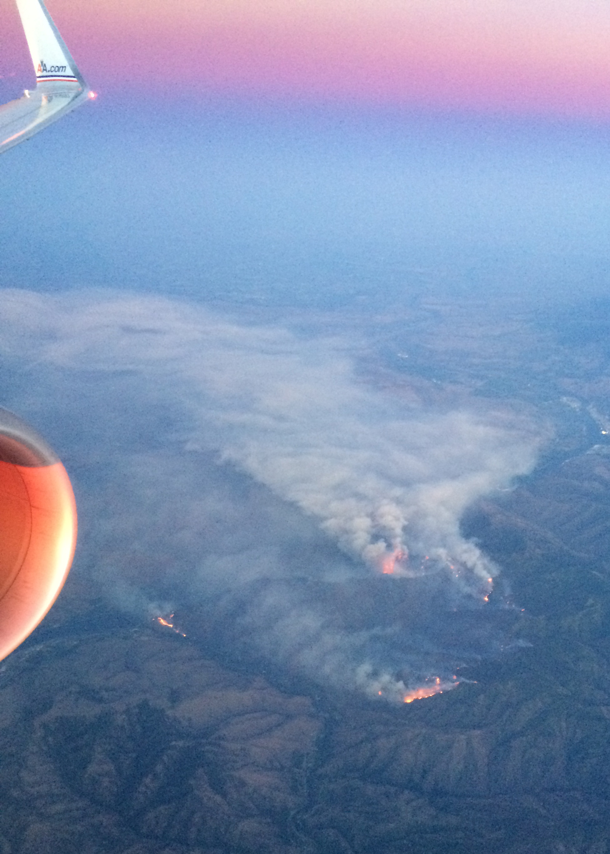
A wildfire burns in Washington, just east of the Cascades. (Credit: Kelly Brunt)
Over the weekend, the team settled into Fairbanks and a hangar at the U.S. Army’s Fort Wainwright, downloading data from the transit flight and ensuring the instruments are ready to fly when the weather allows. Cloudy skies over key sites means the ER-2 won’t fly today (Monday), but the team will check the weather tonight and see if it clears enough to fly the first science flight on Tuesday.
Want to follow MABEL and the ER-2? Check back here, and also check NASA’s flight tracker: http://airbornescience.nasa.gov/tracker/
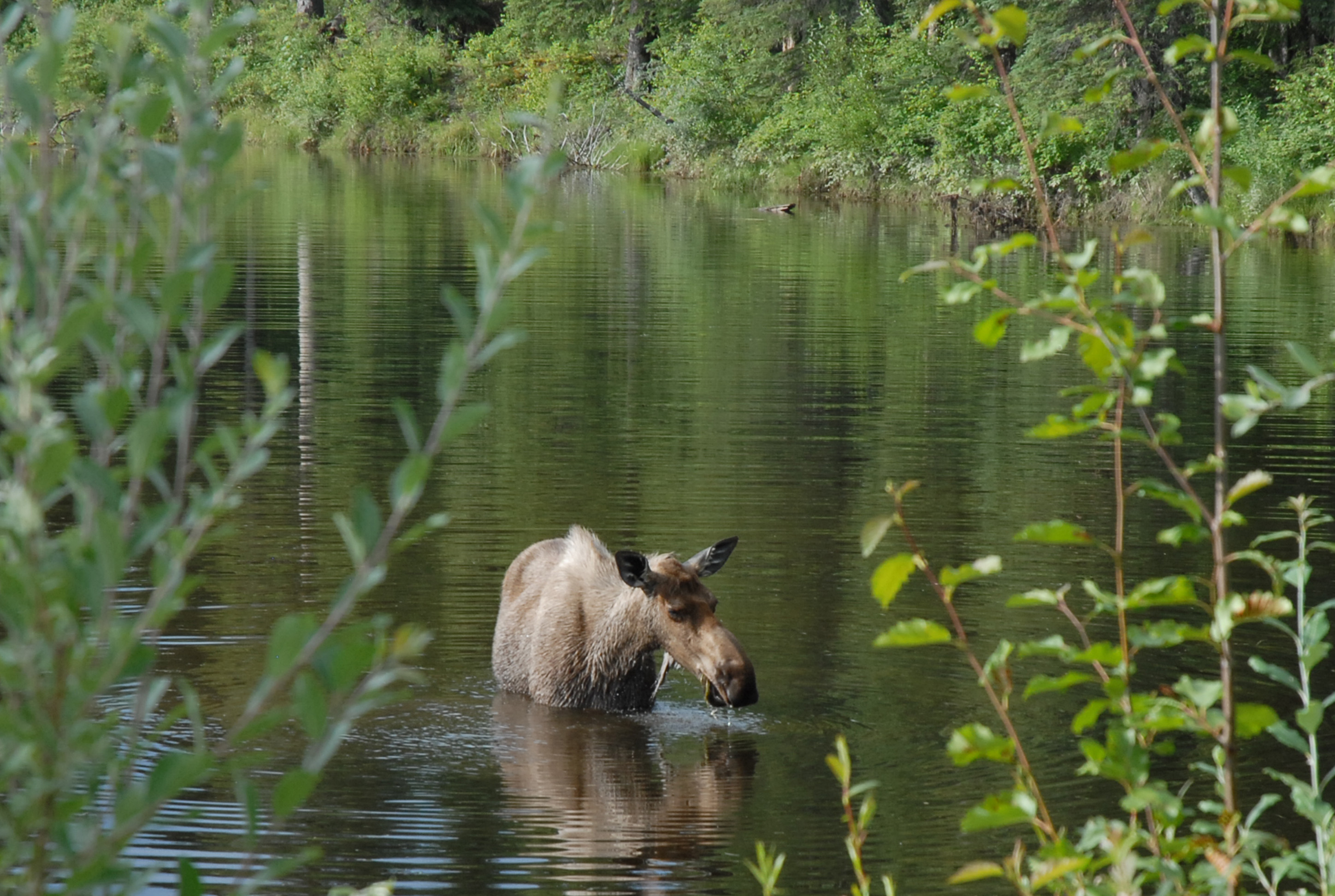
Yep, we’re in Alaska! A moose along a road east of Fairbanks. I’ll call her Mabel. (Credit: Kate Ramsayer)
Welcome to the LARGE (Langley Aerosol Research Group Experiment) blog. We are a group of scientists at NASA Langley Research Center in Hampton, VA who study the chemical, optical, and microphysical properties of atmospheric aerosols and their effects on climate and air quality. We are involved in many exciting experiments with vastly different objectives and applications, but this blog will begin by focusing on a project this summer/fall to assess the distribution and impacts of aerosols on hurricanes.
This project is just starting but the hurricane season is already underway with the passage of Hurricane Arthur, which made landfall on the Outer Banks of North Carolina on July 4, 2014. Our work began the following week with installation of our instrumentation aboard the NOAA WP-3D aircraft known as “Kermit” (the other operational WP-3D aircraft is called “Miss Piggy”). Operating scientific instrumentation aboard airplanes requires a lot of planning and adherence to strict guidelines to ensure flight safety and collection of high-quality data. Since we make measurements in-situ (by bringing ambient air inside the aircraft cabin), our goal is to design a system that routes aerosols into the cabin and to our instruments without losing particles along the way. This involves a complex web of tubing, fittings, and cabling shown below.
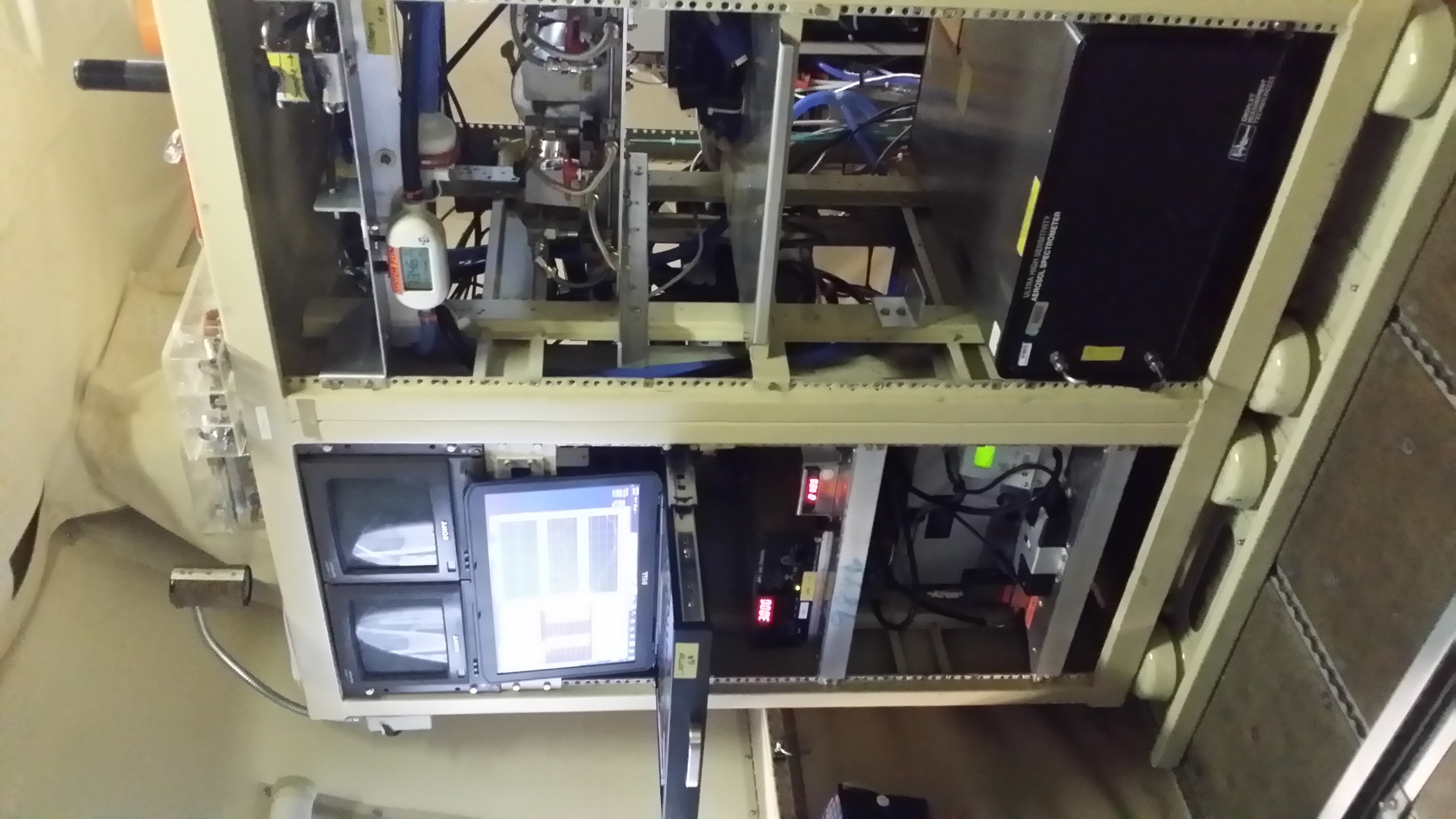
Front-view of the LARGE rack onboard the NOAA WP-3D aircraft.
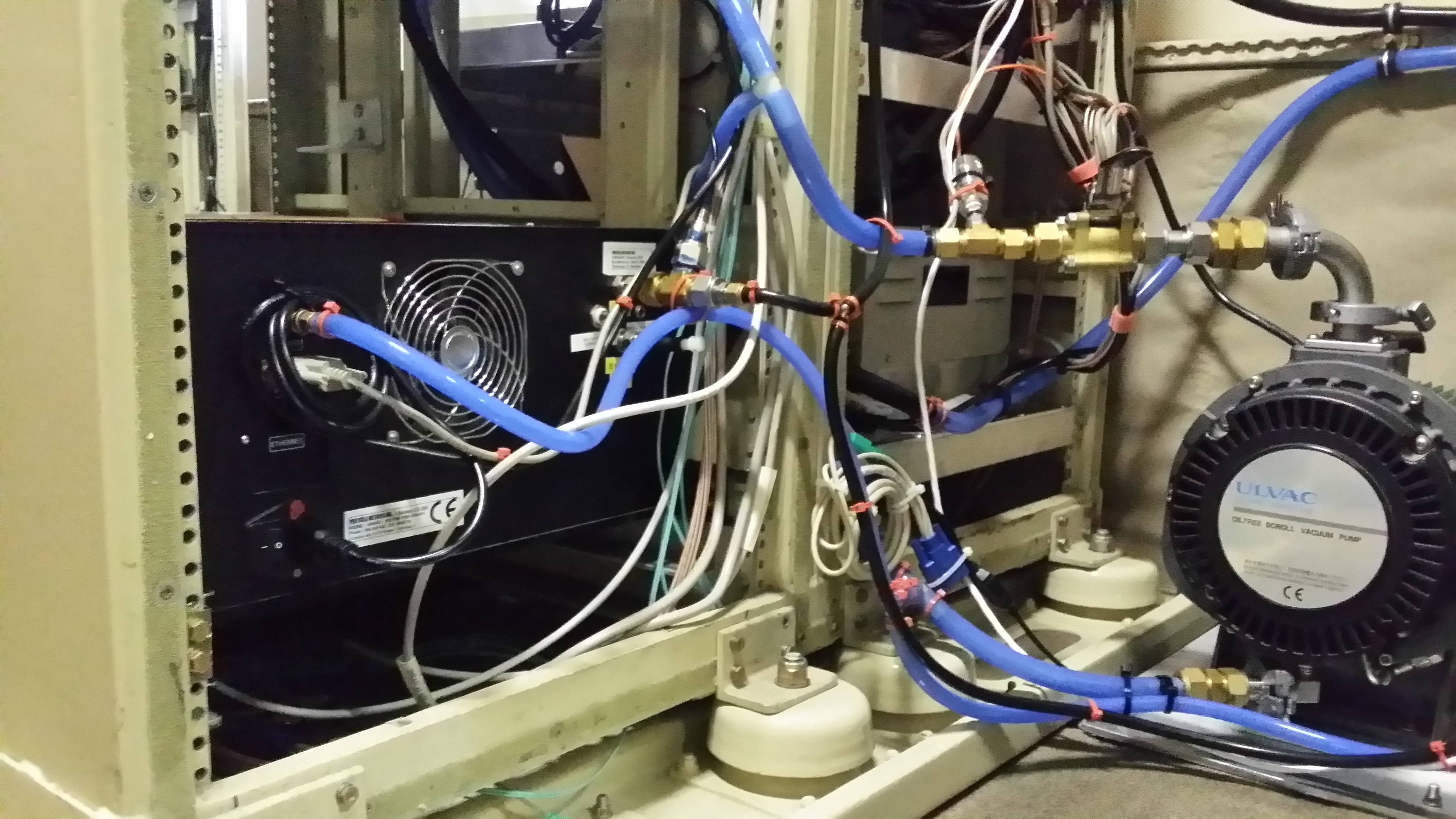
Back-view of LARGE plumbing.
We still have work to do to complete our instrument integration, especially to install an aerosol inlet on the aircraft. This will be completed soon and we will be poised to participate in the next hurricane flights! Check back later for more details about our instrumentation, science objectives, and pictures from inside the next Atlantic hurricane…
More information on our research can be found at the links below:
LARGE: http://science.larc.nasa.gov/large/
NOAA P-3 aircraft at the Aircraft Operations Center: http://www.aoc.noaa.gov/aircraft_lockheed.htm