
Yes, this chart is busy. Yes, there’s a lot of small text to wade through.
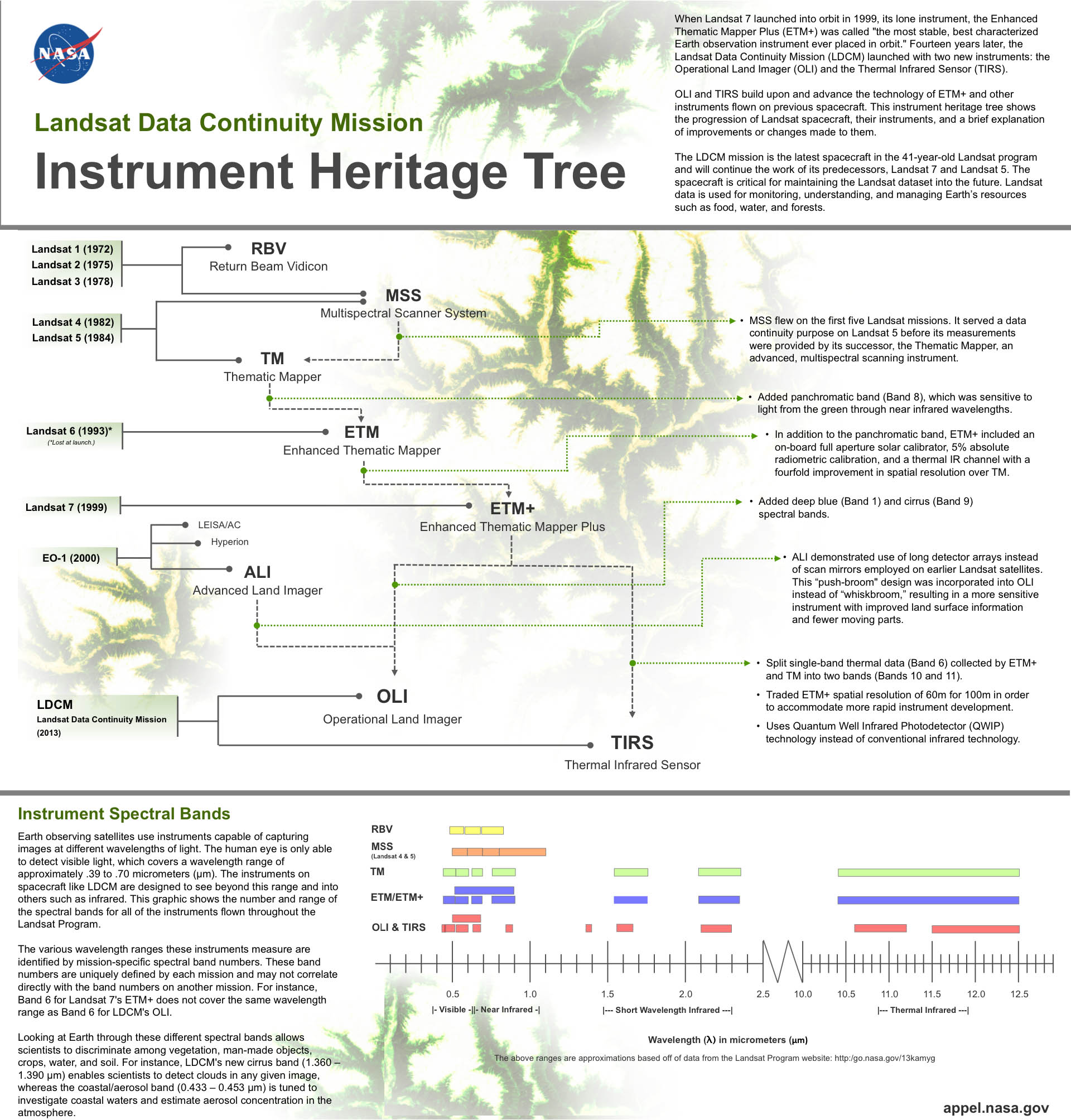
Still, if you want to understand the science various Landsat satellites have been producing for 40+ years you should set aside 5 or 10 minutes to look over the infographic below. It explains how the instruments carried by Landsat satellites have evolved, and it shows exactly where on the electromagnetic spectrum the instruments on the newest Landsat satellite will collect data. Besides visible light, Landsat sensors look at numerous bands in the infrared, beyond what human eyes can see.
Stay tuned to the Landsat program’s Twitter feed for all the latest updates about the status of the satellite. If all goes well, we should get a first glimpse at LDCM data sometime in the next few weeks. Study now and then you’ll really appreciate that this “first light” will be much more than another pretty picture taken from space.