
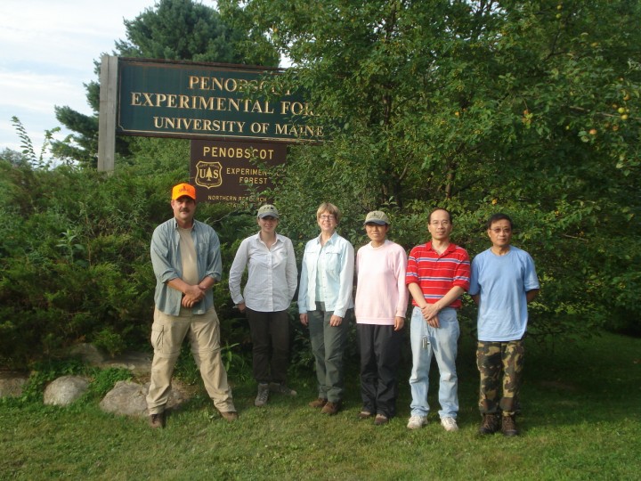
Penobscot Experimental Forest, Bradley, Maine
Temperature: 85 °F Humidity: 100% Wind: 8 mph S Overcast
From Dr. Jon Ranson:
Yes, I know today is Saturday, but North Woods work doesn’t care about the calendar. The plots took a long time to measure yesterday and we didn’t get our daily hectare finished. We don’t want to be behind schedule, especially since the winds and rains from Hurricane Bill might make Monday too bad to get much done. No one was willing to risk going home without all our data, so we voted to go back out and work.
We’re still in the same forest as yesterday and I’m still impressed by how dense it is here. In one subplot we measured 185 trees, most of them between 10 and 15 cm in diameter. A subplot is 25 m x 25 m and an Olympic-size swimming pool is 50 m x 25 m. So if you cut the pool in half lengthwise, then stuck 185 trees in there, you’ve got an idea how cramped it is here. I’m sure it would slow Michael Phelps down to swim in something like that. It slows us down, too.
We worked 3 ½ hours today and only measured ten subplots. With a crew of ten, that means we put in 35 people hours – almost a full week of work for one person – just to measure 62.5% of this one hectare. Field work is time consuming and labor intensive.
This is exactly why we need to have instruments in space that will quickly and accurately measure the Earth’s forests. You can’t evaluate the biomass of the entire Earth measuring by hand. There’s just not enough time or money or trained volunteers to go in and measure every forest on earth. Let alone to go in and do it every year, to keep tabs on what has changed.
If we are to understand the Earth, our home and our own ecosystem, we’ve got to develop systems that will take away the limits of manual labor. Scientists are measuring forests this summer in Maine, New Hampshire and Canada so we can have really solid data to validate our current instruments and to improve them. It’s a great investment. Once systems like DESDynI are working and returning data from all over the world, we are going to have an incredible amount of knowledge opened to us. It’s not going to be a whole new world, but we sure will understand our world in a whole new way.
I’ll never advocate giving up the field campaigns, however. There is nothing that can replace people actually going into the woods and understanding, first hand, what our systems are measuring. If you lose that human connection, you lose the ability to deeply understand the Earth. We need both fine instruments in space and fine people working on the Earth.
Speaking of instruments, I’ve been using a new field instrument to make tree height measurements and it’s pretty cool. The standard way to measure the height of a tree has been by using a meter tape and an inclinometer, which is basically a tool to measure angles. You stand away from the tree and sight through the inclinometer to the tip of the tree. That line from your eye to treetop can be imagined to be one side of a triangle. The inclinometer will give you the angle of that line against a horizontal base line. To get the length of the base, you use a meter tape to measure from you to the tree. Using trigonometry, you can use the known angles and lines to find the third side of the triangle, which is nearly the height of the tree. To get the total tree height, you have to remember to add the distance from your eye to the ground. It takes some thinking, but it’s pretty darn accurate.
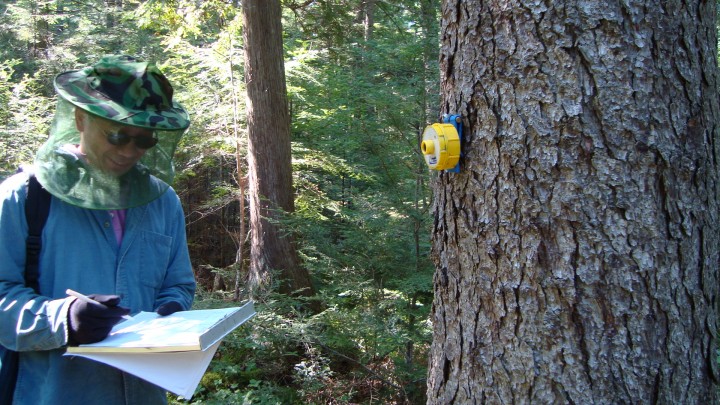
We like to use a laser-based device to make our measurements. You sight from your eye to the top of the tree, and let the laser measure the lines and angles. It will then do the math and give you tree height. It’s great when it works, but it doesn’t work in overgrown conditions because laser won’t go through branches or twigs. It requires a clear line of sight – and that’s something that’s often absent in the forest.
The new instrument is a sonic hypsometer. It uses ultrasound. To measure, you need to place a transponder on the tree at DBH (4.5 feet above the ground). Then you put the instrument to your eye and step backward or forwards until you can sight the top of the tree. By bouncing sound off the transponder and the treetop, these hypsometers will measure, make calculations and give you tree height. Ultrasound can go through or around many obstructions, like needles and twigs, so it’s pretty easy to use even in overgrown conditions. Two of our scientists are carrying these and they let me borrow them a bit. I’m sold – it’s a great way to make tree height measurements.
Outside of the forest, Hurricane Bill is making his way towards us, but offshore. Tomorrow and Monday may have a lot of rain and wind, so I’ve had to cancel our outdoor lobster boil at the Howland site. But we’ve made arrangements with a local lobster “shack”, as they call them, to feed us some fine local fare under the shelter of their covered patio. We will get our lobster, regardless of the whims of Bill. Sunday will be a fine – and a much needed – day of rest.