More than 20 years ago, NASA scientist Ralph Kahn authored a column for the Los Angeles Times anticipating the launch of a new satellite — and ultimately a whole fleet of satellites — that would study Earth.
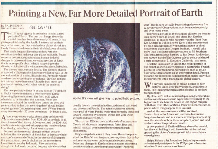
“We want a picture of Earth that is more specific about what is happening to the climate, which after all is what makes the planet habitable,” he wrote. And that picture needed to be rich with detail. “Precisely where are deserts encroaching on grasslands? In what regions is it raining more than usual? Exactly how much are glaciers shrinking, and at what rate is the sea level rising?” he asked.
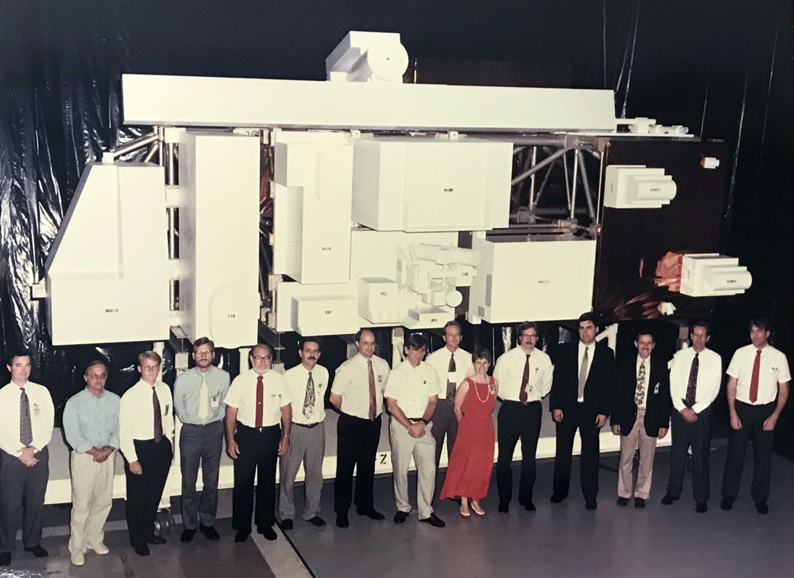
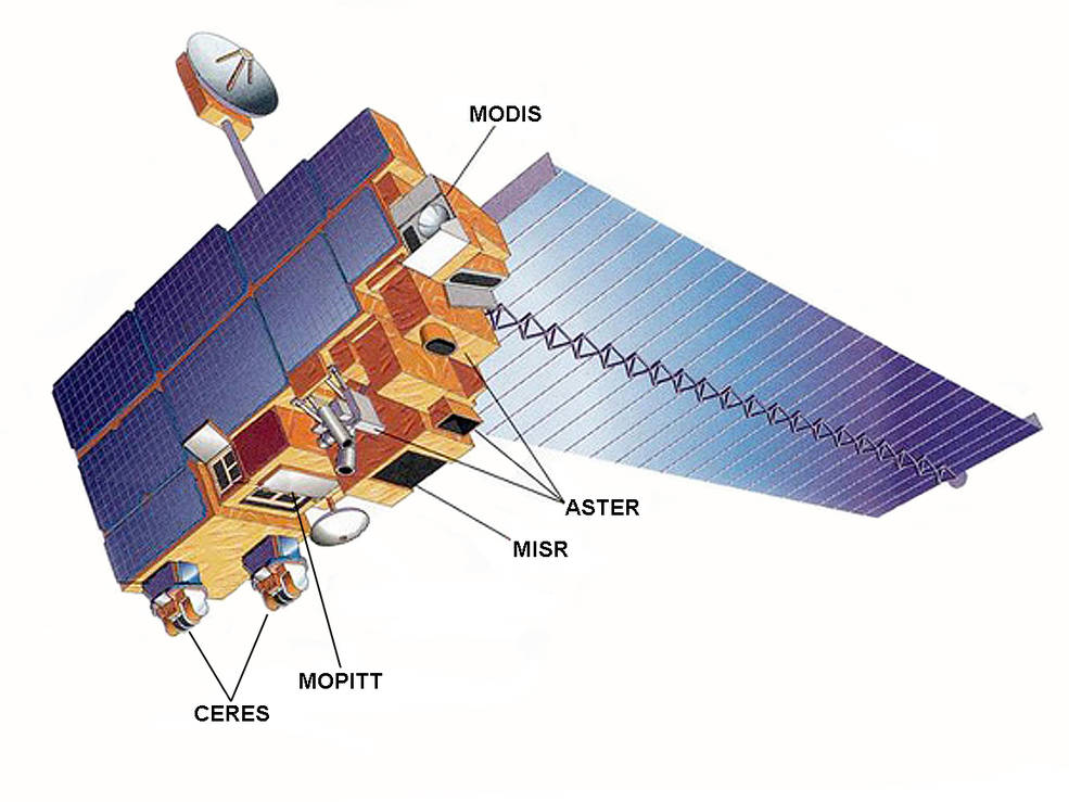
The first satellite, Terra (originally named EOS-AM), roared into space on December 18, 1999, began collecting data in February and March 2000, and collected its first complete day of MODIS data on April 19, 2000.
“About every seven weeks, the satellite archives will receive as much data from EOS-AM as are held in all the volumes of the Library of Congress. And the EOS-AM satellite alone is supposed to keep pouring numbers down from the sky, relentlessly, for at least six years,” Kahn wrote.
Amazingly, all those numbers from Terra continue to pour down 20 years later. Over time, the flood of data from Terra and several other satellites has turned into scientific discoveries. Bit by bit, the questions Kahn initially posed in his column have been answered.
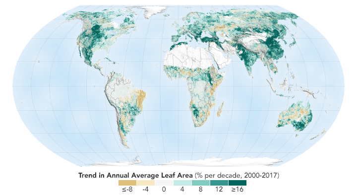
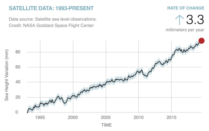
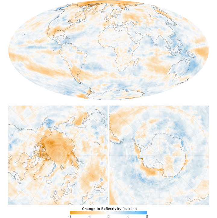
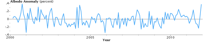
We can say now that sea level is rising at 3.3 millimeters (.13 inches) per year. We can show you a map of where exactly green vegetation has become more common and where it has faded. We can point you to a long-term dataset that will show you precisely where rain has fallen over the past two decades. And we can give you a tour of the world’s glaciers that shows you where they are and many examples of where they are shrinking.
The question to grapple with now: what do we with all this information?
If there was ever a satellite that deserves an award for longevity, it’s Terra. Designed for a mission of 6 years (or 30,000 orbits), the bus-sized spacecraft continues to cruise 705 kilometers (438 miles) above Earth’s surface nearly 19 years after launch. The spacecraft officially surpassed 100,000 orbits on October 6, 2018. To celebrate, here are ten things to know about the intrepid Earth-observing satellite. Click on each image to find out more.
On top of all the great science they make possible, satellites often produce imagery that is simply beautiful.
This image of Turnabout Glacier on Canada’s Ellesmere Island is a case in point. It shows a classic piedmont glacier that looks almost like pancake batter spilling over a frozen landscape. Piedmont glaciers form when steep valley glaciers spill out into relatively flat plains. Unchained from the constraints of the terrain, the ice flows freely in all directions.
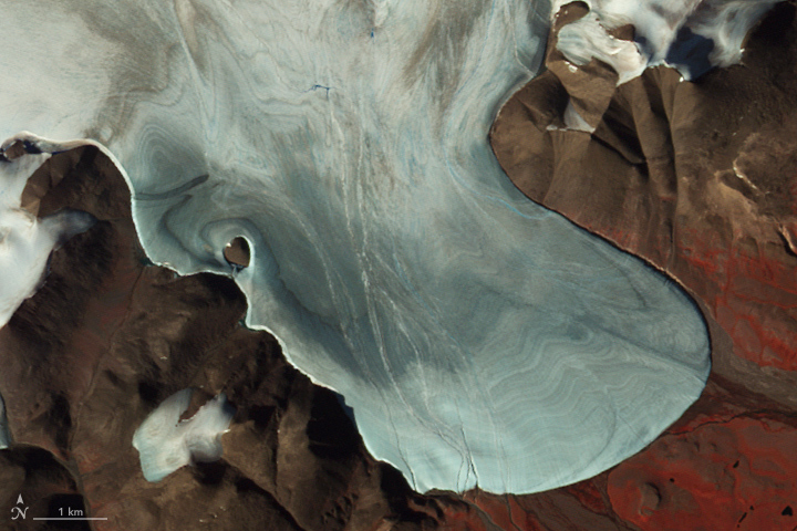
Image Credit: NASA Earth Observatory/ASTER/Jesse Allen
The Advanced Spaceborne Thermal Emissions and Reflection Radiometer (ASTER) instrument on NASA’s Terra satellite acquired an image of the glacier and its surroundings on July 26, 2009. The summertime image shows the glacier free of overlying snow from the previous winter. Banding in the surface of the ice shows different years in which the ice was laid down on the glacier.
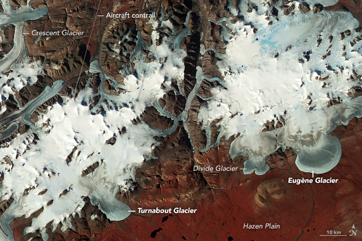
Image Credit: NASA Earth Observatory/ASTER/Jesse Allen
In the wider view, you can see glaciers drain out of ice caps between mountain peaks and ridgelines. Many features, including Turnabout, were first formally cataloged in 1957 and 1958 as part of the first International Geophysical Year (IGY). This area is so far north and the weather so cold much of the year that there has been little in the way of human footprints on the landscape. Hence, features had no official names within the scientific community before the IGY.
Humans have, though, made one visible impact on this image. The line on the top left is a contrail from a plane. Contrails form when water-rich exhaust from jet engines freezes into tiny ice crystals at high altitude.
Compare Turnabout to Eugène Glacier in the wider view. Both are classic piedmont glaciers, but Turnabout exits the mountain pass into the Hazen Plain with some obstacles that cause it to twist and turn before ending and draining into the Turnabout River. Eugène Glacier has no such obstacles and spreads out more evenly.
This false-color image was made by combining observations of near infrared, red, and green light. Red indicates vegetation; the chlorophyll in plants reflects much more strongly in the near infrared than other wavelengths.
