Image by the NASA GSFC Landsat/LDCM EPO Team using Landsat 5 data from the U.S. Geological Survey.
Twenty years ago this month, a hundred-year flood inundated cities along the Red River. The waters rose through April and May 1997, inundating 2,200 square miles (5,700 square kilometers) of North Dakota and Minnesota—a footprint twice as big as Rhode Island. The river spilled over its banks in Winnipeg, Canada, as well.
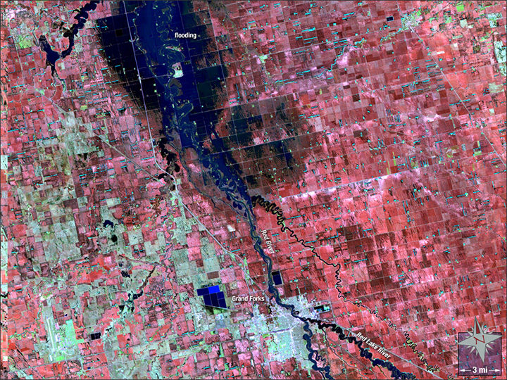
The false-color Landsat 5 image above shows Grand Forks, North Dakota, as it appeared on May 4, 1997. At that point, flood waters had mostly retreated, but the river still appeared swollen, with water lingering in floodplains just north of the city. Water appears dark blue, while structures are off-white.
There have been a several other notable floods since 1997. The river also overflowed its banks in 2006, 2009, and 2011.
In early May 2017, the river’s levels are average, and its water output holds steady, according to ground-based measurements taken at Grand Forks. Yet, the country as a whole just experienced its second-wettest April on record, with severe floods along the Mississippi River.
The U.S. Geological Survey has additional satellite imagery and a gallery of ground photographs of the flood. The Star Tribune has a good story that looks at how Grand Forks has fared since 1997.
