

There have been two rounds of voting in Tournament Earth 2020, and two rounds of stunning upsets. Only two of the top eight seeds made it through. Night Lights? Snuffed out. Colorado River? Dried up. Caspian ice? Melted. Aerosols? Cleaned out. A river of tea? Gone cold. Dark side of the Moon? Someone broke the record. Iconic Earthrise? Didn’t make it to dawn.
Every time we run one of these tournaments, we are surprised by what catches the eyes of our readers. It is time to surprise us again. Cast your votes now in round three to pick the best four of the Earthly 8. Voting ends on April 13 at 9 a.m. U.S. Eastern Time. Check out the remaining competitors below.
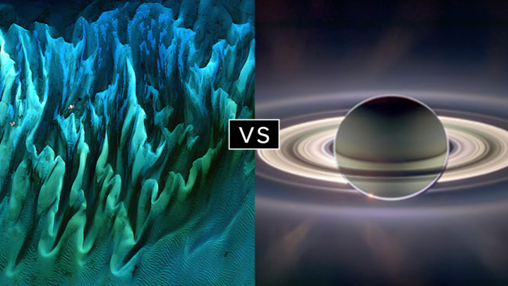
In round 1, Ocean Sand garnered the most votes overall and wiped out #4 seed and 2014 champion El Hierro Submarine Eruption, winning by the largest margin of any pairing (81 to 19 percent). In round 2, Sand beat the #1 seed, The Dark Side and the Bright Side, by a 57 to 43 percent margin.
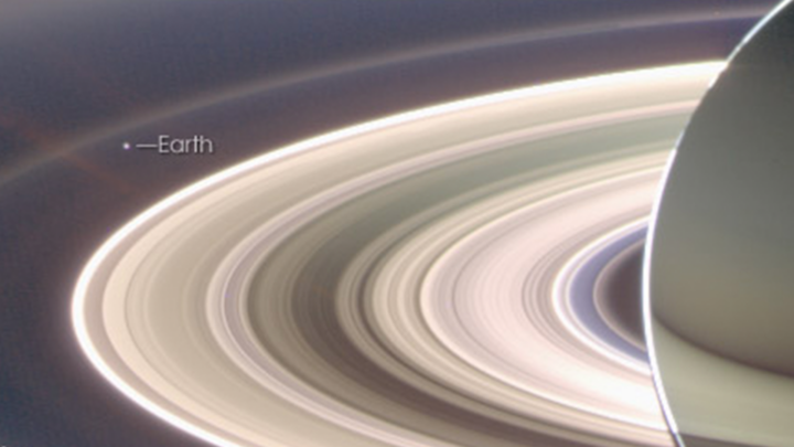
A View from Saturn garnered the second highest vote total in round 1, besting Blooming Baltic Sea by 77 to 23 percent. In the second round, Saturn beat Sensing Lightning from the Space Station, 60 to 40 percent. In case you didn’t notice, Earth is visible in that Saturn image.
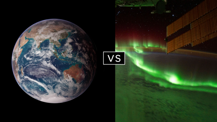
Twin Blue Marbles is the only #1 seed left in the tournament. In round 1, it captured 71 percent of the vote while besting Auroras Light Up the Antarctic Night. In round 2, Blue Marbles was the top overall vote getter and beat the iconic A Voyager Far from Home by 66 to 34 percent.
Fire in the Sky and On the Ground has pulled off two massive upsets. In round 1, it beat #2 seed Night Light Maps Open Up New Applications, 71 to 29 percent. In round 2, Fire beat the sentimental favorite and oldest image in Tournament Earth, All of You on the Good Earth — the original Blue Marble photo (1968) and the inspiration for the first Earth Day (1970). The voters chose the auroral fire over Apollo 8 fame by 57 to 43 percent.
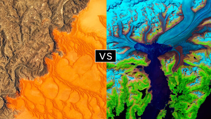
This bracket pairs two low seeds that knocked off highly ranked opponents. #8 seed Where the Dunes End topped #1 A Curious Ensemble of Wonderful Features in round 1 (63 to 37 percent), then topped #4 Roiling Flows on Holuhraun Lava Field (56 to 44).
The false-color image Retreat of the Columbia Glacier got 57 percent of the vote to beat Icy Art in the Sanikov Strait in round 1. Round 2 was a close call: Columbia barely eclipsed Antartica Melts Under the Hottest Days on Record (51 to 49 percent).
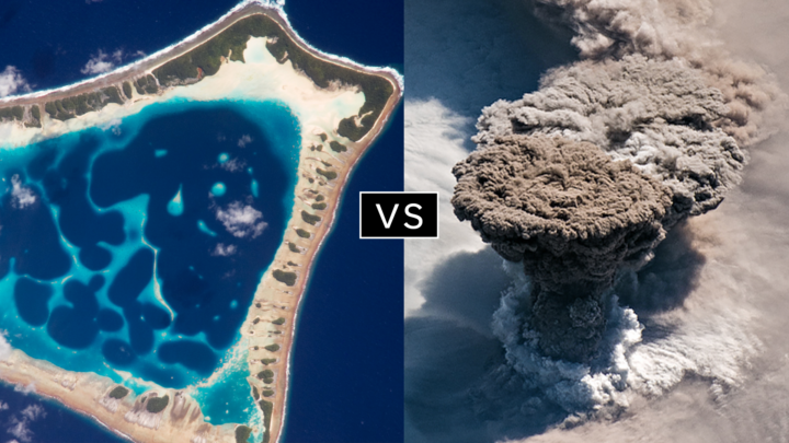
Another pair of Cinderella stories here. Atafu Atoll outclassed #1 seed Some Tea with Your River in round 1 by 75 to 25 percent. In round 2, it collected the second most votes overall, beating #5 Making Waves in the Andaman Sea 62 to 38 percent.
Raikoke erupted in round 1, collecting 72 percent of the vote while beating #3 Awesome, Frightening View of Hurricane Florence. In round 2, the volcanic plume smothered #2 Just Another Day on Aerosol Earth, 61 to 39 percent.
Since its launch on the web in April 1999, NASA Earth Observatory has published more than 15,500 image-driven stories about our planet. In celebration of our 20th anniversary — as well as the 50th anniversary of Earth Day — we want you to help us choose our all-time best image.
For now, we need you to help us brainstorm: what images or stories would you nominate as the best in the Earth Observatory collection? Do you go for the most beautiful and iconic view of our home? the most newsworthy? the most scientifically important? the most inspiring?
Search our site and then post the URLs of your favorite Earth images in the comments section below. Please send your ideas by March 17.
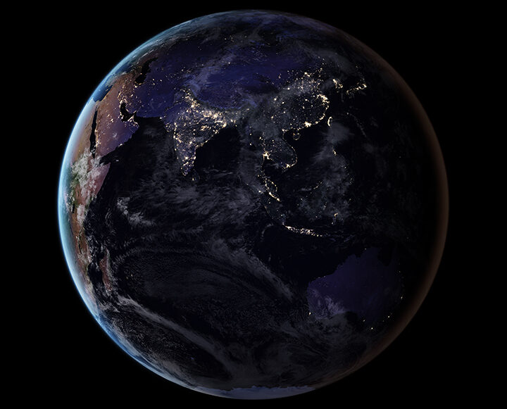
In late March 2020, we will include some of your selections in Tournament Earth, a head-to-head contest to vote for the best of the best from our archives. Each week, readers will pick from pairs of images as we narrow down the field from 32 nominees to one champion.
The all-time best Earth Observatory image will be announced on April 29, 2020, the end of our anniversary year.
If you want some inspiration as you begin your search, take a look at the galleries listed below. Or use our search tool (top left) to find your favorite places, images, and events.
Today’s blog is re-posted from NASA.gov in recognition of the agency’s Earth Day activities.
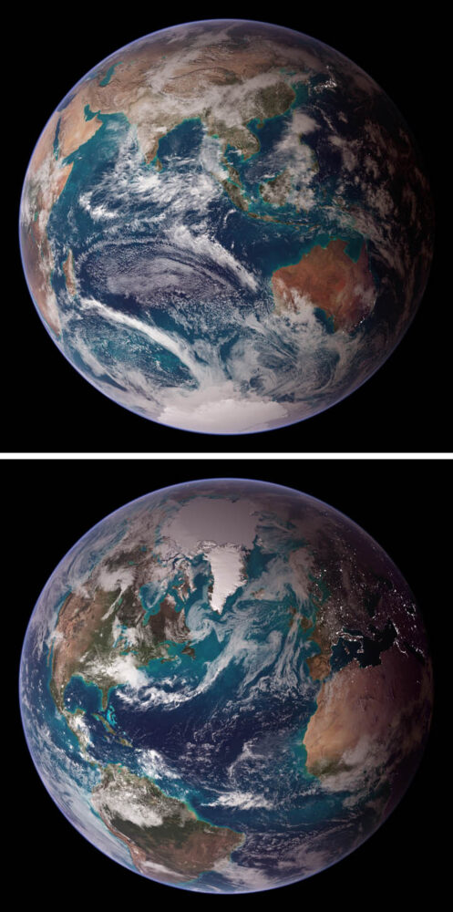
NASA’s Worldview app lets you explore Earth as it looks right now or as it looked almost 20 years ago. See a view you like? Take a snapshot and share your map with a friend or colleague. Want to track the spread of a wildfire? You can even create an animated GIF to see change over time.
Through an easy-to-use map interface, you can watch tropical storms developing over the Pacific Ocean; track the movement of icebergs after they calve from glaciers and ice shelves; and see wildfires spread and grow as they burn vegetation in their path. Pan and zoom to your region of the world to see not only what it looks like today, but to investigate changes over time. Worldview’s nighttime lights layers provide a truly unique perspective of our planet.
What else can you do with Worldview? Add imagery by discipline, natural hazard, or key word to learn more about what’s happening on this dynamic planet. View Earth’s frozen regions with the Arctic and Antarctic views. Take a look at current natural events like tropical storms, volcanic eruptions, wildfires, and icebergs at the touch of a button using the “events” tab.
https://worldview.earthdata.nasa.gov
Worldview is an open-source project at NASA. All data, software, and services are freely available to anyone for any purpose. You can participate in the software development by visiting:
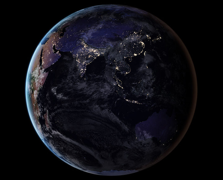
By removing natural and stray light sources, researchers have provided a clearer picture of the human footprint on Earth. Learn more about this image. (NASA Earth Observatory image by Joshua Stevens, using Suomi NPP VIIRS data from Miguel Román, NASA GSFC.)
As we arrive at Earth Day 2017, reporting on Earth science can sometimes feel like a gloomy affair. Global temperatures are at record highs. Arctic sea ice is in pretty bad shape. Bleaching events are taking a toll on coral reefs. And as an interesting article in EOS recently noted, humanity is affecting the very shape of Earth’s surface in unprecedented ways.
“We have altered flood patterns, created barriers to runoff and erosion, funneled sedimentation into specific areas, flattened mountains, piled hills, dredged land from the sea, and even triggered seismic activity,” the authors wrote. (Read our stories about land reclamation in China, mining in Canada, gas and oil infrastructure in Texas, the growing Wax Lake Delta in Louisiana, and the retreat of the Aral Sea to see changes of this nature.)
In spite of the challenges in a changing world, there are reasons to be optimistic. The world has come together to confront global problems before. Levels of protective ozone are stabilizing because of the Montreal Protocol. In the United States and Europe, better technology and regulations have led to drastic reductions in air pollutants such as sulfur dioxide and nitrogen dioxide. There are signs that efforts to clean up the Chesapeake Bay are making a difference.
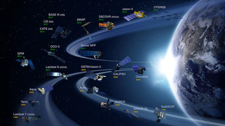
NASA’s operating Earth science missions as of March 31, 2017. (Image Credit: NASA’s Earth Observing Project Science Office.)
Some of the environmental challenges we face are daunting and can seem intractable, but there are some good reasons to feel reassured by the tools and expertise that the scientific community brings to the table. Americans live in a country where the number of deaths due to hurricanes, landslides, floods, droughts, tornadoes, blizzards, and other weather hazards have plummeted over the past century, and that is largely due to better understanding and to appropriate hazards warning systems that Earth scientists have developed.
Computers and instruments that used to take up whole rooms now fit snugly onto autonomous aircraft, satellites, and robots. At this moment, 1,459 satellites orbit Earth—including 19 that are part of the NASA fleet keeping a watchful eye on this dynamic, fragile planet. The authors of the EOS article note that a unified, global, high-resolution 3-D map of the human fingerprint on Earth is within reach due to the remarkable lidar instruments, aerial photogrammetry, and satellite observations that are now available.
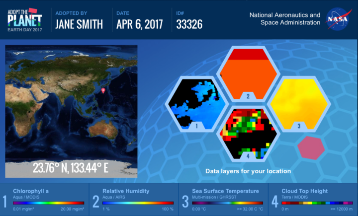
NASA invites people around the world to help us celebrate Earth Day 2017 by “adopting” one of 64,000 individual pieces of Earth as seen from space. Learn more. (Image Credit: NASA)
To get a sense of the sophistication and breadth of the information satellites now collect, just navigate to your home town with NASA’s Worldview browser or take a look at the Earth Observations (NEO) data archive. You will find information on everything from plant health to particulate aerosol levels to fires to city lights.
As you look, keep in mind that NASA isn’t just collecting that data for data’s sake. The Applied Sciences program is focused on making that data useful to citizens, resource managers, and civic planners in ways that make life better here on Earth. So if you plan to celebrate Earth Day by cleaning up trash in your neighborhood or adopting a piece of the planet with NASA, rest assured that you are not alone in working to make the planet just a little bit more livable.