Clouds are an important part of the climate system. They affect how much sunlight reaches the ground and how much heat returns to space, which in turn affects Earth’s temperature and rainfall patterns. Scientists are working to better understand the role that clouds play in the global climate system, but that requires significant amounts of data.
“No single cloud observation method or system … is able to provide a complete and accurate depiction of cloud properties across the Earth under the many conditions that naturally occur,” said Bill Smith, an atmospheric scientist at NASA’s Langley Research Center (LaRC). Cloud observations are gathered by active and passive satellites, ground-based sensors, and, by humans.
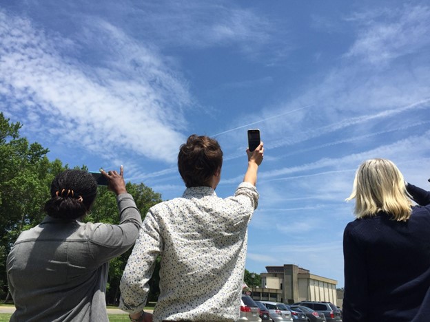
The citizen scientists of the GLOBE Program have been playing a vital role in data collection by observing clouds around the globe, especially at times that “match” a satellite flyover. When that happens, the observations from the citizen scientists on the ground are matched with satellite observations that were made near the same time and place. By combining the ground-up view of GLOBE citizen scientists with the top-down view of satellites, scientists get a more complete view of the atmosphere.
Now, the NASA GLOBE Clouds team is hoping to hit a significant milestone: one million matches by the time of the GLOBE annual meeting in late July 2022.
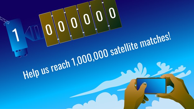
When a GLOBE cloud observation is taken within 15 minutes of a satellite observation, both points of view are coupled, creating a match. Some satellites are geostationary satellites, such as GOES, Himawari, and Meteosat. Others are polar-orbiting satellites, such as Aqua, Terra, and CALIPSO. The satellite-matched data provides an augmented dataset for research. When a match is made, the NASA GLOBE Clouds team sends a personalized email to participants with the matching satellite data. Approximately 4,000 emails are sent to participants each month.
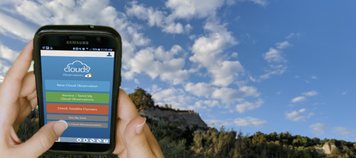
Participants who want to help GLOBE meet their million-match goal this July can photograph clouds, then upload the photographs and classify the clouds using the GLOBE Observer app. Visit the GLOBE Observer website to learn more about the Match to a Million campaign and how you can help NASA learn more about Earth’s atmosphere.
Read more about the value of combining ground and space measurements in the GLOBE blog Counting to a Million Matches and learn more about matching to satellites on the GLOBE Clouds Science page. You can also follow GLOBE on social media and share what you’re doing to help GLOBE match to a million by using the hashtag #GLOBE1M .
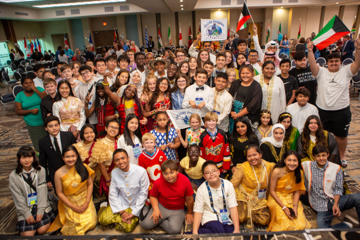
The NASA-funded Global Learning and Observations to Benefit the Environment (GLOBE) program was launched on Earth Day in 1995. Over the past 27 years, millions of students in more than 120 countries have collected and entered more than 200 million environmental measurements into the GLOBE database. Those observations include surface temperatures, rainfall amounts, tree heights, land cover, mosquito habitats, and a variety of other environmental observations, including cloud type and coverage.
The NASA-sponsored Global Learning and Observations to Benefit the Environment (GLOBE) Program has received the American Geophysical Union (AGU) 2021 Excellence in Earth and Space Science Education Award. According to AGU, the annual award honors an individual, group, or team committed to promoting excellent geophysical education.
Through GLOBE, people around the world learn how to document and share useful information about their local environment with scientists. Launched on Earth Day in 1995, GLOBE connects scientists, teachers, and students in 126 countries with hands-on scientific activities.
“GLOBE is a phenomenal program that has a special place at NASA,” said Dr. Allison Leidner, program manager for education and communication in the Earth Science Division of NASA’s Science Mission Directorate. “Enabling students and citizen scientists to investigate our home planet gives them a greater appreciation of our environment, ignites their interest in science-related careers, and connects them to the international Earth science community. We are so happy to see AGU recognize GLOBE with this award.”
Through teachers that have been trained in GLOBE protocols, students learn how to conduct scientific investigations and collect data in their community. GLOBE science protocols were developed with Earth scientists and many protocols have connections to NASA’s satellite missions. So far, GLOBE participants have gathered and shared more than 200 million Earth science observations.
“The GLOBE Program has made outstanding achievements and contributions by pushing the frontiers of our science forward,” said AGU President Susan Lozier in a statement, on behalf of the AGU Earth and space science community. “GLOBE has also embodied AGU’s shared vision of a thriving, sustainable and equitable future for all, powered by discovery, innovation, and action. And you did this with integrity, respect, diversity, and collaboration while creating deep engagement in education and outreach.”
In addition to being sponsored by NASA, GLOBE is supported by the National Science Foundation (NSF), National Oceanic and Atmospheric Administration (NOAA), and the U.S. Department of State.
Dr. Tony Murphy, GLOBE Implementation Office director, and Dr. Caryn Long, middle school science teacher at Montverde Academy (Florida), share more about the program and its recent recognition. Their responses have been edited for clarity.
Tony Murphy: GLOBE has a strong community of citizen scientists, students, and teachers all over the world who are eager to contribute to Earth system science research. GLOBE allows people to contribute to data collection and submission, to understand the scientific research process and the work of scientists, and to see how their local environment fits into the regional and global environment.
Caryn Long: I have used GLOBE in my classroom for five years now. GLOBE is different from other science education programs because it educates students while also immersing them in the practical and applied nature of science. Knowing they are contributing to real research with NASA scientists is a powerful motivational tool to get them to practice the skills of observation, data collection, and analysis in a real and meaningful way. They want to practice the skills they are developing because what they are doing is valued.
Long: Our classroom participates in the Cloud, Aerosols and Hydrology Protocols and the Surface Temperature Field Campaign at the lake behind our school. We are adding more protocols each year. Each time I share with my students that we are learning a new protocol to add to their toolbox, they are excited to get started. What my students have enjoyed most about GLOBE is meeting some of the scientists that are involved with the program. Another highlight for them is gathering the cloud data because it involves NASA satellites. Receiving the email matches with the satellites is exciting to the kids because they love comparing what they saw from a ground level to what the satellite has viewed.
Murphy: Seeing students communicate their research at meetings, and especially at the two GLOBE Learning Expeditions I have attended, has been truly amazing. GLOBE Learning Expeditions are week-long, student-focused events held every few years at sites around the world. I gave a scientific presentation at a national science competition in Ireland when I was in middle school. That experience had a major influence on my life, so it’s incredible to see so many GLOBE participants have a similar opportunity.
Murphy: The GLOBE community has grown tremendously from a small number of countries in 1995 to 126 countries today with a database of over 200 million measurements for use in research by students and scientists. New technology advancements including the GLOBE Program’s app, GLOBE Observer, have impacted the ways in which the program is implemented and enables citizen scientists to participate. The GLOBE community worldwide, including students, country coordinators, teachers, program support staff, government officials, and program sponsors, have allowed GLOBE to earn this recognition.
Through May 15, 2021, the GLOBE Program is hosting the 2021 Trees Community Challenge, a project aimed at making science better together by encouraging participants to collect data and learn about trees.
Using the Trees Challenge Activity Tracker, participants can pick and choose activities – or complete all of them – to become members of the NASA citizen science community. Activities include taking a tree height observation, writing a tree poem, and sharing stories about trees that are special to you on social media
Trees are diverse and tree height can tell us a lot about Earth’s ecosystems. Satellites and ground-based measurements are used to track tree growth, monitor how well an ecosystem supports trees, and estimate how much carbon is stored by trees. The GLOBE community encourages #CitizenScientists to use the GLOBE Observer app to take tree height measurements with their smartphones.
Read more about the challenge and how to participate.
Who knew that being a scientist could be as easy as pointing your phone at the sky? This month, NASA and the GLOBE Program are asking citizen scientists to take out their phones and report what kinds of clouds they see above them.
From October 15 to November 15 citizen scientists young, old, and in-between can submit up to ten cloud observations per day using the GLOBE Observer app or one of GLOBE’s other data entry options (for trained members). Participants with the most observations will receive a personalized thank you from a NASA scientist.
“What excites researchers about GLOBE observations is the ability to see what’s up in the sky from volunteers’ perspectives all over the world,” said Marilé Colón Robles, lead for the GLOBE Clouds Team at NASA’s Langley Research Center. “What our eyes can see is difficult to fully duplicate with instruments. Merging these views is what makes a complete and impactful story.”
“We want to do a data challenge in the fall and see if there are any differences from what was observed during the spring data challenge of 2018,” said Colón Robles. “From thin, high clouds that are hard for satellites to detect to dust storms that impact our daily lives, these observations play an important role in better understanding our atmosphere.”
At NASA, scientists work with a suite of satellite instruments known as the Clouds and the Earth’s Radiant Energy System (CERES). Though they have these highly sensitive instruments, it can sometimes be difficult for scientists to distinguish features such as cirrus clouds from snow cover in their imagery because both are cold and bright from a satellite perspective. By comparing satellite images from a particular area with data submitted by citizen scientists, researchers can differentiate between the two.
Lucky GLOBE observers might make an observation while the Cloud-Aerosol Lidar and Infrared Pathfinder Satellite Observation (CALIPSO) is overhead. CALIPSO is a joint mission between NASA and the French space agency (CNES) that uses laser pulses to measure clouds and atmospheric aerosols. Citizen scientists who make observations at the same time and place as CALIPSO will receive an emailed satellite comparison of CALIPSO’s measurements showing features such as high clouds, dust, and smoke. Scientists are especially interested in these observations in order to improve their understanding of dust storms. During the challenge, make sure you turn on daily satellite notifications in the app or use this satellite overpass website to see the schedule for your location.
“Last year’s challenge gave researchers special glimpses into cloud types around the world,” said Colón Robles. “Photographs provided by observers gave insight into events such as dust storms and wildfires. Our hope is to once again learn from the community and together study our atmosphere.”
The 2018 data challenge, which took place in the spring, received more than 56,000 cloud observations from more than 15,000 locations in 99 countries and Antarctica.
NASA is a sponsor of GLOBE, an international science and education program that provides students and the public with the opportunity to participate in data collection and the scientific process. NASA GLOBE Observer is a free smartphone app that lets anyone make citizen science observations from the palm of their hand.
Cloud Identification Resources and Tips
Data collection and data entry help
Starting this month, you can be part of a project to create more detailed satellite-based global maps of land cover by sharing photos of the world around you in a new NASA citizen science project.
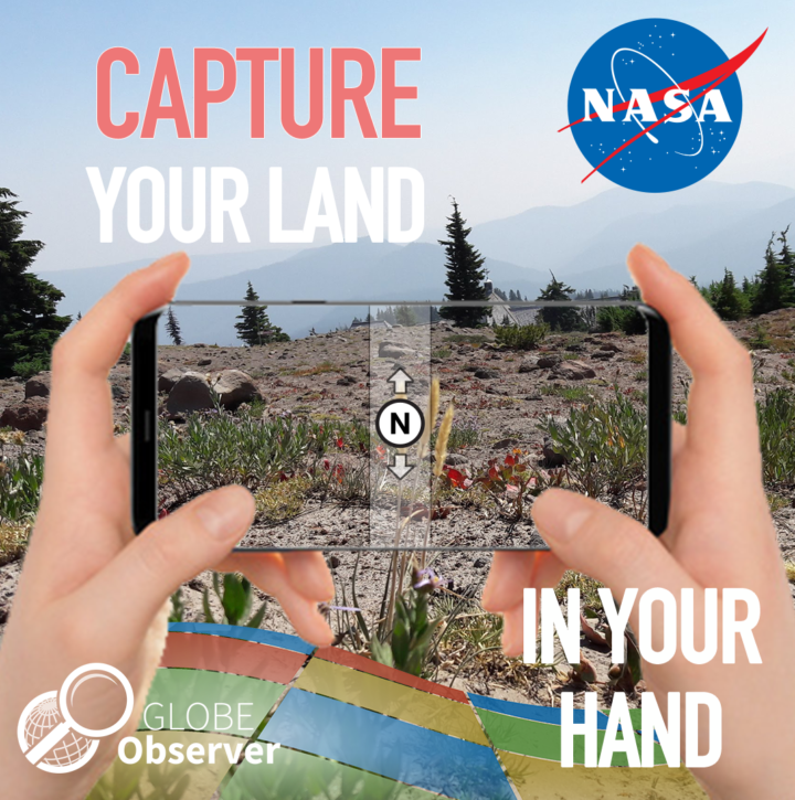
The project is a part of GLOBE Observer, a citizen science program that lets you contribute meaningful data to NASA and the science community. The GLOBE Observer app, introduced in 2016, includes a new “Land Cover: Adopt a Pixel” module that enables citizen scientists to photograph with their smartphones the landscape, identify the kinds of land cover they see (trees, grass, etc.), and then match their observations to satellite data. Users can also share their knowledge of the land and how it has changed.
“Adopt a Pixel” is designed to fill in details of the landscape that are too small for global land-mapping satellites to see.
“Even though land cover is familiar to everyone on the planet, the most detailed satellite-based maps of global land cover are still on the order of hundreds of meters per pixel. That means that a park in a city may be too small to show up on the global map,” says Peder Nelson, a land cover scientist at Oregon State University.
Holli Kohl, coordinator for the project says: “Citizen scientists will be contributing photographs focused on a 50-meter area in each direction, adding observations of an area up to about the size of a soccer field. This information is important because land cover is critical to many different processes on Earth and contributes to a community’s vulnerability to disasters like fire, floods or landslides.”
To kickstart the data collection, GLOBE Observer is challenging citizen scientists to map as much land as possible between Sept. 22, Public Lands Day, and Oct. 1, NASA’s 60th anniversary. The 10 citizen scientists who map the most land in this period will be recognized on social media and will receive a certificate of appreciation from GLOBE Observer.
The free GLOBE Observer app is available from Google Play or the App Store. Once you download the app, register, and open the Land Cover module, an interactive tutorial will teach you how to make land cover observations.
“We created GLOBE Observer Land Cover to be easy to use,” says Kohl. “You can simply take photos with your smartphone, submit them, and be done, if you like. But if you want to take it a step further, you can also classify the landscape in your photo and match it to satellite data.”
Scientists like Nelson anticipate using the photographs and associated information to contribute to more detailed land cover maps of Earth.
“Some parts of the world do have high spatial resolution maps of land cover, but these maps do not exist for every place, and the maps are not always comparable. Efforts like GLOBE Observer Land Cover can fill in local gaps, and contribute to consistent global maps,” says Allison Leidner, GLOBE program manager at NASA Headquarters in Washington.
Changes in land cover matter because land cover can alter temperatures and rainfall patterns. Land cover influences the way water flows or is absorbed, potentially leading to floods or landslides. Some types of land cover absorb carbon from the atmosphere, and when subject to changes, such as a forest burned in a wildfire, result in more carbon entering the atmosphere. Improved land cover maps will provide a better baseline to study all of these factors at both global and local scales, particularly as scientists integrate improved land cover maps into global models.
The data aren’t just for scientists. “Everyone will have access to this data to understand local change,” says Nelson. Citizen scientists who participate will be creating their own local land cover map. The data will be available to anyone through the GLOBE web site.
To learn more, follow GLOBE Observer on Facebook @nasa.globeobserver or Twitter @NASAGO or visit the GLOBE Observer web site. Read the full story here.
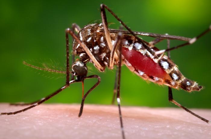
An Aedes aegypti mosquito in the process of acquiring a blood meal. Image Credit: CDC/James Gathany.
Though mosquitoes are small, they are also deadly. Mosquito bites result in the deaths of more than 725,000 people each year—more than any other animal. That compares to about 50,000 deaths from snakes, 25,000 from dogs, 20,000 from tsetse flies, 1,000 from crocodiles, and 500 from hippos.
More than 50 percent of the world’s population lives in areas where mosquito-borne diseases are common, according to the World Health Organization. Malaria is the deadliest disease spread by mosquito, but the bugs also serve as vectors for Chikungunya, Zika, Dengue, West Nile Virus, and Yellow Fever.
NASA and the Global Learning and Observation to Benefit the Environment (GLOBE) Program have a new way of fighting back. The GLOBE Observer Mosquito Habitat Mapper is an app that makes it possible for citizen scientists to collect data on mosquito range and habitat and then feed that information to public health and science institutions trying to combat mosquito-borne illnesses. The app also provides tips on fighting the spread of disease by disrupting mosquito habitats. Specifically, it will help you find potential breeding sites, identify and count larvae, take photos, and clean away pools of standing water where mosquitoes reproduce.
The Crowd & the Cloud, a show hosted by former NASA Chief Scientist Waleed Abdalati, has an excellent segment (video above) that explains how the app works.
Don’t delay. Download the Habitat Mapper for iOS from the iTunes app store or from Google Play for Android now, and start hunting down these blood-sucking killers.
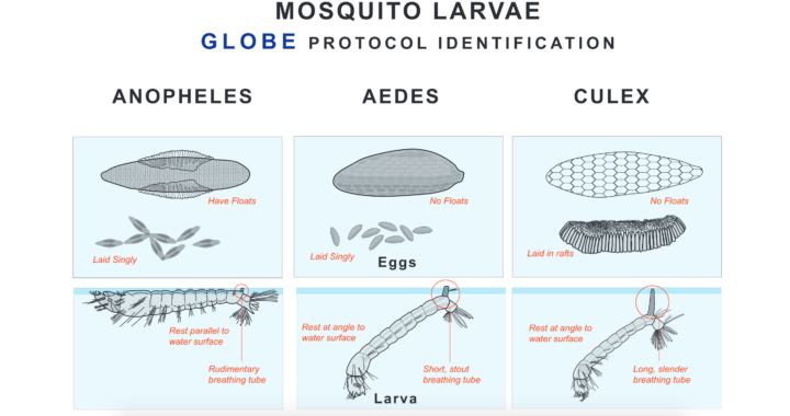
Eggs and larvae of three species of mosquitoes. Image Credit: The Globe Program. Download a larger version.
