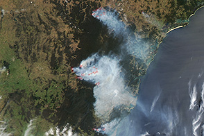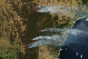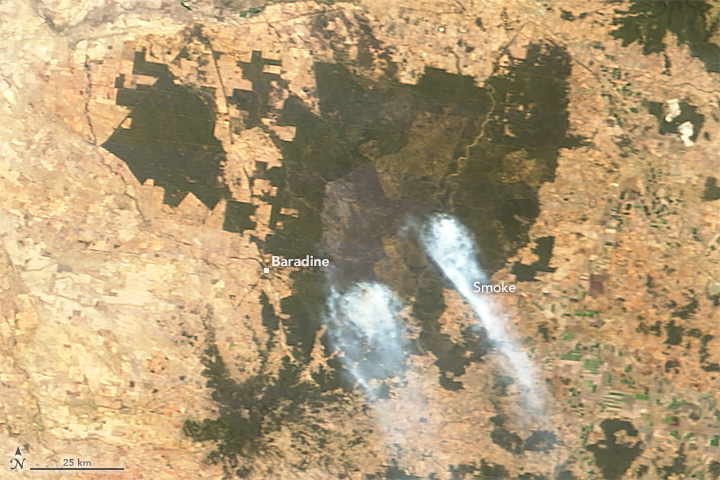
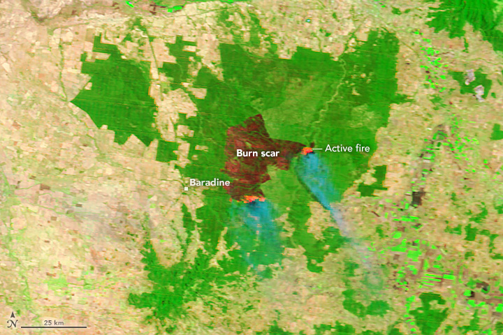
A bushfire burning through Pilliga Forest in New South Wales, Australia, has burned nearly 594 square kilometers (229 square miles). The Moderate Resolution Imaging Spectroradiometer (MODIS) on NASA’s Terra satellite acquired this image of the fire on January 22, 2018.
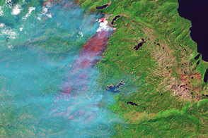
The natural-color image shows two smoke plumes spreading southeast. The false-color image (bands 7-2-1) makes use of portions of the electromagnetic spectrum that are typically invisible to the naked eye. Including information from the infrared makes it easier to distinguish the burn scar and reveals hot spots caused by active fires underneath the smoke. Turn on the image comparison tool to see the differences between the two images.
Common tree species in Pillaga Forest include cypress-pine and sheoak.
NASA image by Jeff Schmaltz, LANCE/EOSDIS Rapid Response. Caption by Adam Voiland.