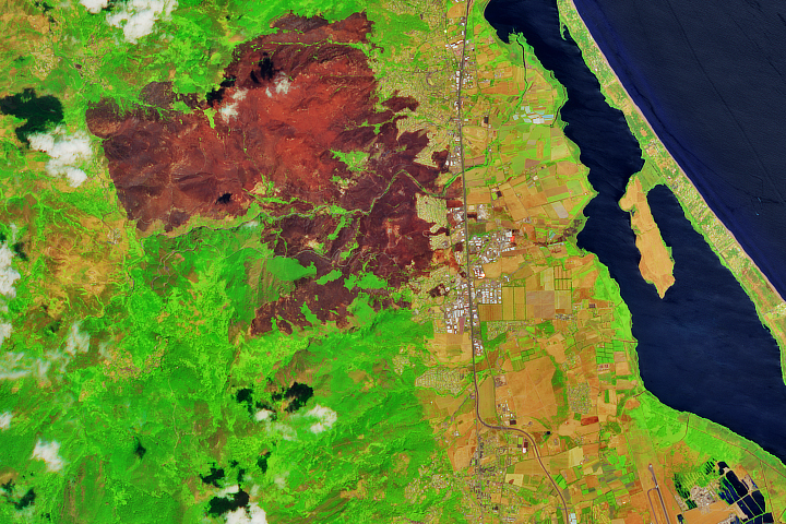
On July 23, 2017, NASA’s Terra satellite detected a thermal anomaly near the town of Biguglia on the French island of Corsica. Over the next few days, the satellite detected several more hot spots as fires moved closer to the town. The wildfires—reportedly started by arsonists, then whipped into a frenzy by strong winds—raged in the hills to the west of the coastal community for a few days before firefighters gained control of them.
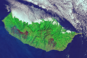
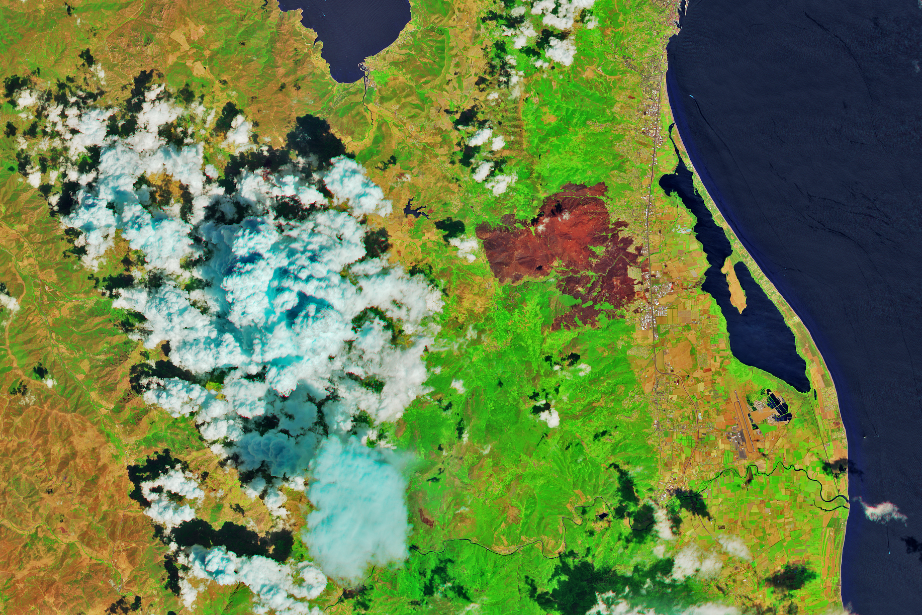
By July 26, 2017, the day Multi Spectral Imager (MSI) on the European Space Agency’s Sentinel-2 satellite captured this false-color image of the burn scar, the fire had charred dozens of square kilometers. The fires mainly affected a forested, hilly area to the west of Biguglia, but flames encroached into the town near Route 11. The Sentinel-2 image is based on observations of shortwave infrared, near infrared, and green light (bands 11-8-3).
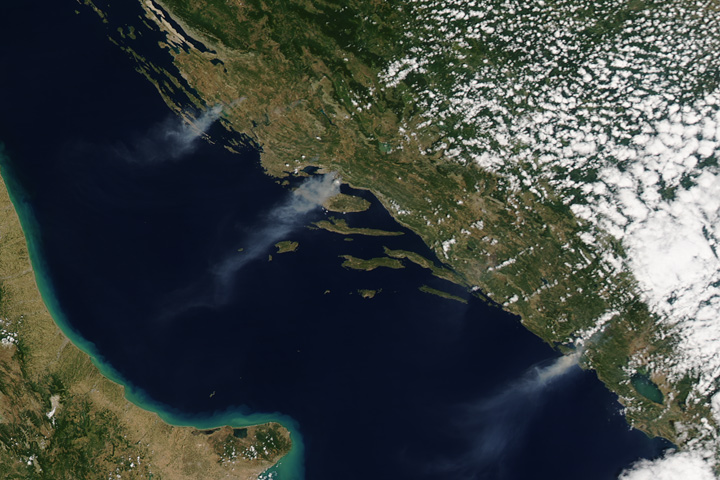
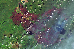
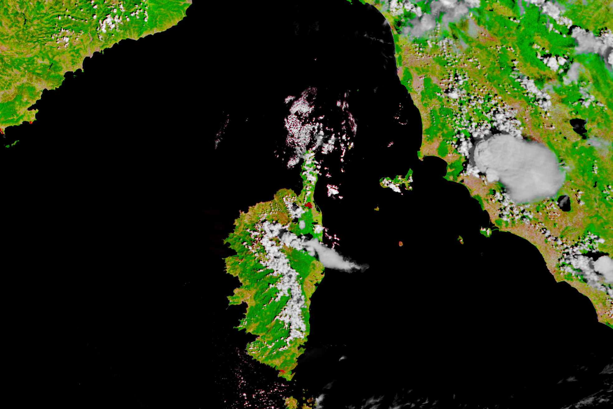
On the same day, the Moderate Resolution Imaging Spectroradiometer (MODIS) on Terra also captured a false-color image of the burn scar that was made with observations of visible and infrared light (bands 7-2-1). The burn scar appears dark brown; unburned forests are dark green. Farmland is light brown.
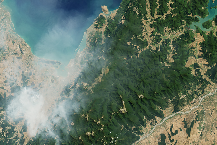
Corsica is not the only part of France that has faced wildfires in recent days. Several fires have burned along the French Riviera, forcing tens of thousands of people to evacuate and causing many to sleep outdoors on beaches for safety.
NASA Earth Observatory images by Joshua Stevens and Jesse Allen, using Terra MODIS data from the Land Atmosphere Near real-time Capability for EOS (LANCE) and modified Copernicus Sentinel data (2017) processed by the European Space Agency. Story by Adam Voiland.