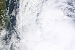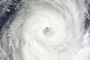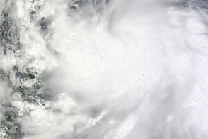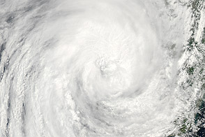
Tropical Storm Nilam formed over the northern Indian Ocean on October 29, 2012. Two days later, it made landfall on the east coast of southern India and then traveled across the subcontinent toward the Arabian Sea. By November 1, the storm had claimed at least a dozen lives and displaced thousands of residents.
The Moderate Resolution Imaging Spectroradiometer (MODIS) on NASA’s Terra satellite captured this natural-color image of Nilam on November 1, 2012. On October 31, the U.S. Navy’s Joint Typhoon Warning Center reported that Nilam had winds of 50 knots (95 kilometers per hour) and gusts up to 65 knots (110 miles per hour). The storm traveled northwestward across India, damaging crops and infrastructure along the way, according to news reports.
NASA image courtesy LANCE MODIS Rapid Response Team at NASA GSFC. Caption by Michon Scott.