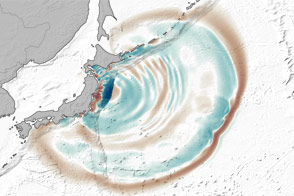
In March 2011, a magnitude 9.0 earthquake—the fourth largest recorded since 1900—triggered a powerful tsunami that pummeled the northeastern coast of Japan. The earthquake occurred offshore, about 130 kilometers (80 miles) east of Sendai at 2:46 p.m. on March 11. Within 20 minutes, massive swells of water started to inundate the mainland.
The tallest waves and most devastating flooding from the 2011 TÅhoku-oki tsunami occurred along the jagged coast of northern Honshu, a landscape dimpled with bays and coves known as ria coast. The steep, narrow bays of ria coasts trap and focus incoming tsunami waves, creating destructive swells and currents that can push huge volumes of water far inland, particularly along river channels.
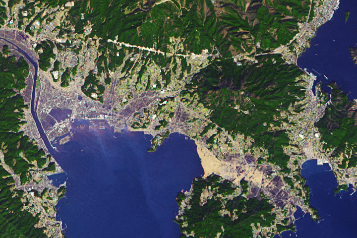
That's exactly what happened in the days before the Advanced Spaceborne Thermal Emission and Reflection Radiometer (ASTER), an instrument on NASA's Terra satellite, captured the middle image above (on March 14, 2011). It shows severe flooding along the Kitakami River three days after the earthquake struck.
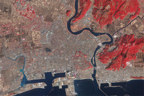
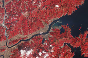
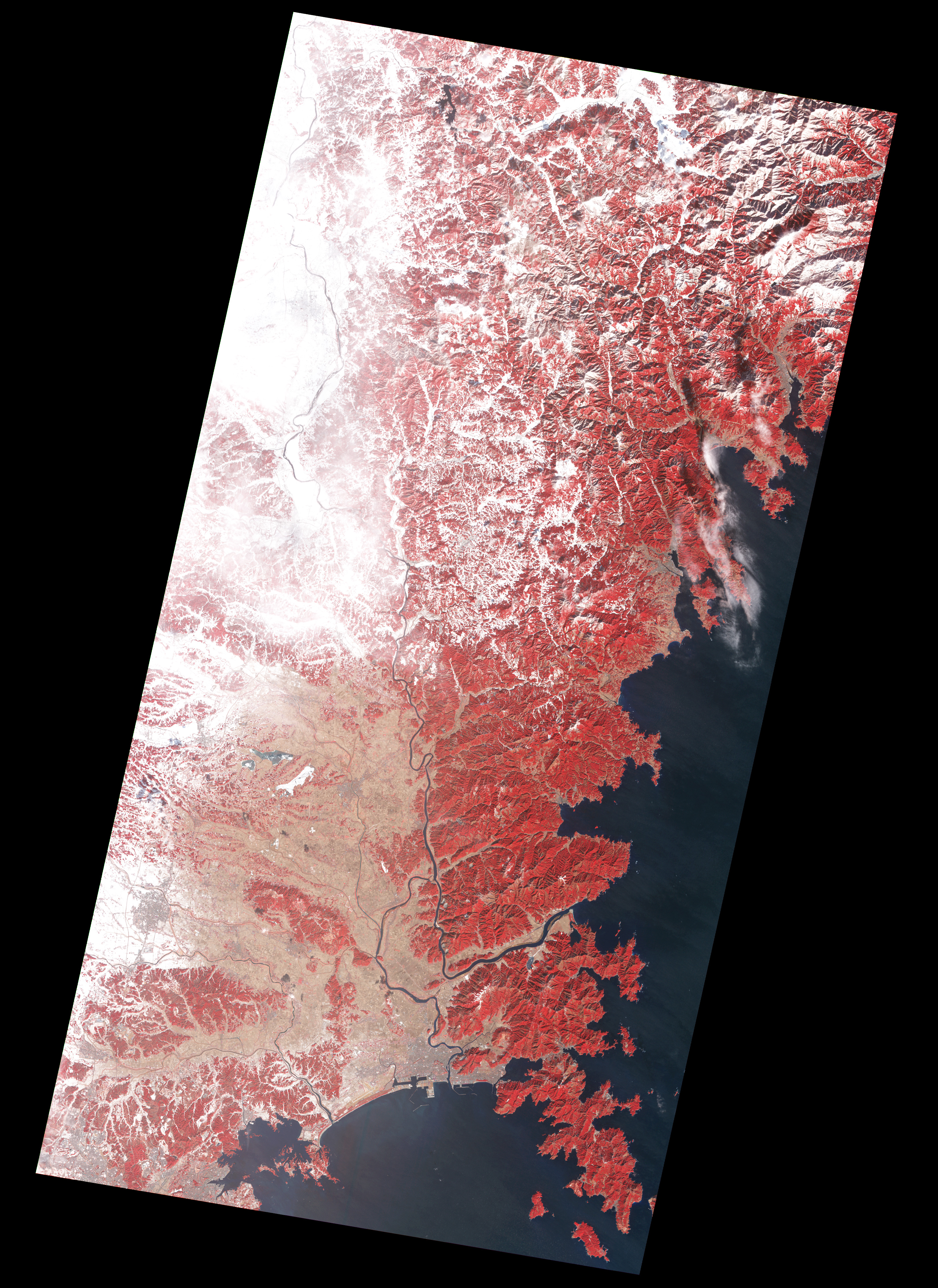
The top image, captured by the Advanced Land Imager on NASA's Earth Observing-1 (EO-1), shows the same scene a year later. And the bottom image, captured by ASTER, shows what the area looked like before the earthquake struck. All three are false-color images that combine infrared, red, and green wavelengths in a way that makes it easy to distinguish between water and land. Vegetation appears red, and fallow fields appear pale brown.
In the image from March 2011 (middle), wide swaths of flood water cover the north and south banks of the river channel, and sediment fills the river's mouth. Some of the most dramatic flooding occurred just to the south of the river, where floodwater washed across large tracts of farmland and the small village of Nagatsura. Notice how far up the river the flooding occurred: Research conducted by scientists at TÅhoku University suggests that waves from the tsunami traveled nearly 50 kilometers (30 miles) upstream from the mouth of the Kitakami River.
One year after the tsunami, floodwaters had subsided, the river was back within its banks, and many of the agricultural fields along the Kitakami were dry again. However, the landscape near the mouth of the river remains irrevocably altered in comparison to how it looked before (bottom image). The farmland immediately north and east of Nagatsura has become river bottom. The width of the river mouth has widened. And water from Oppa Bay has crept inland, leaving only a narrow strip of land and new islands near the river mouth.
See other images from the tsunami—including more imagery from 2012—in our feature slideshow: Tohoku Earthquake and Tsunami: Looking Back from Space.
NASA images by Jesse Allen and Robert Simmon, using ALI data from the EO-1 team, and data from the NASA/GSFC/METI/ERSDAC/JAROS, and U.S./Japan ASTER Science Team. Caption by Adam Voiland.