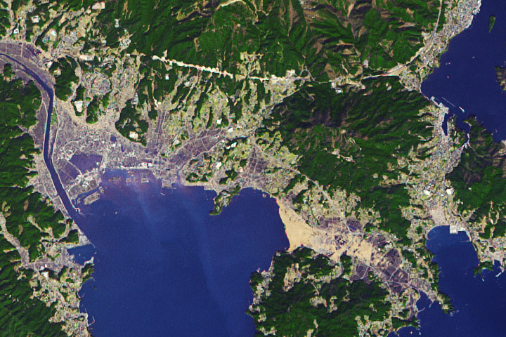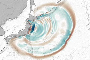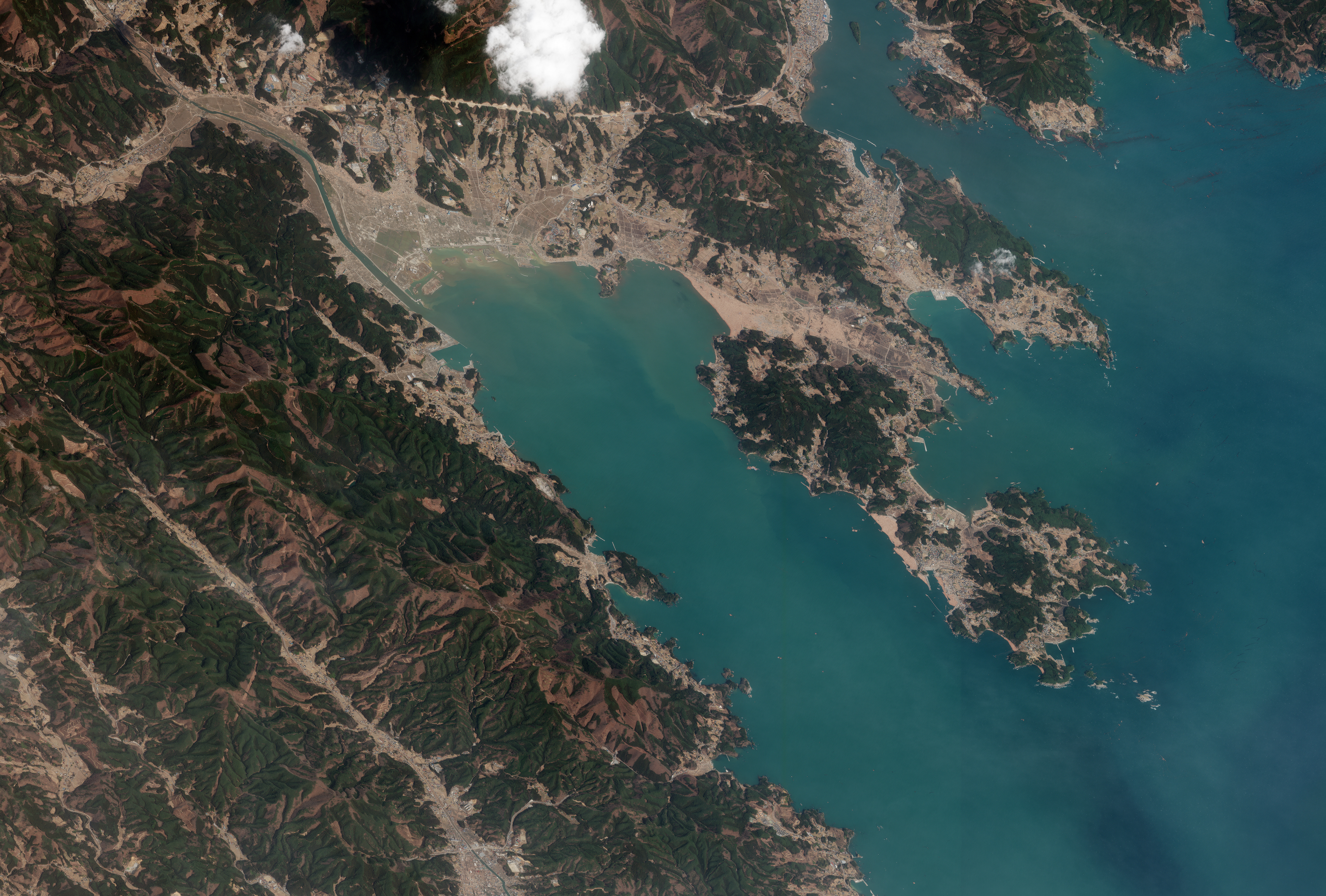
Situated along the coast of northeastern Japan, the town of Rikuzentakata once had a seemingly peaceful seascape, including pine trees and white-sand beaches. But on March 11, 2011, a tsunami wave traveling up Hirota Bay reduced the town of 23,000 residents to rubble. This natural-color image from the WorldView-2 satellite shows Rikuzentakata three days later, on March 14.
In the wake of the tsunami, several large buildings stood out from a landscape of debris. Both the town and the nearby bay appear in shades of tan; farmland south of the town hall is inundated, while sediment colors the water off the coast. The mud in Hirota Bay was scraped from the richly vegetated barrier island that once stood between the town and the sea. (Other NASA satellite images show this area in 2011 and in 2007, when the barrier island was still intact.)
More than two centuries ago, settlers planted more than 60,000 trees along the beach to protect inland fields from salt and sand. After the 2011 tsunami, a lone pine tree survived and became a symbol of hope to Rikuzentakata residents. By February 2012, however, the tree was dying, slowly poisoned by salt water in the soil.
According to a news report from December 2011, the estimated damage to Rikuzentakata totaled $1.5 billion. But the positive signs of recovery were also popping up. Construction on emergency housing began within days of the tsunami, and a new solar-powered city hall opened in June 2011. By December 2011, the city had established a clinic and many small businesses had reopened.
Image by Robert Simmon, using data ©2011 DigitalGlobe. Caption by Michon Scott.
© All Rights Reserved: Use of IKONOS, GeoEye, QuickBird and WorldView imagery must be coordinated with Maxar.