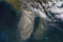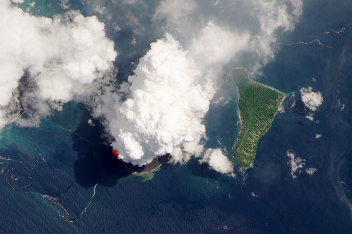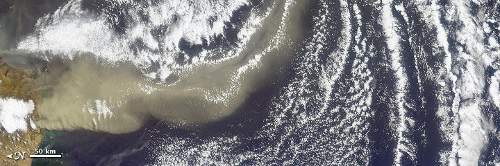


As NASA’s Terra satellite flew over Iceland’s erupting Eyjafjallajökull volcano on April 19, 2010, its Multi-angle Imaging SpectroRadiometer (MISR) instrument acquired 36 near-simultaneous images of the ash plume, covering nine view angles in each of four wavelengths. From these numerous observations, the extent of the plume is easily visible, but in addition, they allow scientists to determine the amount and type of particles in the plume.
The top-most image gives a natural-color nadir (vertical) view of the scene, with the plume emanating from the ice-covered volcano in the left of the image, heading south to southeast. The thick brown ash cloud is distinct from the white clouds and dark blue ocean.
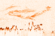
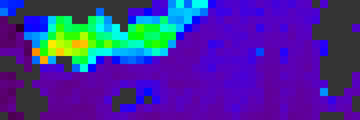
The next image covers the same area, and gives a map of retrieved aerosol optical depth, a measure of the amount of particulate matter in the atmosphere. Purple and blue correspond to low particle amounts, yellow and orange indicate high amounts. The plume here is about five times thicker than the background aerosol.
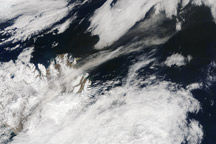
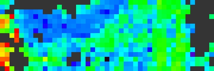
The third image shows the Angstrom exponent, which is related to average particle size—bigger particles generally have smaller Angstrom exponents. Big particles are shown in blue, and smaller ones in yellow and red. In this case, the volcanic plume contains distinctly larger particles than the surrounding atmosphere.
The final image shows particle shape. Volcanic ash is composed primarily of angular, non-spherical particles, whereas background maritime particles are typically tiny, spherical liquid droplets. High concentrations of non-spherical particles are represented by orange and yellow. The plume stands out relative to the unperturbed air as being composed of close to 100 percent non-spherical particles, the kind that create concern for jet aircraft safety.
Each panel covers an area 264 kilometers wide by 792 kilometers north-south (164 miles by 492 miles). The resolution of the nadir image in the first panel is 1.1 kilometers (0.7 miles); aerosol amount and type in the other three panels are given at 17.6 kilometers (10.9 miles) per pixel. MISR has been acquiring aerosol information routinely for the past 10 years, covering the entire globe about once per week.
NASA image courtesy GSFC/LaRC/JPL MISR Team. Caption by Ralph Kahn & the MISR Team, adapted by Robert Simmon.