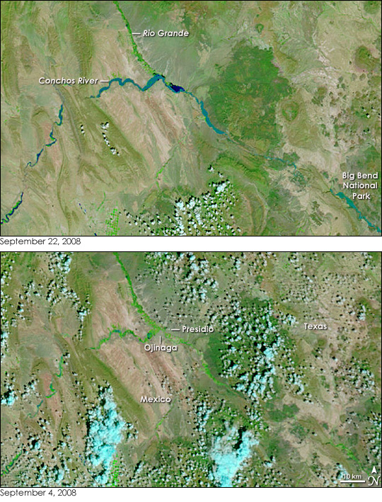
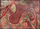
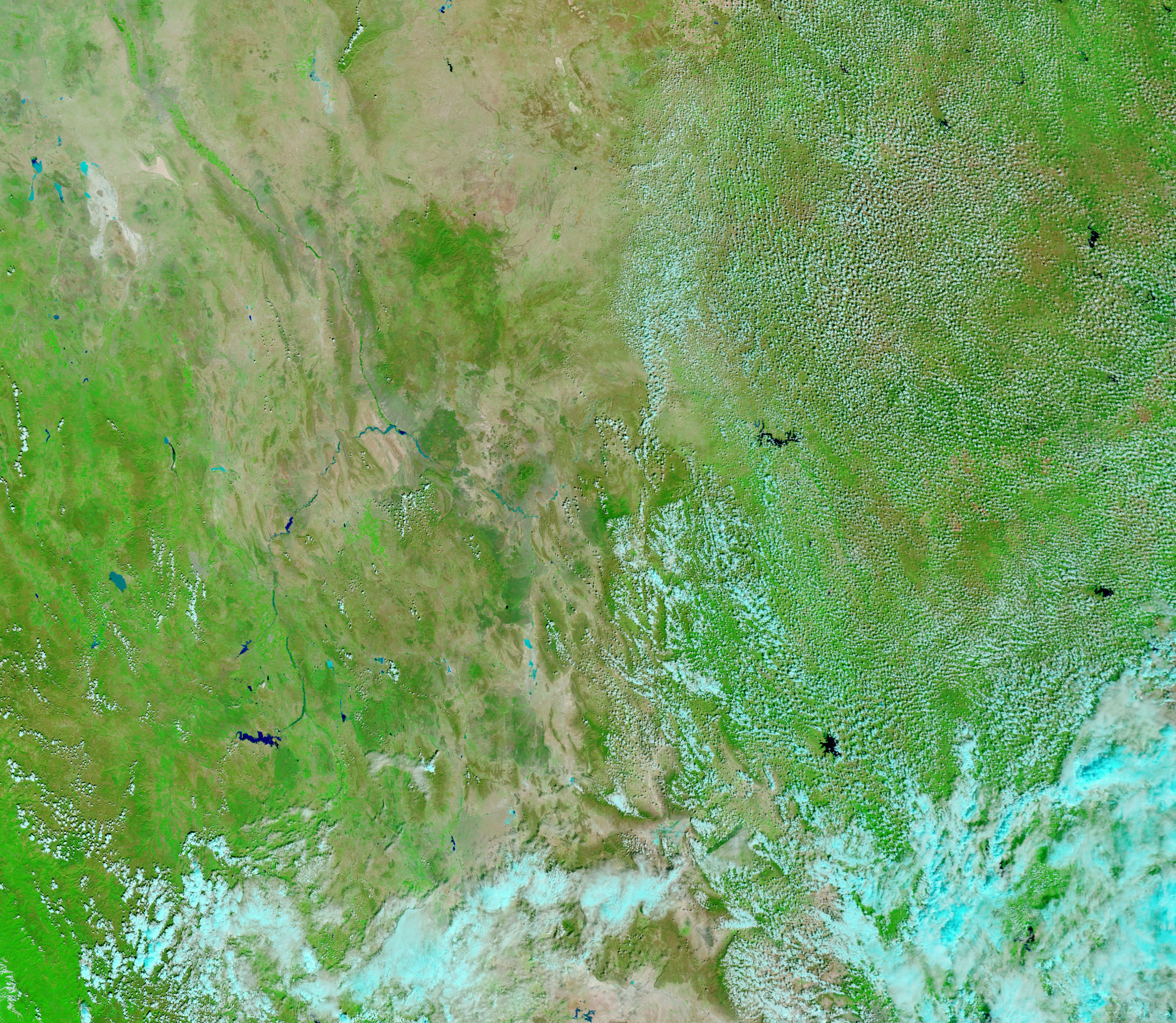
The Rio Grande pushed over its banks in mid-September as heavy rain drenched the river’s southern tributaries. Normally visible only by the strip of green vegetation that lines its banks, the river is a distinct ribbon of blue in the top image, captured by the Moderate Resolution Imaging Spectroradiometer (MODIS) on NASA’s Terra satellite on September 22, 2008. The lower image, taken by Terra MODIS on September 4, 2008, shows the river under normal conditions. Both images have been enhanced with infrared light, so that water is dark blue or black, plant-covered land is bright green, bare earth is tan-pink, and clouds are pale blue and white.
The floods on the Rio Grande begin near Presidio, Texas, downstream of the river’s confluence with the Conchos River. The Conchos River, which according to the Associated Press, inundated the Mexican border city of Ojinaga, is swollen in this image. Water has built up near the point where the Conchos meets the Rio Grande. Downstream on the Rio Grande, a pool of dark blue pushes out from the river where water burst through a levee. Additional flooding is visible in the lower right corner of the image, where the Rio Grande enters Big Bend National Park.
NASA images courtesy the MODIS Rapid Response Team at NASA GSFC. Caption by Holli Riebeek.


