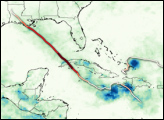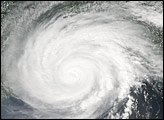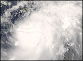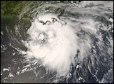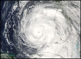
Hurricane Gustav formed off the coast of Hispaniola in the Caribbean Sea on August 25, 2008. In the days that followed, Gustav brought heavy rains to the northern Caribbean nations of Jamaica, Cuba, Haiti, and the Dominican Republic, then built into a major hurricane in the Gulf of Mexico. At one point, Gustav reached Category 4 strength, with peak winds of 240 kilometers per hour (150 miles per hour) on August 30. However, the storm eased off this intensity significantly before coming ashore in Louisiana on September 1 as a Category 2 strength hurricane.
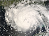
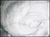
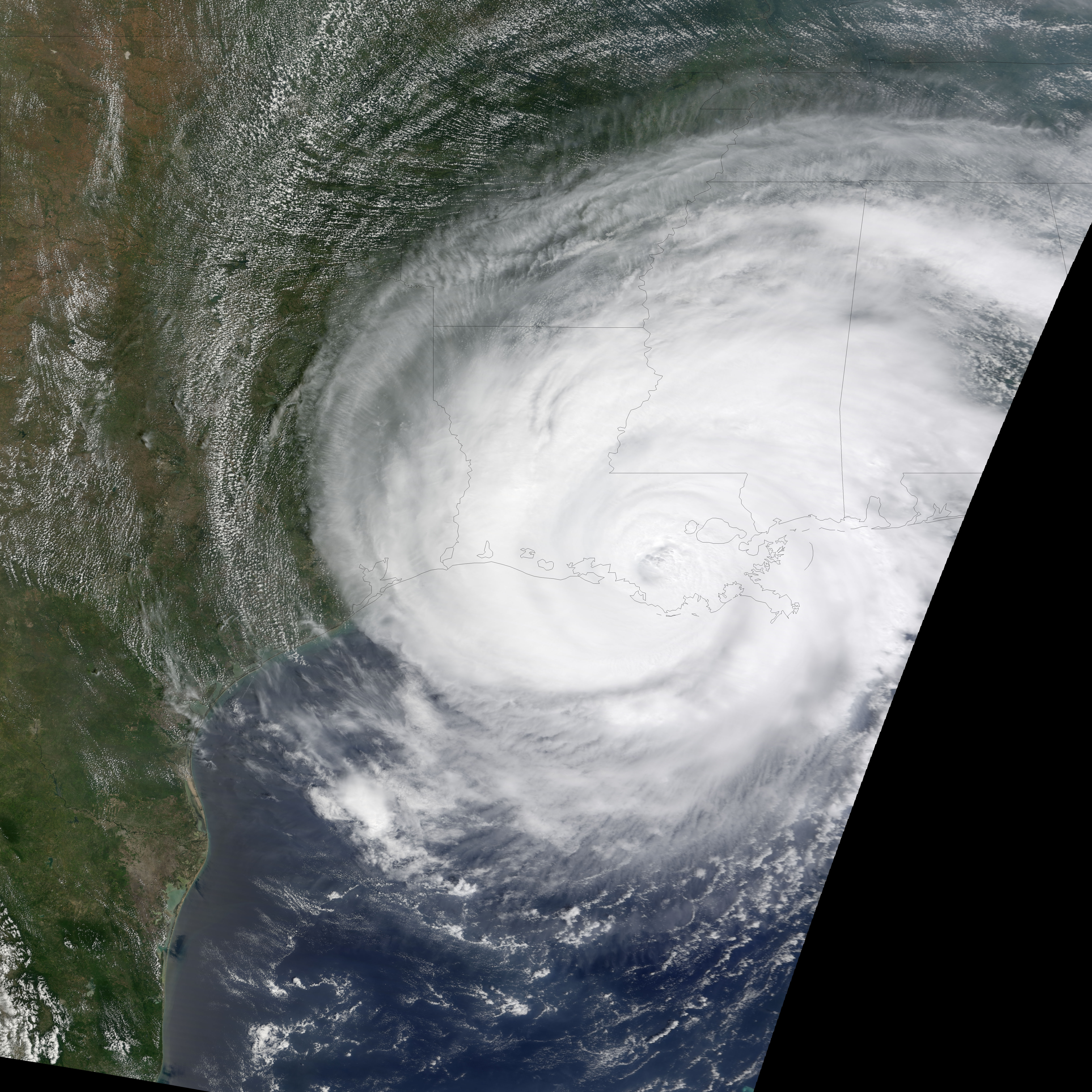
This photo-like image shows Gustav just as it was making landfall. The data were collected by the Moderate Resolution Imaging Spectroradiometer (MODIS) on NASA’s Terra satellite at 12:25 p.m. local time (17:25 UTC) on September 1. The hurricane is a sprawling mass of clouds covering nearly all of Louisiana and Mississippi and reaching far beyond. Gustav’s westward path was clear when the storm’s position in this image is compared to its position in an image acquired just hours later by the MODIS instrument on the Aqua satellite. Storm surge and heavy rains pounded the Louisiana coast.
NASA image created by Jesse Allen, using data provided courtesy of the University of Wisconsin’s Space Science and Engineering Center MODIS Direct Broadcast system. Caption by Jesse Allen.