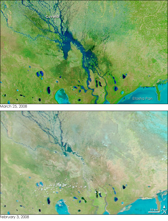
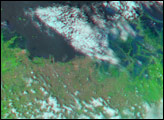
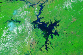
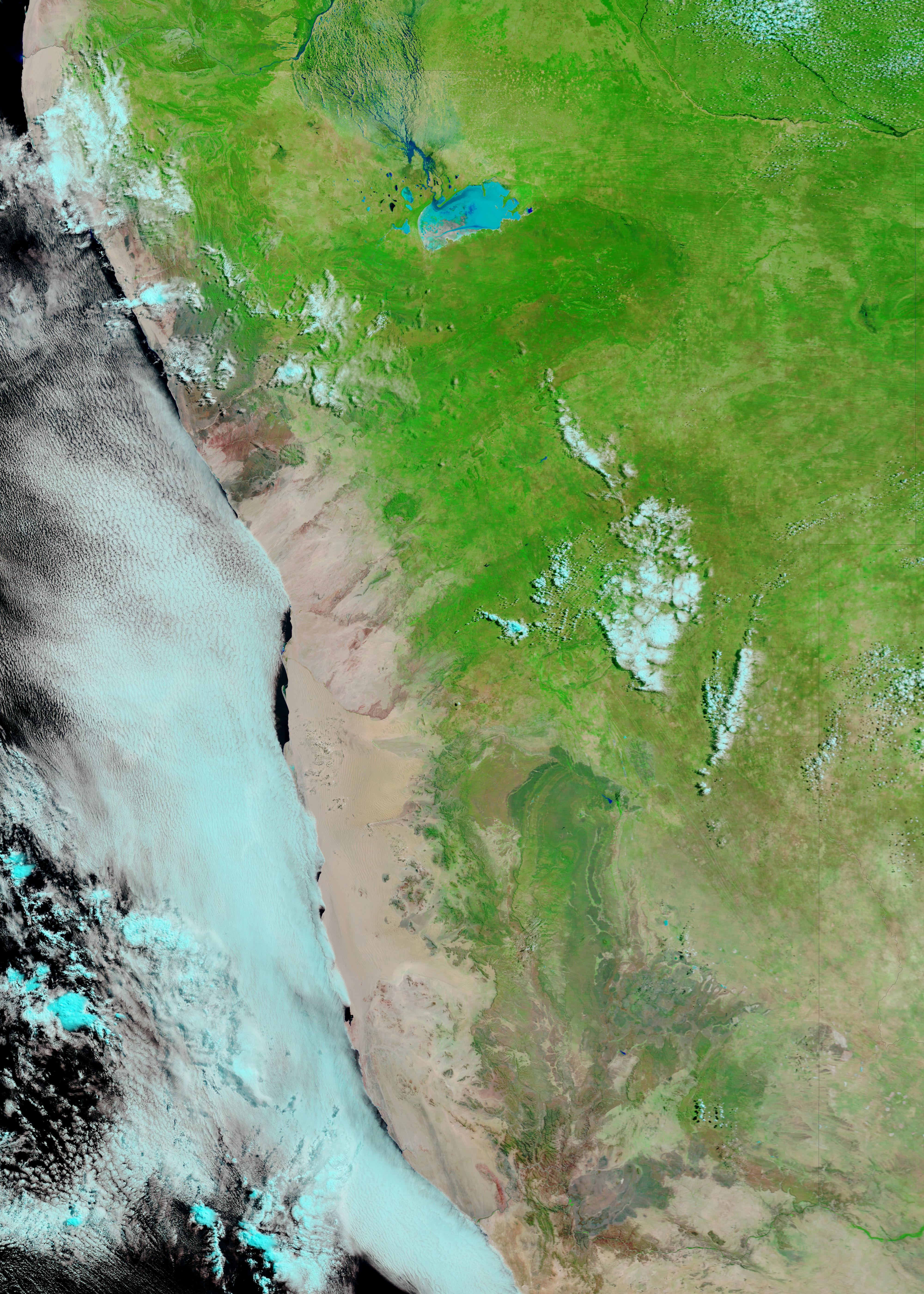
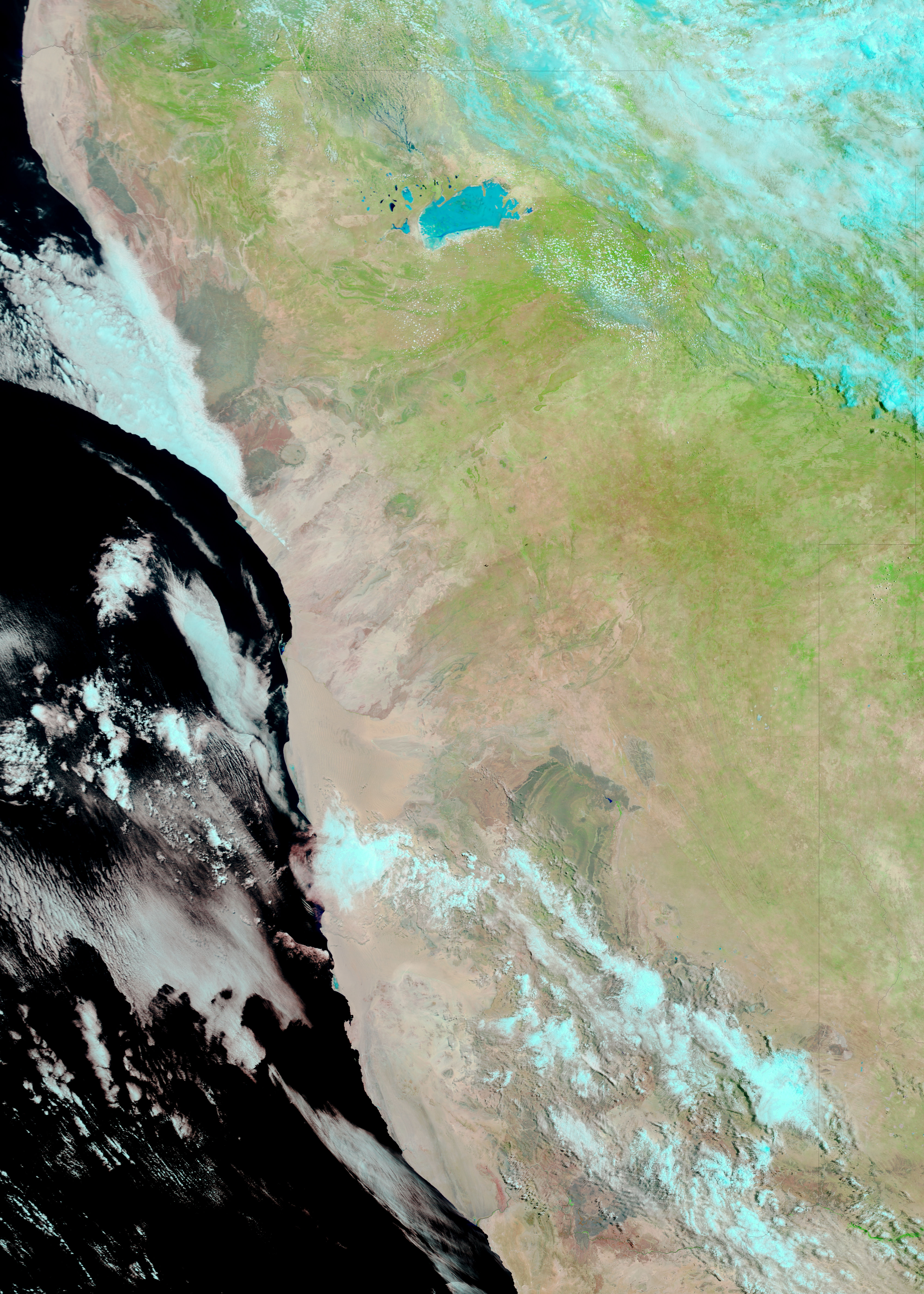
Water flowed from the highlands of Angola into northern Namibia in the wake of intense seasonal rains during February and March 2008. Water levels on the tangle of waterways known as the Cuvelai continued to rise into late March. As of March 26, at least 65,000 people had been affected by the floods, reported The Namibian. The Moderate Resolution Imaging Spectroradiometer (MODIS) on NASA’s Terra satellite captured this clear view of the floods on March 25. In the portion of the Cuvelai shown in this image, water levels had gone up since March 15. MODIS captured the lower image on February 3, 2008, just after the floods started.
Water is dark blue or black in this type of image, which is made with a combination of infrared and visible light. This coloring makes water stand out in stark contrast to the surrounding landscape, which is tan and green. Normally dry salt pans along the lower edge of the image, including the large Etosha Pan, are colored turquoise. The bright-colored soil in the pans is either moist or covered in a thin film of water, and this combination of soil and water yields the vibrant color shown here. Free-flowing water in the Cuvelai is darker in color. Daily images of Namibia are available from the MODIS Rapid Response System.
NASA images courtesy the MODIS Rapid Response Team at NASA GSFC. Caption by Holli Riebeek.


