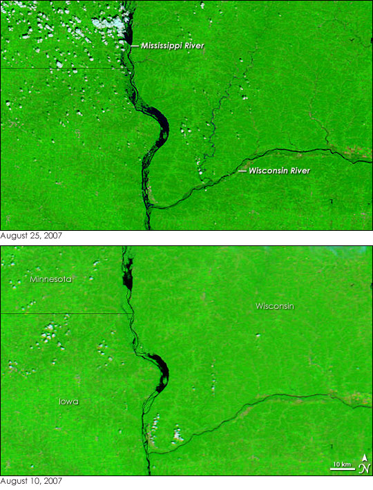
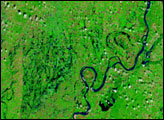
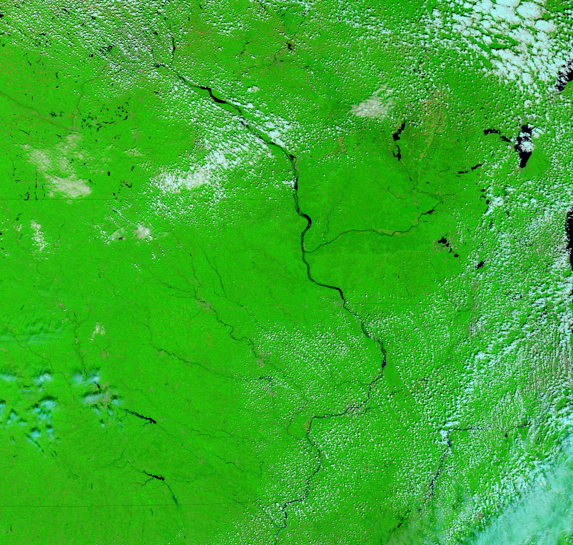
After a week of clouds and rain, the skies cleared over the midwestern United States on August 25, 2007, giving the Moderate Resolution Imaging Spectroradiometer (MODIS) flying on NASA’s Terra satellite this view of the region’s swollen rivers. A string of severe thunderstorms pounded the U.S. Midwest during the third week of August, leaving devastating floods in their wake. Though the floods had started to recede by the time MODIS captured the top image, the Mississippi and Wisconsin Rivers and their tributaries were still running high.
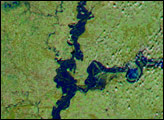
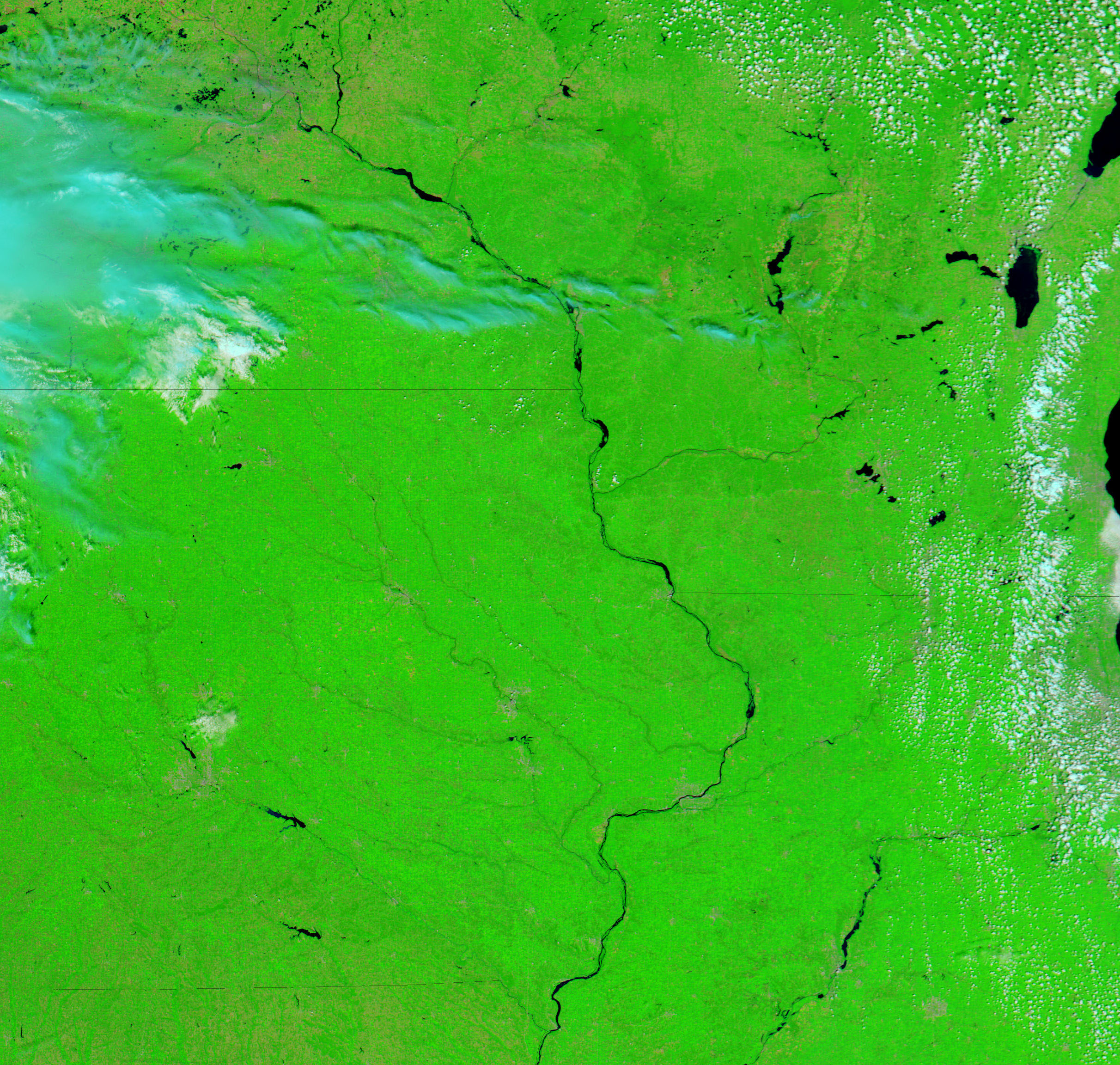
The lower image shows the river system in southeastern Minnesota, northeastern Iowa, and western Wisconsin on August 10, before the storms came through. Both images were made with a combination of infrared and visible light, which makes water appear black, while the surrounding plant-covered land is bright green. A comparison between the two images reveals that the Mississippi River was overflowing; dark pools of water surround its banks in the top image. The Wisconsin River looks only slightly swollen, but its tributaries, too small to be visible in early August, have widened enough to show up clearly. At least 18 deaths have been blamed on the storms and floods, reported the Associated Press on August 26.
These images are displayed at MODIS’ maximum resolution of 250 meters per pixel. Daily images of the United States are available from the MODIS Rapid Response System in a variety of resolutions.
NASA images courtesy the MODIS Rapid Response Team at NASA GSFC.


