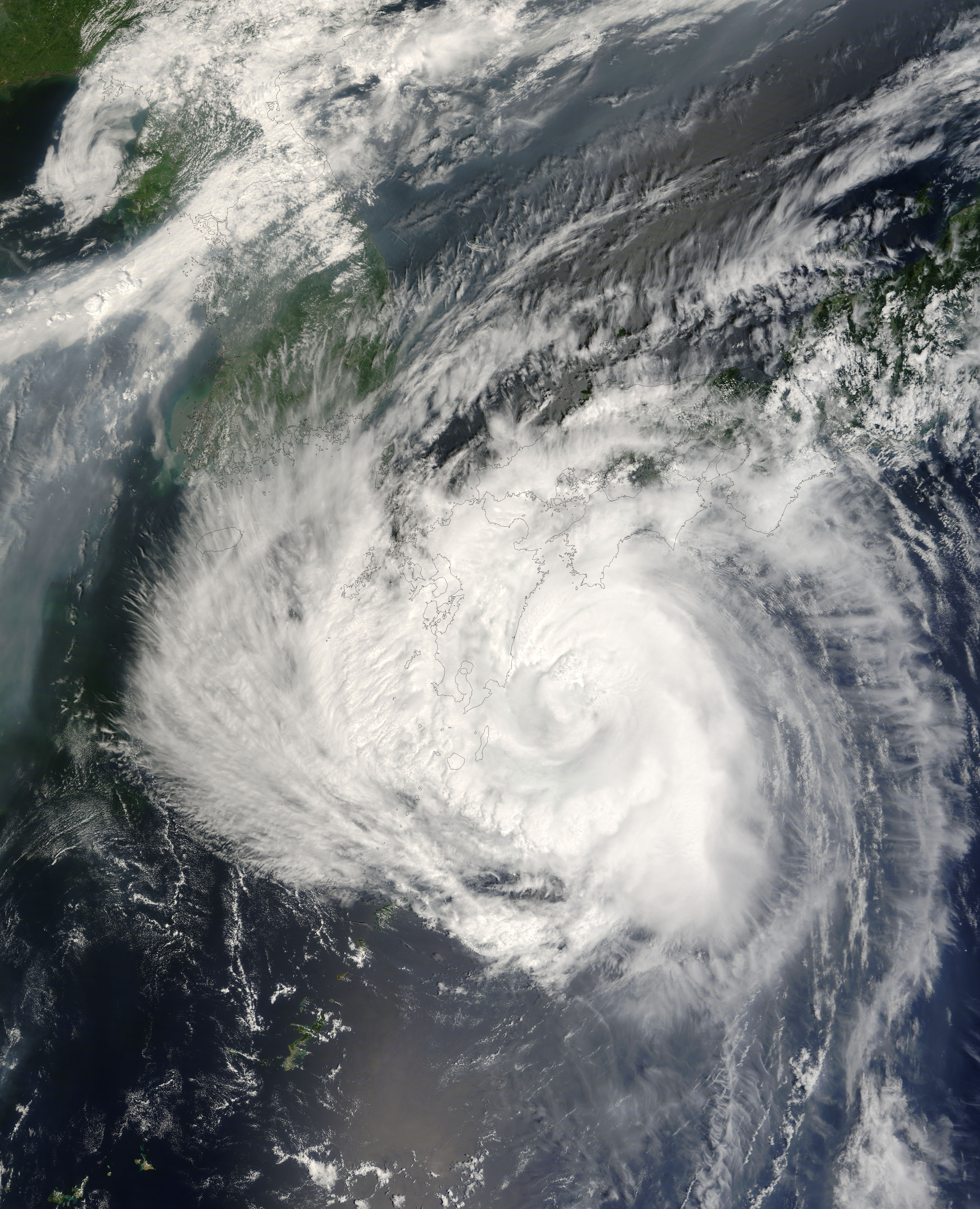
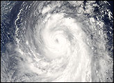
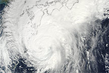
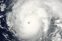
Just weeks after taking a beating from Typhoon Man-Yi in mid-July 2007, Japan’s southern islands were visited by Typhoon Usagi in early August. Although not as strong as Man-Yi, Usagi still forced the region to cancel air traffic and ferry services, and it left tens of thousand of homes without power, said news reports.
This image from the Moderate Resolution Imaging Spectroradiometer (MODIS) on NASA’s Terra satellite was captured on August 2, 2007, at 02:10 Universal Coordinated Time (11:10 a.m. local time in Japan). The northwest quadrant of Typhoon Usagi blankets Kyushu, Shikoku, and western Honshu with clouds. The outermost bands of clouds reach South Korea. The eye of the storm was about 55 kilometers (34 miles) off shore of southern Kyushu. Towering thunderstorms along the northern rim of the eye make it seem like the clouds are boiling.
Usagi was the fifth named storm of 2007 in the western Pacific. The storm reached Category 4 status, with maximum sustained winds of 120 knots (222 kilometers per hour, 138 miles per hour), but had weakened to Category 3 status, with winds of 100 knots (185 kilometers per hour, 115 miles per hour) about two hours before this image was captured.
The large image provided above has a spatial resolution (level of detail) of 250 meters per pixel. The MODIS Rapid Response Team provides this image in additional resolutions.
You can download a 250-meter-resolution KMZ file of Typhoon Usagi suitable for use with Google Earth.
NASA image by Jeff Schmaltz, MODIS Rapid Response Team, Goddard Space Flight Center.


