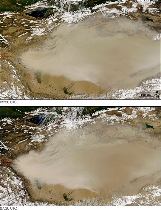


On May 10, 2007, a dust storm covered most of the Taklimakan Desert in western China. The Moderate Resolution Imaging Spectroradiometer (MODIS) on NASA’s Terra satellite captured an image of the storm at 05:50 UTC. The storm had intensified by the time the MODIS sensor on NASA’s Aqua satellite took another picture at 07:30 UTC.
In both of these images, the dust appears as a beige blur over the landscape, thickest in the west. In the later image, the dust is even more concentrated at the western edge of the desert—lighter in color and larger.
Lying in the Tarim Basin, between the Tien Shan Mountains to the north and Kunlun Mountains to the south, the Taklimakan Desert is home to one of Earth’s largest shifting-sand deserts. The basin’s lowest point is roughly 150 meters (490 feet) below sea level, and salt collects in the basin due to lack of drainage. Because of its aridity and abundant sand, this desert produces many of Asia’s dust storms.
NASA image by Jeff Schmaltz, MODIS Rapid Response Team, Goddard Space Flight Center.