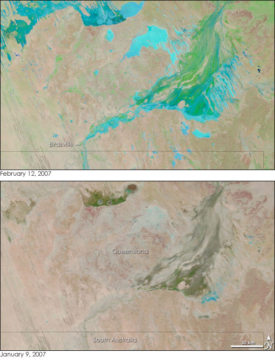
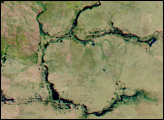
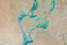
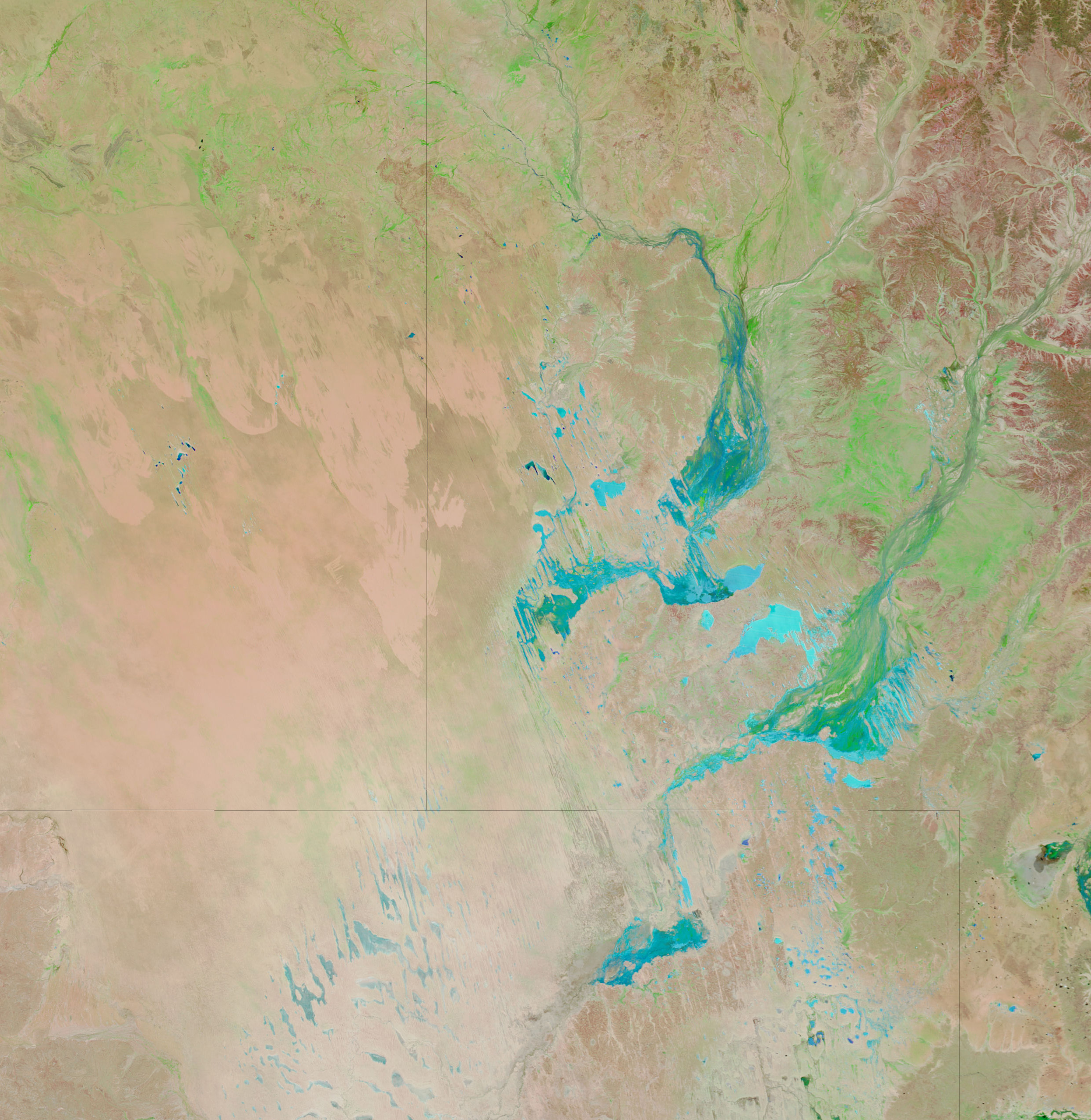
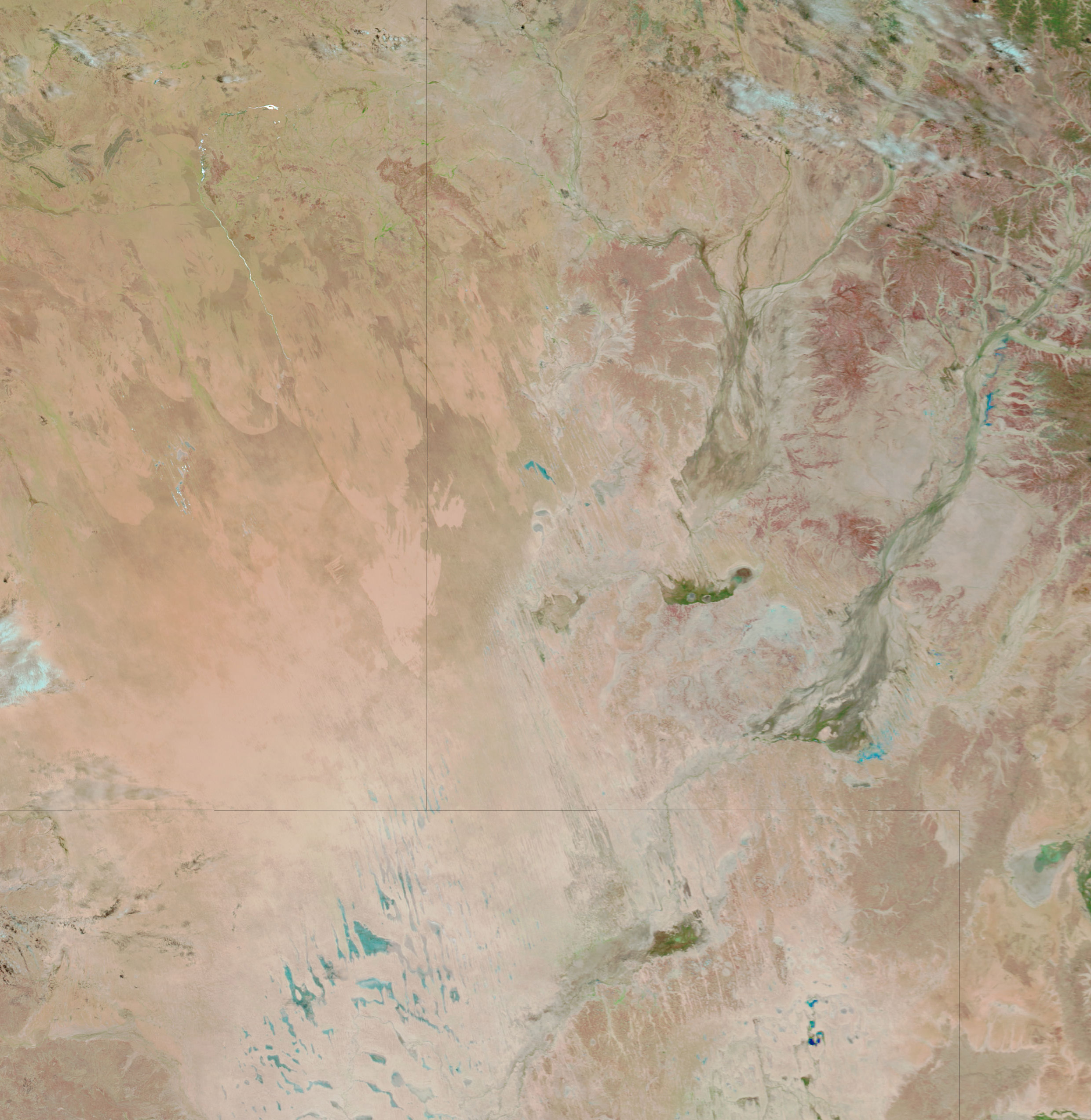
A fresh round of rain over Australia’s Channel Country brought a resurgence of floods, reported the Australian Broadcasting Corporation (ABC) on February 10, 2007. Heavy rains filled the creeks and channels of southwestern Queensland and northeastern South Australia at the end of January, but those floods had started to recede when another storm brought additional moisture on February 9 and 10. The new floods cut off the town of Birdsville near the Queensland-South Australia border for the second time in 2007, reported ABC News.
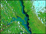
The mud-laden flood water colored the landscape a brilliant blue on February 12, when the Moderate Resolution Imaging Spectroradiometer (MODIS) on NASA’s Terra satellite captured the top image. This type of image, made with both visible and infrared light, typically displays water as dark blue or black. In this case, the water contains light-scattering dirt, which gives it the turquoise color seen here. The barren desert landscape is tan and pink, while vegetation is green. The lower image, provided to show the region before the floods started, was taken on January 9, 2007.
NASA image courtesy the MODIS Rapid Response Team at NASA GSFC.


