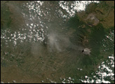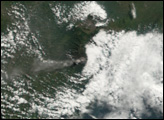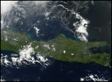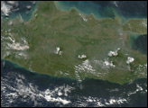
The volcanoes of Java are part of the “Ring of Fire,” an area of heightened seismic activity around Pacific Ocean Basin. Just three days after an earthquake struck Java, on May 27, 2006, the island’s Semeru Volcano showed signs of heightened activity.
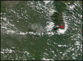
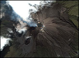
The Moderate Resolution Imaging Spectroradiometer (MODIS) flying onboard NASA’s Terra satellite took this picture on May 30, 2006. In this image, Semeru’s summit is outlined in red. The outline indicates that MODIS detected unusually high surface temperatures. To the west of the summit are gray-brown clouds that dissipate as they move westward. These clouds could result from volcanic ash emitted by the Semeru Volcano.
Semeru ranks among Indonesia’s most active volcanoes. It is Java’s highest volcano, rising 3,676 meters (over 12,000 feet) above the nearby coastal plains. Like its neighbor Merapi Volcano, it has claimed human lives in historical eruptions.
NASA image created by Jesse Allen, Earth Observatory, using data provided courtesy of the MODIS Rapid Response team.