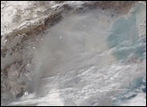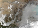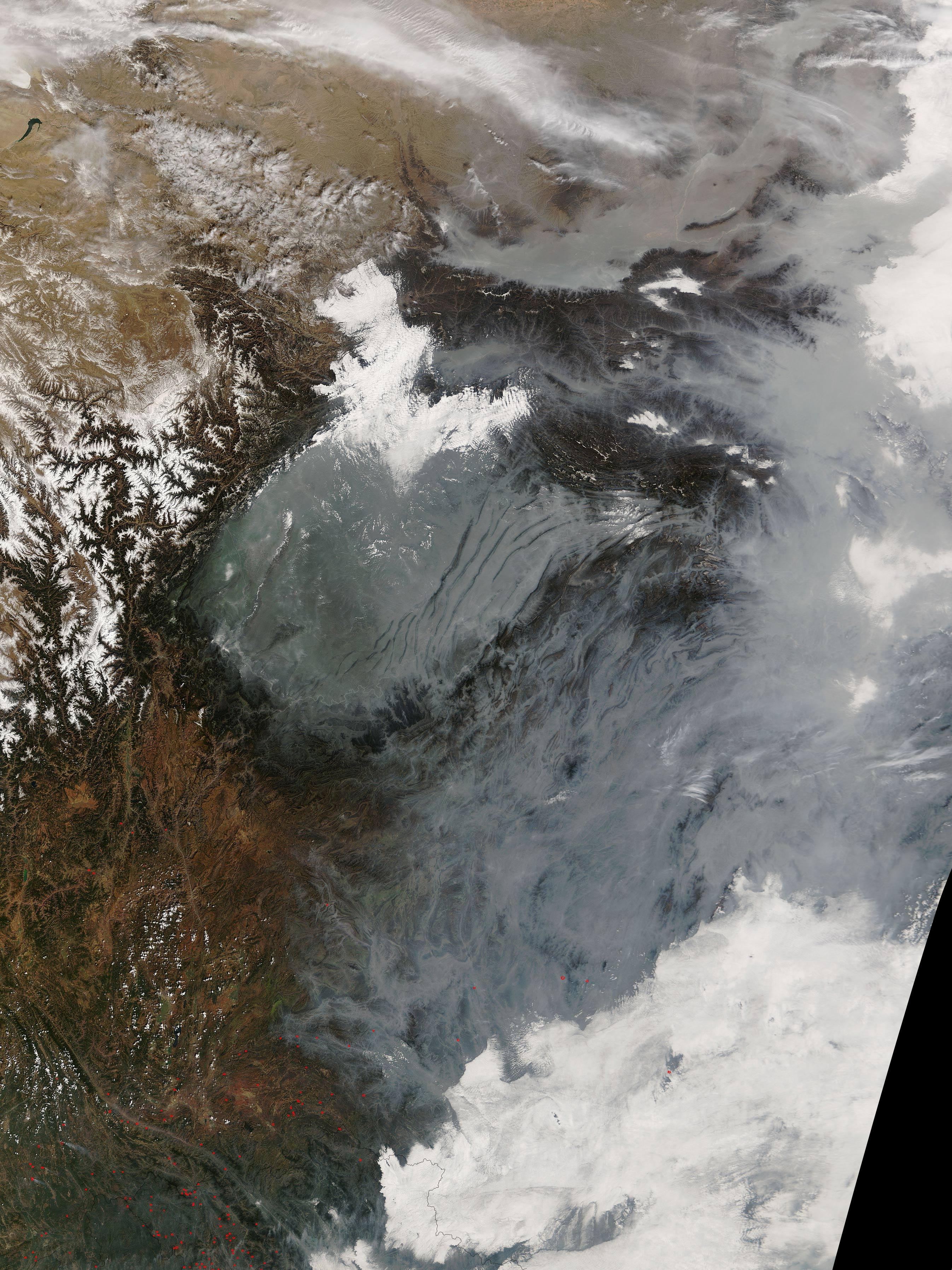
A thick haze settled heavily into low-lying areas in the mountainous terrain of southern China on February 24, 2005. The gray pall is packed into river valleys and basins, such as a large, circular basin ringed by mountains near image center. The Yangtze River flows through that basin, and it is densely populated, having three cities with populations between 1 and 5 million, five cities with populations between 500,000 and 1 million, six cities with populations between 100,000 and 500,000, and several other smaller cities and towns. To the north, where the Yellow River flows out of the mountains and heads eastward toward the sea, the river is lined with a succession of similarly large cities.
Where there are cities, there are vehicles emitting pollution, people burning coal and other fuels for heat and electricity, and business and industry doing the same. In the winter, cold air has a natural tendency to settle into low-lying areas. These natural and human factors work together to create difficult air quality problems for the Chinese to tackle as their country’s economy continues to develop.
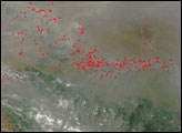
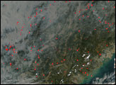
In the lower left corner, numerous fires, probably agricultural in purpose, were detected by MODIS, and their locations have been marked with red dots. The fires may also be contributing to the regional haze. This image was created from observations collected by the Moderate Resolution Imaging Spectroradiometer (MODIS) on NASA’s Terra satellite on February 24, 2005.Image courtesy the MODIS Rapid Response Team, NASA-Goddard Space Flight Center