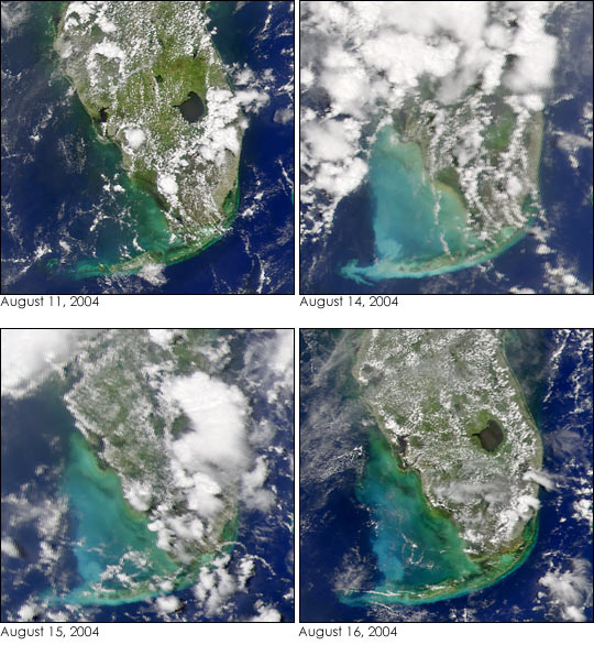
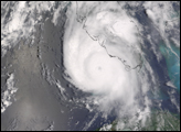
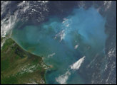
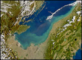
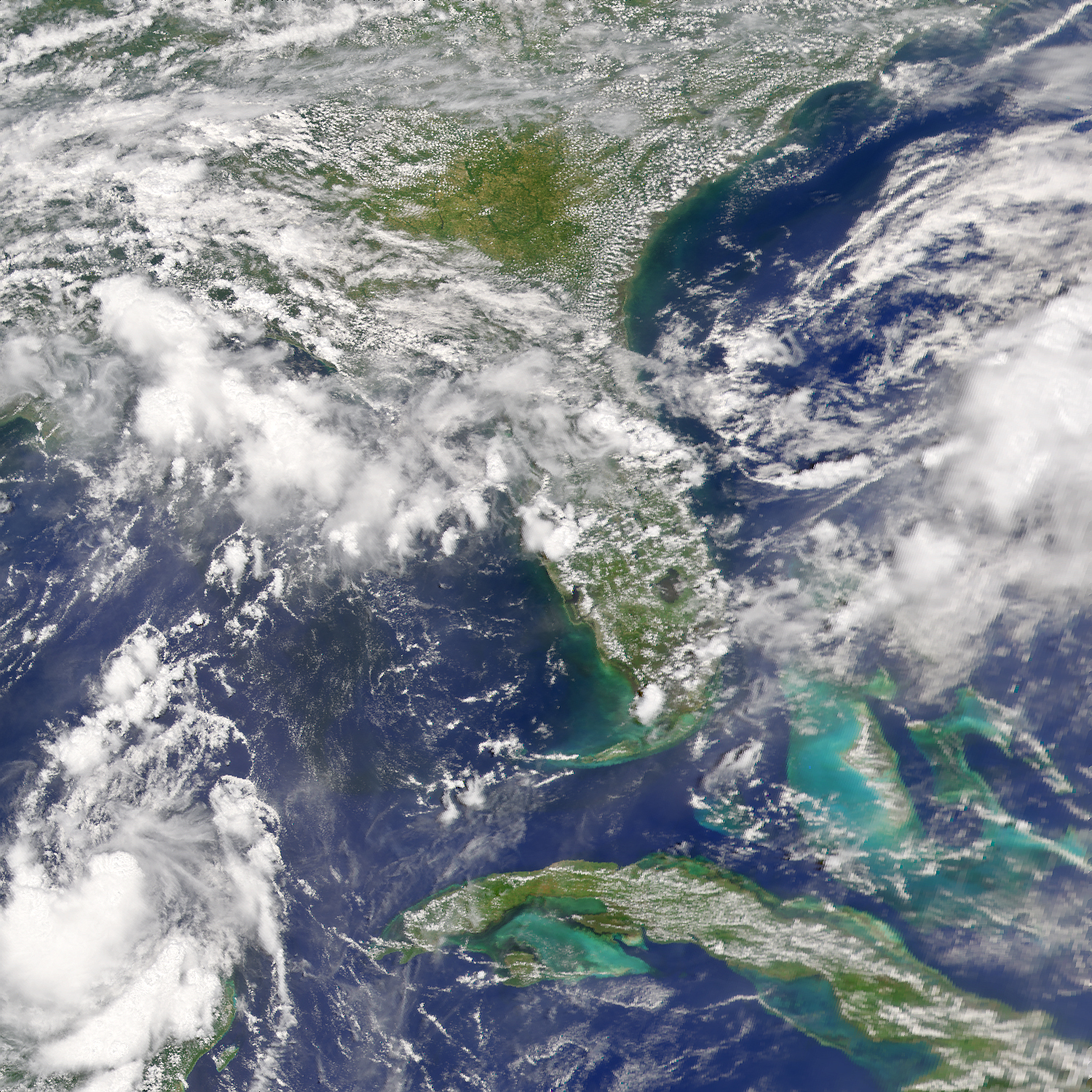
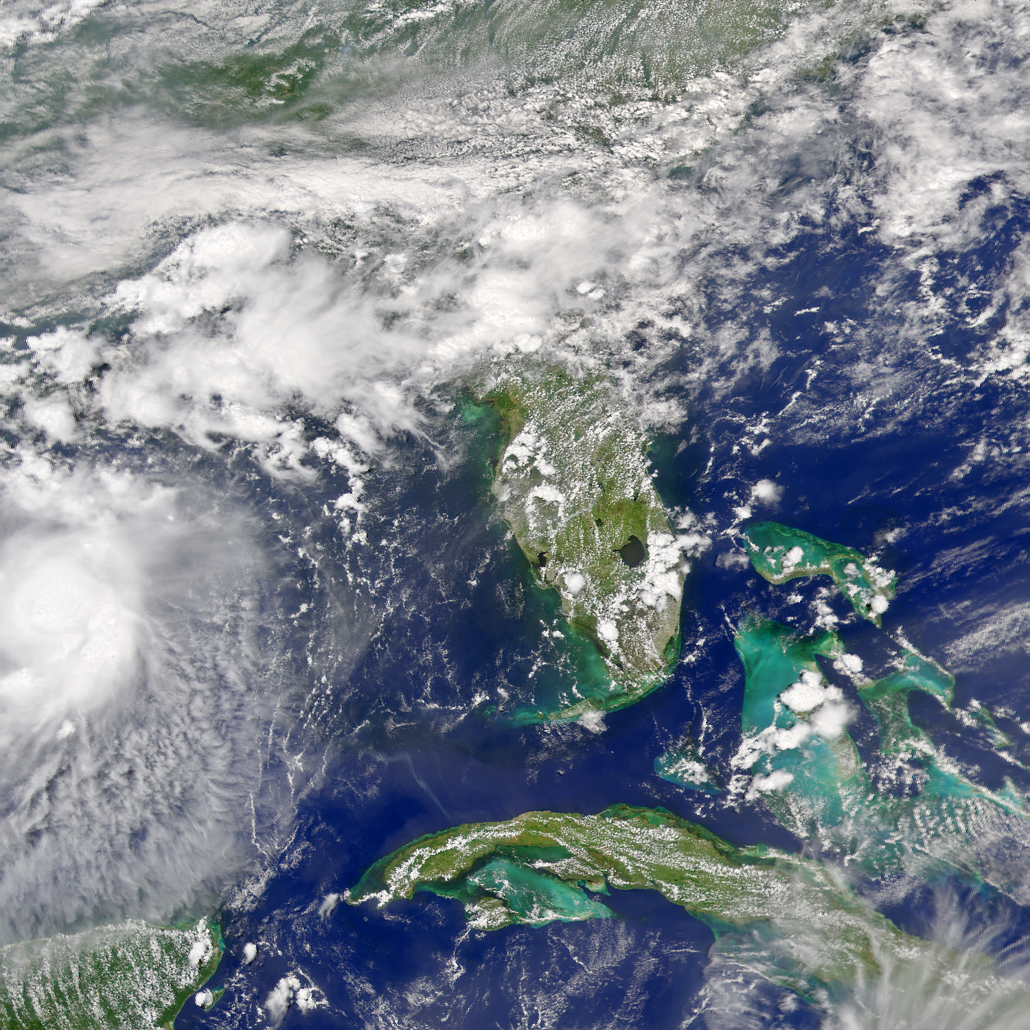
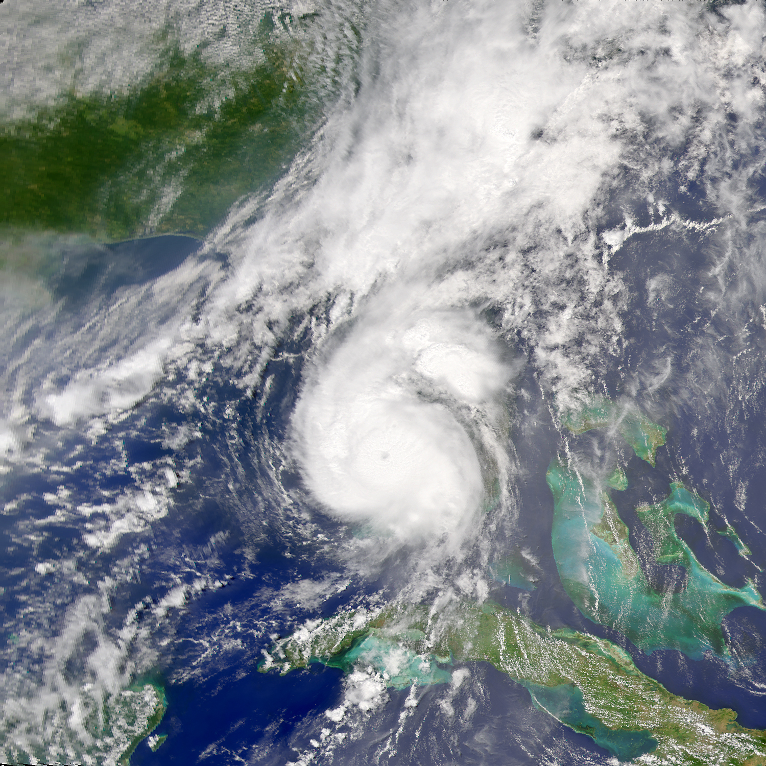
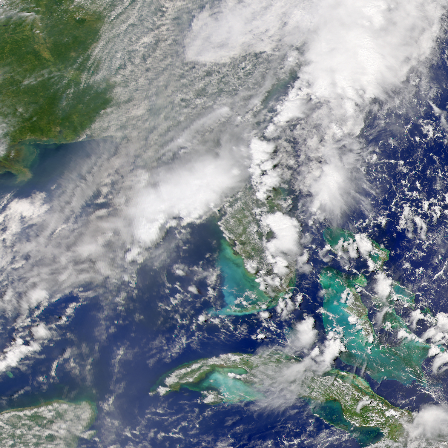
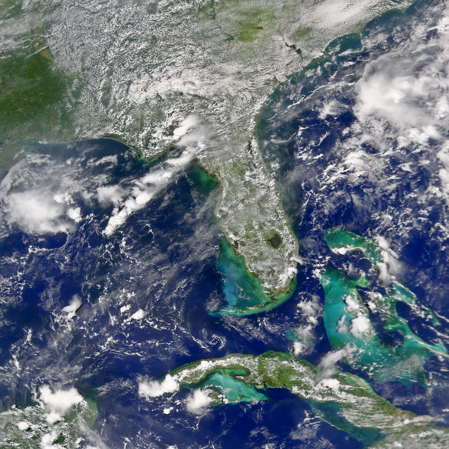
As Hurricane Charley pounded up the west Florida coast, it churned the shallow ocean waters over the West Florida shelf, bringing up sediment up from the sea floor. Like glitter in a freshly shaken snow-globe, the resuspended sediment increased the reflectivity of the surface waters, giving them a turquoise hue after the storm passed. The effect is clearly visible in this series images, captured by the Sea-viewing Wide Field-of-view Sensor (SeaWiFS) on the Orbview-2 satellite on the days before and after Charley moved across the area on August 13, 2004. The waters were relatively clear on August 11, before the storm entered the area. On August 14, the day after Charley crossed over the West Florida Shelf, the water is clouded with recently resuspended sediment. In the following two days, the clouds of turquoise gradually disappear as the sediment settles on the ocean floor.
Image provided by the SeaWiFS Project, NASA/Goddard Space Flight Center, and ORBIMAGE


