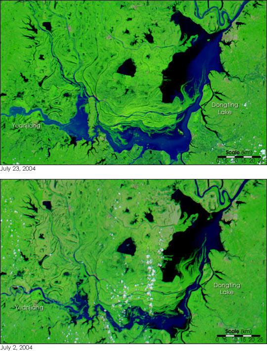
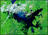
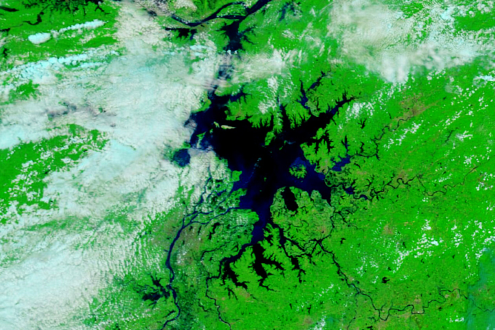
Monsoon rain continues to drench eastern China bringing with it the floods that annually plague the country. On July 23, 2004, the Moderate Resolution Imaging Spectroradiometer (MODIS) on NASA’s Terra satellite captured this image of floods around Dongting Lake in China’s Hunan province. The lake, the largest body of fresh water in China, covers the right half of the image. The southern sections of the lake are visibly larger on July 23 than they were in a MODIS image acquired by the Aqua satellite on July 2, 2004. The Yuanjiang River, which flows into Dongting Lake from the west, is also flooded. According to local news reports, water levels on both the lake and the river continue to rise.
The images show the Dongting Lake region at MODIS’ maximum resolution of 250 meters per pixel. Both the July 23 and July 2 images are available in additional resolutions.
NASA images courtesy the MODIS Rapid Response Team at Goddard Space Flight Center.


