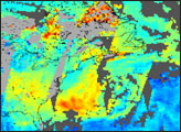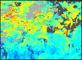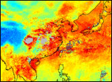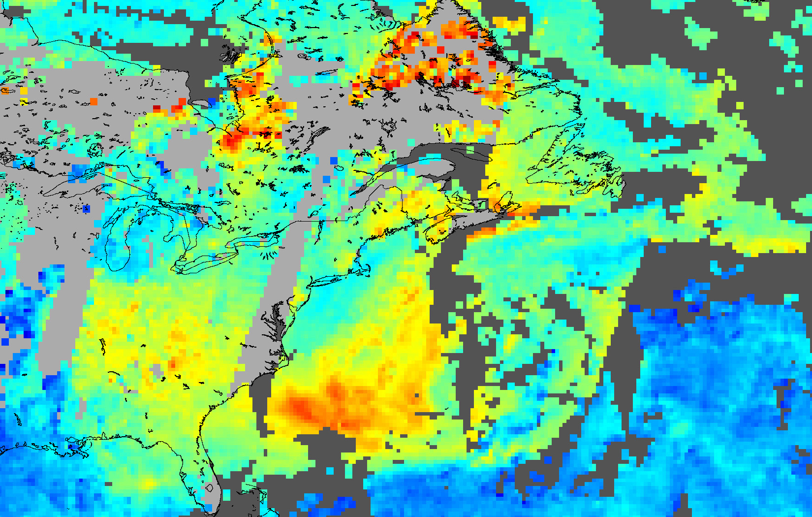
NASA’s Measurement of Pollution in the Troposphere (MOPITT) sensor on the Terra satellite captured these observations of carbon monoxide over the eastern United States (bottom left), Canada (top), and the Atlantic Ocean (right) on June 26, 2003. True-color imagery revealed a pall of haze stretching over a large area, and these observations confirm the high values (red pixels) of the pollutant carbon monoxide associated with the haze. Cloudy areas are shown in gray.
MOPITT data visualized by Jesse Allen. Data provided by the NCAR/UCAR MOPITT science team.