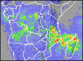
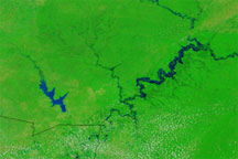
Heavy rains across southeastern Africa led to flooding throughout Zambia, Malawi, and Mozambique that displaced thousands of people and destroyed hundreds of acres of invaluable crops. This true color image of flooding in Zambia was acquired on January 10, 2003, by the Moderate Resolution Imaging Spectroradiometer (MODIS) aboard NASA’s Terra spacecraft. The floods looks like bruises on the land just below Lake Bengwuelu. Farther east in Malawi and Mozambique, flooding has driven over 30,000 people from their homes and killed seven people. The fallout from the floods, however, may be worse than the floods themselves. A food shortage currently exists in southeastern Africa, and the floods have now destroyed much valuable cropland along the rivers and lakes.
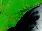
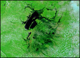
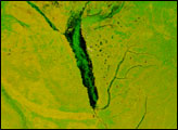
In this false-color image, land is green, water is black and dark blue, and clouds are light blue and white.
Image courtesy Jacques Descloitres, MODIS Land Rapid Response Team at NASA GSFC