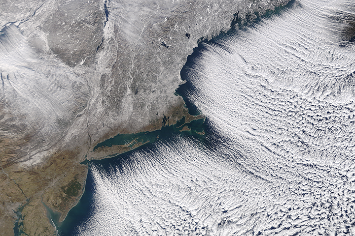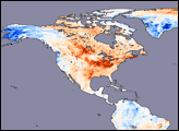
It is frigid in much of Canada and the Midwestern and Eastern United States. Daily low-temperature records have dropped like snowflakes. New Year’s polar plunges have been canceled due to the cold, and many people in the Southeast are in a battle to keep their pipes from freezing.
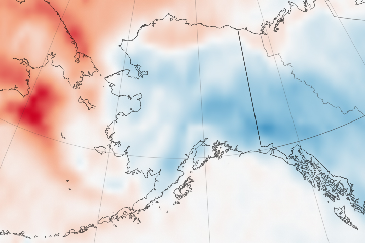
In the Western U.S., Alaska, Europe, and Asia—not so much. December and January have been abnormally warm for most of the world. People in California have been worrying about wildfires in what should be the wet season, and Alaskans are ice skating in T-shirts.
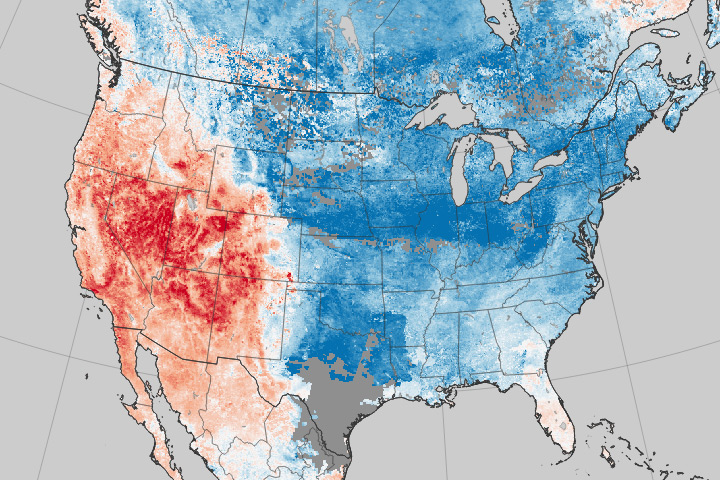
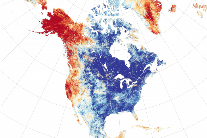
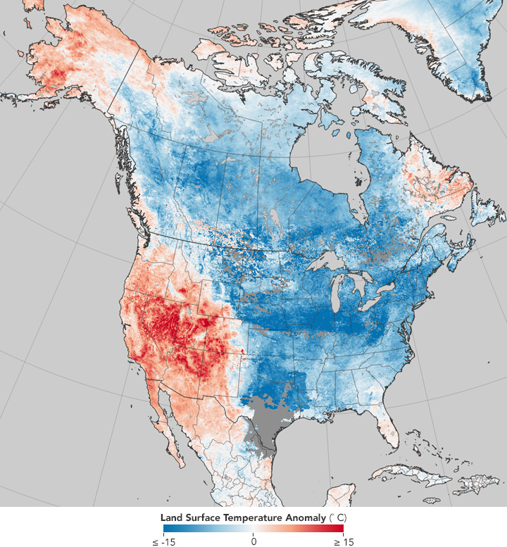
This temperature anomaly map is based on data from the Moderate Resolution Imaging Spectroradiometer (MODIS) on NASA’s Terra satellite. It shows land surface temperatures (LSTs) from December 26, 2017 to January 2, 2018, compared to the 2001–2010 average for the same eight-day period. Red colors depict areas that were hotter than average; blues were colder than average. White pixels were normal, and gray pixels did not have enough data, most likely due to excessive cloud cover. Note that it depicts land surface temperatures, not air temperatures. Land surface temperatures reflect how hot the surface of the Earth would feel to the touch in a particular location. They can sometimes be significantly hotter or cooler than air temperatures. (To learn more about LSTs and air temperatures, read: Where is the Hottest Place on Earth?)
The map of North America underscores one of the realities of weather—when a cold snap hits one region, warmth often bakes another one. A giant meander (or Rossby wave) in the jet stream is the common thread that connects the warm weather west of the Rockies with the chill east of them. As the crest of a Rossby wave—a ridge—pushed unusually far toward Alaska in December, it dragged warm tropical air with it. In response, the other side of the wave—a trough—slid deep into the eastern United States, bringing pulses of dense, cold Arctic air south with it. The Rocky Mountains have boxed in much of the coldest, densest air, serving as a barrier between the cold and warm air masses.
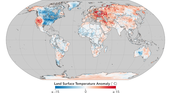
Even as the Eastern U.S. freezes, comparatively balmy conditions are dominating many other parts of the world. Europe, much of Asia, and the Middle East have been abnormally warm. In the southern hemisphere, Antarctica, eastern Australia, southern Africa, and the Horn of Africa have been warmer than usual, while the Amazon in South America, the Sahara in Africa, and western Australia were cool.
NASA Earth Observatory maps by Jesse Allen, based on MODIS land surface temperature data provided by the Land Processes Distributed Active Archive Center. Story by Adam Voiland.