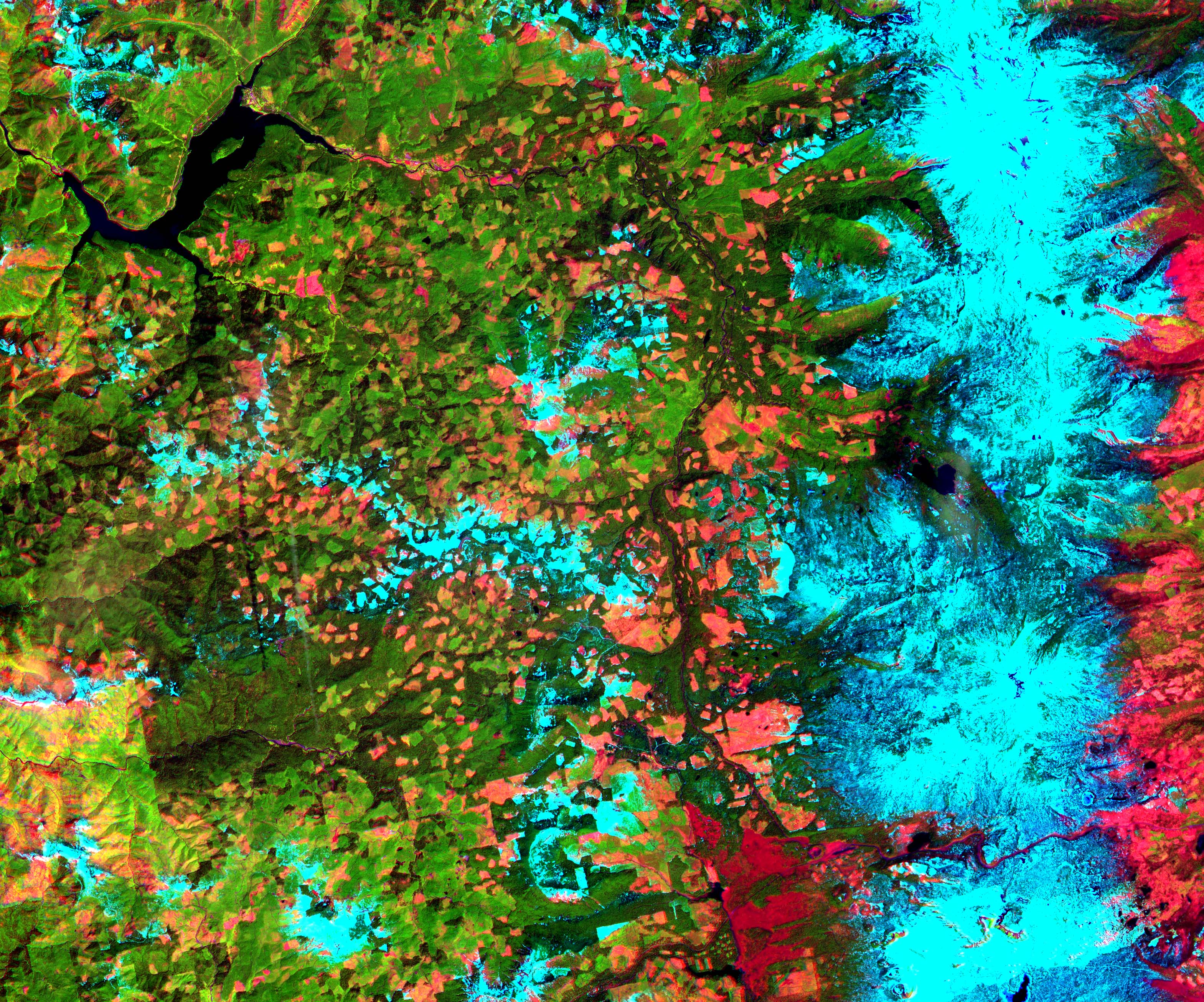
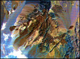
This Advanced Spaceborne Thermal Emission and Reflection Radiometer (ASTER) sub-scene was acquired on May 20, 2000 and shows an area along the west side of the Cascade Range in west central Oregon. (the full image measures 39 by 47 km) Bands 4 (shortwave infrared), 3 (near infrared), and 2 (red) were combined as red, green, and blue. In this composite, snow appears blue, forests are green, and clear-cut areas are orange-pink. The magnitude of logging operations is quite obvious, appearing as a checker board pattern.
Image courtesy NASA/GSFC/MITI/ERSDAC/JAROS, and U.S./Japan ASTER Science Team


