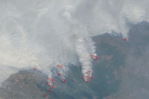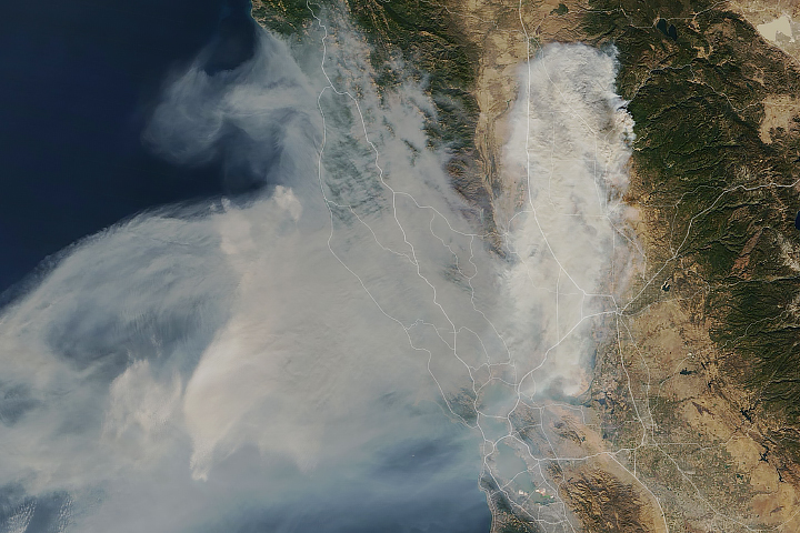
Despite the moist climate of tropical Asia, fire has become common in the region in September and October. For the past few decades, people have used fire to clear land for farming and to burn away leftover crop debris. What was unusual in 2015 was how many fires burned and how many went uncontrolled for weeks and even months, sending clouds of toxic gas and particulate matter into the air over Indonesia.
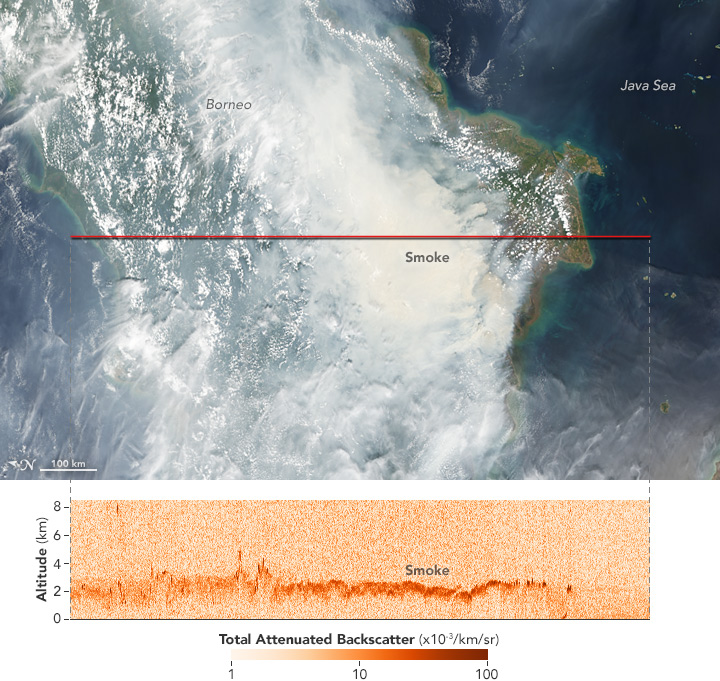
To study the fires, scientists in Indonesia and around the world have been using many different tools—from sensors on the ground to data collected by satellites. One of the satellites is called CALIPSO: Cloud-Aerosol Lidar and Infrared Pathfinder Satellite Observations. CALIPSO combines an active lidar with passive infrared and visible imagers to observe the vertical structure of thin clouds and aerosols.
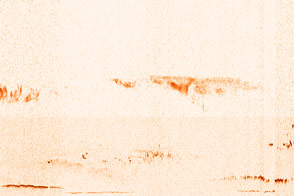
Smoke plumes are comprised of aerosols and gases emitted by fires. Since inhaling smoke can cause health problems, understanding where smoke is moving in the atmosphere is important. For the atmospheric scientists who track smoke and predict its movement, knowing the height of a plume is critical. In many parts of the world, fires can loft smoke 5 or more kilometers (3 miles) into the air, and occasionally as high as 10 kilometers, explained Michael Tosca, an atmospheric scientist at NASA’s Jet Propulsion Laboratory. But Tosca has previously found that smoke from Indonesian fires often remains relatively low in the atmosphere—between the surface and 3 kilometers.
As shown by the image above, CALIPSO confirmed that the smoke in 2015 fit this pattern on October 4, 2015, when the satellite observed a plume of smoke over central Kalimantan at about 2 kilometers above the surface. The top natural-color image was made with data collected by the Moderate Resolution Imaging Spectroradiometer (MODIS) on NASA’s Aqua satellite.
To learn more about fires in Indonesia, read: “Seeing Through the Smoky Pall: Observations from a Grim Indonesian Fire Season.”
NASA Earth Observatory image by Jesse Allen, using data provided by the CALIPSO team. Caption by Adam Voiland