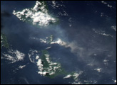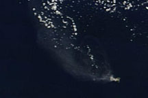
On September 20, 2015, satellites—as well as air travelers—detected a curious plume moving westward over Mount Meru, a stratovolcano in Tanzania. Some observers speculated it was evidence of Meru’s first eruption since 1910. Others argued it was more likely just a wildfire.
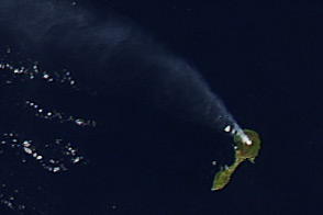
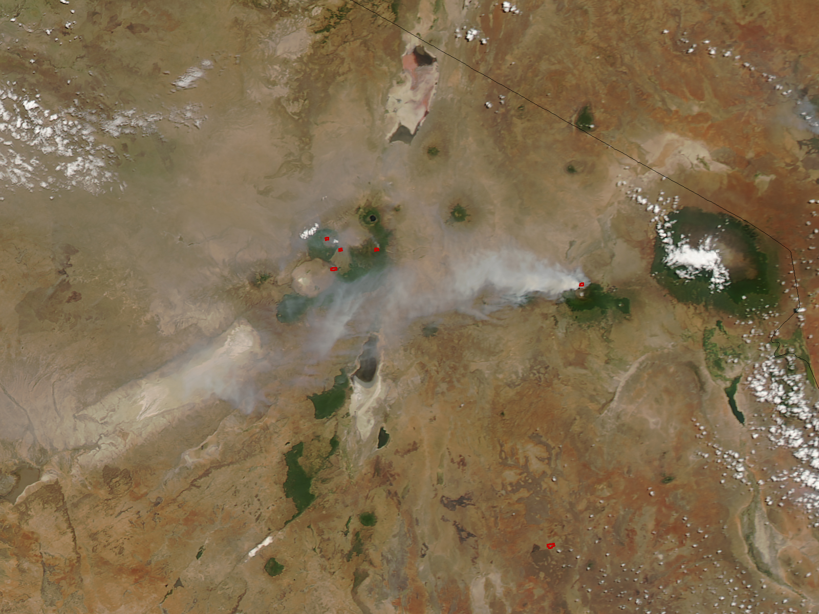
The Moderate Resolution Imaging Spectroradiometer (MODIS) on NASA’s Aqua satellite acquired this natural-color image of the plume on September 20, 2015. Red outlines indicate hot spots where the sensor detected unusually warm surface temperatures.
“The whole image is covered with volcanic features, so an eruption in the area wouldn’t be too outlandish,” explained Erik Klemetti, a volcanologist at Denison University. “However, in this case, it does seem to be a fire on the slopes of the volcano rather than any eruption.”
Depending on the event, the difference between a plume from a fire and from an eruption can be subtle. In natural-color satellite imagery, a volcanic plume that contains mostly steam can look very similar to smoke from a fire. However, volcanic plumes tend to become bluer when sulfur dioxide levels rise, and greyer and browner when ash content is high.
In this case, Klemetti notes there are several clues that suggest the plume’s origins are not volcanic. There have been no other signs of renewed volcanic activity, such as seismic shaking. Nor have satellites picked up any evidence of sulfur dioxide within the plume. And the plume emanates from the mountain’s northern flank, which is outside the caldera wall where the last few eruptions have occurred.
This is not the first time that the smoke has been mistaken for ash, according to Klemetti. In summer 2015, some thought that Mount Adams in Washington was erupting. That also turned out to be a forest fire.
Although the plume at Mount Meru stemmed from fire, the concern over volcanic hazards is real for the people living on the mountain’s flanks. More than 400,000 people live in Arusha—a city just south of the mountain and 14 kilometers (8.7 miles) from its summit. The British Geological Survey outlined volcanic hazards for populations surrounding the mountain in a 2014 report.
NASA image by Jeff Schmaltz, LANCE MODIS Rapid Response. Caption by Kathryn Hansen.