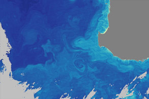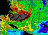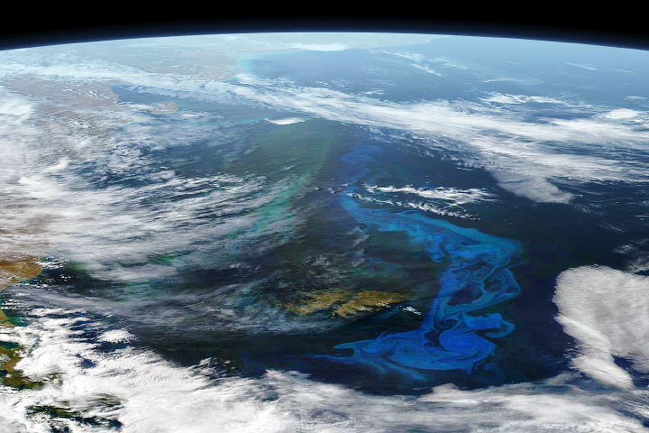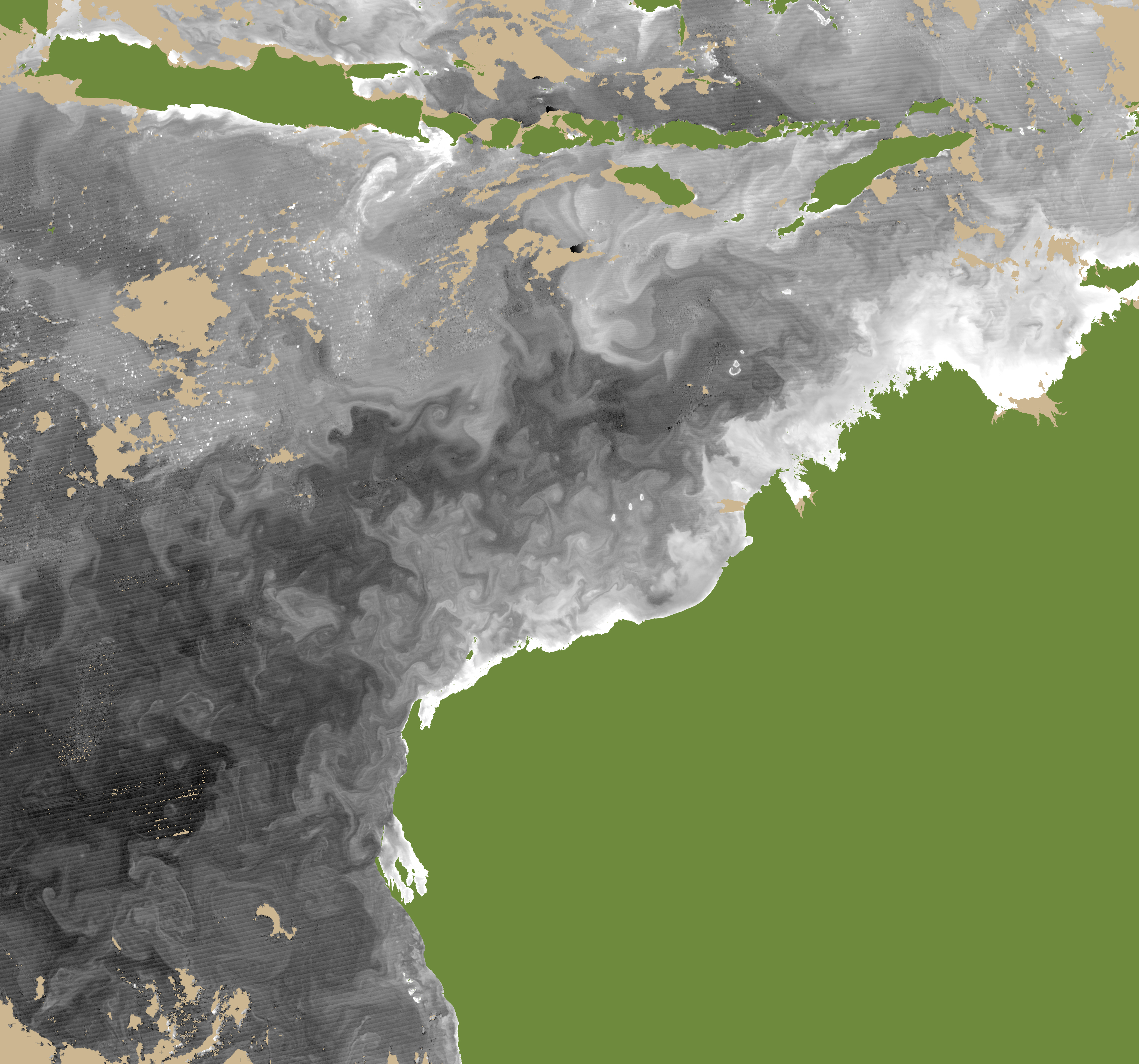

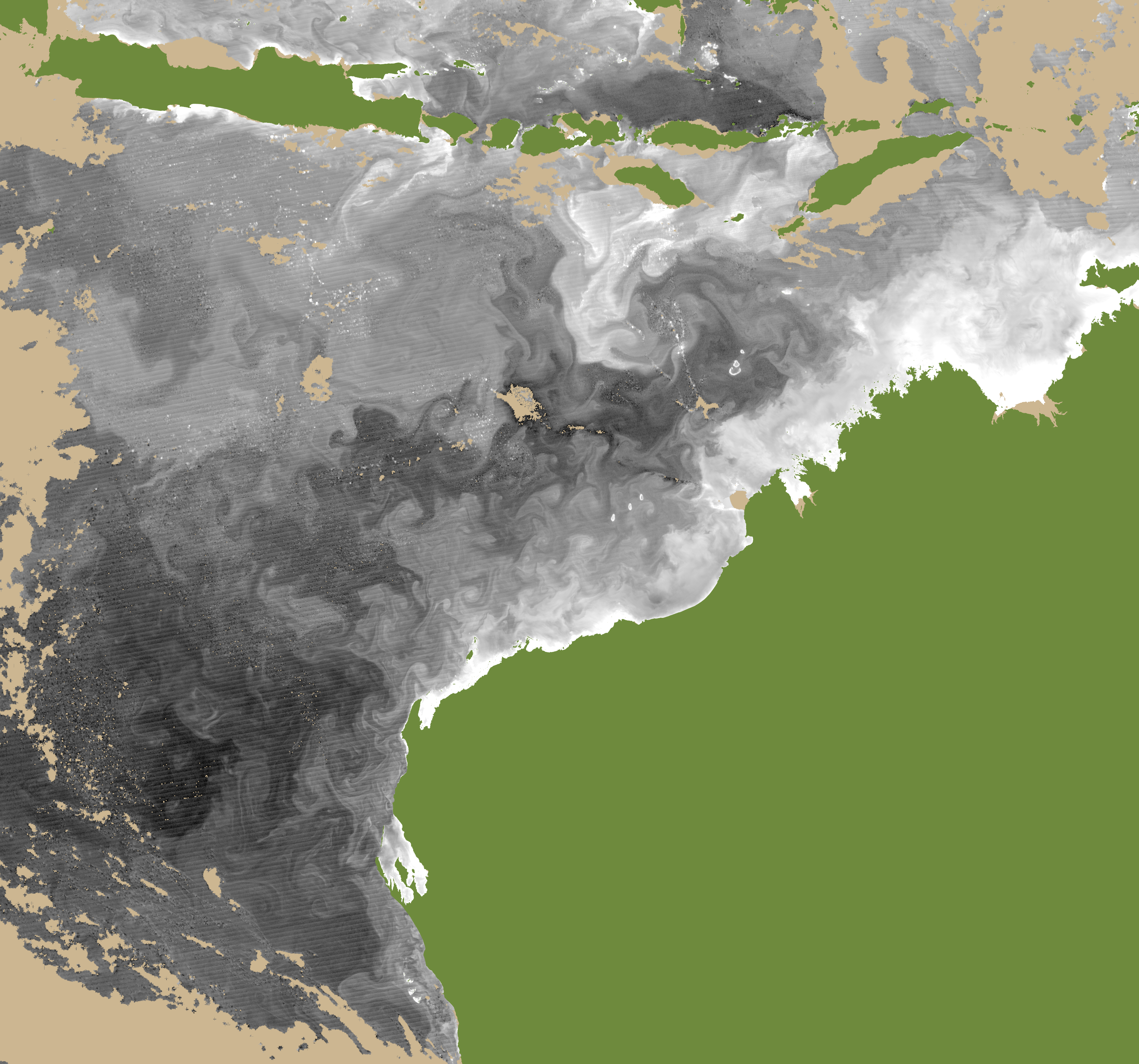
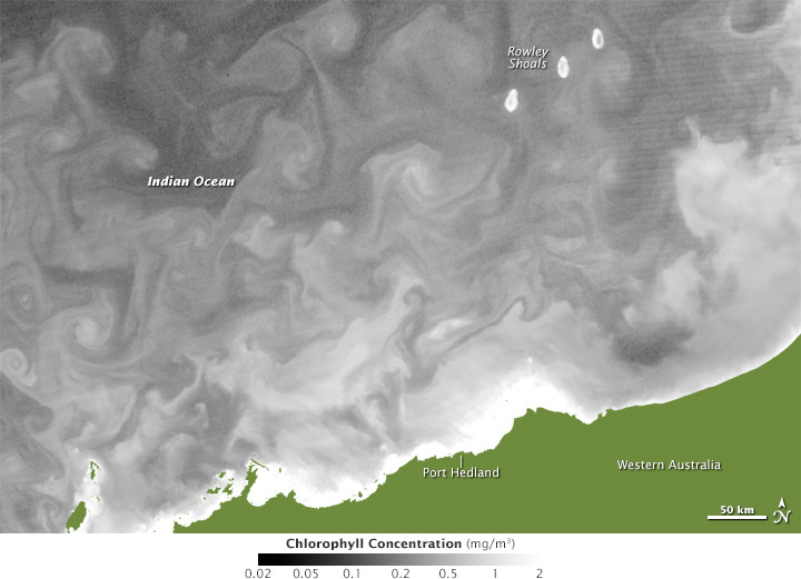
Phytoplankton, for the most part, move wherever ocean currents take them. These floating, plant-like organisms also carry chlorophyll—which turns sunlight, water, and carbon dioxide into sugars—and satellite imagers can detect that green pigment. Because of this, phytoplankton can sometimes be used to reveal the flow of currents in the ocean.
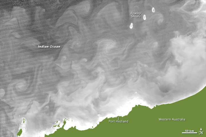
The still images above and the animation below show chlorophyll concentrations in the waters off the northwestern coast of Australia. The observations were acquired by the Visible Infrared Imaging Radiometer Suite on the Suomi NPP satellite in August and September 2014. The chlorophyll data are represented in grayscale shading to make it easier to tease out subtle differences in concentration. Turn on the image comparison tool to see the movements of currents and the rise or decline of chlorophyll in different locations each day.
The animation shows a wider view of Australian coastal waters from August 2 to September 4, 2014. Note the larger eddies that rotate farther offshore. Black patches within the animation are clouds moving through the scene.
The waters off northwest Australia are a turbulent intersection between two major current systems. The Indonesian Throughflow (or South Equatorial Current) moves from east to west across the top of the scene, carrying warm waters from the western Pacific into the Indian Ocean. It is a potent current and key part of the global ocean conveyor belt. The Leeuwin Current—the longest coastal current in the world—also starts in this area, heading south along the west coast.
The result is a mashup of currents and eddies spinning off from the main currents, doubling back on themselves, and generally churning up the ocean. Rowley Shoals, visible in the still images, are very productive areas for fish and coral species, and it is likely that the abundant, swirling phytoplankton (often diatoms) have something to do with that.
NASA Earth Observatory images by Jesse Allen, using Suomi NPP VIIRS data provided by Norman Kuring, NASA Ocean Color Group. Animation by Norman Kuring. Caption by Mike Carlowicz and Norman Kuring. Suomi NPP is a partnership between NASA, NOAA, and the Department of Defense.