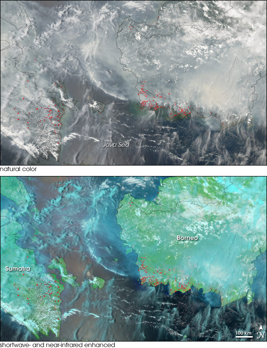
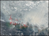
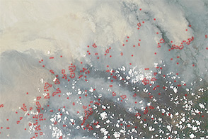
Choking smoke was interrupting air and ship transportation in and around the islands of Sumatra and Borneo in early October 2006. Fires on the two islands were churning out a blanket of haze that mingled with clouds and reduced visibility to unsafe levels. In addition to their immediate impacts on air quality and human society, fires in tropical lowland forests affect increasingly threatened habitat for rainforest plants and animals, including the endangered orangutans. And because they release significant amounts of carbon dioxide and particle pollution, such as soot, the fires affect the global climate.
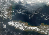
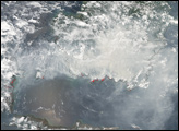
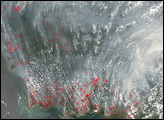
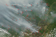
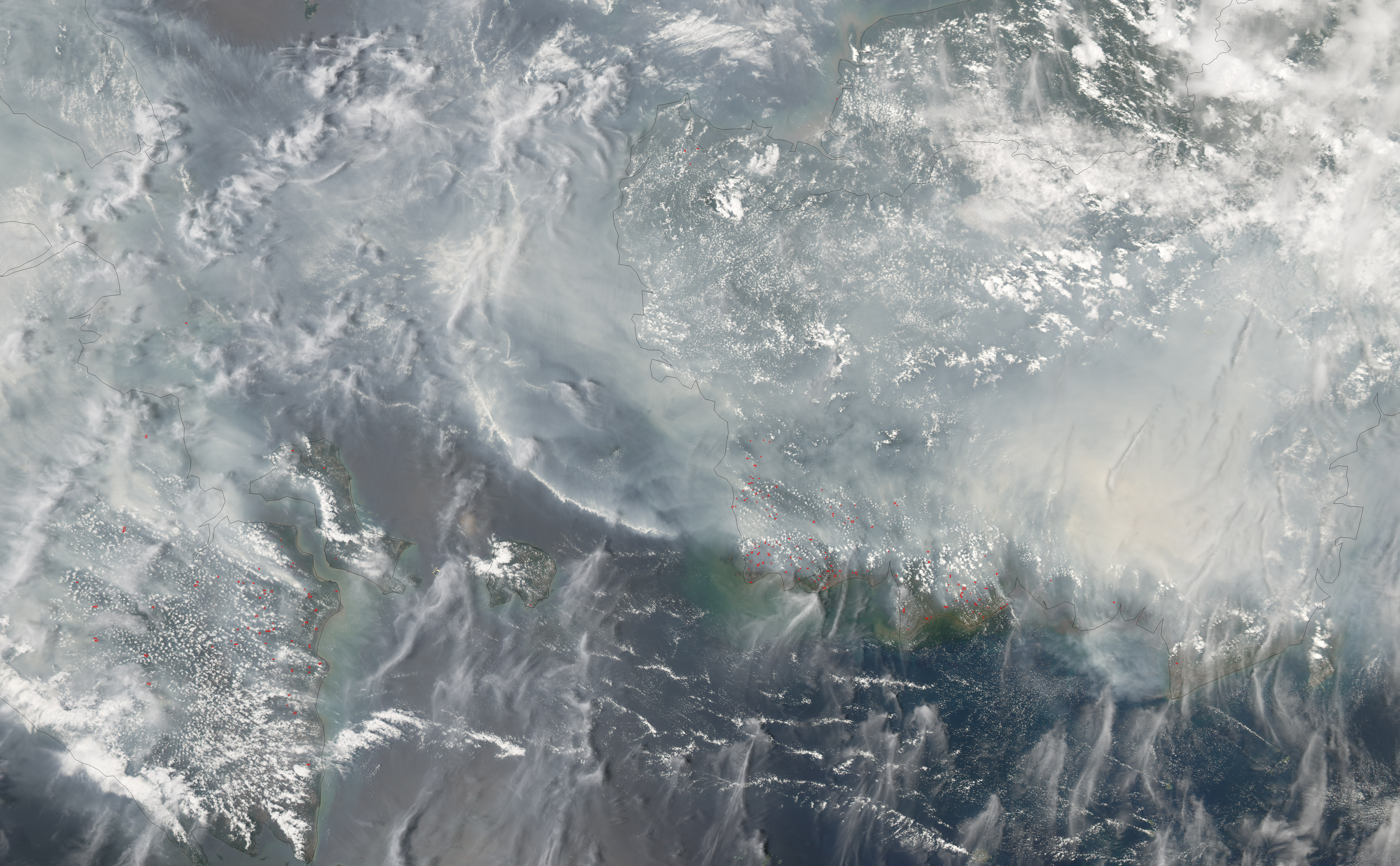
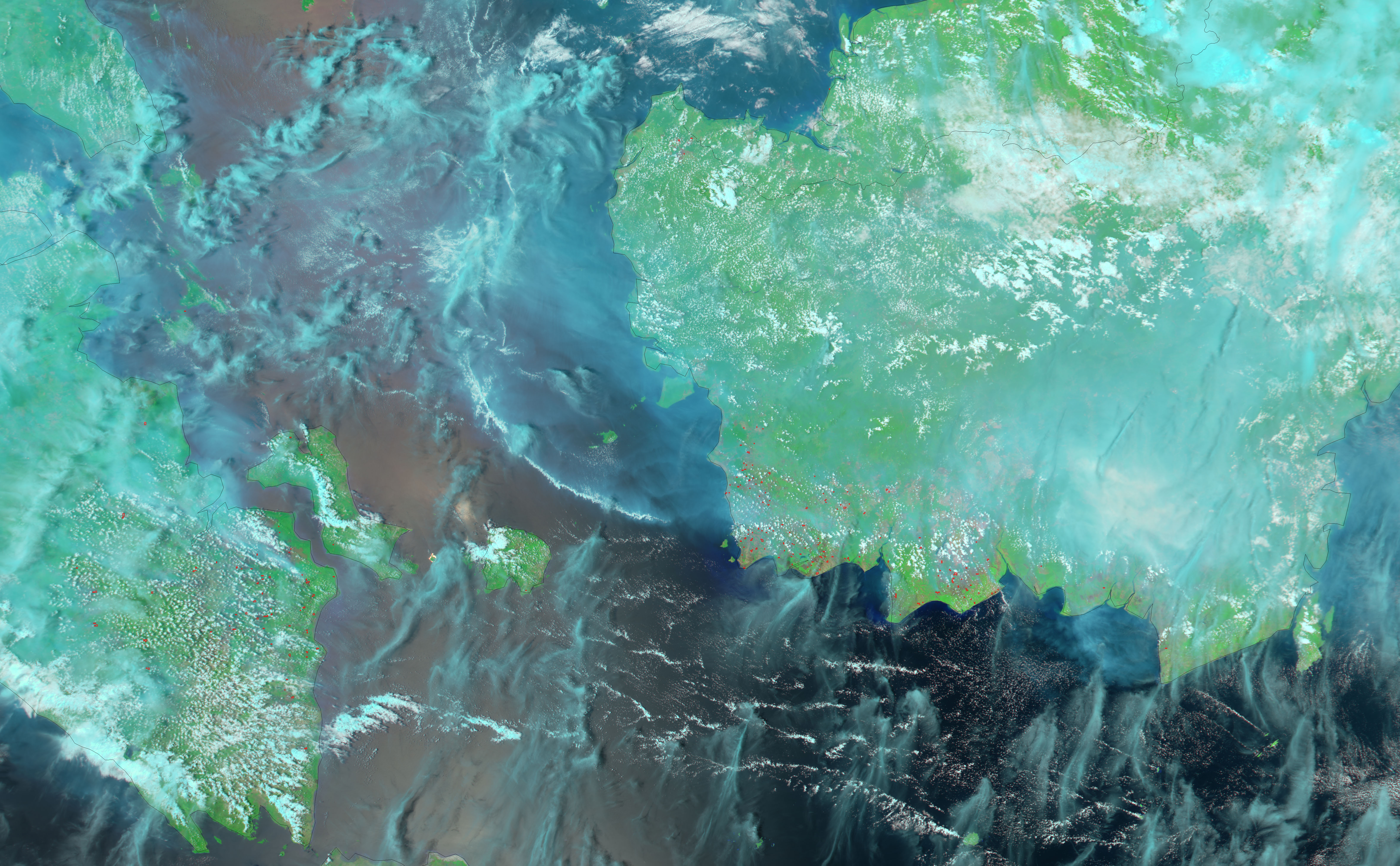
This pair of images from the Moderate Resolution Imaging Spectroradiometer (MODIS) on NASA’s Aqua satellite from Sunday, October 8, 2006, shows the haze in the area. The top image is a photo-like image, made from MODIS’ observations of visible light. Smoke appears grayish white in contrast to the bright white of clouds. Fires detected by MODIS are marked in red. The bottom image is made from a combination of visible, shortwave infrared, and near-infrared light. Because smoke is more transparent in the shortwave and near-infrared part of the light spectrum than it is in the visible part, this “false-color” type of image thins the haze and permits a view at the islands below. Smoke is transparent blue, clouds made of water droplets are white, clouds made of ice crystals are bright blue, vegetation is bright green, and the ocean is dark blue to black.
The fires on Sumatra and Borneo had been burning for several weeks. During the regional dry season (roughly August-October), fires are common, despite Indonesia’s efforts to crack down on illegal burning. Sometimes fires are the result of slash and burn deforestation—clearing of rainforest for palm plantations, for example. Other times, the fires escape during brush clearing or other maintenance activities on already cleared land. Fires in the islands’ low-lying forests and peat swamps generate massive amounts of smoke. Because these low-lying forests and swamp areas are inundated throughout parts of the year, the decay of dead vegetation on the ground proceeds slowly. The thick layers of dead, but un-decayed, vegetation—peat—accumulate over many years. Fires burning in dry peat are very smoky and difficult to put out: some can burn underground for years.
Large- and small-scale agriculture are not the only contributors to the fires. The droughts Indonesia experiences during El Niño episodes, such as the particularly severe 1997-1998 event, make the forests and peat lands more likely to catch fire. Forests that have been degraded by logging are also more likely to burn. According to a 2002 study published in the scientific journal Nature, somewhere between 0.81 and 2.57 million tons of carbon were released by tropical lowland forest and peat land fires in Indonesia in 1997. The incident was one of the leading culprits behind what turned out to be the largest annual increase in atmospheric carbon dioxide concentrations since records began in the late 1950s.
NASA image created by Jesse Allen, Earth Observatory, using data provided courtesy of the MODIS Rapid Respose team.


